Levy County, Florida
| Levy County, Florida | |
|---|---|
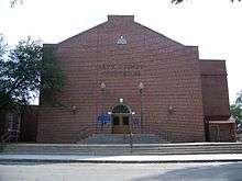 Levy County Courthouse | |
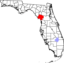 Location in the U.S. state of Florida | |
 Florida's location in the U.S. | |
| Founded | March 10, 1845 |
| Named for | David Levy Yulee |
| Seat | Bronson |
| Largest city | Williston |
| Area | |
| • Total | 1,413 sq mi (3,660 km2) |
| • Land | 1,118 sq mi (2,896 km2) |
| • Water | 295 sq mi (764 km2), 20.9% |
| Population (est.) | |
| • (2017) | 40,355[1] |
| • Density | 36/sq mi (14/km2) |
| Congressional district | 2nd |
| Time zone | Eastern: UTC−5/−4 |
| Website |
www |

Levy County is a county located in the U.S. state of Florida. As of the 2010 census, the population was 40,801.[2] Its county seat is Bronson.[3]
History
Levy County was created in 1845, after the Seminole Wars. It was named for David Levy Yulee, a planter elected in 1841 as the state's territorial delegate to the US House of Representatives, where he served two terms.[4] When Florida was admitted as a state, Levy was elected by the new state legislature as one of Florida's first two U.S. senators; he served from 1845 to 1851. In 1855 he was again elected to the Senate, and he served until withdrawing in 1861 in order to support the Confederacy at the start of the American Civil War. He was the first Jewish American elected to the United States Senate.
Levy provided for long-term development in the state by constructing the first railroad across Florida, the Florida Railroad, linking the deep-water ports of Fernandina (Port of Fernandina) on the Atlantic Ocean and Cedar Key on the Gulf of Mexico. He developed a network of feeder railroads through central Florida as well. For his efforts, Levy was called "the father of Florida railroads."
The Rosewood Massacre occurred in Levy County in the first week of January 1923. White citizens from the nearby town of Sumner, reacting to a what turned out to be a false accusation that a black man raped a white woman, burned the predominantly black town of Rosewood to the ground and brutally murdered several of Rosewood's black citizens. A film based on the incident was made in 1997, but was not filmed in Levy County.
Geography
According to the U.S. Census Bureau, the county has a total area of 1,413 square miles (3,660 km2), of which 1,118 square miles (2,900 km2) is land and 295 square miles (760 km2) (20.9%) is water.[5]
Adjacent counties
- Dixie County — west
- Gilchrist County — north
- Alachua County — northeast
- Marion County — east
- Citrus County — south
National protected areas
Demographics
| Historical population | |||
|---|---|---|---|
| Census | Pop. | %± | |
| 1850 | 465 | — | |
| 1860 | 1,781 | 283.0% | |
| 1870 | 2,018 | 13.3% | |
| 1880 | 5,767 | 185.8% | |
| 1890 | 6,586 | 14.2% | |
| 1900 | 8,603 | 30.6% | |
| 1910 | 10,361 | 20.4% | |
| 1920 | 9,921 | −4.2% | |
| 1930 | 12,456 | 25.6% | |
| 1940 | 12,550 | 0.8% | |
| 1950 | 10,637 | −15.2% | |
| 1960 | 10,364 | −2.6% | |
| 1970 | 12,756 | 23.1% | |
| 1980 | 19,870 | 55.8% | |
| 1990 | 25,923 | 30.5% | |
| 2000 | 34,450 | 32.9% | |
| 2010 | 40,801 | 18.4% | |
| Est. 2017 | 40,355 | [6] | −1.1% |
| U.S. Decennial Census[7] 1790-1960[8] 1900-1990[9] 1990-2000[10] 2010-2015[2] | |||
As of the census[11] of 2000, there were 34,450 people, 13,867 households, and 9,679 families residing in the county. The population density was 31 people per square mile (12/km²). There were 16,570 housing units at an average density of 15 per square mile (6/km²). The racial makeup of the county was 85.88% White, 10.97% Black or African American, 0.47% Native American, 0.37% Asian, 0.03% Pacific Islander, 0.96% from other races, and 1.32% from two or more races. 3.89% of the population were Hispanic or Latino of any race.
There were 13,867 households out of which 27.40% had children under the age of 18 living with them, 53.40% were married couples living together, 11.80% had a female householder with no husband present, and 30.20% were non-families. 24.90% of all households were made up of individuals and 11.60% had someone living alone who was 65 years of age or older. The average household size was 2.44 and the average family size was 2.88.
In the county, the population was spread out with 23.60% under the age of 18, 6.90% from 18 to 24, 25.00% from 25 to 44, 26.60% from 45 to 64, and 17.90% who were 65 years of age or older. The median age was 41 years. For every 100 females there were 94.00 males. For every 100 females age 18 and over, there were 90.80 males.
The median income for a household in the county was $26,959, and the median income for a family was $30,899. Males had a median income of $26,029 versus $20,252 for females. The per capita income for the county was $14,746. About 15.00% of families and 18.60% of the population were below the poverty line, including 25.80% of those under age 18 and 12.90% of those age 65 or over.
Proposed Nuclear Power Plant
On April 7, 2008, Progress Energy Florida of St. Petersburg announced it had authorized Shaw and Westinghouse to purchase long-lead-time materials for up to two AP1000 nuclear reactors for its Levy County plant, a greenfield plant in Levy County, producing about 1,100 MW each.
Progress expects to apply for a Combined Construction and Operating License (COL) in the summer of 2008, according to a spokeswoman. Southern Company and SCANA, of whom each own an interest in the plant, would not reveal cost estimates, but Progress has said its plant will cost $14 billion,[12] with an additionan $3 billion required for transmission infrastructure.[13]
Applying for a COL does not commit the utilities to construct the plant, but it is part of the licensing process, say officials of all the utilities. The application starts a 40-month review by the Nuclear Regulatory Commission, meaning that approval could come in August 2011.
In late July, 2013 the company said it had scrapped its plan to build the plant.[14]
Politics
Voter registration
According to the Secretary of State's office, Republicans comprise a plurality of registered voters in Levy County.
| Levy County Voter Registration and Party Enrollment as of September 30, 2016[15] | |||||
|---|---|---|---|---|---|
| Political party | Total voters | Percentage | |||
| Republican | 12,107 | 45.6% | |||
| Democratic | 9,430 | 35.5% | |||
| other party affiliation | 1,286 | 4.8% | |||
| no party affiliation | 3,742 | 14.1% | |||
| Total | 26,565 | 100% | |||
| Year | Republican | Democratic | Other |
|---|---|---|---|
| 2016 | 70.64% 13,775 | 26.16% 5,101 | 3.20% 623 |
| 2012 | 65.31% 12,054 | 33.15% 6,119 | 1.54% 284 |
| 2008 | 62.56% 11,754 | 35.72% 6,711 | 1.72% 324 |
| 2004 | 62.52% 10,410 | 36.48% 6,074 | 1.01% 168 |
| 2000 | 53.91% 6,863 | 42.40% 5,398 | 3.69% 469 |
| 1996 | 38.85% 4,299 | 44.63% 4,938 | 16.52% 1,828 |
| 1992 | 34.71% 3,796 | 39.59% 4,330 | 25.70% 2,810 |
| 1988 | 59.75% 5,253 | 39.06% 3,434 | 1.18% 104 |
| 1984 | 64.19% 5,561 | 35.81% 3,103 | |
| 1980 | 42.26% 3,210 | 54.90% 4,170 | 2.84% 216 |
| 1976 | 31.87% 1,965 | 65.28% 4,025 | 2.85% 176 |
| 1972 | 79.12% 3,273 | 20.84% 862 | 0.05% 2 |
| 1968 | 18.81% 745 | 19.36% 767 | 61.83% 2,449 |
| 1964 | 44.31% 1,580 | 55.69% 1,986 | |
| 1960 | 33.21% 996 | 66.79% 2,003 | |
| 1956 | 33.90% 934 | 66.10% 1,821 | |
| 1952 | 34.66% 1,066 | 65.34% 2,010 | |
| 1948 | 11.12% 225 | 55.76% 1,128 | 33.12% 670 |
| 1944 | 9.65% 225 | 90.35% 2,107 | |
| 1940 | 9.52% 266 | 90.48% 2,527 | |
| 1936 | 8.37% 183 | 91.63% 2,003 | |
| 1932 | 7.05% 123 | 92.95% 1,621 | |
| 1928 | 46.23% 711 | 51.82% 797 | 1.95% 30 |
| 1924 | 26.23% 214 | 64.22% 524 | 9.56% 78 |
| 1920 | 29.50% 377 | 69.01% 882 | 1.49% 19 |
| 1916 | 22.29% 216 | 73.48% 712 | 4.23% 41 |
| 1912 | 13.91% 74 | 70.49% 375 | 15.60% 83 |
| 1908 | 27.19% 189 | 59.14% 411 | 13.67% 95 |
| 1904 | 24.59% 151 | 69.38% 426 | 6.03% 37 |
Education
Public schools
School Board of Levy County operates public schools.
Public libraries
The current Levy County Library Director is Jeanine Turner.
The Levy County Public Library System has five branches:
- Bronson Public Library
600 Gilbert Street Bronson, FL 32621 Phone: (352) 486-2015
- Cedar Key Public Library
460 Second Street Cedar Key, FL 32625 Phone: (352) 543-5777
- Luther Callaway Public Library
104 NE 3rd Street Chiefland, FL 32626 Phone: (352) 493-2758
- Williston Public Library
10 SE 1st Street Williston, FL 32696 Phone: (352) 528-2313
- A.F. Knotts Public Library
11 56th Street Yankeetown, FL 34498 Phone: (352) 447-4212[17]
Transportation
Airports
Railroads
Levy County has only one railroad line running throughout the county, and only within eastern Levy along US 41. The line is a former Atlantic Coast Line Railroad line that is now used by the Florida Northern Railroad for freight to the Crystal River 3 Nuclear Power Plant in Red Level, Citrus County. Notable abandoned lines include a Seaboard Air Line Railroad line that is in proximity to the existing former ACL line, a Florida Railway and Navigation Company line running parallel to State Road 24, and a third in western and southern Levy County that spans from Fanning Springs towards the Dunnellon area running along US 19-98 until it reaches Lebanon Junction, where it runs along CR 336. The segment of that line between Fanning Springs and Chiefland is part of the Nature Coast State Trail.
Major roads


Communities
Cities
Towns
Census-designated places
Other unincorporated communities
- Ellzey
- Fowlers Bluff
- Gulf Hammock
- Lebanon Station
- Rosewood
- Turkeytown
- Usher
- Eve
- Levyville
See also
References
- ↑ https://www.census.gov/quickfacts/fact/table/levycountyflorida/PST045217
- 1 2 "State & County QuickFacts". United States Census Bureau. Archived from the original on July 13, 2011. Retrieved June 14, 2014.
- ↑ "Find a County". National Association of Counties. Retrieved 2011-06-07.
- ↑ Publications of the Florida Historical Society. Florida Historical Society. 1908. p. 32.
- ↑ "US Gazetteer files: 2010, 2000, and 1990". United States Census Bureau. 2011-02-12. Retrieved 2011-04-23.
- ↑ "Population and Housing Unit Estimates". Retrieved June 9, 2017.
- ↑ "U.S. Decennial Census". United States Census Bureau. Retrieved June 14, 2014.
- ↑ "Historical Census Browser". University of Virginia Library. Retrieved June 14, 2014.
- ↑ "Population of Counties by Decennial Census: 1900 to 1990". United States Census Bureau. Retrieved June 14, 2014.
- ↑ "Census 2000 PHC-T-4. Ranking Tables for Counties: 1990 and 2000" (PDF). United States Census Bureau. Retrieved June 14, 2014.
- ↑ "American FactFinder". United States Census Bureau. Retrieved 2011-05-14.
- ↑ reuters.com
- ↑ [https://www.thefreelibrary.com/Florida+PSC+Approves+Progress+Energy%27s+Plans+for+New+Nuclear+Power...-a0181424366 Florida PSC Approves Progress Energy's Plans for New Nuclear Power Units units/?printmode=1
- ↑ Florida Power & Light asks to continue to collect for Turkey Point expansion, by Mary Ellen Klas and Herald Times, 6 August 2013
- ↑ "Archived copy". Archived from the original on 2016-10-24. Retrieved 2016-10-24.
- ↑ Leip, David. "Dave Leip's Atlas of U.S. Presidential Elections". uselectionatlas.org. Retrieved 2018-06-15.
- ↑ "Levy County Library System". Retrieved 2016-10-21.
External links
| Wikimedia Commons has media related to Levy County, Florida. |
Newspapers and media
Government links/Constitutional offices
- Levy County official website
- Levy County Supervisor of Elections
- Levy County Property Appraiser
- Levy County Sheriff's Office
- Levy County Tax Collector
Special districts
Judicial branch
Tourism links/Chambers of Commerce
- Levy County Visitors Bureau
- Withlacoochee/Gulf Area Chamber of Commerce
- Cedar Key Chamber of Commerce
- Greater Chiefland Chamber of Commerce
- Fanning Springs Chamber of Commerce
- Cedar Key Scrub State Preserve
- Cedar Keys National Wildlife Refuge
- Goethe State Forest
- Manatee Springs State Park
Places adjacent to Levy County, Florida | ||||||||||
|---|---|---|---|---|---|---|---|---|---|---|
| ||||||||||
Municipalities and communities of Levy County, Florida, United States | ||
|---|---|---|
| Cities | | |
| Towns | ||
| CDPs | ||
| Unincorporated communities | ||
| Footnotes | ‡This populated place also has portions in an adjacent county or counties | |

| Topics |  Map of North Florida | |
|---|---|---|
| Counties | ||
| Major cities | ||
| Cities and towns 100k+ | ||
| Cities and towns 25k–100k | ||
| Cities and towns 10k–25k | ||
| Metro areas | ||
| Regions | ||