Dixie County, Florida
| Dixie County, Florida | ||
|---|---|---|
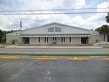 Dixie County Courthouse | ||
| ||
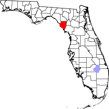 Location in the U.S. state of Florida | ||
 Florida's location in the U.S. | ||
| Founded | April 25, 1921 | |
| Seat | Cross City | |
| Largest town | Cross City | |
| Area | ||
| • Total | 864 sq mi (2,238 km2) | |
| • Land | 705 sq mi (1,826 km2) | |
| • Water | 159 sq mi (412 km2), 18.4% | |
| Population (est.) | ||
| • (2015) | 16,203 | |
| • Density | 23/sq mi (9/km2) | |
| Congressional district | 2nd | |
| Time zone | Eastern: UTC−5/−4 | |
| Website |
dixie | |
Dixie County is a county located in the U.S. state of Florida. As of the 2010 census, the population was 16,422.[1] Its county seat is Cross City.[2]
History
Dixie County was created in 1921 from the southern portion of Lafayette County and named for "Dixie", the common nickname for the southern United States.[3]
Geography
According to the U.S. Census Bureau, the county has a total area of 864 square miles (2,240 km2), of which 705 square miles (1,830 km2) is land and 159 square miles (410 km2) (18.4%) is water.[4]
Adjacent counties
- Taylor County - northwest
- Lafayette County - north
- Gilchrist County - east
- Levy County - southeast
National protected area
Demographics
| Historical population | |||
|---|---|---|---|
| Census | Pop. | %± | |
| 1930 | 6,419 | — | |
| 1940 | 7,018 | 9.3% | |
| 1950 | 3,928 | −44.0% | |
| 1960 | 4,479 | 14.0% | |
| 1970 | 5,480 | 22.3% | |
| 1980 | 7,751 | 41.4% | |
| 1990 | 10,585 | 36.6% | |
| 2000 | 13,827 | 30.6% | |
| 2010 | 16,422 | 18.8% | |
| Est. 2016 | 16,300 | [5] | −0.7% |
| U.S. Decennial Census[6] 1790-1960[7] 1900-1990[8] 1990-2000[9] 2010-2015[1] | |||
As of the census[10] of 2008, there were 14,957 people. In 2000 there were an estimated 5,205 households and 3,659 families residing in the county. The population density was 20 people per square mile (8/km²). There were 7,362 housing units at an average density of 10 per square mile (4/km²). The racial makeup of the county was 88.80% White, 8.98% Black or African American, 0.46% Native American, 0.25% Asian, 0.03% Pacific Islander, 0.45% from other races, and 1.03% from two or more races. 1.80% of the population were Hispanic or Latino of any race. In terms of ancestry, 39.7% were English, 15.2% were Irish, 14.7% were American, and 5.2% were German.
There were 5,205 households out of which 27.40% had children under the age of 18 living with them, 54.90% were married couples living together, 10.60% had a female householder with no husband present, and 29.70% were non-families. 23.90% of all households were made up of individuals and 11.60% had someone living alone who was 65 years of age or older. The average household size was 2.44 and the average family size was 2.87.
In the county, the population was spread out with 22.10% under the age of 18, 7.90% from 18 to 24, 26.60% from 25 to 44, 26.20% from 45 to 64, and 17.10% who were 65 years of age or older. The median age was 41 years. For every 100 females there were 113.90 males. For every 100 females age 18 and over, there were 117.20 males.
The median income for a household in the county was $26,082, and the median income for a family was $31,157. Males had a median income of $26,694 versus $17,863 for females. The per capita income for the county was $13,559. About 14.50% of families and 19.10% of the population were below the poverty line, including 23.90% of those under age 18 and 16.10% of those age 65 or over.
Politics
Voter registration
According to the Secretary of State's office, Democrats maintain a plurality among registered voters in Dixie County.
| Dixie County Voter Registration & Party Enrollment as of December 31, 2016[11] | |||||
|---|---|---|---|---|---|
| Political Party | Total Voters | Percentage | |||
| Democratic | 4,711 | 47.33% | |||
| Republican | 3,685 | 37.02% | |||
| Independent | 1,326 | 13.32% | |||
| Third Parties | 231 | 2.32% | |||
| Total | 9,953 | 100.00% | |||
Statewide elections
Democrats hold a plurality of registered voters in the county, but have not carried a majority of votes in a Presidential election since before 1992 (and last carried a plurality in 1996), nor have they carried a majority in a gubernatorial election since 1994. The county has rapidly and steadily shifted Republican since the 1990s; by 2016, the Republican candidate earned over 80% of the vote in the Presidential election.
| Year | Republican | Democratic | Third parties |
|---|---|---|---|
| 2016 | 80.35% 5,822 | 17.53% 1,270 | 2.13% 154 |
| 2012 | 72.60% 5,052 | 25.84% 1,798 | 1.57% 109 |
| 2008 | 71.22% 5,194 | 26.40% 1,925 | 2.39% 174 |
| 2004 | 68.83% 4,434 | 30.43% 1,960 | 0.75% 48 |
| 2000 | 57.79% 2,697 | 39.15% 1,827 | 3.07% 143 |
| 1996 | 36.82% 1,399 | 45.63% 1,734 | 17.55% 667 |
| 1992 | 32.04% 1,401 | 42.42% 1,855 | 25.55% 1,117 |
| 1988 | 59.79% 2,031 | 40.21% 1,366 | |
| 1984 | 64.29% 2,204 | 35.71% 1,224 | |
| 1980 | 34.70% 1,101 | 63.35% 2,010 | 1.96% 62 |
| 1976 | 20.28% 558 | 78.82% 2,169 | 0.91% 25 |
| 1972 | 81.52% 1,628 | 18.38% 367 | 0.10% 2 |
| 1968 | 10.39% 217 | 15.57% 325 | 74.04% 1,546 |
| 1964 | 49.59% 908 | 50.41% 923 | |
| 1960 | 28.65% 392 | 71.35% 976 | |
| 1956 | 29.04% 370 | 70.96% 904 | |
| 1952 | 34.81% 440 | 65.19% 824 | |
| 1948 | 8.73% 111 | 67.82% 862 | 23.45% 298 |
| 1944 | 7.07% 84 | 92.93% 1,104 | |
| 1940 | 5.59% 84 | 94.41% 1,420 | |
| 1936 | 5.19% 64 | 94.81% 1,170 | |
| 1932 | 4.78% 55 | 95.22% 1,096 | |
| 1928 | 57.52% 463 | 42.48% 342 | |
| 1924 | 5.13% 14 | 94.14% 257 | 0.73% 2 |
| Year | Republican | Democratic | Third parties |
|---|---|---|---|
| 2014 | 62.41% 3,345 | 30.91% 1,657 | 6.68% 358 |
| 2010 | 53.64% 2,810 | 39.28% 2,058 | 7.08% 371 |
| 2006 | 52.69% 2,651 | 41.92% 2,109 | 5.39% 271 |
| 2002 | 56.03% 2,273 | 42.45% 1,722 | 1.53% 62 |
| 1998 | 60.44% 1,855 | 39.39% 1,209 | 0.16% 5 |
| 1994 | 49.66% 1,981 | 50.21% 2,003 | 0.13% 5 |
Points of interest
- City of Hawkinsville - sunken steamboat in the Suwannee River near Old Town, one of the Florida Underwater Archaeological Preserves.
- Old Town Elementary School, now the Dixie County Cultural Center.
- Old Town Methodist Church built in 1890 located behind the 1983 church building.
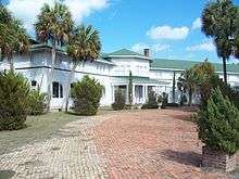
- Putnam Lodge in Cross City, Florida built by the Putnam Lumber Company for its nearby lumber town of Shamrock
Library
The Dixie County Library is part of the Three Rivers Regional Library System, which also serves Gilchrist, Lafayette, and Taylor counties. It is located at 16328 SE 19th Highway in Cross City, Florida. The branch is open Monday through Friday, 8:30 a.m.–5:30 p.m. The current library director is Cindy Bellot.
Communities
Towns
Unincorporated communities
- Clara (partly in Taylor County)
- Eugene
- Hines
- Jena
- Jonesboro
- Old Town
- Shamrock
- Shired Island
- Suwannee
- Yellow Jacket
Transportation
Airports
- Dixie County Airport
See also
References
- 1 2 "State & County QuickFacts". United States Census Bureau. Archived from the original on July 9, 2011. Retrieved February 12, 2014.
- ↑ "Find a County". National Association of Counties. Archived from the original on 2011-05-31. Retrieved 2011-06-07.
- ↑ Mayo, Nathan (1925). The Fifth Census of the State of Florida. Florida Department of Agriculture.
- ↑ "US Gazetteer files: 2010, 2000, and 1990". United States Census Bureau. 2011-02-12. Retrieved 2011-04-23.
- ↑ "Population and Housing Unit Estimates". Retrieved June 9, 2017.
- ↑ "U.S. Decennial Census". United States Census Bureau. Archived from the original on May 12, 2015. Retrieved June 13, 2014.
- ↑ "Historical Census Browser". University of Virginia Library. Retrieved June 13, 2014.
- ↑ "Population of Counties by Decennial Census: 1900 to 1990". United States Census Bureau. Retrieved June 13, 2014.
- ↑ "Census 2000 PHC-T-4. Ranking Tables for Counties: 1990 and 2000" (PDF). United States Census Bureau. Retrieved June 13, 2014.
- ↑ "American FactFinder". United States Census Bureau. Archived from the original on 2013-09-11. Retrieved 2011-05-14.
- ↑ "Archived copy". Archived from the original on 2016-10-24. Retrieved 2016-10-24.
- ↑ Leip, David. "Dave Leip's Atlas of U.S. Presidential Elections". uselectionatlas.org.
External links
| Wikimedia Commons has media related to Dixie County, Florida. |
- Dixie County Advocate, local newspaper available in full-text for free from the Florida Digital Newspaper Library
- Dixie County Times, A recently started local newspaper managed by the former editor of the Dixie County Advocate.
- WZCC-AM 1240, Cross City's Community Radio Station.
Government links/Constitutional offices
- Dixie County Board of County Commissioners
- Dixie County Supervisor of Elections
- Dixie County Property Appraiser
- Dixie County Sheriff's Office
- Dixie County Tax Collector
Special districts
Judicial branch
Tourism links
Places adjacent to Dixie County, Florida | ||||||||||
|---|---|---|---|---|---|---|---|---|---|---|
| ||||||||||
Municipalities and communities of Dixie County, Florida, United States | ||
|---|---|---|
| Towns | | |
| Unincorporated communities | ||

| Topics |  Map of North Florida | |
|---|---|---|
| Counties | ||
| Major cities | ||
| Cities and towns 100k+ | ||
| Cities and towns 25k–100k | ||
| Cities and towns 10k–25k | ||
| Metro areas | ||
| Regions | ||