Glades County, Florida
| Glades County, Florida | |
|---|---|
 Glades County Courthouse | |
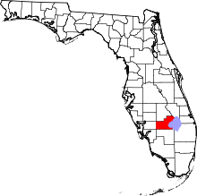 Location in the U.S. state of Florida | |
 Florida's location in the U.S. | |
| Founded | April 23, 1921 |
| Named for | Florida Everglades |
| Seat | Moore Haven |
| Largest city | Moore Haven |
| Area | |
| • Total | 987 sq mi (2,556 km2) |
| • Land | 806 sq mi (2,088 km2) |
| • Water | 181 sq mi (469 km2), 18.3% |
| Population (est.) | |
| • (2015) | 13,670 |
| • Density | 16/sq mi (6/km2) |
| Congressional district | 17th |
| Time zone | Eastern: UTC−5/−4 |
| Website |
www |
Glades County is a county located in the U.S. state of Florida. As of the 2010 census, the population was 12,884,[1] making it the fourth-least populous county in Florida. Its county seat is Moore Haven.[2]
Awards
- Gov. Jeb Bush acknowledged Muse winning the Florida's Outstanding Rural Community of the Year 2002 award after "providing a safe community shelter to be used during storms."[3]
- Senior Ranger Danny Callahan, of the Florida Forest Service presented Jimmy Cianfrani and the Muse Community with a "10 Year Firewise Service Award" for "its diligence and commitment to the National Firewise Communities USA program. From the smallest project of cleaning the debris off their roofs to the largest undertaking of clearing flammable vegetation 30 feet away from their houses, the Muse Community’s dedication to reducing wildfire risk is commendable."[4]
History
Indigenous people lived in this area for thousands of years. Due to warfare and exposure to infectious diseases after European contact, native tribes became depopulated. In the eighteenth century, when the area was under Spanish rule, Native American peoples of Creek and other tribes migrated into present-day Florida from Georgia. Africans and African Americans who escaped from slavery and shipwrecks also migrated to the area, where they created maroon communities. Some were given freedom by the Spanish in exchange for serving with their militias. Gradually the Seminole nation formed out of these multi-ethnic people. Some African-descended people set up communities near the Seminole and became known as Black Seminole. In the nineteenth century, most of the Seminole and many blacks were removed to Indian Territory after the Seminole Wars, a result of pressure from increasing Anglo-American settlement.
Glades County was created, in 1921, from Desoto County. It was named for the Florida Everglades, though most of the county is prairie and pinelands.[5]
It is one of five counties surrounding Lake Okeechobee and the Lake Okeechobee Scenic Trail.
Glades County sponsors one of Florida's oldest recurring festivals. Chalo Nitka Festival is a celebration of local history and culture, similar to a county fair. The festival also draws attention to the long and friendly relationship between the local Seminole groups and Glades County settlers. Brighton Seminole Indian Reservation is located in the county.
Geography
According to the U.S. Census Bureau, the county has a total area of 987 square miles (2,560 km2), of which 806 square miles (2,090 km2) is land and 181 square miles (470 km2) (18.3%) is water.[6]
Fisheating Creek is a stream that flows into Lake Okeechobee in Florida. It is the only remaining free-flowing water course feeding into the lake, and the second-largest natural source for the lake.
Adjacent counties
- Highlands County, Florida - north
- Okeechobee County, Florida - northeast
- Martin County, Florida - east
- Palm Beach County, Florida - southeast
- Hendry County, Florida - south
- Lee County, Florida - southwest
- Charlotte County, Florida - west
- DeSoto County, Florida - northwest
Climate
| Climate data for Glades County, Florida (1980-2010) | |||||||||||||
|---|---|---|---|---|---|---|---|---|---|---|---|---|---|
| Month | Jan | Feb | Mar | Apr | May | Jun | Jul | Aug | Sep | Oct | Nov | Dec | Year |
| Average high °F (°C) | 73.7 (23.2) |
76.3 (24.6) |
80.0 (26.7) |
84.1 (28.9) |
89.3 (31.8) |
91.1 (32.8) |
91.8 (33.2) |
91.8 (33.2) |
90.1 (32.3) |
86.1 (30.1) |
80.2 (26.8) |
75.1 (23.9) |
84.1 (29) |
| Average low °F (°C) | 47.8 (8.8) |
50.9 (10.5) |
54.6 (12.6) |
58.0 (14.4) |
64.6 (18.1) |
70.2 (21.2) |
71.8 (22.1) |
72.4 (22.4) |
71.4 (21.9) |
65.2 (18.4) |
57.3 (14.1) |
51.1 (10.6) |
61.3 (16.3) |
| Average precipitation inches (mm) | 1.9 (48) |
2.5 (64) |
3.3 (84) |
2.3 (58) |
3.3 (84) |
8.6 (218) |
7.7 (196) |
7.9 (201) |
6.7 (170) |
2.7 (69) |
2.0 (51) |
1.9 (48) |
50.8 (1,291) |
| Source: USA.com[7] | |||||||||||||
Demographics
| Historical population | |||
|---|---|---|---|
| Census | Pop. | %± | |
| 1930 | 2,762 | — | |
| 1940 | 2,745 | −0.6% | |
| 1950 | 2,199 | −19.9% | |
| 1960 | 2,950 | 34.2% | |
| 1970 | 3,669 | 24.4% | |
| 1980 | 5,992 | 63.3% | |
| 1990 | 7,591 | 26.7% | |
| 2000 | 10,576 | 39.3% | |
| 2010 | 12,884 | 21.8% | |
| Est. 2016 | 13,970 | [8] | 8.4% |
| U.S. Decennial Census[9] 1790-1960[10] 1900-1990[11] 1990-2000[12] 2010-2015[1] | |||
As of the census[13] of 2000, there were 10,576 people, 3,852 households, and 2,765 families residing in the county. The population density was 14 people per square mile (5/km²). There were 5,790 housing units at an average density of 8 per square mile (3/km²). The racial makeup of the county was 76.99% White, 10.53% Black or African American, 4.93% Native American, 0.33% Asian, 0.02% Pacific Islander, 5.63% from other races, and 1.58% from two or more races. 15.07% of the population were Hispanic or Latino of any race.
In 2005 the population was 67.0% non-Hispanic white, 17.6% Latino, 10.5% African-American and 4.9% Native American.[14]
There were 3,852 households out of which 25.80% had children under the age of 18 living with them, 58.30% were married couples living together, 8.60% had a female householder with no husband present, and 28.20% were non-families. 22.70% of all households were made up of individuals and 11.40% had someone living alone who was 65 years of age or older. The average household size was 2.51 and the average family size was 2.91.
In the county, the population was spread out with 22.10% under the age of 18, 7.60% from 18 to 24, 27.00% from 25 to 44, 24.50% from 45 to 64, and 18.80% who were 65 years of age or older. The median age was 40 years. For every 100 females there were 121.50 males. For every 100 females age 18 and over, there were 125.40 males.
The median income for a household in the county was $30,774, and the median income for a family was $34,223. Males had a median income of $29,196 versus $20,987 for females. The per capita income for the county was $15,338. About 10.70% of families and 15.20% of the population were below the poverty line, including 18.20% of those under age 18 and 11.20% of those age 65 or over.
Education
- Moore Haven Elementary School[15]
- Moore Haven Middle-High School[15]
- West Glades School, Muse[15]
- Pemayetv Emahakv Charter School, Brighton Seminole Reservation[16][15]
Politics
| Year | Republican | Democratic | Other |
|---|---|---|---|
| 2016 | 68.37% 2,996 | 29.01% 1,271 | 2.62% 115 |
| 2012 | 58.54% 2,344 | 40.03% 1,603 | 1.42% 57 |
| 2008 | 59.45% 2,533 | 39.29% 1,674 | 1.27% 54 |
| 2004 | 58.33% 2,443 | 41.02% 1,718 | 0.64% 27 |
| 2000 | 54.71% 1,841 | 42.85% 1,442 | 2.43% 82 |
| 1996 | 39.67% 1,361 | 44.59% 1,530 | 15.74% 540 |
| 1992 | 35.12% 1,185 | 38.68% 1,305 | 26.20% 884 |
| 1988 | 59.66% 1,547 | 39.88% 1,034 | 0.46% 12 |
| 1984 | 65.00% 1,987 | 35.00% 1,070 | |
| 1980 | 45.96% 1,098 | 50.36% 1,203 | 3.68% 88 |
| 1976 | 31.76% 624 | 66.72% 1,311 | 1.53% 30 |
| 1972 | 78.81% 1,019 | 19.57% 253 | 1.62% 21 |
| 1968 | 23.92% 261 | 21.08% 230 | 55.00% 600 |
| 1964 | 55.09% 541 | 44.91% 441 | |
| 1960 | 44.35% 314 | 55.65% 394 | |
| 1956 | 47.69% 309 | 52.31% 339 | |
| 1952 | 39.70% 264 | 60.30% 401 | |
| 1948 | 27.03% 150 | 49.37% 274 | 23.60% 131 |
| 1944 | 30.54% 164 | 69.46% 373 | |
| 1940 | 27.95% 180 | 72.05% 464 | |
| 1936 | 31.00% 235 | 69.00% 523 | |
| 1932 | 21.89% 148 | 78.11% 528 | |
| 1928 | 53.73% 331 | 45.62% 281 | 0.65% 4 |
| 1924 | 23.92% 83 | 61.10% 212 | 14.98% 52 |
Energy and environment
Florida Public Service Commission voted unanimously to deny a request by Florida Power and Light to build a huge coal-fired power plant in Glades County, that was to be located several miles to the west of Lake Okeechobee.[18] The Glades County Commission also allowed the construction in 2007 of a 200-acre (0.81 km2) landfill on the southwest shore of Lake Okeechobee.
Libraries
Glades County is part of the Heartland Library Cooperative which has 7 branches that serve Glades county and some of the surrounding counties, including DeSoto, Highlands, Hardee, and Okeechobee.
- Avon Park
- DeSoto
- Glades
- Hardee
- Lake Placid
- Okeechobee
- Sebring
Communities
Indian reservation
City
Census-designated place
Other unincorporated communities
Memorials
- The Community Center features a veteran memorial to Jim J. Greer at the base of the flagpole. Memorial reads as follows: In Memory of, SMSGT Jim J. Greer, USAF RET., Glades County Tax Collector, January 1994 to October 2000, For His Outstanding Service, To Muse and Glades County, The Muse Community Association, April 18, 2002.[19]
Fictional references
- Charles "Trip" Tucker III, (short for "Triple", since he is the third generation of his family to be named Charles Tucker), played by Connor Trinneer, is a fictional character in the television series Star Trek: Enterprise. According to Star Trek lore, "Trip" had a sister who was killed by the Xindi along with 7 million other Humans in the year 2153. The CGI depiction of the attack on Earth in The Expanse (Star Trek: Enterprise episode) shows that the beam hits Florida in Glades County and cuts a swath directly south, through Hendry County and Cuba, until reaching South America.
- Moore Haven is mentioned in the Sundance drama, Camp X-Ray (film), as the hometown of PFC Amy Cole.
See also
References
- 1 2 "State & County QuickFacts". United States Census Bureau. Archived from the original on July 10, 2011. Retrieved February 12, 2014.
- ↑ "Find a County". National Association of Counties. Archived from the original on 2011-05-31. Retrieved 2011-06-07.
- ↑ Kinner, Derek L. (January 25, 2003). "Pool Effort Makes a Big Splash". The Florida Times Union.
- ↑ Browne, Don (October 6, 2014). "Muse Community Recognized For Fire Prevention Efforts". Southwest Florida Online - Sunday Morning News.
- ↑ "Florida Memory: History of Glades County". Florida Memory. 1939.
- ↑ "US Gazetteer files: 2010, 2000, and 1990". United States Census Bureau. 2011-02-12. Retrieved 2011-04-23.
- ↑ "Climatological Information for Glades County, Florida", USA.com, 2003. Web: .
- ↑ "Population and Housing Unit Estimates". Retrieved June 9, 2017.
- ↑ "U.S. Decennial Census". United States Census Bureau. Archived from the original on May 12, 2015. Retrieved June 13, 2014.
- ↑ "Historical Census Browser". University of Virginia Library. Retrieved June 13, 2014.
- ↑ "Population of Counties by Decennial Census: 1900 to 1990". United States Census Bureau. Retrieved June 13, 2014.
- ↑ "Census 2000 PHC-T-4. Ranking Tables for Counties: 1990 and 2000" (PDF). United States Census Bureau. Retrieved June 13, 2014.
- ↑ "American FactFinder". United States Census Bureau. Archived from the original on 2013-09-11. Retrieved 2011-05-14.
- ↑ Source: https://www.webcitation.org/604iB0t4G?url=http://quickfacts.census.gov/qfd/states/12/12043.html
- 1 2 3 4 "Glades County School District". Glades County School District. Retrieved 1 October 2018.
- ↑ "Pemayetv Emahakv Charter School". Pemayetv Emahakv Charter School.
- ↑ Leip, David. "Dave Leip's Atlas of U.S. Presidential Elections". uselectionatlas.org.
- ↑ "Archived copy". Archived from the original on 2008-10-10. Retrieved 2008-09-11.
- ↑ "Jim J. Greer - Muse, Florida, USA - Specific Veteran Memorials".
External links
- "The Glades County Republican Party" Primary website for the Glades County Republican Party.
- Glades County Democrat newspaper that serves Glades County, Florida available in full-text with images in Florida Digital Newspaper Library
| Wikimedia Commons has media related to Glades County, Florida. |
Government links/Constitutional offices
- Glades County Supervisor of Elections info
- Glades County Sheriff bio
- Glades County Tax Collector info
- Glades County Sheriff's Office Official Website
Special districts
Judicial branch
- Glades County Clerk of Courts
- Public Defender, 20th Judicial Circuit of Florida serving Charlotte, Collier, Glades, Hendry and Lee Counties
- Office of the State Attorney, 20th Judicial Circuit of Florida
- Circuit and County Court for the 20th Judicial Circuit of Florida
Places adjacent to Glades County, Florida | ||||||||||
|---|---|---|---|---|---|---|---|---|---|---|
| ||||||||||
Municipalities and communities of Glades County, Florida, United States | ||
|---|---|---|
| City | | |
| CDP | ||
| Indian reservation | ||
| Unincorporated communities | ||
