Gadsden County, Florida
| Gadsden County, Florida | ||
|---|---|---|
.jpg) Gadsden County Courthouse | ||
| ||
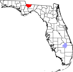 Location in the U.S. state of Florida | ||
 Florida's location in the U.S. | ||
| Founded | June 24, 1823 | |
| Named for | James Gadsden | |
| Seat | Quincy | |
| Largest city | Quincy | |
| Area | ||
| • Total | 529 sq mi (1,370 km2) | |
| • Land | 516 sq mi (1,336 km2) | |
| • Water | 12 sq mi (31 km2), 2.3% | |
| Population (est.) | ||
| • (2017) | 46,071[1] | |
| • Density | 89.3/sq mi (34.5/km2) | |
| Congressional district | 5th | |
| Time zone | Eastern: UTC−5/−4 | |
| Website |
www | |
Gadsden County is a county located in the panhandle of the U.S. state of Florida. As of the 2010 census, the population was 46,389.[2] Its county seat is Quincy.[3]
Gadsden County is included in the Tallahassee, FL Metropolitan Statistical Area.
Gadsden County is the only majority (over 50%) African-American county in Florida and Gadsden’s county administrator is an African-American woman Dee Jackson.
History
Gadsden County was created in 1823.[4] It was named for James Gadsden[5] of South Carolina, who served as Andrew Jackson's aide-de-camp in Florida in 1818. Gadsden County is historically known for its tobacco crop which is obsolete today.
Geography
According to the U.S. Census Bureau, the county has a total area of 529 square miles (1,370 km2), of which 516 square miles (1,340 km2) is land and 12 square miles (31 km2) (2.3%) is water.[6]
Gadsden County is part of the Tallahassee Metropolitan Statistical Area. Gadsden County is in the Eastern Time Zone. Its western border with Jackson County forms the boundary in this area between the Eastern and Central Time Zones.
Adjacent counties
- Decatur County, Georgia - north
- Seminole County, Georgia - north
- Grady County, Georgia - northeast
- Leon County, Florida - east
- Liberty County, Florida - southwest
- Calhoun County, Florida - southwest (CST)
- Jackson County, Florida - northwest (CST)
Demographics
| Historical population | |||
|---|---|---|---|
| Census | Pop. | %± | |
| 1830 | 4,895 | — | |
| 1840 | 5,992 | 22.4% | |
| 1850 | 8,784 | 46.6% | |
| 1860 | 9,396 | 7.0% | |
| 1870 | 9,802 | 4.3% | |
| 1880 | 12,169 | 24.1% | |
| 1890 | 11,894 | −2.3% | |
| 1900 | 15,294 | 28.6% | |
| 1910 | 22,198 | 45.1% | |
| 1920 | 23,539 | 6.0% | |
| 1930 | 29,890 | 27.0% | |
| 1940 | 31,450 | 5.2% | |
| 1950 | 36,457 | 15.9% | |
| 1960 | 41,989 | 15.2% | |
| 1970 | 39,184 | −6.7% | |
| 1980 | 41,565 | 6.1% | |
| 1990 | 41,105 | −1.1% | |
| 2000 | 45,087 | 9.7% | |
| 2010 | 46,389 | 2.9% | |
| Est. 2017 | 46,071 | [7] | −0.7% |
| U.S. Decennial Census[8] 1790-1960[9] 1900-1990[10] 1990-2000[11] 2010-2015[2] | |||
Gadsden County is unique in Florida in that it is the state's only county with an African American majority population. As of the 2010 United States Census, there were 46,389 people residing in the county. 56.0% were Black or African American, 35.9% White, 0.5% Asian, 0.3% Native American, 5.9% of some other race and 1.3% of two or more races. 9.5% were Hispanic or Latino (of any race).
As of the census[12] of 2000, there were 45,087 people, 15,867 households, and 11,424 families residing in the county. The population density was 87 people per square mile (34/km²). There were 17,703 housing units at an average density of 34 per square mile (13/km²). The racial makeup of the county was 57.14% Black or African American, 38.70% White, 0.23% Native American, 0.26% Asian, 0.02% Pacific Islander, 2.76% from other races, and 0.89% from two or more races. 6.17% of the population were Hispanic or Latino of any race.
There were 15,867 households out of which 32.60% had children under the age of 18 living with them, 44.50% were married couples living together, 22.50% had a female householder with no husband present, and 28.00% were non-families. 23.90% of all households were made up of individuals and 9.50% had someone living alone who was 65 years of age or older. The average household size was 2.69 and the average family size was 3.18.
In the county, the population was spread out with 26.40% under the age of 18, 9.50% from 18 to 24, 28.90% from 25 to 44, 23.00% from 45 to 64, and 12.20% who were 65 years of age or older. The median age was 36 years. For every 100 females, there were 90.70 males. For every 100 females age 18 and over, there were 86.50 males.
The median income for a household in the county was $31,248, and the median income for a family was $36,238. Males had a median income of $27,159 versus $21,721 for females. The per capita income for the county was $14,499. About 16.40% of families and 19.90% of the population were below the poverty line, including 28.50% of those under age 18 and 16.90% of those age 65 or over.
Education
| Level of Education | ||||
|---|---|---|---|---|
| Level | Gadsden Co. | Florida | U.S. | |
| College/Associate Degree | 21.9% | 28.8% | 27.4% | |
| Bachelor's Degree | 8.0% | 14.3% | 15.5% | |
| Master's or Ph. D. | 4.9% | 8.1% | 8.9% | |
| Total | 34.8% | 51.2% | 51.8% | |
The Gadsden County School District operates public schools.
Gadsden County is home to one public high school, Gadsden County High School (formerly East Gadsden High School), formed in 2017 by the merger of East Gadsden High and the high school portion of West Gadsden High School; the West Gadsden High building was converted to West Gadsden Middle.[13][14] West Gadsden was formed by the merger of the former Chattahoochee High and Greensboro High and was located on the western outskirts of Quincy near Greensboro. East Gadsden, formed by the merger of James A. Shanks High and Havana Northside High, was located on Hwy. 90 east of Quincy.
Robert F. Munroe Day School and Tallavanna Christian School are private schools in the county.
Libraries
The Gadsden County Public Library System has 3 branches.
- William A. McGill Library
- Havana Branch
- Chattahoochee Branch
Politics
Voter Registration
According to the Secretary of State’s office, Democrats maintain a massive majority of registered voters in Gadsden County. As of September 30, 2015, the county has the second-highest percentage of registered Democrats of all counties in Florida (only in Liberty County do Democrats have a higher percentage of registered voters countywide). The last Republican to win a majority in the county was Richard Nixon in his landslide 1972 victory,[15] and Gadsden was the solitary Florida county to vote against Reagan in 1984[16] and Bush Senior in 1988.
| Gadsden County Voter Registration & Party Enrollment as of September 30, 2015[17] | |||||
|---|---|---|---|---|---|
| Political Party | Total Voters | Percentage | |||
| Democratic | 22,279 | 76.95% | |||
| Republican | 4,084 | 14.11% | |||
| Independent | 2,249 | 7.77% | |||
| Third Parties | 339 | 1.17% | |||
| Total | 28,951 | 100.00% | |||
Statewide Elections
| Year | Republican | Democratic | Third parties |
|---|---|---|---|
| 2016 | 30.29% 6,728 | 67.62% 15,020 | 2.10% 466 |
| 2012 | 29.43% 6,630 | 70.01% 15,770 | 0.55% 125 |
| 2008 | 30.22% 6,811 | 69.14% 15,582 | 0.64% 145 |
| 2004 | 29.80% 6,253 | 69.72% 14,629 | 0.49% 102 |
| 2000 | 32.38% 4,770 | 66.09% 9,736 | 1.52% 225 |
| 1996 | 26.88% 3,817 | 66.25% 9,407 | 6.87% 975 |
| 1992 | 27.62% 3,975 | 58.96% 8,486 | 13.43% 1,933 |
| 1988 | 47.64% 5,992 | 50.66% 6,372 | 1.69% 213 |
| 1984 | 43.95% 5,807 | 56.03% 7,403 | 0.02% 2 |
| 1980 | 30.41% 3,718 | 67.26% 8,222 | 2.33% 285 |
| 1976 | 33.85% 3,531 | 65.17% 6,798 | 0.98% 102 |
| 1972 | 61.01% 5,995 | 38.97% 3,829 | 0.02% 2 |
| 1968 | 14.76% 1,337 | 36.15% 3,274 | 49.09% 4,446 |
| 1964 | 53.33% 5,207 | 46.67% 4,556 | |
| 1960 | 46.18% 2,010 | 53.82% 2,343 | |
| 1956 | 36.87% 1,321 | 63.13% 2,262 | |
| 1952 | 40.41% 1,835 | 59.59% 2,706 | |
| 1948 | 13.42% 376 | 50.93% 1,427 | 35.65% 999 |
| 1944 | 15.22% 462 | 84.78% 2,574 | |
| 1940 | 11.47% 417 | 88.53% 3,218 | |
| 1936 | 7.15% 198 | 92.85% 2,572 | |
| 1932 | 5.33% 105 | 94.67% 1,865 | |
| 1928 | 22.31% 346 | 76.34% 1,184 | 1.35% 21 |
| 1924 | 5.86% 47 | 84.91% 681 | 9.22% 74 |
| 1920 | 1.91% 38 | 96.68% 1,922 | 1.41% 28 |
| 1916 | 5.53% 57 | 84.95% 875 | 9.51% 98 |
| 1912 | 9.73% 75 | 78.99% 609 | 11.28% 87 |
| 1908 | 12.06% 89 | 76.29% 563 | 11.65% 86 |
| 1904 | 10.07% 54 | 87.87% 471 | 2.05% 11 |
| Year | Republican | Democratic | Third parties |
|---|---|---|---|
| 2014 | 27.27% 4,798 | 70.62% 12,425 | 2.11% 371 |
| 2010 | 25.90% 4,324 | 72.27% 12,067 | 1.83% 307 |
| 2006 | 32.45% 4,557 | 66.25% 9,303 | 1.29% 182 |
| 2002 | 25.83% 3,948 | 73.46% 11,228 | 0.71% 109 |
| 1998 | 35.66% 4,028 | 64.34% 7,269 | |
| 1994 | 30.63% 3,422 | 69.37% 7,751 |
Transportation
Airports
Major Roads


Railroads
Gadsden County has at least four existing railroad lines, three of which are owned by CSX. The first two CSX lines being P&A Subdivision, a line formerly owned by the Louisville and Nashville Railroad, and the other is the Tallahassee Subdivision, a former Seaboard Air Line Railroad line. These two lines meet in Chatahoochee and served Amtrak's Sunset Limited until it was truncated to New Orleans in 2005 by Hurricane Katrina. A third line is the Apalachicola Northern Railroad, a line that spans as far south as Port St. Joe. The line enters from Liberty County, then crosses SR 12 in Greensboro, runs under I-10, follows CR 268 in Hardaway, and then turns west into Chatahoochee. The fourth line is the third CSX Line, the Bainbridge Subdivision, which runs along the west side of US 27 from Leon County by way of a bridge over the Ochlockonee River to the Georgia State Line. While some spurs still exist, other lines within the county were abandoned.
Communities
Cities
Towns
Unincorporated areas
Gallery
 Gadsden County Board of Commissioners
 Gadsden County Sheriff's Office
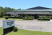
 Gadsden County Emergency Medical Services and Gadsden County Fire Services
See also
References
- ↑ https://www.census.gov/quickfacts/fact/table/gadsdencountyflorida/PST045216
- 1 2 "State & County QuickFacts". United States Census Bureau. Archived from the original on July 10, 2011. Retrieved February 12, 2014.
- ↑ "Find a County". National Association of Counties. Archived from the original on 2011-05-31. Retrieved 2011-06-07.
- ↑ Publications of the Florida Historical Society. Florida Historical Society. 1908. p. 31.
- ↑ Gannett, Henry (1905). The Origin of Certain Place Names in the United States. Govt. Print. Off. p. 133.
- ↑ "US Gazetteer files: 2010, 2000, and 1990". United States Census Bureau. 2011-02-12. Retrieved 2011-04-23.
- ↑ "Population and Housing Unit Estimates". Retrieved June 9, 2017.
- ↑ "U.S. Decennial Census". United States Census Bureau. Archived from the original on May 12, 2015. Retrieved June 13, 2014.
- ↑ "Historical Census Browser". University of Virginia Library. Retrieved June 13, 2014.
- ↑ "Population of Counties by Decennial Census: 1900 to 1990". United States Census Bureau. Retrieved June 13, 2014.
- ↑ "Census 2000 PHC-T-4. Ranking Tables for Counties: 1990 and 2000" (PDF). United States Census Bureau. Retrieved June 13, 2014.
- ↑ "American FactFinder". United States Census Bureau. Archived from the original on 2013-09-11. Retrieved 2011-05-14.
- ↑ "SCHOOL MERGERS NOT POPULAR AT WEST GADSDEN". Havana Herald. 2017-03-03. Archived from the original on 2017-04-06. Retrieved 2017-04-06.
- ↑ Jiwanmall, Stephen (2017-04-04). "Gadsden County Schools to Consolidate in 2017-18". WTXL. Retrieved 2017-04-06.
- ↑ Sullivan, Robert David; ‘How the Red and Blue Map Evolved Over the Past Century’; America Magazine in The National Catholic Review; June 29, 2016
- ↑ David Leip’s Atlas of U.S. Presidential Elections; 1984 Presidential General Election Data Graphs – Florida by County
- ↑ "Archived copy". Archived from the original on 2016-10-24. Retrieved 2016-10-27.
- ↑ Leip, David. "Dave Leip's Atlas of U.S. Presidential Elections". uselectionatlas.org. Retrieved 2018-06-14.
- Gadsden: a Florida County in Word and Picture, by Miles Kenan Womack, Jr.
External links
| Wikimedia Commons has media related to Gadsden County, Florida. |
Government links/Constitutional offices
- Gadsden County Board of County Commissioners
- Gadsden County Supervisor of Elections
- Gadsden County Property Appraiser
- Gadsden County Sheriff's Office
- Gadsden County Tax Collector
Special districts
Judicial branch
Tourism links
- Gadsden County Chamber of Commerce
- RiverWay South, FL regional tourism website
- Official Gadsden County Tourism website
Places adjacent to Gadsden County, Florida | ||||||||||
|---|---|---|---|---|---|---|---|---|---|---|
| ||||||||||
Municipalities and communities of Gadsden County, Florida, United States | ||
|---|---|---|
| Cities | | |
| Towns | ||
| Unincorporated communities | ||

| Topics |  Map of North Florida | |
|---|---|---|
| Counties | ||
| Major cities | ||
| Cities and towns 100k+ | ||
| Cities and towns 25k–100k | ||
| Cities and towns 10k–25k | ||
| Metro areas | ||
| Regions | ||