Washington County, Florida
| Washington County, Florida | ||
|---|---|---|
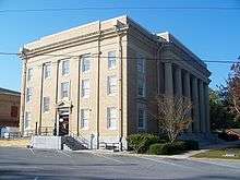
 Washington County Courthouse | ||
| ||
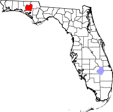 Location in the U.S. state of Florida | ||
 Florida's location in the U.S. | ||
| Founded | December 9, 1825 | |
| Named for | George Washington | |
| Seat | Chipley | |
| Largest city | Chipley | |
| Area | ||
| • Total | 616 sq mi (1,595 km2) | |
| • Land | 583 sq mi (1,510 km2) | |
| • Water | 33 sq mi (85 km2), 5.4% | |
| Population (est.) | ||
| • (2017) | 24,567 | |
| • Density | 42/sq mi (16/km2) | |
| Congressional district | 2nd | |
| Time zone | Central: UTC−6/−5 | |
| Website |
www | |

Washington County is a county located in the state of Florida. As of the 2010 census, the population was 24,935.[1] Its county seat is Chipley.[2] Washington County is a prohibition or entirely dry county, meaning that the sale of alcoholic beverages is banned in the county.
History
Washington County, Florida was created in 1825, and was nearly twice the size of the State of Delaware, stretching all the way to the Gulf of Mexico. After a century of boundary shifts, the county, with over 382,000 acres (1,546 km2) of rolling hills covered in thick, stately pines and mixed hardwood forests, now covers a large portion of the central Florida Panhandle.
Over a span of more than 150 years, Washington County has seen Native American, Spanish and English cultural influences. The County's historical lore is rich with stories of the exploits of Andrew Jackson. There are numerous Native American Mounds and evidence of strong settlements still being discovered.
Named after George Washington,[3] the first President of the United States of America, the area was first settled by those seeking both economic and political freedom in this frontier land of vast timber and mineral resources. Inland waterway transportation brought about heavy river settlements. The arrival of railroads in the late 1800s boosted economic, social and political developments.
Vernon, the geographical center of the county derives is named for George Washington's Virginia home, Mt. Vernon. The pioneer town was also the site of a major Indian settlement.
The county courthouse was located in Vernon during the early part of this century until a railroad town in northeastern Washington County, Chipley, became the new and present county seat in 1927.
Geography
According to the U.S. Census Bureau, the county has a total area of 616 square miles (1,600 km2), of which 583 square miles (1,510 km2) is land and 33 square miles (85 km2) (5.4%) is water.[4]
Adjacent Counties
- Holmes County, Florida - north
- Jackson County, Florida - northeast
- Bay County, Florida - south
- Walton County, Florida - west
Demographics
| Historical population | |||
|---|---|---|---|
| Census | Pop. | %± | |
| 1830 | 978 | — | |
| 1840 | 859 | −12.2% | |
| 1850 | 1,950 | 127.0% | |
| 1860 | 2,154 | 10.5% | |
| 1870 | 2,302 | 6.9% | |
| 1880 | 4,089 | 77.6% | |
| 1890 | 6,426 | 57.2% | |
| 1900 | 10,154 | 58.0% | |
| 1910 | 16,403 | 61.5% | |
| 1920 | 11,828 | −27.9% | |
| 1930 | 12,180 | 3.0% | |
| 1940 | 12,302 | 1.0% | |
| 1950 | 11,888 | −3.4% | |
| 1960 | 11,249 | −5.4% | |
| 1970 | 11,453 | 1.8% | |
| 1980 | 14,509 | 26.7% | |
| 1990 | 16,919 | 16.6% | |
| 2000 | 20,973 | 24.0% | |
| 2010 | 24,896 | 18.7% | |
| Est. 2017 | 24,567 | [5] | −1.3% |
| U.S. Decennial Census[6] 1790-1960[7] 1900-1990[8] 1990-2000[9] 2010-2015[1] | |||
As of the census[10] of 2000, there were 20,973 people, 7,931 households, and 5,646 families residing in the county. The population density was 36 inhabitants per square mile (14/km2). There were 9,503 housing units at an average density of 16 per square mile (6/km²). The racial makeup of the county was 81.72% White, 13.69% Black or African American, 1.54% Native American, 0.36% Asian, 0.06% Pacific Islander, 0.58% from other races, and 2.05% from two or more races. 2.30% of the population were Hispanic or Latino of any race.
There were 7,931 households out of which 30.30% had children under the age of 18 living with them, 56.20% were married couples living together, 11.40% had a female householder with no husband present, and 28.80% were non-families. 25.10% of all households were made up of individuals and 12.00% had someone living alone who was 65 years of age or older. The average household size was 2.46 and the average family size was 2.93.
In the county, the population was spread out with 23.40% under the age of 18, 7.70% from 18 to 24, 28.50% from 25 to 44, 24.70% from 45 to 64, and 15.70% who were 65 years of age or older. The median age was 39 years. For every 100 females there were 105.80 males. For every 100 females age 18 and over, there were 105.90 males.
The median income for a household in the county was $27,922, and the median income for a family was $33,057. Males had a median income of $26,597 versus $20,198 for females. The per capita income for the county was $14,980. About 15.40% of families and 19.20% of the population were below the poverty line, including 26.90% of those under age 18 and 19.40% of those age 65 or over.
Education
The Washington County School District includes:[11]
- Kate Smith Elementary School
- Vernon Elementary School
- Roulhac Middle School
- Vernon Middle School
- Chipley High School
- Vernon High School (Vernon, Florida)
Washington Public Library System
Washington County Public Library system has three branches:
- Sam Mitchell Public Library
- Wausau Public Library
- Sunny Hills Public Library
Media
Communities

Cities
Towns
Unincorporated communities
- Crow
- Five Points
- Gilberts Mill
- Greenhead
- Hinson's Crossroads
- Holmes Valley
- New Hope
- Poplar Head
- Red Head
- Sunny Hills
Politics
| Year | Republican | Democratic | Third parties |
|---|---|---|---|
| 2016 | 77.04% 8,637 | 20.19% 2,264 | 2.77% 310 |
| 2012 | 72.79% 8,038 | 25.54% 2,820 | 1.67% 184 |
| 2008 | 73.23% 8,178 | 25.64% 2,863 | 1.13% 126 |
| 2004 | 71.09% 7,369 | 28.09% 2,912 | 0.82% 85 |
| 2000 | 62.24% 4,995 | 34.86% 2,798 | 2.90% 233 |
| 1996 | 44.83% 3,524 | 38.06% 2,992 | 17.11% 1,345 |
| 1992 | 46.94% 3,695 | 32.32% 2,544 | 20.74% 1,632 |
| 1988 | 66.64% 4,374 | 32.66% 2,144 | 0.70% 46 |
| 1984 | 70.62% 4,608 | 29.36% 1,916 | 0.02% 1 |
| 1980 | 49.92% 3,251 | 47.75% 3,110 | 2.34% 152 |
| 1976 | 38.58% 2,313 | 59.47% 3,566 | 1.95% 117 |
| 1972 | 86.11% 3,777 | 13.82% 606 | 0.07% 3 |
| 1968 | 10.71% 528 | 14.64% 722 | 74.66% 3,682 |
| 1964 | 64.50% 2,725 | 35.50% 1,500 | |
| 1960 | 36.96% 1,230 | 63.04% 2,098 | |
| 1956 | 32.18% 1,027 | 67.82% 2,164 | |
| 1952 | 32.71% 1,100 | 67.29% 2,263 | |
| 1948 | 13.43% 297 | 62.42% 1,380 | 24.15% 534 |
| 1944 | 22.98% 507 | 77.02% 1,699 | |
| 1940 | 25.14% 643 | 74.86% 1,915 | |
| 1936 | 17.51% 486 | 82.49% 2,289 | |
| 1932 | 12.46% 345 | 87.54% 2,424 | |
| 1928 | 69.72% 1,672 | 27.98% 671 | 2.29% 55 |
| 1924 | 24.76% 206 | 67.55% 562 | 7.70% 64 |
| 1920 | 25.37% 307 | 61.98% 750 | 12.64% 153 |
| 1916 | 15.85% 159 | 62.41% 626 | 21.73% 218 |
| 1912 | 7.61% 82 | 64.38% 694 | 28.02% 302 |
| 1908 | 24.64% 288 | 55.77% 652 | 19.59% 229 |
| 1904 | 26.03% 202 | 53.35% 414 | 20.62% 160 |
See also
- Dry counties Washington is a partially dry county. Alcohol cannot be bought or sold on Sunday within the city limits of Chipley. Vernon, Ebro and Wausau are excluded from this ordinance.
- National Register of Historic Places listings in Washington County, Florida
References
- 1 2 "State & County QuickFacts". United States Census Bureau. Retrieved June 16, 2014.
- ↑ "Find a County". National Association of Counties. Retrieved 2011-06-07.
- ↑ Publications of the Florida Historical Society. Florida Historical Society. 1908. p. 35.
- ↑ "US Gazetteer files: 2010, 2000, and 1990". United States Census Bureau. 2011-02-12. Retrieved 2011-04-23.
- ↑ "Population and Housing Unit Estimates". Retrieved June 9, 2017.
- ↑ "U.S. Decennial Census". United States Census Bureau. Retrieved June 16, 2014.
- ↑ "Historical Census Browser". University of Virginia Library. Retrieved June 16, 2014.
- ↑ "Population of Counties by Decennial Census: 1900 to 1990". United States Census Bureau. Retrieved June 16, 2014.
- ↑ "Census 2000 PHC-T-4. Ranking Tables for Counties: 1990 and 2000" (PDF). United States Census Bureau. Retrieved June 16, 2014.
- ↑ "American FactFinder". United States Census Bureau. Retrieved 2011-05-14.
- ↑ District, Washington County School. "Schools". Archived from the original on 2009-05-14. Retrieved 2009-05-26.
- ↑ Leip, David. "Dave Leip's Atlas of U.S. Presidential Elections". uselectionatlas.org. Retrieved 2018-06-16.
External links
- Washington County News newspaper that serves Washington County, Florida available in full-text with images in Florida Digital Newspaper Library
- Chipley Banner newspaper that served Washington County, Florida from 1897-1900 available in full-text with images in Florida Digital Newspaper Library
| Wikimedia Commons has media related to Washington County, Florida. |
Government links/Constitutional offices
- Washington County Board of County Commissioners
- Washington County Supervisor of Elections
- Washington County Property Appraiser
- Washington County Sheriff's Office
- Washington County Tax Collector
Special districts
Judicial branch
- Washington County Clerk of Courts
- Circuit and County Court for the 14th Judicial Circuit of Florida serving Bay, Calhoun, Gulf, Holmes, Jackson and Washington counties
Community services
- Washington County Council on Aging Provides senior and elderly services including meals on wheels, case management, respite, workshops and more to residents throughout Washington County, Florida.
- UF IFAS Extension Washington County The Cooperative Extension Service is nationwide and was established by the Smith-Lever Act of 1914. It is a partnership between state land grant universities, the United States Department of Agriculture (USDA) and the county governments throughout the nation. In Florida, the Cooperative Extension Service is administered by the University of Florida. Thus, the Washington County Extension Service is a partnership between the USDA, the University of Florida and Washington County government. All of these groups share in the planning, financing, and operation of extension programs in the areas of Agriculture, Horticulture, Family and Consumer Sciences and 4H Youth Development.
Tourism links
- Washington County Chamber of Commerce
- Washington County Tourist Development Council
- Washington County Outdoor Expo / Gun & Knife Show
Places adjacent to Washington County, Florida | ||||||||||
|---|---|---|---|---|---|---|---|---|---|---|
| ||||||||||
Municipalities and communities of Washington County, Florida, United States | ||
|---|---|---|
| Cities | | |
| Towns | ||
| Unincorporated communities | ||

| Topics |  Map of North Florida | |
|---|---|---|
| Counties | ||
| Major cities | ||
| Cities and towns 100k+ | ||
| Cities and towns 25k–100k | ||
| Cities and towns 10k–25k | ||
| Metro areas | ||
| Regions | ||