Taylor County, Florida
| Taylor County, Florida | |
|---|---|
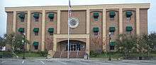 Taylor County Courthouse | |
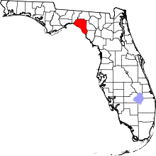 Location in the U.S. state of Florida | |
 Florida's location in the U.S. | |
| Founded | December 23, 1856 |
| Named for | Zachary Taylor |
| Seat | Perry |
| Largest city | Perry |
| Area | |
| • Total | 1,232 sq mi (3,191 km2) |
| • Land | 1,043 sq mi (2,701 km2) |
| • Water | 189 sq mi (490 km2), 15.3% |
| Population (est.) | |
| • (2017) | 21,833[1] |
| • Density | 21/sq mi (8/km2) |
| Congressional district | 2nd |
| Time zone | Eastern: UTC−5/−4 |
| Website |
www |
Taylor County is a county located in the state of Florida. As of the 2010 census, the population was 22,570.[2] Its county seat is Perry.[3] The county hosts the annual Florida Forest Festival and has been long known as the "Tree Capital of the South" since a 1965 designation from then-Governor W. Haydon Burns.[4]
History
Taylor County was created in 1856. It was named for Zachary Taylor, twelfth President of the United States of America, who served from 1849 to 1850.[5]
Geography
According to the U.S. Census Bureau, the county has a total area of 1,232 square miles (3,190 km2), of which 1,043 square miles (2,700 km2) is land and 189 square miles (490 km2) (15.3%) is water.[6]
Adjacent counties
- Jefferson County, Florida - northwest
- Madison County, Florida - north
- Lafayette County, Florida - east
- Dixie County, Florida - southeast
National protected area
Demographics
| Historical population | |||
|---|---|---|---|
| Census | Pop. | %± | |
| 1860 | 1,384 | — | |
| 1870 | 1,453 | 5.0% | |
| 1880 | 2,279 | 56.8% | |
| 1890 | 2,122 | −6.9% | |
| 1900 | 3,999 | 88.5% | |
| 1910 | 7,103 | 77.6% | |
| 1920 | 11,219 | 57.9% | |
| 1930 | 13,136 | 17.1% | |
| 1940 | 11,565 | −12.0% | |
| 1950 | 10,416 | −9.9% | |
| 1960 | 13,168 | 26.4% | |
| 1970 | 13,641 | 3.6% | |
| 1980 | 16,532 | 21.2% | |
| 1990 | 17,111 | 3.5% | |
| 2000 | 19,256 | 12.5% | |
| 2010 | 22,570 | 17.2% | |
| Est. 2017 | 21,833 | [7] | −3.3% |
| U.S. Decennial Census[8] 1790-1960[9] 1900-1990[10] 1990-2000[11] 2010-2015[2] | |||
As of the census[12] of 2000, there were 19,256 people, 7,176 households, and 5,130 families residing in the county. The population density was 18 people per square mile (7/km²). There were 9,646 housing units at an average density of 9 per square mile (4/km²). The racial makeup of the county was 77.84% White, 19.04% Black or African American, 0.98% Native American, 0.44% Asian, 0.02% Pacific Islander, 0.32% from other races, and 1.38% from two or more races. 1.53% of the population were Hispanic or Latino of any race.
There were 7,176 households out of which 31.60% had children under the age of 18 living with them, 52.50% were married couples living together, 14.40% had a female householder with no husband present, and 28.50% were non-families. 24.20% of all households were made up of individuals and 10.60% had someone living alone who was 65 years of age or older. The average household size was 2.51 and the average family size was 2.95.
In the county, the population was spread out with 24.60% under the age of 18, 8.20% from 18 to 24, 28.30% from 25 to 44, 24.80% from 45 to 64, and 14.10% who were 65 years of age or older. The median age was 38 years. For every 100 females there were 104.40 males. For every 100 females age 18 and over, there were 104.80 males.
The median income for a household in the county was $30,032, and the median income for a family was $35,061. Males had a median income of $27,967 versus $19,054 for females. The per capita income for the county was $15,281. About 14.50% of families and 18.00% of the population were below the poverty line, including 22.20% of those under age 18 and 17.90% of those age 65 or over.
In March 2016, the county's unemployment rate was 5.6%.
Education
Students are served by the Taylor County School System. For the 2006 - 2007 school year the Florida Department of Education gave the District a "B" grade with three of its schools earning an "A" and one school earning a "B" grade.[13]
Taylor County High School also has an Army JROTC unit which has been an Honor Unit with Distinction for 27 consecutive years.[14]
Library
The Taylor County Public Library is part of the Three Rivers Regional Library System], which also serves Gilchrist, Lafayette, and Dixie counties.[15]
Communities
City
Census-designated place
Other unincorporated communities
- Athena
- Bucell Junction
- Clara (shared with Dixie County)
- Dekle Beach
- Eridu
- Fenholloway
- Fish Creek
- Foley
- Hampton Springs
- Iddo
- Keaton Beach
- Lake Bird
- Pinland
- Salem
- Shady Grove
- Tennille
Politics
| Year | Republican | Democratic | Third parties |
|---|---|---|---|
| 2016 | 74.13% 6,930 | 23.02% 2,152 | 2.85% 266 |
| 2012 | 68.37% 6,249 | 30.24% 2,764 | 1.39% 127 |
| 2008 | 68.79% 6,457 | 29.86% 2,803 | 1.35% 127 |
| 2004 | 63.71% 5,467 | 35.53% 3,049 | 0.76% 65 |
| 2000 | 59.59% 4,058 | 38.90% 2,649 | 1.52% 103 |
| 1996 | 39.86% 3,188 | 44.80% 3,583 | 15.34% 1,226 |
| 1992 | 37.34% 2,693 | 35.60% 2,568 | 27.06% 1,952 |
| 1988 | 69.06% 4,057 | 30.01% 1,763 | 0.94% 55 |
| 1984 | 69.98% 4,038 | 30.02% 1,732 | |
| 1980 | 47.31% 2,776 | 50.49% 2,963 | 2.20% 129 |
| 1976 | 36.68% 1,983 | 62.34% 3,370 | 0.98% 53 |
| 1972 | 84.50% 4,109 | 15.50% 754 | |
| 1968 | 15.71% 794 | 18.62% 941 | 65.66% 3,318 |
| 1964 | 60.91% 2,661 | 39.09% 1,708 | |
| 1960 | 38.85% 1,212 | 61.15% 1,908 | |
| 1956 | 28.52% 776 | 71.48% 1,945 | |
| 1952 | 29.40% 744 | 70.60% 1,787 | |
| 1948 | 10.81% 216 | 67.73% 1,354 | 21.46% 429 |
| 1944 | 8.28% 165 | 91.72% 1,828 | |
| 1940 | 7.34% 198 | 92.66% 2,499 | |
| 1936 | 6.27% 127 | 93.73% 1,897 | |
| 1932 | 8.24% 130 | 91.76% 1,447 | |
| 1928 | 38.05% 465 | 60.47% 739 | 1.47% 18 |
| 1924 | 16.45% 100 | 78.29% 476 | 5.26% 32 |
| 1920 | 17.73% 128 | 77.98% 563 | 4.29% 31 |
| 1916 | 8.36% 51 | 89.67% 547 | 1.97% 12 |
| 1912 | 15.43% 56 | 65.01% 236 | 19.56% 71 |
| 1908 | 31.13% 160 | 48.64% 250 | 20.23% 104 |
| 1904 | 37.54% 119 | 53.00% 168 | 9.46% 30 |
Transportation
Airports
See also
References
- ↑ https://www.census.gov/quickfacts/fact/table/taylorcountyflorida/PST045217
- 1 2 "State & County QuickFacts". United States Census Bureau. Retrieved February 15, 2014.
- ↑ "Find a County". National Association of Counties. Retrieved 2011-06-07.
- ↑ Viola, Mark (October 19, 2015). "Tree Capital of the South". Perry Newspapers. Archived from the original on March 4, 2016. Retrieved October 21, 2015.
- ↑ Publications of the Florida Historical Society. Florida Historical Society. 1908. p. 34.
- ↑ "US Gazetteer files: 2010, 2000, and 1990". United States Census Bureau. 2011-02-12. Retrieved 2011-04-23.
- ↑ "Population and Housing Unit Estimates". Retrieved June 9, 2017.
- ↑ "U.S. Decennial Census". United States Census Bureau. Retrieved June 16, 2014.
- ↑ "Historical Census Browser". University of Virginia Library. Retrieved June 16, 2014.
- ↑ "Population of Counties by Decennial Census: 1900 to 1990". United States Census Bureau. Retrieved June 16, 2014.
- ↑ "Census 2000 PHC-T-4. Ranking Tables for Counties: 1990 and 2000" (PDF). United States Census Bureau. Retrieved June 16, 2014.
- ↑ "American FactFinder". United States Census Bureau. Retrieved 2011-05-14.
- ↑ District, Taylor County School. "Taylor County School District". www.taylor.k12.fl.us. Retrieved 23 March 2018.
- ↑ "Archived copy". Archived from the original on 2012-01-01. Retrieved 2011-08-15.
- ↑ "Three Rivers Regional Library System » Serving Dixie, Gilchrist, Lafayette, & Taylor counties". 3riverslibrary.com. Retrieved 2016-11-29.
- ↑ Leip, David. "Dave Leip's Atlas of U.S. Presidential Elections". uselectionatlas.org. Retrieved 23 March 2018.
External links
| Wikimedia Commons has media related to Taylor County, Florida. |
Government links/Constitutional offices
- Taylor County Board of County Commissioners
- Taylor County Supervisor of Elections
- Taylor County Property Appraiser
- Taylor County Sheriff's Office
- Taylor County Tax Collector
- Taylor County Public Library
Special districts
Judicial branch
Tourism links
Places adjacent to Taylor County, Florida | ||||||||||
|---|---|---|---|---|---|---|---|---|---|---|
| ||||||||||
Municipalities and communities of Taylor County, Florida, United States | ||
|---|---|---|
| City | | |
| CDP | ||
| Unincorporated communities | ||

| Topics |  Map of North Florida | |
|---|---|---|
| Counties | ||
| Major cities | ||
| Cities and towns 100k+ | ||
| Cities and towns 25k–100k | ||
| Cities and towns 10k–25k | ||
| Metro areas | ||
| Regions | ||