Seminole County, Florida
| Seminole County, Florida | ||
|---|---|---|
| County | ||
| Seminole County | ||
.JPG) Seminole County Courthouse | ||
| ||
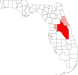
 Location in the U.S. state of Florida | ||
 Florida's location in the U.S. | ||
| Founded | April 25, 1913 | |
| Named for | Seminole people | |
| Seat | Sanford | |
| Largest city | Sanford | |
| Area | ||
| • Total | 345 sq mi (894 km2) | |
| • Land | 309 sq mi (800 km2) | |
| • Water | 36 sq mi (93 km2), 10.4% | |
| Population (est.) | ||
| • (2015) | 449,144 | |
| • Density | 1,372.0/sq mi (529.72/km2) | |
| Congressional district | 7th | |
| Time zone | Eastern: UTC−5/−4 | |
| Website |
www | |
Seminole County (/ˈsɛmɪnoʊl/, SEM-i-nohl) is a county in the state of Florida. As of the 2010 census, the population was 422,718.[1] Its county seat and largest city is Sanford.[2]
Seminole County is part of the Orlando-Kissimmee-Sanford, Florida Metropolitan Statisticial Area.
History
On July 21, 1821, two counties formed Florida: Escambia to the west and St. Johns to the east. In 1824, the area to the south of St. Johns County was designated Mosquito County, with its seat at Enterprise. The county's name was changed to Orange County in 1845 when Florida became a state, and over the next 70 years several other counties were created. Seminole County was one of the last to split.
Seminole County was created on April 25, 1913 out of the northern portion of Orange County by the Florida Legislature. It was named for the Seminole people who historically lived throughout the area. The name "Seminole" is thought to be derived from the Spanish word cimarron, meaning "wild" or "runaway."
Geography
According to the U.S. Census Bureau, the county has an area of 345 square miles (890 km2), of which 309 square miles (800 km2) is land and 36 square miles (93 km2) (10.4%) is water.[3] It is Florida's fourth-smallest county by land area and third-smallest by total area.
Seminole County's location between Volusia County and Orange County has made it one of Florida's fastest-growing counties. The Greater Orlando Metropolitan District which includes Seminole, Osceola, and the surrounding counties of Lake and Orange counties, together with neighboring Volusia and Brevard counties create a viable, progressive and diverse setting for economic growth and residential development.
Adjacent counties
- Volusia County, Florida - northeast
- Orange County, Florida - south and west
- Lake County, Florida - northwest
- Brevard County, Florida - east
Demographics
| Historical population | |||
|---|---|---|---|
| Census | Pop. | %± | |
| 1920 | 10,986 | — | |
| 1930 | 18,735 | 70.5% | |
| 1940 | 22,304 | 19.0% | |
| 1950 | 26,883 | 20.5% | |
| 1960 | 54,947 | 104.4% | |
| 1970 | 83,692 | 52.3% | |
| 1980 | 179,752 | 114.8% | |
| 1990 | 287,529 | 60.0% | |
| 2000 | 365,196 | 27.0% | |
| 2010 | 422,718 | 15.8% | |
| Est. 2016 | 455,479 | [4] | 7.8% |
| U.S. Decennial Census[5] 1790-1960[6] 1900-1990[7] 1990-2000[8] 2010-2015[1] | |||
As of the census of 2000, there were 365,196 people, 139,572 households, and 97,281 families residing in the county. The U.S. Census Bureau estimates that the population of the County has grown to 394,878 by 2003. Current 2012 estimates put the population at more than 430,838. The population density was 1,185 people per square mile (458/km²). There were 147,079 housing units at an average density of 477 per square mile (184/km²). The racial makeup of the county was 82.4% White, 9.5% Black or African American, 0.3% Native American, 2.5% Asian, <0.1% Pacific Islander, 3.1% from other races, and 2.2% from two or more races. 11.2% of the population were Hispanic or Latino of any race.
There were 139,572 households out of which 33.9% had children under the age of 18 living with them, 54.3% were married couples living together, 11.5% had a female householder with no husband present, and 30.3% were non-families. 22.9% of all households were made up of individuals and 6.6% had someone living alone who was 65 years of age or older. The average household size was 2.59 and the average family size was 3.07. The Department of Education states that in 2003, school enrollment was approximately 72,630. As of 2006, the Seminole County School District was the 52nd largest in the nation.[9]

Population was distributed with 25.4% under the age of 18, 8.4% from 18 to 24, 32.0% from 25 to 44, 23.6% from 45 to 64, and 10.6% who were 65 years of age or older. The median age was 36 years. For every 100 females, there were 95.90 males. For every 100 females age 18 and over, there were 92.90 males.
The median income for a household in the county was $49,326, and the median income for a family was $56,895. Males had a median income of $40,001 versus $28,217 for females. The per capita income for the county was $24,591. About 5.1% of families and 7.4% of the population were below the poverty line, including 8.6% of those under age 18 and 6.6% of those age 65 or over. As of March 2009, according to Workforce Central Florida, the unemployment rate for Seminole County is 9.2 percent.
Religion
The following reflects the latest year available for religious statistics, which was 2000.[10]
- Did not claim a religious affiliation - 230,901
- Catholic - 60,191
- Evangelical Protestant - 48,430
- Mainline Protestant - 19,713
- Other - 5,487
- Orthodox - 474
Government and politics
Seminole County is part of the strongly Republican belt of central and southwest Florida that was the first portion of the state to move politically distance itself from the "Solid South": the last Democrat to win a majority in the county was Harry Truman in 1948.[11] However, Seminole County is now considered to be a slightly Republican-leaning swing area. The entire county is currently represented by Democratic congresswoman Stephanie Murphy.
| Year | GOP | Dem | Others |
|---|---|---|---|
| 2016 | 48.10% 109,443 | 46.55% 105,914 | 5.35% 12,169 |
| 2012 | 52.57% 109,943 | 46.12% 96,445 | 1.31% 2,732 |
| 2008 | 50.90% 105,070 | 48.12% 99,335 | 0.98% 2,021 |
| 2004 | 58.10% 108,172 | 41.34% 76,971 | 0.56% 1,052 |
| 2000 | 55.00% 75,790 | 42.98% 59,227 | 2.02% 2,788 |
| 1996 | 52.04% 59,797 | 39.21% 45,058 | 8.74% 10,049 |
| 1992 | 48.57% 57,101 | 30.33% 35,660 | 21.10% 24,799 |
| 1988 | 72.20% 60,401 | 27.06% 22,635 | 0.74% 622 |
| 1984 | 75.91% 56,244 | 24.02% 17,795 | 0.07% 53 |
| 1980 | 66.16% 39,989 | 28.86% 17,443 | 4.98% 3,007 |
| 1976 | 56.94% 26,655 | 41.89% 19,609 | 1.17% 549 |
| 1972 | 80.84% 27,658 | 19.01% 6,503 | 0.15% 51 |
| 1968 | 44.69% 10,821 | 25.27% 6,120 | 30.04% 7,275 |
| 1964 | 52.48% 10,078 | 47.52% 9,125 | |
| 1960 | 64.63% 8,936 | 35.37% 4,891 | |
| 1956 | 65.15% 5,841 | 34.85% 3,125 | |
| 1952 | 60.02% 4,683 | 39.98% 3,120 | |
| 1948 | 33.25% 1,665 | 45.16% 2,261 | 21.59% 1,081 |
| 1944 | 31.50% 1,352 | 68.50% 2,940 | |
| 1940 | 30.29% 1,369 | 69.71% 3,150 | |
| 1936 | 25.80% 897 | 74.20% 2,580 | |
| 1932 | 30.68% 948 | 69.32% 2,142 | |
| 1928 | 58.89% 1,788 | 39.10% 1,187 | 2.01% 61 |
| 1924 | 23.46% 372 | 59.58% 945 | 16.96% 269 |
| 1920 | 32.28% 767 | 62.50% 1,485 | 5.22% 124 |
| 1916 | 15.56% 155 | 70.88% 706 | 13.55% 135 |
The government operates under a County Charter adopted in 1989 and amended in November, 1994. Policymaking and the legislative authority are vested in the Board of County Commissioners, a five-member board elected to four-year terms in partisan, countywide elections and from single member districts. The Board adopts the County budget, levies property taxes and other fees, and hires the County Manager and County Attorney. In addition to the Board, five Constitutional Officers are elected to partisan, four-year terms in accordance with the constitution of the State of Florida.
The Constitutional Officers, Clerk of the Circuit and County Courts, Sheriff, Tax Collector, Property Appraiser, and Supervisor of Elections, maintain separate accounting records and budgets. The Board funds a portion or, in certain instances, all of the operating budgets of the county's Constitutional Officers.
The county provides a full range of services; the construction and maintenance of the County's infrastructure, public safety, recreation, health and human services, and development and protection of the physical and economic environment.
In addition to the county government described above, there are other political entities which are controlled by the County, but have their own appointed boards; the Seminole County Expressway Authority, the Seminole County Port Authority, the Fred R. Wilson Memorial Law Library and the US 17-92 Community Redevelopment Agency.
Principal Officials
The following officers are elected as indicated:
- Commissioner, District I - Bob Dallari (R)
- Commissioner, District II - John Horan (R)
- Commissioner, District III - Lee Constantine (R)
- Commissioner, District IV - Carlton D. Henley (R)
- Commissioner, District V - Brenda Carey (R)
- Clerk of the Circuit Court - Grant Maloy (R)
- Sheriff - Dennis M. Lemma (R)
- Tax Collector - Joel M. Greenberg (R)
- Property Appraiser - David Johnson (R)
- Supervisor of Elections - Mike Ertel (R)
- County Manager (appointed) - Nicole Guillet
- County Attorney (appointed) - A. Bryant Applegate
- Soil and Water Conservation District Supervisor - Group 1 - Jason Kirby
- Soil and Water Conservation District Supervisor - Group 2 - David Mahnken
- Soil and Water Conservation District Supervisor - Group 3 - Justin York
- Soil and Water Conservation District Supervisor - Group 4 - Ed Young
- Soil and Water Conservation District Supervisor - Group 5 - Judith Benson
Libraries
The library system was founded in 1978 by the Seminole County Board of County Commissioners. It contains 500,000 volumes and has a circulation of 2.5 million books annually.[13] There are five branches, located in the cities of Casselberry, Sanford, Lake Mary, Oviedo, and Longwood.[14]
An online catalog is available including access to e-books and audio books. Library cards are restricted to county residents, property owners, students (enrolled in a county public school), or employed by the county government.[15]
Economy
AAA and Ruth's Hospitality Group have their headquarters in Heathrow, unincorporated Seminole County.[16][17]
Principal Taxpayers
| Taxpayer | Type of Business | Assessed Valuation | Percent of Total Taxable Valuation |
|---|---|---|---|
| Colonial Realty LP | Property Management / Development | $217,597,511 | 1.18% |
| Progress Energy Florida, Inc. | Electric Utility | 162,934,377 | .88% |
| BellSouth Telecommunications | Communications | 91,591,862 | .50% |
| Seminole Towne Center LP | Shopping Mall | 87,867,747 | .48% |
| Altamonte Mall A Jt. Venture | Shopping Mall | 86,903,276 | .47% |
| Sprint Nextel Corp. | Communications | 83,090,520 | .45% |
| Convergys | Call Center Outsourcing | 68,774,402 | .37% |
| United Dominion Realty Tr | Property Management / Development | 61,467,400 | .33% |
| Rouse-Orlando Inc. | Shopping Mall | 60,318,083 | .33% |
Per Capita Income and Unemployment Rate

Education
Seminole County Public Schools operates public schools.
Transportation
Interstates and Expressways
Surface Roads
Airports
Public Transportation
Communities
Cities
Census-designated places
- Black Hammock
- Chuluota
- Fern Park
- Forest City
- Geneva
- Goldenrod (with Orange County)
- Heathrow
- Midway
- Wekiwa Springs
Unincorporated communities
See also
References
- 1 2 "State & County QuickFacts". United States Census Bureau. Retrieved June 16, 2014.
- ↑ "Find a County". National Association of Counties. Retrieved 2011-06-07.
- ↑ "US Gazetteer files: 2010, 2000, and 1990". United States Census Bureau. 2011-02-12. Retrieved 2011-04-23.
- ↑ "Population and Housing Unit Estimates". Retrieved June 9, 2017.
- ↑ "U.S. Decennial Census". United States Census Bureau. Retrieved June 16, 2014.
- ↑ "Historical Census Browser". University of Virginia Library. Retrieved June 16, 2014.
- ↑ "Population of Counties by Decennial Census: 1900 to 1990". United States Census Bureau. Retrieved June 16, 2014.
- ↑ "Census 2000 PHC-T-4. Ranking Tables for Counties: 1990 and 2000" (PDF). United States Census Bureau. Retrieved June 16, 2014.
- ↑ "National Center for Educations Statistics - 100 Largest School Districts in the United States". Retrieved 2008-07-31.
- ↑ "The Association of Religion Data Archives | Maps & Reports". Thearda.com. Retrieved 2012-12-18.
- ↑ Sullivan, Robert David; ‘How the Red and Blue Map Evolved Over the Past Century’; America Magazine in The National Catholic Review; June 29, 2016
- ↑ Leip, David. "Dave Leip's Atlas of U.S. Presidential Elections". uselectionatlas.org. Retrieved 2018-06-15.
- ↑ "Seminole County Public Library: About Us". Seminole County Government. Archived from the original on 4 June 2013. Retrieved 26 July 2013.
- ↑ "Seminole County Public Library: Branch Information". Seminole County Government. Archived from the original on 9 May 2013. Retrieved 26 July 2013.
- ↑ "Seminole County Public Library: Obtaining a Library Card". Seminole County Government. Archived from the original on 9 May 2013. Retrieved 26 July 2013.
- ↑ "Heathrow CDP, Florida Archived 2011-06-06 at the Wayback Machine.." U.S. Census Bureau. Retrieved on February 26, 2010.
- ↑ "Home Office Archived 2010-02-25 at the Wayback Machine.." Ruth's Hospitality Group. Retrieved on February 26, 2010.
External links
| Wikimedia Commons has media related to Seminole County, Florida. |
- Seminole (County) at Curlie (based on DMOZ)
- Seminole County Government / Board of County Commissioners
- Seminole County Government / Mosquito Control Program
- Photographs from the State Library & Archives of Florida.
- Seminole County Jail Information
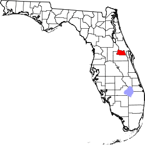
Places adjacent to Seminole County, Florida | ||||||||||
|---|---|---|---|---|---|---|---|---|---|---|
| ||||||||||
Municipalities and communities of Seminole County, Florida, United States | ||
|---|---|---|
| Cities | | |
| CDPs | ||
| Unincorporated communities | ||
| Footnotes | ‡This populated place also has portions in an adjacent county or counties | |