Pasco County, Florida
| Pasco County, Florida | |||
|---|---|---|---|
| County | |||
| Pasco County | |||
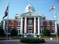 Pasco County Courthouse | |||
| |||
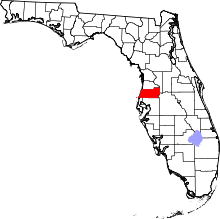 Location in the U.S. state of Florida | |||
 Florida's location in the U.S. | |||
| Founded | June 2, 1887 | ||
| Seat | Dade City | ||
| Largest city | New Port Richey | ||
| Area | |||
| • Total | 868 sq mi (2,248 km2) | ||
| • Land | 747 sq mi (1,935 km2) | ||
| • Water | 122 sq mi (316 km2), 14.0% | ||
| Population (est.) | |||
| • (2017) | 525,643 | ||
| • Density | 704/sq mi (272/km2) | ||
| Congressional district | 12th | ||
| Time zone | Eastern: UTC−5/−4 | ||
| Website |
www | ||


Pasco County is a county located in the U.S. state of Florida. As of the 2010 census, the population was 464,697.[1] Its county seat is Dade City,[2] and its largest city is New Port Richey. The county is named for Samuel Pasco.
Pasco County is included in the Tampa-St. Petersburg-Clearwater Tampa Bay Area and is primarily a bedroom community for Tampa.
It includes numerous parks and trails including along rivers, the Gulf of Mexico, lakes, and highway/ railroad right of ways. Several nudist resorts are located in Pasco. West Pasco includes retirement areas, commercial fishing, and suburbs of Tampa. The Suncoast Parkway and U.S. 19 both pass through Pasco.
History

Pasco County was created on June 2, 1887, from the southern third of Hernando County. The same legislation also created Citrus County from the northern third of Hernando County. The county was named for Samuel Pasco, who had just been elected to the United States Senate.[3]
Dade City was named the temporary county seat until a popular vote was held in 1889, at which time voters made Dade City the permanent county seat. As early as 1917, residents of the western part of the county proposed forming a separate county or merging with Pinellas County, as Dade City was not centrally located in the county. The issue was finally resolved in the late 1970s with the construction of identical government centers in both Dade City and New Port Richey.
The earliest towns were Anclote, Blanton, Dade City, Earnestville, Fort Dade (not to be confused with Fort Dade on Egmont Key), Macon (Trilby), Lacoochee, Saint Leo,[4] and San Antonio. Citrus was an important industry when the county was formed, although a decline followed a freeze in 1895. Several large sawmills operated in the county in the early part of the twentieth century. During the Florida land boom of the 1920s, New Port Richey became the winter home of silent screen star Thomas Meighan and golfer Gene Sarazen; Meighan attempted to bring other Hollywood figures to the city. The county has experienced significant population growth since the 1960s. The growth began along the Gulf coast but is now occurring most rapidly in areas north of Tampa.
Geography
According to the U.S. Census Bureau, the county has a total area of 868 square miles (2,250 km2), of which 747 square miles (1,930 km2) is land and 122 square miles (320 km2) (14.0%) is water.[5]
Adjacent counties
- Hernando County—north
- Sumter County—northeast
- Polk County—southeast
- Hillsborough County—south
- Pinellas County—southwest
Demographics
| Historical population | |||
|---|---|---|---|
| Census | Pop. | %± | |
| 1890 | 4,249 | — | |
| 1900 | 6,054 | 42.5% | |
| 1910 | 7,502 | 23.9% | |
| 1920 | 8,802 | 17.3% | |
| 1930 | 10,574 | 20.1% | |
| 1940 | 13,981 | 32.2% | |
| 1950 | 20,529 | 46.8% | |
| 1960 | 36,785 | 79.2% | |
| 1970 | 75,955 | 106.5% | |
| 1980 | 193,643 | 154.9% | |
| 1990 | 281,131 | 45.2% | |
| 2000 | 344,765 | 22.6% | |
| 2010 | 464,697 | 34.8% | |
| Est. 2017 | 525,643 | [6] | 13.1% |
| U.S. Decennial Census[7] 1790-1960[8] 1900-1990[9] 1990-2000[10] 2010-2015[1] | |||
As of the census[11] of 2000, there were 344,765 people, 147,566 households, and 99,016 families residing in the county. The population density was 463 people per square mile (179/km²). There were 173,717 housing units at an average density of 233 per square mile (90/km²). The racial makeup of the county was 93.70% White, 2.07% Black or African American, 0.35% Native American, 0.94% Asian, 0.03% Pacific Islander, 1.52% from other races, and 1.38% from two or more races. 5.69% of the population were Hispanic or Latino of any race.
There were 147,566 households out of which 23.50% had children under the age of 18 living with them, 54.60% were married couples living together, 8.90% had a female householder with no husband present, and 32.90% were non-families. 27.30% of all households were made up of individuals and 15.90% had someone living alone who was 65 years of age or older. The average household size was 2.30 and the average family size was 2.77.
In the county, the population was spread out with 20.20% under the age of 18, 5.80% from 18 to 24, 24.10% from 25 to 44, 23.10% from 45 to 64, and 26.80% who were 65 years of age or older. The median age was 45 years. For every 100 females there were 92.20 males. For every 100 females age 18 and over, there were 89.10 males.
The median income for a household in the county was $32,969, and the median income for a family was $39,568. Males had a median income of $30,974 versus $23,802 for females. The per capita income for the county was $18,439. About 7.60% of families and 10.70% of the population were below the poverty line, including 15.20% of those under age 18 and 7.70% of those age 65 or over.
Government and politics
Though the county seat is in Dade City, duplicate county government offices and court facilities are also located in the New Port Richey area on the west side of the county.
Politically, the county has been a swing area over the past quarter century. However, three of the last four elections have trended strongly Republican in Presidential elections, with 2008 being the exception. Although the GOP had the most votes in 2008, it was by a much smaller margin than the previous 2004 election or the subsequent 2012 and 2016 elections.
| Year | Republican | Democratic | Third parties |
|---|---|---|---|
| 2016 | 58.41% 142,101 | 37.06% 90,142 | 4.53% 11,022 |
| 2012 | 52.48% 112,427 | 45.86% 98,263 | 1.66% 3,558 |
| 2008 | 51.07% 110,104 | 47.51% 102,417 | 1.42% 3,068 |
| 2004 | 54.07% 103,230 | 44.39% 84,749 | 1.54% 2,937 |
| 2000 | 48.05% 68,607 | 48.73% 69,576 | 3.21% 4,586 |
| 1996 | 36.23% 48,355 | 49.80% 66,475 | 13.97% 18,641 |
| 1992 | 35.11% 47,735 | 39.08% 53,130 | 25.82% 35,097 |
| 1988 | 55.59% 63,820 | 43.89% 50,385 | 0.52% 598 |
| 1984 | 61.92% 66,618 | 38.07% 40,962 | 0.01% 8 |
| 1980 | 56.67% 50,120 | 38.50% 34,054 | 4.83% 4,268 |
| 1976 | 45.11% 28,306 | 53.72% 33,710 | 1.16% 731 |
| 1972 | 71.91% 29,249 | 27.85% 11,330 | 0.24% 97 |
| 1968 | 42.36% 9,743 | 27.36% 6,292 | 30.29% 6,966 |
| 1964 | 48.32% 7,606 | 51.68% 8,135 | |
| 1960 | 55.21% 7,188 | 44.79% 5,832 | |
| 1956 | 56.82% 5,501 | 43.18% 4,181 | |
| 1952 | 56.24% 4,562 | 43.76% 3,549 | |
| 1948 | 37.68% 1,839 | 48.66% 2,375 | 13.67% 667 |
| 1944 | 34.89% 1,352 | 65.11% 2,523 | |
| 1940 | 30.59% 1,362 | 69.41% 3,091 | |
| 1936 | 34.21% 1,159 | 65.79% 2,229 | |
| 1932 | 24.35% 806 | 75.65% 2,504 | |
| 1928 | 54.26% 1,591 | 44.61% 1,308 | 1.13% 33 |
| 1924 | 32.42% 472 | 53.57% 780 | 14.01% 204 |
| 1920 | 33.44% 630 | 61.89% 1,166 | 4.67% 88 |
| 1916 | 19.82% 236 | 65.41% 779 | 14.78% 176 |
| 1912 | 8.34% 60 | 67.45% 485 | 24.20% 174 |
| 1908 | 14.21% 81 | 76.49% 436 | 9.30% 53 |
| 1904 | 16.84% 96 | 79.47% 453 | 3.68% 21 |
Transportation
Aviation
- Zephyrhills Municipal Airport (ZPH)[13]
- Pilot Country Airport (X05)[14]
- Tampa North Aero Park (X39)[15]
- Hidden Lake Estates Airport (FA40, private airport near Moon Lake)[16]
Bus service
Pasco County Public Transportation provides bus service in West Pasco, Dade City and Zephyrhills.[17]
Railroads
CSX operates three rail lines within the county. Dade City and Zephyrhills are served with a line from Plant City. Amtrak formerly provided passenger rail service to Dade City on that line, but the stop was terminated in late 2004.[18] The other two lines include the Brooksville Subdivision which runs close to US 41 and the Vitis Subdivision, which runs southeast into Lakeland.
Notable abandoned railroad lines include a former branch of the Atlantic Coast Line Railroad northwest of Trilacoochee (formerly Owensboro Junction) that became part of the Withlacoochee State Trail, a segment of the Seaboard Air Line Railroad branch stretching from Zephyrhills to Trilacoochee, another line along the east side of US 301 that spanned from Sulphur Springs to Zephyrhills, part of the Orange Belt Railway which became the Atlantic Coast Line Railroad which ran from St. Petersburg and entered the county in what is today Trinity to Trilby (abandoned during the early to mid-1970s), and a branch of the Seaboard Air Line that ran through Holiday, Elfers and into New Port Richey. This line was truncated to Elfers in 1943. The tracks from Elfers and Chemical (an industrial area in the extreme southwest part of the county along the Anclote River west of Holiday) to Tarpon Springs were removed in the late 1980s, leaving the western half of the county without rail service.
Major roads


Education
Public schools in the county are operated by Pasco County Schools.
The county has seen explosive growth in student enrollment, increasing from 46,458 students in the 1999-2000 year to 65,126 in the 2007-2008 year, an increase of 18,668 or 40.2%. The projected enrollment for the 2007-2008 was 64,674, so the actual enrollment was 452 students over the projection.[19][20] Yearly, the school district has grown 2,489 or 5.4%, which has led to the building of one new school a year. The enrollment in 2017 is up to 73,538.
High schools
- Anclote High School - Holiday
- Cypress Creek High School - Wesley Chapel
- Fivay High School - Hudson
- Gulf High School - New Port Richey
- Hudson High School - Hudson
- J. W. Mitchell High School - New Port Richey
- Land O' Lakes High School - Land O' Lakes
- Pasco eSchool
- Pasco High School - Dade City
- Ridgewood High School - New Port Richey
- River Ridge High School - New Port Richey
- Sunlake High School - Land O' Lakes
- Wesley Chapel High School - Wesley Chapel
- Wiregrass Ranch High School - Wesley Chapel
- Zephyrhills High School - Zephyrhills
Middle schools
- Bayonet Point Middle School - New Port Richey
- Centennial Middle School - Dade City
- Charles S. Rushe Middle School - Land O' Lakes
- Chasco Middle School - Port Richey
- Crews Lake Middle School - Spring Hill
- Cypress Creek Middle School - Wesley Chapel
- Dr. John Long Middle School - Wesley Chapel
- Gulf Middle School - New Port Richey
- Hudson Middle School - Hudson
- Pasco eSchool
- Pasco Middle School - Dade City
- Paul R. Smith Middle School - Holiday
- Pine View Middle School - Land O' Lakes
- River Ridge Middle School - New Port Richey
- Raymond B. Stewart Middle School - Zephyrhills
- Seven Springs Middle School - New Port Richey
- Thomas E. Weightman Middle School - Wesley Chapel
Elementary schools
- Anclote Elementary School - New Port Richey
- Bexley Elementary School - Land O' Lakes
- C. W. Taylor Elementary School - Zephyrhills
- Calusa Elementary School - New Port Richey
- Centennial Elementary School - Dade City
- Chasco Elementary School - Port Richey
- Connerton Elementary School - Land O' Lakes
- Cotee River Elementary School - New Port Richey
- Cypress Elementary School - New Port Richey
- Deer Park Elementary School - New Port Richey
- Denham Oaks Elementary School - Lutz
- Double Branch Elementary School - Wesley Chapel
- Fox Hollow Elementary School - Port Richey
- Gulf Highlands Elementary School - Port Richey
- Gulf Trace Elementary School - Holiday
- Gulfside Elementary School - Holiday
- Hudson Elementary School - Hudson
- J. M. Marlowe Elementary School - New Port Richey
- Lacoochee Elementary School - Dade City
- Lake Myrtle Elementary School - Land O' Lakes
- Longleaf Elementary School - New Port Richey
- M. P. Locke Elementary School - New Port Richey
- Mary Giella Elementary School - Shady Hills
- Moon Lake Elementary School - New Port Richey
- New River Elementary School - Wesley Chapel
- Northwest Elementary School - Hudson
- Oaksted Elementary School - Land O' Lakes
- Odessa Elementary School - New Port Richey
- Pasco Elementary School - Dade City
- Pine View Elementary School - Land O' Lakes
- Quail Hollow Elementary School - Wesley Chapel
- R. B. Cox Elementary School - Dade City
- Richey Elementary School - New Port Richey
- San Antonio Elementary School - Dade City
- Sand Pine Elementary School - Wesley Chapel
- Sanders Memorial Elementary School - Land O' Lakes
- Schrader Elementary School - New Port Richey
- Seven Oaks Elementary School - Wesley Chapel
- Seven Springs Elementary School - New Port Richey
- Shady Hills Elementary School - Spring Hill
- Sunray Elementary School - Holiday
- Trinity Elementary School - New Port Richey
- Trinity Oaks Elementary School - New Port Richey
- Veterans Elementary School - Wesley Chapel
- Watergrass Elementary School - Wesley Chapel
- Wesley Chapel Elementary School - Wesley Chapel
- West Zephyrhills Elementary School - Zephyrhills
- Wiregrass Elementary School - Wesley Chapel
- Woodland Elementary School - Zephyrhills
Special education centers
- F. K. Marchman Technical College - New Port Richey
- Harry Schwettman Education Center - New Port Richey
- James Irvin Education Center - Dade City
Private schools
- Academy at the Lakes (JK–12) - Land O' Lakes
- Bishop Larkin Catholic School (EC–8) - Port Richey
- Bishop McLaughlin Catholic High School (9–12) - Spring Hill
- East Pasco Adventist Academy (K–10) - Dade City
- Genesis Preparatory School (6–12) - New Port Richey
- Saint Anthony Catholic School (K–8) - San Antonio
Colleges and universities
Libraries
Pasco County Library Cooperative
The Pasco County Library Cooperative (PCLC) is the public library system that serves residents of Pasco County.[21] It consists of seven branch libraries and one cooperative partner, the Zephyrhills Public Library.[22] The Pasco County Libraries operated on a budget of $6,344,041 for fiscal year 2016. Pasco Libraries circulated 1,195,649 items for fiscal year 2016. The head of library services reports to the Assistant County Administrator for Public Services.[23]
Pasco County Library Cooperative Libraries
New Port Richey Public Library
The New Port Richey Public Library[32] is located in the New Port Richey area of Pasco County. It is the only public library in Pasco County that is not a part of the Pasco County Library Cooperative. Since the library is independent, it issues its own library cards. Cards are free for all Pasco County residents and for those who pay property taxes to the city of New Port Richey. Members of libraries which have reciprocal borrowing agreements with the NPR library are also issued free cards.[33]
Parks and recreation
Recreational areas include Hudson Beach, The New Port Richey Recreation & Aquatic Center, Veterans Memorial Park, J. Ben Harrill Recreation Complex, the Jay Starkey Preserve, Werner-Boyce Salt Springs State Park, a section of the Suncoast Trail, a section of the Withlacoochee State Trail, Conner Preserve, Cypress Creek Preserve, Withlacoochee River Park, and Crews Lake Wilderness Park.[34] Kayaking, canoeing, sailing, power boating, jet skiing, and fishing are popular along the coast, and large tracts are preserved from development.
Environmental lands acquired for preservation include Aripeka Sandhills Preserve, Boy Scout Preserve, Cypress Creek Preserve, Pasco County, Jumping Gully Preserve, Pasco Palms Preserve, Tierra Del Sol Preserve and Upper Pithlachascotee River Preserve.
Communities

Cities
- Dade City (1)
- New Port Richey (2)
- Port Richey (3)
- San Antonio (4)
- Zephyrhills (6)
Town
- St. Leo (5)
Census-designated places
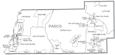
- Aripeka
- Bayonet Point
- Beacon Square
- Connerton
- Crystal Springs
- Dade City North
- Elfers
- Heritage Pines
- Holiday
- Hudson
- Jasmine Estates
- Key Vista
- Lacoochee
- Land O' Lakes
- Meadow Oaks
- Moon Lake
- New Port Richey East
- Odessa
- Pasadena Hills
- Quail Ridge
- River Ridge
- Shady Hills
- Trinity
- Trilby
- Wesley Chapel
- Zephyrhills North
- Zephyrhills South
- Zephyrhills West
Unincorporated communities
- Blanton
- Branchborough
- Darby
- Gulf Harbors
- Hudson Beach
- Jessamine
- Richland
- Seven Springs
- St. Joseph
- Starkey Ranch
- Trilacoochee
- Vitis
Notable residents
- The Bellamy Brothers, country duo from Darby with the hit "Let Your Love Flow" on the popular charts
- John Cena, WWE wrestler, actor, rapper and reality television show host
See also
References
- 1 2 "State & County QuickFacts". United States Census Bureau. Archived from the original on July 16, 2011. Retrieved June 16, 2014.
- ↑ "Find a County". National Association of Counties. Retrieved 2011-06-07.
- ↑ Publications of the Florida Historical Society. Florida Historical Society. 1908. p. 33.
- ↑ FL, Town of St. Leo,. "Welcome to St. Leo, FL". www.townofstleo-fl.gov. Retrieved 2016-08-05.
- ↑ "US Gazetteer files: 2010, 2000, and 1990". United States Census Bureau. 2011-02-12. Retrieved 2011-04-23.
- ↑ "Population and Housing Unit Estimates". Retrieved June 9, 2017.
- ↑ "U.S. Decennial Census". United States Census Bureau. Retrieved June 16, 2014.
- ↑ "Historical Census Browser". University of Virginia Library. Retrieved June 16, 2014.
- ↑ "Population of Counties by Decennial Census: 1900 to 1990". United States Census Bureau. Retrieved June 16, 2014.
- ↑ "Census 2000 PHC-T-4. Ranking Tables for Counties: 1990 and 2000" (PDF). United States Census Bureau. Retrieved June 16, 2014.
- ↑ "American FactFinder". United States Census Bureau. Retrieved 2011-05-14.
- ↑ Leip, David. "Dave Leip's Atlas of U.S. Presidential Elections". uselectionatlas.org. Retrieved 2018-06-15.
- ↑ Zephyrhills Municipal Airport
- ↑ Pilot Country Airport (archived)
- ↑ Tampa North Aero Park
- ↑ Hidden Lake Estates Airport
- ↑ http://www.pascocountyfl.net/Index.aspx?NID=243
- ↑ "St. Petersburg Times". Loss of Amtrak service shouldn't derail Dade City. Retrieved 2004-10-29.
- ↑
- ↑
- ↑ Pasco County Library Cooperative. (2012). 2012-2015 strategic vision, www.pascolibraries.org/PascoLibraryStratPlanFinal2.pdf
- ↑ Zephyrhills Public Library
- ↑ Pasco County Board of County Commissioners. (2012). Annual budget Pasco County FY 2013, http://www.pascocountyfl.net/Archive.aspx?ADID=644
- ↑ "Centennial Park Branch Library | Pasco Libraries". www.pascolibraries.org. Retrieved 2015-11-30.
- ↑ "Hudson Library\Administration & Support Services | Pasco Libraries". www.pascolibraries.org. Retrieved 2015-11-30.
- ↑ "Hugh Embry Branch Library | Pasco Libraries". www.pascolibraries.org. Retrieved 2015-11-30.
- ↑ "Land O' Lakes Branch Library | Pasco Libraries". www.pascolibraries.org. Retrieved 2015-11-30.
- ↑ "New River Branch Library | Pasco Libraries". www.pascolibraries.org. Retrieved 2015-11-30.
- ↑ "Regency Park Branch Library | Pasco Libraries". www.pascolibraries.org. Retrieved 2015-11-30.
- ↑ "South Holiday Branch Library | Pasco Libraries". www.pascolibraries.org. Retrieved 2015-11-30.
- ↑ "Zephyrhills Public Library | Pasco Libraries". www.pascolibraries.org. Retrieved 2015-11-30.
- ↑ "NPR Library". nprlibrary.org. Retrieved 2015-11-30.
- ↑ "FAQs". nprlibrary.org. Retrieved 2015-11-30.
- ↑ Conner Preserve • Central Pasco County
- History of Pasco County (1943) by Jefferson Alexis Hendley.
- Horgan, James J., Alice F. Hall, and Edward J. Herrmann, The Historic Places of Pasco County, Pasco County Historical Preservation Committee, Pasco County, Florida.
External links
| Wikimedia Commons has media related to Pasco County, Florida. |
Government links/Constitutional offices
- Pasco County Board of County Commissioners
- Pasco County Supervisor of Elections
- Pasco County Property Appraiser
- Pasco County Sheriff's Office
- Pasco County Tax Collector
- Pasco County Office of Emergency Management
- Pasco Mosquito Control
- Pasco County Cooperative Extension Service
- Pasco County Public Transportation
Special districts
Judicial branch
Tourism links
Other sites
- Pasco Economic Development Council
- History of Pasco County
- Pasco County Collection on RICHES Mosaic Interface
- West Pasco Weather Conditions & Webcam
- Pasco County Fishing Forum
- Pasco County Library System
Places adjacent to Pasco County, Florida | ||||||||||
|---|---|---|---|---|---|---|---|---|---|---|
| ||||||||||
Municipalities and communities of Pasco County, Florida, United States | ||
|---|---|---|
| Cities | | |
| Town | ||
| CDPs |
| |
| Unincorporated communities | ||
| Footnotes | ‡This populated place also has portions in an adjacent county or counties | |