Marion County, Florida
| Marion County, Florida | ||
|---|---|---|
| County | ||
| Marion County | ||
.JPG) Marion County Courthouse in Ocala | ||
| ||
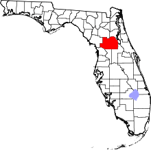 Location in the U.S. state of Florida | ||
 Florida's location in the U.S. | ||
| Founded | March 14, 1844 | |
| Named for | Francis Marion | |
| Seat | Ocala | |
| Largest city | Ocala | |
| Area | ||
| • Total | 1,663 sq mi (4,307 km2) | |
| • Land | 1,585 sq mi (4,105 km2) | |
| • Water | 78 sq mi (202 km2), 4.7% | |
| Population (est.) | ||
| • (2017) | 354,353[1] | |
| • Density | 224/sq mi (86/km2) | |
| Congressional districts | 2nd, 3rd, 11th | |
| Time zone | Eastern: UTC−5/−4 | |
| Website |
www | |

Marion County is a county located in the U.S. state of Florida. As of the 2010 census, the population was 331,298.[2] Its county seat is Ocala.[3]
Marion County comprises the Ocala, FL Metropolitan Statistical Area. it includes part of Ocala National Forest, which also extends into three other counties.
History
Evidence of ancient cultures has been found in Marion County, as well as of the earliest encounter between European explorers and historic indigenous peoples. In 1976, an archaeological investigation found ancient artifacts in Marion County that appear to be the oldest in mainland United States. Excavations at an ancient stone quarry (on the Container Corporation of America site (8Mf154) in Marion County) yielded "crude stone implements". Thousands of pieces of chert were found at the site. These showed signs of extensive wear and were found in deposits below those holding Paleo-Indian artifacts. Thermoluminescence dating and weathering analysis independently gave dates of 26,000 to 28,000 Years Before Present (YBP) for the production of these artifacts, prior to Clovis points. The findings suggested human habitation in this area much earlier than documented by other evidence.[4] Barbara Purdy also had bipoint evidence from the CCA site which she reported in a 2008 paper.[5]
The county seat of Ocala, Florida is named for an Indian site visited and recorded by the Hernando de Soto Expedition in the sixteenth century. During the colonial period, Spain and Great Britain traded control of this area.
European-American settlement
After acquisition of the Florida territory by the United States in the 1820s, Marion County was created in 1844 from portions of Alachua, Mosquito (Orange), and Hillsborough counties. Until 1853, Marion County included most of what are now Lake and Sumter counties. In 1849, Putnam County was created and took the northeast portion of Marion. Levy County’s creation took some of the western portion of Marion in 1877, near the end of the Reconstruction era.
Marion County is named after General Francis Marion of South Carolina, a guerrilla fighter and hero of the American Revolutionary War who was known as the "Swamp Fox".[6] Numerous early settlers of this area were natives of South Carolina and likely picked their local hero as the county's namesake.[7] The Act creating the county of Marion of the Territory of Florida was signed on March 14, 1844, by the territorial governor, R. K. Call. The county motto is "Kingdom of the Sun."
Post-Reconstruction era to mid-20th century
During the post-Reconstruction period, there was considerable racial violence by whites against blacks in Marion County; they exercised terrorism to re-establish and maintain white supremacy. Whites lynched 19 African Americans here from 1877-1950; most were killed around the turn of the 20th century. This was the 4th highest total of any county in the state.[8]
Mid-20th century to present
The rural area has been developed for breeding racehorses, and some farms have been quite successful. Since the mid-20th-century, thoroughbred farms in the county have become known for such race champions as Needles, bred at Bonnie Heath Farm, and in 1956 becoming the first Florida-bred horse to win the Kentucky Derby; and Affirmed from Harbor View Farm. Carl G. Rose, who had come to Florida in 1916 from Indiana to oversee construction of the first asphalt road in the state, developed the first horse farm in 1943. As an engineer, he had become familiar with the area's limestone, which he realized supported good pasture for raising strong horses. (Limestone nurtures Kentucky's noted Bluegrass Region.) In 1943, Rose bought land along State Highway 200, at $10 per acre, which became Rosemere Farm. The next year one of his horses, Gornil, won at Miami's Tropical Park, becoming the first Florida-raised thoroughbred to win a Florida race.
Close on Rose's heels, entrepreneur Bonnie Heath set up his own thoroughbred farm, producing Needles, which in 1956 became the state's first native-bred winner of the Kentucky Derby. (see further below). Bonnie Heath Farm is owned and operated by Bonnie Heath III and his wife Kim. Rosemere Farm was sold long ago, and the large site was redeveloped for the retail center Paddock Mall and the College of Central Florida.
In 1956, the Ocala-area Thoroughbred industry received a boost when Needles became the first Florida-bred to win the Kentucky Derby. In 1978, Marion County-bred-and-raised Affirmed won the Triple Crown. Today, Marion County is a major world thoroughbred center with more than 1200 horse farms, including about 900 thoroughbred farms, totaling some 77,000 acres (310 km2). Ocala is well known as a "horse capital of the world."[9]
Tourism
The nearby community of Silver Springs developed around the Silver Springs, a group of artesian springs on the Silver River. In the 19th century, this site became Florida's first tourist destination. Today, well known for glass-bottom boat tours of the area, Silver Springs is owned by the State of Florida and was incorporated into Silver Springs State Park in 2013.[10][11] Other nearby natural attractions include the Ocala National Forest and the Florida Trail. Several prominent man-made attractions in the Ocala area existed in the past, such as the Western-themed Six Gun Territory theme park (operated from 1963 to 1984) and the Wild Waters water park (operated from 1978 to 2016).
Geography
According to the U.S. Census Bureau, the county has a total area of 1,663 square miles (4,310 km2), of which 1,585 square miles (4,110 km2) is land and 78 square miles (200 km2) (4.7%) is water.[12]
Marion County is generally composed of rolling hills, some high and some low. The majority of its trees consist of live oaks, pine, and palm trees. Marion County is considered the southernmost county in North Central Florida, and the northernmost county in Central Florida.
It is about a two-hour drive from many of Florida's major cities, Orlando is 75 minutes to the southeast while Daytona Beach is about 90 minutes to the east. Tampa is about 75 minutes to the southwest. Jacksonville is roughly a two-hour drive northeast. Miami is about five hours to the southeast. Fort Lauderdale is about a four-hour drive from Marion County.
Marion County also has three large lakes at its opposite borders. Orange Lake is in the far northern part of Marion County, near the border with Alachua County. Lake Kerr is in the northeastern part of the county, near the town of Salt Springs, which is near the border with Putnam County. Lake Weir, the largest of the three, is in the far southern region near the border with Lake County. Part of Lake George is in Marion County also.
Marion County is inland, centered between the Atlantic Ocean to the east and the Gulf of Mexico to the west. Because of this, Marion County is not affected as much by hurricanes as the more coastal counties to its east and west. It has, however, been affected by major hurricanes within the historical record, including ones that would produce tremendous damage if they were to happen again. The second-greatest threat from tropical cyclones, both financial and in terms of life, is the threat created by fresh water flooding. Major winds above 100mph are possible from hurricanes in Marion County, but have not been recorded in modern times. However, tornadoes are a major threat to this region of the state. It takes a little less than an hour by car to get to the Gulf of Mexico from Marion County, while it takes about half an hour longer to get to the Atlantic Ocean.
Adjacent counties
- Putnam County, Florida – northeast
- Volusia County, Florida – east
- Lake County, Florida – southeast
- Sumter County, Florida – south
- Citrus County, Florida – southwest
- Levy County, Florida – west
- Alachua County, Florida – northwest
National protected area
- Ocala National Forest (part)
Demographics
| Historical population | |||
|---|---|---|---|
| Census | Pop. | %± | |
| 1850 | 3,338 | — | |
| 1860 | 8,609 | 157.9% | |
| 1870 | 10,804 | 25.5% | |
| 1880 | 13,046 | 20.8% | |
| 1890 | 20,796 | 59.4% | |
| 1900 | 24,403 | 17.3% | |
| 1910 | 26,941 | 10.4% | |
| 1920 | 23,968 | −11.0% | |
| 1930 | 29,578 | 23.4% | |
| 1940 | 31,243 | 5.6% | |
| 1950 | 38,187 | 22.2% | |
| 1960 | 51,616 | 35.2% | |
| 1970 | 69,030 | 33.7% | |
| 1980 | 122,488 | 77.4% | |
| 1990 | 194,833 | 59.1% | |
| 2000 | 258,916 | 32.9% | |
| 2010 | 331,298 | 28.0% | |
| Est. 2017 | 354,353 | [13] | 7.0% |
| U.S. Decennial Census[14] 1790-1960[15] 1900-1990[16] 1990-2000[17] 2010-2015[2] | |||
As of the census[18] of 2000, there were 258,916 people, 106,755 households, and 74,621 families residing in the county. The population density was 164 people per square mile (63/km²). There were 122,663 housing units at an average density of 78 per square mile (30/km²). The racial makeup of the county was 84.16% White, 11.55% Black or African American, 0.45% Native American, 0.70% Asian, 0.02% Pacific Islander, 1.69% from other races, and 1.44% from two or more races. 6.03% of the population were Hispanic or Latino of any race. According to the 2000 Census the largest European ancestry groups in Marion County were English (18.7%), German (16.7%) and Irish (14.0%).
There were 106,755 households out of which 24.70% had children under the age of 18 living with them, 55.60% were married couples living together, 10.70% had a female householder with no husband present, and 30.10% were non-families. 25.00% of all households were made up of individuals and 13.00% had someone living alone who was 65 years of age or older. The average household size was 2.36 and the average family size was 2.79.
In the county, the population was spread out with 21.40% under the age of 18, 6.40% from 18 to 24, 23.80% from 25 to 44, 23.90% from 45 to 64, and 24.50% who were 65 years of age or older. The median age was 44 years. For every 100 females there were 93.30 males. For every 100 females age 18 and over, there were 89.90 males.
The median income for a household in the county was $31,944, and the median income for a family was $37,473. Males had a median income of $28,836 versus $21,855 for females. The per capita income for the county was $17,848. About 9.20% of families and 13.10% of the population were below the poverty line, including 20.20% of those under age 18 and 7.40% of those age 65 or over.
Government and infrastructure
The Florida Department of Corrections operates facilities in unincorporated areas in the county, including the Lowell Correctional Institution and the Lowell Annex.[19][20] The annex houses Florida's female death row.[21]
| Year | Republican | Democratic | Other |
|---|---|---|---|
| 2016 | 61.30% 107,833 | 35.27% 62,041 | 3.43% 6,026 |
| 2012 | 57.53% 93,043 | 41.32% 66,831 | 1.15% 1,864 |
| 2008 | 55.14% 89,628 | 43.58% 70,839 | 1.28% 2,075 |
| 2004 | 58.19% 81,283 | 41.00% 57,271 | 0.80% 1,123 |
| 2000 | 53.55% 55,146 | 43.39% 44,674 | 3.06% 3,151 |
| 1996 | 45.92% 41,409 | 41.08% 37,045 | 13.00% 11,717 |
| 1992 | 40.74% 35,442 | 35.44% 30,829 | 23.82% 20,718 |
| 1988 | 66.38% 41,501 | 33.09% 20,685 | 0.53% 334 |
| 1984 | 69.97% 37,815 | 30.02% 16,225 | 0.01% 6 |
| 1980 | 58.49% 23,743 | 37.94% 15,400 | 3.57% 1,449 |
| 1976 | 47.99% 16,163 | 50.37% 16,963 | 1.64% 553 |
| 1972 | 78.18% 19,505 | 21.63% 5,397 | 0.18% 46 |
| 1968 | 32.66% 7,468 | 25.36% 5,798 | 41.98% 9,600 |
| 1964 | 54.42% 10,879 | 45.58% 9,112 | |
| 1960 | 49.43% 7,043 | 50.57% 7,206 | |
| 1956 | 50.99% 6,362 | 49.01% 6,114 | |
| 1952 | 51.17% 6,134 | 48.83% 5,854 | |
| 1948 | 22.43% 1,829 | 57.01% 4,650 | 20.56% 1,677 |
| 1944 | 22.68% 1,642 | 77.32% 5,597 | |
| 1940 | 17.47% 1,297 | 82.53% 6,127 | |
| 1936 | 14.01% 760 | 85.99% 4,664 | |
| 1932 | 23.07% 962 | 76.93% 3,208 | |
| 1928 | 49.75% 1,927 | 48.10% 1,863 | 2.14% 83 |
| 1924 | 17.25% 359 | 73.43% 1,528 | 9.33% 194 |
| 1920 | 31.57% 1,232 | 62.43% 2,436 | 6.00% 234 |
| 1916 | 19.50% 462 | 66.15% 1,567 | 14.35% 340 |
| 1912 | 10.87% 179 | 70.73% 1,165 | 18.39% 303 |
| 1908 | 22.05% 482 | 61.85% 1,352 | 16.10% 352 |
| 1904 | 15.84% 230 | 75.14% 1,091 | 9.02% 131 |
Law enforcement
Education
County public education is supervised under the Marion County School District.
Public school system
- 28 elementary schools
- 8 middle schools
- 1 4-8 school
- 1 K-8 center
- 10 high schools
- 3 charter schools
- 14 special needs schools
Elementary schools
- Anthony Elementary School
- Belleview Elementary School
- Belleview-Santos Elementary School
- College Park Elementary School
- Dr. N.H. Jones Elementary (magnet)
- Dunnellon Elementary School
- East Marion Elementary School
- Eighth Street Elementary School
- Emerald Shores Elementary School
- Evergreen Elementary School
- Fessenden Elementary School
- Fort McCoy School (K-8)
- Greenway Elementary School
- Hammett Bowen Jr. Elementary School
- Harbour View Elementary School
- Horizon Academy at Marion Oaks (grades 5-8)
- Katie Fay Elementary School
- Legacy Elementary School
- Madison Street Academy of Visual and Performing Arts (magnet)
- Maplewood Elementary School
- Oakcrest Elementary School
- Ocala Springs Elementary School
- Reddick-Collier Elementary School
- Romeo Elementary School
- Saddlewood Elementary School
- Shady Hill Elementary School
- South Ocala Elementary School
- Sparr Elementary School
- Stanton-Weirsdale Elementary School
- Sunrise Elementary School
- Ward-Highlands Elementary School
- Wyomina Park Elementary School
Middle schools
- Belleview Middle School
- Dunnellon Middle School
- Fort King Middle School
- Fort McCoy School (K-8)
- Horizon Academy at Marion Oaks (grades 4-8)
- Howard Middle School
- Lake Weir Middle School
- Liberty Middle School
- North Marion Middle School
- Osceola Middle School
High schools
Private schools
- Ambleside School Of Ocala, grades K-8[27]
- Belleview Christian Academy, grades PK-9
- Blessed Trinity School, grades K-9
- Children's Palace East & Academy, grades K-2
- The Cornerstone School, grades PK-8[28]
- Crossroads Academy, grades 3-12
- Grace Building Blocks School, grades K-2
- Grace Christian School, grades PK-8
- Meadowbrook Academy, grades K-12[29]
- Montessori Preparatory School, grades K-5
- New Generation School, grades K-12
- Ocala Christian Academy, grades PK-12[30]
- Ocean's High School, grades PK-12
- Promiseland Academy, grades K-7
- First Assembly Christian School, grades K-9[31]
- The Reading Clinic, grades 2-6
- Redeemer Christian School, grades K-9
- The Rock Academy, grades PK-9
- The School of the Kingdom, grades 1-12
- Shiloh SDA Church School[32]
- St John Lutheran School, grades PK-12
- Trinity Catholic, grades 9-12
Libraries
The Marion County Public Library System has eight branches. The system also has two bookmobiles that have routes throughout the county on weekdays.
Headquarters – Ocala
2720 E. Silver Springs Blvd.
Ocala, FL 34470
Belleview
13145 SE Highway 484
Belleview, FL 34420
Dunnellon
20351 Robinson Road
Dunnellon, FL 34431
Forest
905 S. Highway 314A
Ocklawaha, FL 32179
Freedom
5870 SW 95th St.
Ocala, FL 34476
Ft. McCoy
14660 NE Highway 315
Ft. McCoy, FL 32134
Marion Oaks
294 Marion Oaks Lane
Ocala, FL 34473
Reddick
15150 NW Gainesville Road
Reddick, FL 32686
Transportation
Airports
- Marion County Airport[33]
- Ocala International Airport
Interstates and expressways
Surface roads


Public surface transportation
Politics
| Year | Republican | Democratic |
|---|---|---|
| 2016 | 61.3% 107,833 | 35.3% 62,041 |
| 2012 | 57.5% 93,043 | 41.3% 66,831 |
| 2008 | 55.1% 89,628 | 43.6% 70,839 |
| 2004 | 58.2% 81,283 | 41.0% 57,271 |
| 2000 | 55.6% 55,146 | 43.4% 44,674 |
| 1996 | 45.9% 41,409 | 41.1% 37,045 |
| 1992 | 40.5% 35,442 | 35.4% 30,829 |
| 1988 | 66.4% 41,501 | 33.1% 20,685 |
| 1984 | 70.0% 37,815 | 30.0% 16,225 |
| 1980 | 58.5% 23,743 | 37.9% 15,400 |
| 1976 | 48.0% 16,163 | 50.4% 16,963 |
| 1972 | 78.2% 19,505 | 21.6% 5,397 |
| 1968 | 32.7% 7,468 | 25.4% 5,798 |
| 1964 | 54.4% 10,879 | 45.6% 9,112 |
| 1960 | 49.4% 7,043 | 50.6% 7,206 |
Since 1980 Marion County has become a solidly Republican county.
Communities
Cities
Towns
Census-designated places
- Silver Springs Shores
- The Villages (with Sumter County)
Other unincorporated communities
See also
References
- ↑ https://www.census.gov/quickfacts/fact/table/marioncountyflorida/PST045217
- 1 2 "State & County QuickFacts". United States Census Bureau. Archived from the original on July 14, 2011. Retrieved June 15, 2014.
- ↑ "Find a County". National Association of Counties. Retrieved June 7, 2011.
- ↑ Barbara A. Purdy, "Investigations into the Use of Chert Outcrops by Prehistoric Floridians: The Container Corporation of America Site", Florida Anthropologist, Vol. 34, No. 2, June 1981, pp. 90-
- ↑ Wm Jack Hranicky, Bipoints Before Clovis: Trans-Oceanic Migrations and Settlement of Prehistoric Americas, Universal-Publishers, 2012, p. 225
- ↑ Publications of the Florida Historical Society. Florida Historical Society. 1908. p. 33.
- ↑ Pyle, Nancy (May 14, 1987). "County's history reflected in its names". Ocala Star-Banner. pp. 8A. Retrieved May 30, 2015.
- ↑ Lynching in America/ Supplement: Lynchings by County, 3rd Edition, 2015, p.2
- ↑ "The Horse Capital of the World". Ocalacc.com. Retrieved January 11, 2013.
- ↑ Thompson, Bill. "State lets Palace Entertainment out of Silver Springs lease". Ocala.com. Retrieved December 17, 2015.
- ↑ Stone, Rick (January 24, 2013). "Silver Springs, Oldest Florida Tourist Attraction, Will Become A State Park". wlrn.com. WLRN. Retrieved April 8, 2014.
- ↑ "US Gazetteer files: 2010, 2000, and 1990". United States Census Bureau. February 12, 2011. Retrieved April 23, 2011.
- ↑ "Population and Housing Unit Estimates". Retrieved June 9, 2017.
- ↑ "U.S. Decennial Census". United States Census Bureau. Retrieved June 15, 2014.
- ↑ "Historical Census Browser". University of Virginia Library. Retrieved June 15, 2014.
- ↑ "Population of Counties by Decennial Census: 1900 to 1990". United States Census Bureau. Retrieved June 15, 2014.
- ↑ "Census 2000 PHC-T-4. Ranking Tables for Counties: 1990 and 2000" (PDF). United States Census Bureau. Retrieved June 15, 2014.
- ↑ "American FactFinder". United States Census Bureau. Retrieved May 14, 2011.
- ↑ "Lowell Correctional Institution Archived February 28, 2014, at the Wayback Machine.." Florida Department of Corrections. Retrieved on August 31, 2010.
- ↑ "Lowell Annex Archived August 18, 2010, at the Wayback Machine.." Florida Department of Corrections. Retrieved on August 31, 2010.
- ↑ "Death Row Fact Sheet Archived August 3, 2010, at the Wayback Machine.." Florida Department of Corrections. Retrieved on August 15, 2010.
- ↑ Leip, David. "Dave Leip's Atlas of U.S. Presidential Elections". uselectionatlas.org. Retrieved June 15, 2018.
- ↑ Marion County Sheriff's Office
- ↑ Belleview Police Departments
- ↑ Dunnellon Police Departments
- ↑ Ocala Police Departments
- ↑ "A living education". Amblesideocala.com. Archived from the original on December 14, 2015. Retrieved December 17, 2015.
- ↑ "Home". Thecornerstoneschool.org. December 8, 2015. Retrieved December 17, 2015.
- ↑ "Meadowbrook Academy : Home". Mbaocala.org. Retrieved December 17, 2015.
- ↑ "Home — Ocala Christian Academy". Ocacrusaders.com. Retrieved December 17, 2015.
- ↑ "Ocala First Assembly of God — An A/G Church in North Central Florida — Ocala, FL". Ocalafirst.org. Retrieved December 17, 2015.
- ↑ "Shiloh SDA Church School : Home". Antt40.adventistschoolconnect.org. Retrieved December 17, 2015.
- ↑ Marion County Airport
- ↑ "Archived copy". Archived from the original on June 13, 2010. Retrieved November 26, 2013.
- ↑ http://uselectionatlas.org/RESULTS/
External links
| Wikimedia Commons has media related to Marion County, Florida. |
Places adjacent to Marion County, Florida | ||||||||||
|---|---|---|---|---|---|---|---|---|---|---|
| ||||||||||
Municipalities and communities of Marion County, Florida, United States | ||
|---|---|---|
| Cities | | |
| Towns | ||
| CDPs | ||
| Unincorporated communities |
| |
| Footnotes | ‡This populated place also has portions in an adjacent county or counties | |

| Topics |  Map of North Florida | |
|---|---|---|
| Counties | ||
| Major cities | ||
| Cities and towns 100k+ | ||
| Cities and towns 25k–100k | ||
| Cities and towns 10k–25k | ||
| Metro areas | ||
| Regions | ||