North Miami Beach, Florida
- For the northern neighborhood of the city of Miami Beach, see North Beach (Miami Beach).
- For the separate city, see North Miami.
| City of North Miami Beach [1] | ||
|---|---|---|
| City | ||
| ||
| Nickname(s): NMB | ||
| Motto(s): "Where People Care" | ||
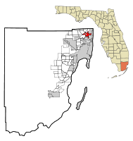 Location in Miami-Dade County and the state of Florida | ||
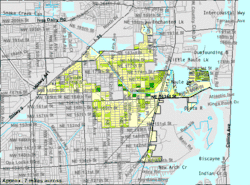 U.S. Census Bureau map showing city limits | ||
| Coordinates: 25°55′49″N 80°10′11″W / 25.93028°N 80.16972°WCoordinates: 25°55′49″N 80°10′11″W / 25.93028°N 80.16972°W | ||
| Country |
| |
| State |
| |
| County |
| |
| Incorporated | June 15, 1931 | |
| Government | ||
| • Type | Council-Manager | |
| • Mayor | Beth Spiegel | |
| • Vice Mayor | Barbara Kramer | |
| • Councilmembers | Anthony F. DeFillipo, Phyllis S. Smith, Evan Piper, Fortuna Smukler and Ingrid Forbes | |
| • City Manager | Esmond Scott | |
| • City Clerk | Pamela L. Latimore | |
| Area[3] | ||
| • City | 5.37 sq mi (13.90 km2) | |
| • Land | 4.83 sq mi (12.50 km2) | |
| • Water | 0.54 sq mi (1.40 km2) 6.43% | |
| Elevation | 10 ft (3 m) | |
| Population (2010) | ||
| • City | 41,523 | |
| • Estimate (2016)[4] | 43,891 | |
| • Density | 9,090.93/sq mi (3,510.18/km2) | |
| • Metro | 5,422,200 | |
| Time zone | UTC-5 (EST) | |
| • Summer (DST) | UTC-4 (EDT) | |
| Zip Codes |
33160,33162,33169, 33179,33180,33181 | |
| Area code(s) | 305, 786 | |
| FIPS code | 12-49475[5] | |
| GNIS feature ID | 0287838[6] | |
| Website | http://www.citynmb.com | |
.png)
North Miami Beach (commonly referred to as NMB) is a city in Miami-Dade County, Florida, United States. Originally named Fulford in 1926 after Captain William H. Fulford of the United States Coast Guard, the city was renamed North Miami Beach in 1931. The population was 41,523 at the 2010 census.
The hurricane of 1926 essentially ended the South Florida real estate boom, and in an effort to alleviate their losses and the damage to the city, local residents came together as the Town of Fulford. In 1927, the city was incorporated as the City of Fulford.[7]
Geography
North Miami Beach is located at 25°55′49″N 80°10′1″W / 25.93028°N 80.16694°W.[8] According to the United States Census Bureau, the city has a total area of 5.3 square miles (14 km2). 5.0 square miles (13 km2) of it is land and 0.3 square miles (0.78 km2) of it (6.43%) is water.
Although the North Miami Beach boundaries once stretched to the Atlantic Ocean, this city on the Intracoastal Waterway no longer has any beaches within its city limits, although they are a short distance away across the inlet.
Surrounding areas
Demographics
| Historical population | |||
|---|---|---|---|
| Census | Pop. | %± | |
| 1940 | 871 | — | |
| 1950 | 2,129 | 144.4% | |
| 1960 | 21,405 | 905.4% | |
| 1970 | 30,544 | 42.7% | |
| 1980 | 36,553 | 19.7% | |
| 1990 | 35,359 | −3.3% | |
| 2000 | 40,786 | 15.3% | |
| 2010 | 41,523 | 1.8% | |
| Est. 2016 | 43,891 | [4] | 5.7% |
| U.S. Decennial Census[9] | |||
As of 2010, there were 16,402 households out of which 12.1% were vacant. As of 2000, 37.6% had children under the age of 18 living with them. 44.3% were married couples living together, 19.5% had a female householder with no husband present, and 29.9% were non-families. 23.9% of all households were made up of individuals and 8.6% had someone living alone who was 65 years of age or older. The average household size was 2.89 and the average family size was 3.44.
In 2000, the city population was spread out with 27.3% under the age of 18, 9.4% from 18 to 24, 30.9% from 25 to 44, 21.1% from 45 to 64, and 11.3% who were 65 years of age or older. The median age was 34 years. For every 100 females, there were 91.6 males. For every 100 females age 18 and over, there were 86.3 males.
In 2000, the median income for a household in the city was $31,377, and the median income for a family was $35,047. Males had a median income of $26,278 versus $22,110 for females. The per capita income for the city was $14,699. About 18.4% of families and 20.5% of the population were below the poverty line, including 25.1% of those under age 18 and 18.2% of those age 65 or over.
As of 2000, English was the first language for 38.50% of all residents, while Spanish accounted for 31.97%. French Creole was 19.32%, French made up 2.33%, Chinese (which included Cantonese) was totaled at 1.66%, Portuguese totaled 1.20%, Hebrew was at 0.87%, Russian at 0.65%, Yiddish spoken by 0.56%, and Italian was the mother tongue for 0.52% of the population.[10]
As of 2000, North Miami Beach had the fifth highest percentage of Haitian residents in the U.S., with 19.90% of the U.S. populace.[11] It had the 48th highest percentage of Colombian residents in the U.S., at 2.83% of the city's population,[12] and the 68th highest percentage of Cuban residents in the US, at 4.92% of the city's population.[13] It also had the 62nd highest percentage of Dominicans in the U.S., at 2.39%,[14] while it had the ninth highest percentage of Bahamians at 1.10% of all residents.[15] North Miami Beach's Jamaican community had the 28th highest percentage of residents, which was at 5.50% of all residents.[11] It is also home to the thirtieth highest percentage of Peruvian residents in the U.S., at 1.80% of the population.[16]
North Miami Beach has a large middle class Haitian-American and Jewish-American community who were born in the U.S. or abroad.
Despite making up only 3.4% of North Miami Beaches population. The cities main commercial artery along NE 167th street converging into North Miami Beach Boulevard and then becoming 163rd street. Has taken the unofficial name of "Chinatown" due to the large concentration of Asian ran and operated businesses in the area. The area is has been referred to unofficially as "Chinatown" since the early 1990's by both locals and North Miami Beach city officials. As of recent even Miami-Dade County officials have even begun to reference the area as Chinatown. Even local guides and Miami websites have called 163rd street Miami's unofficial Chinatown.
| North Miami Beach demographics | |||
|---|---|---|---|
| 2010 Census | North Miami Beach | Miami-Dade County | Florida |
| Total population | 41,523 | 2,496,435 | 18,801,310 |
| Population, percent change, 2000 to 2010 | +1.8%% | +10.8% | +17.6% |
| Population density | 8,602.2/sq mi | 1,315.5/sq mi | 350.6/sq mi |
| White or Caucasian (including White Hispanic) | 47.1% | 73.8% | 75.0% |
| (Non-Hispanic White or Caucasian) | 18.4% | 15.4% | 57.9% |
| Black or African-American | 41.4% | 18.9% | 16.0% |
| Hispanic or Latino (of any race) | 36.6% | 65.0% | 22.5% |
| Asian | 3.4% | 1.5% | 2.4% |
| Native American or Native Alaskan | 0.2% | 0.2% | 0.4% |
| Pacific Islander or Native Hawaiian | 0.1% | 0.0% | 0.1% |
| Two or more races (multiracial) | 3.8% | 2.4% | 2.5% |
| Some other race | 4.0% | 3.2% | 3.6% |
Attractions


Attractions in the vicinity of North Miami Beach include a line of popular ocean beaches. Haulover Park and Haulover Beach, operated by Dade County Parks and Recreation, has a well-known clothing optional beach.
The name Baker's Haulover is presumed to derive from a man named Baker who hauled small boats over the isthmus between ocean and bay. The name appeared on a map as early as 1823. There is a State of Florida Historical Landmark Marker (over 50 years old) at the original Lighthouse Dock site dedicated on February 21, 2004, to the first charter-boat captains at the 1926–1951 dock. It is the only marker in the State of Florida for a fishing dock. There is still a charter-boat fishing fleet there.
North Miami Beach also has an authentic Medieval Spanish monastery, the St. Bernard de Clairvaux Church. This stone building around a patio, the cloisters of the Monastery of St. Bernard de Clairvaux, was built in Sacramenia, Segovia, Spain in the 12th century. It was purchased by William Randolph Hearst in the 1920s, dismantled and shipped to the United States, and reassembled after Hearst's death in North Miami Beach in the 1950s. It is a tourism attraction and a popular spot for weddings.
The Mall at 163rd Street and the Fulford-by-the-Sea Monument are also popular attractions in North Miami Beach.
Parks and recreation
In 1966, a major accomplishment was the completion of the tennis complex and two community centers, Victory Park and Uleta Community Center.
In 1968, the Washington Park Community Center[17] was built, and the Allen Park Youth Center[18] was completed in 1973.
North Miami beach expanded its parks in the 1980s as a result of the city council making strides to benefit the community.
The city now has the Judge Arthur I. Snyder Tennis Center. It includes twelve clay hydrogrid tennis courts (six are lighted), six lighted lay-kold hard tennis courts, four racquetball courts, and two paddleball courts. The center also has a clubhouse and pro-shop, a picnic area, and lounge and shower facilities.[19]
Government and infrastructure
North Miami beach is governed by a council-manager system[20] in the form of a mayor and council. In this type of a government, council members are the leaders and policy makers in the community. This form of government was implemented in 1958, after a new charter was voted on.[7]
The mayor is elected citywide and serves up to two consecutive two-year terms.[21]
There is an elected mayor and six-member city council: Beth Spiegel[22] (Mayor), Anthony F. DeFillipo[23] (Councilman), Phyllis S. Smith[24] (Councilwoman), Ingrid Forbes[25] (Councilwoman), Evan Piper[26] (Councilman), Barbara Kramer[27] (Councilwoman), and Fortuna Smukler[28] (Councilwoman).
The City Manager (Esmond Scott[29]), City Clerk (Pamela L. Latimore, CMC[30]) and City Attorney (Jose Smith[31]) are all appointed positions and are responsible for implementing the policies of the city council.
North Miami Beach City Manager, City Attorney, and City Clerk are appointed by the city council.[21]
The Federal Bureau of Investigation (FBI) Miami field office was previously in North Miami Beach. It moved to Miramar on December 8, 2014.[32]
In 1993, in an effort to promote neighborhood stability throughout the city, North Miami Beach built a state-of-the-art police station and redeveloped infrastructure in the Government Center neighborhood.
The bond program Proud Neighborhoods took place in September 2000 and had 67 different projects. This allowed for the improvement of streets, sidewalks, lighting and landscaping in every neighborhood of the city. It took five years but it brought substantial improvements.
Education
Primary and secondary schools
Dade County Public Schools serves North Miami Beach.
Public elementary schools
- Fulford Elementary School
- Greynolds Park Elementary School
- Madie Ives Elementary School
- Oak Grove Elementary School
- Ojus Elementary School
- Sabal Palm Elementary
Public middle schools
Public high schools
- Alonzo and Tracy Mourning Senior High Biscayne Bay Campus
- Dr. Michael Krop Senior High School
- North Miami Beach Senior High School
Prior to the opening of North Miami Beach High and Krop, students from North Miami Beach were assigned to Miami Beach High School and Miami Norland High School.[33]
Colleges and universities
- Nova Southeastern University – Miami Campus
- Union Institute and University – North Miami Beach campus
Public libraries
North Miami Beach Public Library is the city's library.[34] In 1994 it was doubled in size.
The North Miami Beach Library started as a branch in the Miami-Dade Public Library System (then known as the City of Miami Library system) in 1959. In 1961, the City of North Miami Beach Library ended its attachment with the Miami-Dade Public Library System to become an independent library. In 1964 residents of the City of North Miami Beach voted to build a permanent location for the library, which was built in 1965.
Notable people
References
- ↑ "Article I. Incorporation and Boundaries". Cith of North Miami Beach. Retrieved 9 December 2012.
- ↑ "Article I. Incorporation and Boundaries". Cith of North Miami Beach. Retrieved 9 December 2012.
- ↑ "2016 U.S. Gazetteer Files". United States Census Bureau. Retrieved Jul 7, 2017.
- 1 2 "Population and Housing Unit Estimates". Retrieved June 9, 2017.
- ↑ "American FactFinder". United States Census Bureau. Retrieved 2008-01-31.
- ↑ "US Board on Geographic Names". United States Geological Survey. 2007-10-25. Retrieved 2008-01-31.
- 1 2 "Our History – City of North Miami Beach, Florida". www.citynmb.com. Retrieved 2016-04-18.
- ↑ "US Gazetteer files: 2010, 2000, and 1990". United States Census Bureau. 2011-02-12. Retrieved 2011-04-23.
- ↑ "Census of Population and Housing". Census.gov. Retrieved June 4, 2015.
- ↑ "MLA Data Center Results of North Miami Beach, FL". Modern Language Association. Retrieved 2007-10-28.
- 1 2 "Ancestry Map of Haitian Communities". Epodunk.com. Retrieved 2007-10-28.
- ↑ "Ancestry Map of Colombian Communities". Epodunk.com. Retrieved 2007-10-28.
- ↑ "Ancestry Map of Cuban Communities". Epodunk.com. Retrieved 2007-10-28.
- ↑ "Ancestry Map of Dominican Communities". Epodunk.com. Retrieved 2007-10-28.
- ↑ "Ancestry Map of Bahamian Communities". Epodunk.com. Retrieved 2007-10-28.
- ↑ "Ancestry Map of Peruvian Communities". Epodunk.com. Retrieved 2007-10-28.
- ↑ Washington Park Community Center
- ↑ Allen Park Youth Center
- ↑ "Judge Arthur I. Snyder Tennis Center." City of North Miami Beach. Retrieved on March 12, 2010.
- ↑ "Government – City of North Miami Beach, Florida". www.citynmb.com. Retrieved 2016-04-18.
- 1 2 "City of North Miami – Government". www.northmiamifl.gov. Retrieved 2016-04-18.
- ↑ Beth Spiegel
- ↑ Anthony F. DeFillipo
- ↑ Phyllis S. Smith
- ↑ Ingrid Forbes
- ↑ Evan Piper
- ↑ Barbara Kramer
- ↑ Fortuna Smukler
- ↑ Esmond Scott
- ↑ Pamela L. Latimore, CMC
- ↑ Jose Smith
- ↑ "FBI Miami Division Moves to New Location." Federal Bureau of Investigation. December 8, 2014. Retrieved on June 9, 2015.
- ↑ Bramson, Seth. From Farms and Fields to the Future: The Incredible History of North Miami Beach. Arcadia Publishing, June 1, 2012. ISBN 1614236410, 9781614236412. Google Books PT 125. "[...] and then on to North Miami Beach Senior High,[...] or Dr. Michael Krop Senior High,[...] to complete their secondary educations. (Prior to the opening of NMB and Krop, North Miami Beach's high school-age students went to North Miami or Norland High Schools.)"
- ↑ "North Miami Beach Public Library." City of North Miami Beach. Retrieved on March 12, 2010.
External links
Municipalities and communities of Miami-Dade County, Florida, United States | ||
|---|---|---|
| Cities | 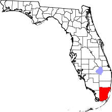 | |
| Towns | ||
| Villages | ||
| CDPs |
| |
| Unincorporated communities | ||
| Indian reservation | ||
| Footnotes | ‡This populated place also has portions in an adjacent county or counties | |
