Santa Rosa County, Florida
| Santa Rosa County, Florida | ||
|---|---|---|
.JPG) Santa Rosa County Courthouse | ||
| ||
 Location in the U.S. state of Florida | ||
 Florida's location in the U.S. | ||
| Founded | February 18, 1842 | |
| Named for | Saint Rose of Viterbo | |
| Seat | Milton | |
| Largest city | Navarre | |
| Area | ||
| • Total | 1,174 sq mi (3,041 km2) | |
| • Land | 1,012 sq mi (2,621 km2) | |
| • Water | 162 sq mi (420 km2), 13.8% | |
| Population (est.) | ||
| • (2017) | 174,272[1] | |
| • Density | 172/sq mi (66/km2) | |
| Congressional district | 1st | |
| Time zone | Central: UTC−6/−5 | |
| Website |
www | |
Santa Rosa County is a county located in the northwestern portion of the U.S. state of Florida. As of 2017 estimates, the population was 174,272. The county seat is Milton, which lies in the geographic center of the county. The largest communities are Navarre, Pace, and Gulf Breeze. [2]
Santa Rosa County is included in the Pensacola-Ferry Pass-Brent, FL Metropolitan Statistical Area.
History
Santa Rosa County was created in 1842. It was named for the Roman Catholic saint, Rosa de Viterbo.[3]
Santa Rosa County repealed its prohibition on alcohol in 2005.[4]
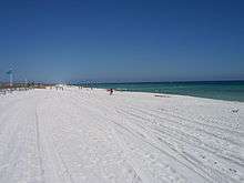
Santa Rosa County has seen unprecedented growth in population, specifically in the communities of Navarre, Pace, and to a lesser extent, Gulf Breeze. The county is also becoming a quickly growing tourist destination, due to its great access to beaches, as well as to wilderness and protected forests, for kayaking, hiking, and camping.
Geography
According to the U.S. Census Bureau, the county has a total area of 1,174 square miles (3,040 km2), of which 1,012 square miles (2,620 km2) is land and 162 square miles (420 km2) (13.8%) is water.[5]
National protected area
Regions
Santa Rosa County can be divided into three distinct sections: South Santa Rosa, Central Santa Rosa, and North Santa Rosa. The sections are centered on the main east/west roads that pass through the county.
South Santa Rosa County comprises the area from Holley and Navarre in the east to Gulf Breeze at the western end of the Fairpoint Peninsula, and along U.S. Highway 98. A section of Santa Rosa Island, containing the unincorporated community of Navarre Beach, is also part of South Santa Rosa County. Major bodies of water including Santa Rosa Sound, Pensacola Bay and East Bay strongly influence the housing and life style of citizens in the southern part of the county. This fast-growing region serves primarily as "bedroom communities" for Pensacola to the west and Hurlburt Field, Fort Walton Beach, and Eglin Air Force Base to the east. The U.S. Navy presence is marked by Whiting Field, NOLF Spencer Field and the former Ellyson Field.
Central Santa Rosa County is the area north of the bays and south of the extensive forests separating it from North Santa Rosa. The central section developed along "The Old Spanish Trail" that ran from St. Augustine on the Atlantic Ocean all the way to New Orleans, and further points west. Today, U.S. Highway 90 closely parallels the old trail. The county seat, Milton is located where the trail crossed the Blackwater River. To the west of Milton, the fast-growing community of Pace has turned the west central part of the county into one large "bedroom community" for people who work in the industries here and in Escambia County, to the west. Interstate 10 also passes through this section of the county.
Northern Santa Rosa County is forest and farming country. The only town in the north is Jay. Most development has been along State Road 4 which runs through the northern sections of Escambia, Santa Rosa, and Okaloosa counties. A large oil and natural gas field around Jay produced a great deal of oil, and made many farmers millionaires in the 1970s and 1980s, but the field has been depleted and is producing little oil today. The citizens have, for the most part, returned to farming and forestry for their livelihoods.
State Road 87 traverses the county from north to south, between U.S. Highway 98 and the border with Escambia County, Alabama near Brewton, where it connects with State Route 41. This road is a primary emergency evacuation route for the county during hurricanes.
Adjacent counties
- Escambia County, Alabama - north
- Okaloosa County, Florida - east
- Escambia County, Florida - west
Government
Board of County Commissioners
The Board of County Commissioners serves as the legislative and policy setting body of Santa Rosa County as established under Section 125 of the Florida Statutes. As such, the Board enacts all legislation and authorizes programs and expenditures within the County. The Board appoints a professionally trained County Administrator who is responsible for policy and budget development and implementation.
The Board comprises five members, elected countywide. Each member must reside within particular district for which seat he/she seeks election. Each year the Board organizes itself selecting a Chair and Vice-Chair from among its members to preside at Commission meetings.
Current Santa Rosa County Commissioners
| District | Commissioner |
|---|---|
| 1 (Pace) | Sam Parker |
| 2 (Milton/Central to Northeastern Region) | Bob Cole |
| 3 (Jay/Central to Northwestern Region) | Don Salter |
| 4 (Navarre/Southeastern Region) | Rob Williamson |
| 5 (Gulf Breeze/Southwestern Region) | Lane Lynchard |
The Commission meets in regular session beginning at 9:00 a.m. the second and fourth Thursday of the month in the Commissioner's Board Room in the Administrative Center, 6495 Caroline Street, in Milton. Called meetings and workshops are scheduled periodically and are advertised and open to the public.
County officials
| Office | Officeholder |
|---|---|
| Supervisor of Elections | Tappie A Villane |
| Property Appraiser | Greg Brown |
| Sheriff | Bob Johnson |
| Tax Collector | Stan Colie Nichols |
| Clerk of Courts | Donald C Spencer, Esq. |
Demographics
| Historical population | |||
|---|---|---|---|
| Census | Pop. | %± | |
| 1850 | 2,883 | — | |
| 1860 | 5,480 | 90.1% | |
| 1870 | 3,312 | −39.6% | |
| 1880 | 6,645 | 100.6% | |
| 1890 | 7,961 | 19.8% | |
| 1900 | 10,293 | 29.3% | |
| 1910 | 14,897 | 44.7% | |
| 1920 | 13,670 | −8.2% | |
| 1930 | 14,083 | 3.0% | |
| 1940 | 16,085 | 14.2% | |
| 1950 | 18,554 | 15.3% | |
| 1960 | 29,547 | 59.2% | |
| 1970 | 37,741 | 27.7% | |
| 1980 | 55,988 | 48.3% | |
| 1990 | 81,608 | 45.8% | |
| 2000 | 117,743 | 44.3% | |
| 2010 | 151,372 | 28.6% | |
| Est. 2017 | 174,272 | [6] | 15.1% |
| U.S. Decennial Census[7] 1790-1960[8] 1900-1990[9] 1990-2000[10] 2010-2015[11] | |||
As of the census[12] of 2000, there were 117,743 people, 43,793 households, and 33,326 families residing in the county. The population density was 116 people per square mile (45/km²). There were 49,119 housing units at an average density of 48 per square mile (19/km²). The racial makeup of the county was 90.72% White, 4.25% Black or African American, 1.01% Native American, 1.30% Asian, 0.08% Pacific Islander, 0.67% from other races, and 1.98% from two or more races. 2.52% of the population were Hispanic or Latino of any race.
There were 43,793 households out of which 36.50% had children under the age of 18 living with them, 62.20% were married couples living together, 10.20% had a female householder with no husband present, and 23.90% were non-families. 19.30% of all households were made up of individuals and 6.60% had someone living alone who was 65 years of age or older. The average household size was 2.63 and the average family size was 3.00.
In the county, the population was spread out with 26.60% under the age of 18, 7.20% from 18 to 24, 31.10% from 25 to 44, 24.10% from 45 to 64, and 11.00% who were 65 years of age or older. The median age was 37 years. For every 100 females, there were 100.60 males. For every 100 females age 18 and over, there were 97.90 males.
The median income for a household in the county was $41,881, and the median income for a family was $46,929. Males had a median income of $34,878 versus $22,304 for females. The per capita income for the county was $20,089. About 7.90% of families and 9.80% of the population were below the poverty line, including 12.60% of those under age 18 and 7.50% of those age 65 or over.
Libraries
The Santa Rosa County Library System has 5 branches.
- Gulf Breeze
- Jay
- Milton
- Pace
- Navarre
Communities
Cities
Town
Census-designated places
Politics
| Year | Republican | Democratic | Third parties |
|---|---|---|---|
| 2016 | 73.68% 65,339 | 20.82% 18,464 | 5.50% 4,881 |
| 2012 | 75.51% 58,186 | 23.06% 17,768 | 1.44% 1,106 |
| 2008 | 73.28% 55,972 | 25.49% 19,470 | 1.22% 935 |
| 2004 | 77.35% 52,059 | 21.78% 14,659 | 0.88% 589 |
| 2000 | 72.10% 36,339 | 25.43% 12,818 | 2.47% 1,245 |
| 1996 | 62.02% 26,301 | 25.79% 10,936 | 12.20% 5,173 |
| 1992 | 52.90% 17,339 | 20.00% 6,556 | 27.10% 8,882 |
| 1988 | 77.85% 18,973 | 21.56% 5,254 | 0.59% 143 |
| 1984 | 82.04% 21,265 | 17.94% 4,649 | 0.02% 6 |
| 1980 | 63.93% 13,802 | 32.26% 6,964 | 3.82% 824 |
| 1976 | 52.39% 9,122 | 46.06% 8,020 | 1.55% 270 |
| 1972 | 88.94% 12,669 | 10.47% 1,491 | 0.60% 85 |
| 1968 | 20.19% 2,567 | 12.58% 1,600 | 67.23% 8,549 |
| 1964 | 62.63% 5,983 | 37.37% 3,570 | |
| 1960 | 35.89% 2,777 | 64.11% 4,960 | |
| 1956 | 31.54% 1,909 | 68.46% 4,144 | |
| 1952 | 28.50% 1,744 | 71.50% 4,375 | |
| 1948 | 15.58% 549 | 65.72% 2,316 | 18.70% 659 |
| 1944 | 24.85% 862 | 75.15% 2,607 | |
| 1940 | 18.40% 656 | 81.60% 2,910 | |
| 1936 | 20.23% 744 | 79.77% 2,934 | |
| 1932 | 10.09% 315 | 89.91% 2,806 | |
| 1928 | 73.97% 1,628 | 24.58% 541 | 1.45% 32 |
| 1924 | 23.34% 229 | 70.64% 693 | 6.01% 59 |
| 1920 | 28.88% 333 | 70.51% 813 | 0.61% 7 |
| 1916 | 10.23% 111 | 82.58% 896 | 7.19% 78 |
| 1912 | 7.84% 70 | 66.29% 592 | 25.87% 231 |
| 1908 | 26.40% 212 | 66.63% 535 | 6.97% 56 |
| 1904 | 13.30% 73 | 73.41% 403 | 13.30% 73 |
Transportation
Airports
See also
References
- ↑ https://www.census.gov/quickfacts/fact/table/santarosacountyflorida/PST045217
- ↑ "Find a County". National Association of Counties. Retrieved 2011-06-07.
- ↑ Publications of the Florida Historical Society. Florida Historical Society. 1908. p. 34.
- ↑ "Suwannee Votes Wet". Suwannee Democrat. August 16, 2011. Retrieved 7 January 2014.
- ↑ "US Gazetteer files: 2010, 2000, and 1990". United States Census Bureau. 2011-02-12. Retrieved 2011-04-23.
- ↑ "Population and Housing Unit Estimates". Retrieved June 9, 2017.
- ↑ "U.S. Decennial Census". United States Census Bureau. Retrieved June 16, 2014.
- ↑ "Historical Census Browser". University of Virginia Library. Retrieved June 16, 2014.
- ↑ "Population of Counties by Decennial Census: 1900 to 1990". United States Census Bureau. Retrieved June 16, 2014.
- ↑ "Census 2000 PHC-T-4. Ranking Tables for Counties: 1990 and 2000" (PDF). United States Census Bureau. Retrieved June 16, 2014.
- ↑ "State & County https://www.census.gov/quickfacts/table/PST045215/12113". United States Census Bureau. External link in
|title=(help); Missing or empty|url=(help) - ↑ "American FactFinder". United States Census Bureau. Retrieved 2011-05-14.
- ↑ Leip, David. "Dave Leip's Atlas of U.S. Presidential Elections". uselectionatlas.org. Retrieved 2018-06-15.
External links
Media links
- Gulf Breeze News
- Northwest Florida Daily News
- Santa Rosa Press Gazette newspaper that serves Santa Rosa County, Florida, available in full-text with images in Florida Digital Newspaper Library
| Wikimedia Commons has media related to Santa Rosa County, Florida. |
- The EscaRosa Press newspaper that serves Santa Rosa County Florida, Digital Newspaper
- Navarre Press News and Information
- The Pensacola News Journal covers Santa Rosa County
- The Milton Chronicle provides analysis of issues facing Milton, Florida in Santa Rosa County.
Government links/Constitutional offices
- Santa Rosa County Website
- Santa Rosa County Board of County Commissioners
- Santa Rosa County Supervisor of Elections
- Santa Rosa County Property Appraiser
- Santa Rosa County Sheriff's Office
- Santa Rosa County Tax Collector
- TEAM Santa Rosa Economic Development Council
- Santa Rosa County GIS Mapping System
Special districts
Judicial branch
Tourism links
Community and Civic Organizations
Hospitals
- Santa Rosa Medical Center Hospital and Emergency Room located in Milton, Florida
Places adjacent to Santa Rosa County, Florida | ||||||||||
|---|---|---|---|---|---|---|---|---|---|---|
| ||||||||||
| Counties |  | |
|---|---|---|
| Major city | ||
| Incorporated Cities | ||
| Unincorporated | ||

| Topics |  Map of North Florida | |
|---|---|---|
| Counties | ||
| Major cities | ||
| Cities and towns 100k+ | ||
| Cities and towns 25k–100k | ||
| Cities and towns 10k–25k | ||
| Metro areas | ||
| Regions | ||