Parkland, Florida
| Parkland, Florida | |
|---|---|
| City | |
| Motto(s): Environmentally Proud | |
 | |
| Coordinates: 26°18′55″N 80°14′26″W / 26.31528°N 80.24056°WCoordinates: 26°18′55″N 80°14′26″W / 26.31528°N 80.24056°W | |
| Country |
|
| State |
|
| County |
|
| Incorporated | July 10, 1963[1] |
| Government | |
| • Type | Commission-Manager |
| • Mayor | Christine Hunschofsky |
| • Vice Mayor | Stacy Kagan |
| • Commissioners | Ken Cutler, Grace Solomon, Bob Mayersohn |
| • City Manager | Bob Payton |
| • City Clerk | Jennifer Johnson |
| Area[2] | |
| • City | 14.37 sq mi (37.21 km2) |
| • Land | 13.89 sq mi (35.98 km2) |
| • Water | 0.47 sq mi (1.23 km2) 3.77% |
| Elevation | 9 ft (4 m) |
| Population (2010) | |
| • City | 23,962 |
| • Estimate (2016)[3] | 31,507 |
| • Density | 2,268.00/sq mi (875.70/km2) |
| • Metro | 5,564,635 |
| Time zone | UTC-5 (EST) |
| • Summer (DST) | UTC-4 (EDT) |
| ZIP code | 33067, 33073, 33076 |
| Area code(s) | 754, 954 |
| FIPS code | 12-55125[4] |
| GNIS feature ID | 0307615[5] |
| Website |
www |
Parkland is a city in Broward County, Florida, United States. As of the 2010 census, the population of Parkland was 23,962,[6] and the 2016 census estimates a population of 31,507. Parkland is part of the Miami metropolitan area, which was home to an estimated 6,012,331 people in 2015.
Parkland is known for its zoning laws, which are designed to protect the "park-like" character of the city. There were no stores or traffic lights in Parkland until the mid-1990s and early 2000s when large neighborhood developments (Heron Bay and Parkland Isles) were built.
On February 14, 2018, in the Stoneman Douglas High School shooting, the deadliest secondary school shooting in American history, a shooter killed 17 people in Parkland.[7]
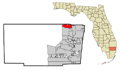
Geography
Parkland is located at 26°18′55″N 80°14′26″W / 26.315357°N 80.240444°W.[8] According to the United States Census Bureau, the city has a total area of 12.8 square miles (33.2 km2), of which 12.3 square miles (31.9 km2) is land and 0.50 square miles (1.3 km2) (3.97%) is water.[6] The northern boundary of Parkland coincides with the border between Broward and Palm Beach counties. West Boca Raton, an unincorporated area of Palm Beach County that extends west of Boca Raton's city limits, lies to the north. Coconut Creek lies to the east, Coral Springs lies to the south and the west is bounded by the Everglades.
Demographics
| Historical population | |||
|---|---|---|---|
| Census | Pop. | %± | |
| 1970 | 165 | — | |
| 1980 | 545 | 230.3% | |
| 1990 | 3,558 | 552.8% | |
| 2000 | 13,835 | 288.8% | |
| 2010 | 23,962 | 73.2% | |
| Est. 2016 | 31,507 | [3] | 31.5% |
| U.S. Decennial Census[9] | |||
| Parkland Demographics | |||
|---|---|---|---|
| 2010 Census | Parkland | Broward County | Florida |
| Total population | 23,962 | 1,748,066 | 18,801,310 |
| Population, percent change, 2000 to 2010 | +73.2% | +7.7% | +17.6% |
| Population density | 1,943.3/sq mi | 1,444.9/sq mi | 350.6/sq mi |
| White or Caucasian (including White Hispanic) | 84.0% | 63.1% | 75.0% |
| (Non-Hispanic White) | 73.1% | 43.5% | 57.9% |
| Black or African-American (including Black Hispanic) | 6.5% | 26.7% | 16.0% |
| Hispanic or Latino (of any race) | 13.0% | 25.1% | 22.5% |
| Asian | 5.9% | 3.2% | 2.4% |
| Native American or Native Alaskan | 0.1% | 0.3% | 0.4% |
| Pacific Islander or Native Hawaiian | 0.0% | 0.1% | 0.1% |
| Two or more races (Multiracial) | 1.9% | 2.9% | 2.5% |
| Some Other Race | 1.6% | 3.7% | 3.6% |
As of 2010, there were 8,292 households out of which 7.4% were vacant. In 2000, the city population was spread out with 35.1% under the age of 18, 4.3% from 18 to 24, 32.8% from 25 to 44, 24.0% from 45 to 64, and 3.8% who were 65 years of age or older. The median age was 36 years. For every 100 females, there were 99.0 males. For every 100 females age 18 and over, there were 93.7 males.
According to a 2016 estimate, the median income for a household in the city was $131,340, and the estimated median house value was $596,212.[10] Males had a median income of $103,942 versus $81,425 for females. The per capita income for the city was $56,793. About 2.0% of families and .4% of the population were below the poverty line, including 3.2% of those under age 18 and none of those age 65 or over.
As of 2000, speakers of English as a first language were 82.79%, of Spanish were at 11.48%, of Italian at 2.03%, while those of German made up 1.20% of the population.[11]
Education
Broward County Public Schools operates public schools in Parkland.[12]
Public high school
- Marjory Stoneman Douglas High School serves almost all of the city limits,[13] while small sections are zoned to Coral Springs High School[14]
In addition the community is in the service area of the magnet school Pompano Beach High School.[15]
Public middle school
- Westglades Middle School in Parkland serves almost all of the city limits,[16] while small sections are zoned to Forest Glen Middle School in Coral Springs.[17]
Public elementary schools
- Riverglades Elementary School[18]
- Park Trails Elementary School[19]
- Heron Heights Elementary School[20]
Portions are zoned to Coral Park and Park Springs elementaries in Coral Springs.[21][22]
Private schools include:
Private primary schools
- Mary Help of Christians School
Notable people
- Anthony Rizzo, professional baseball player for the Chicago Cubs
- Jon "Stugotz" Weiner, ESPN Radio host
- Roberto Luongo, NHL Goalie for the Florida Panthers
- XXXTentacion, rapper, singer and songwriter, lived in a mansion in Parkland from 2017 until his death
References
- ↑ "Broward-by-the-Numbers (pages 3-5)" (PDF). www.broward.org. Archived from the original (PDF) on 2015-10-10. Retrieved 2015-07-08.
- ↑ "2016 U.S. Gazetteer Files". United States Census Bureau. Retrieved Jul 7, 2017.
- 1 2 "Population and Housing Unit Estimates". Retrieved June 9, 2017.
- ↑ "American FactFinder". United States Census Bureau. Archived from the original on September 11, 2013. Retrieved 2008-01-31.
- ↑ "US Board on Geographic Names". United States Geological Survey. 2007-10-25. Retrieved 2008-01-31.
- 1 2 "Geographic Identifiers: 2010 Demographic Profile Data (G001): Parkland city, Florida". U.S. Census Bureau, American Factfinder. Retrieved October 22, 2013.
- ↑ "Google Maps". Google Maps. Retrieved 2018-02-14.
- ↑ "US Gazetteer files: 2010, 2000, and 1990". United States Census Bureau. 2011-02-12. Retrieved 2011-04-23.
- ↑ "Census of Population and Housing". Census.gov. Archived from the original on May 12, 2015. Retrieved June 4, 2015.
- ↑ "Parkland, Florida (FL 33067) profile: population, maps, real estate, averages, homes, statistics, relocation, travel, jobs, hospitals, schools, crime, moving, houses, news, sex offenders". www.city-data.com.
- ↑ "MLA Data Center Results for Parkland, FL". Modern Language Association. Retrieved 2007-09-25.
- ↑ "Zoning Map." City of Parkland. Retrieved on September 22, 2018.
- ↑ "Stoneman Douglas, Marjory." Broward County Public Schools. Retrieved on September 22, 2018.
- ↑ "Coral Springs High." Broward County Public Schools. Retrieved on September 22, 2018.
- ↑ "Pompano Beach High." Broward County Public Schools. Retrieved on September 23, 2018.
- ↑ "Westglades." Broward County Public Schools. Retrieved on September 22, 2018.
- ↑ "Forest Glen Middle." Broward County Public Schools. Retrieved on September 22, 2018.
- ↑ "Riverglades." Broward County Public Schools. Retrieved on September 22, 2018.
- ↑ "Park Trails." Broward County Public Schools. Retrieved on September 22, 2018.
- ↑ "Heron Heights." Broward County Public Schools. Retrieved on September 22, 2018.
- ↑ "https://www.browardschools.com/cms/lib/FL01803656/Centricity/domain/13425/maps/school%20boundary%20maps/2018-19/elementary/CoralParkElementary.pdf Coral Park]." Broward County Public Schools. Retrieved on September 22, 2018.
- ↑ "Park Springs." Broward County Public Schools. Retrieved on September 22, 2018.
External links
Municipalities and communities of Broward County, Florida, United States | ||
|---|---|---|
| Cities | 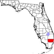 | |
| Towns | ||
| Villages | ||
| CDPs | ||
| Unincorporated community | ||
| Indian reservations | ||
| Ghost towns | ||
| Footnotes | ‡This populated place also has portions in an adjacent county or oounties | |
