Jackson County, Florida
| Jackson County, Florida | ||
|---|---|---|
| County | ||
| Jackson County | ||
 | ||
| ||
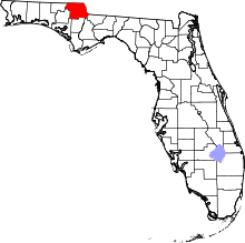 Location in the U.S. state of Florida | ||
 Florida's location in the U.S. | ||
| Founded | August 12, 1822 | |
| Named for | Andrew Jackson | |
| Seat | Marianna | |
| Largest city | Marianna | |
| Area | ||
| • Total | 955 sq mi (2,473 km2) | |
| • Land | 918 sq mi (2,378 km2) | |
| • Water | 37 sq mi (96 km2), 3.9% | |
| Population (est.) | ||
| • (2017) | 48,330[1] | |
| • Density | 52.6/sq mi (20.3/km2) | |
| Congressional district | 2nd | |
| Time zone | Central: UTC−6/−5 | |
| Website |
www | |

Jackson County is a county located in the U.S. state of Florida, on its northern border with Alabama. As of the 2010 census, the population was 49,746.[2] Its county seat is Marianna.[3]
History
Jackson County was created by the Florida Territorial Council in 1822 out of Escambia County, along with Duval County out of St. Johns County, making them the third and fourth counties in the Territory. The county was named for Andrew Jackson, who had served as Florida's first military governor for six months in 1821.[4] Jackson County originally extended from the Choctawhatchee River on the west to the Suwannee River on the east. The county had been reduced close to its present boundaries by 1840 through the creation of new counties from its original territory. Minor adjustments to the county boundaries continued through most of the 19th century, however.[5][6][7]
There were no towns in Jackson County when it was formed. The first county court met at what was called "Robinson's Big Spring" (later called Blue Springs) in 1822 and then at the "Big Spring of the Choctawhatchee" in 1823. The following year the county court met at "Chipola Settlement" which is also known as Waddell's Mill Pond.
This area of Florida was developed as part of the plantation belt in the antebellum years. Cotton was cultivated as a commodity crop by large work gangs of enslaved African Americans.
Gradually towns were developed. Webbville had been established as the first town in Jackson County, in January 1821, and was first designated as the county seat. Marianna was founded by Robert Beveridge, a native of Scotland, in September 1821. It developed about 9 miles (14 km) southeast of Webbville. The first county seat thrived until 1828, when Beveridge and other Marianna settlers went to Tallahassee to lobby for the county seat to be moved to Marianna.
They enticed the Florida Legislature with offers of free land, construction of a courthouse and a public square, and $500 to purchase a quarter section of land to be sold at public auction as a way to finance the new government, if the county seat was moved to Marianna.[8] Beveridge and his supporters succeeded in their civic bribe. Marianna became the county seat of the county justice and civil authority, although it was never officially proclaimed as the county seat. Marianna began to grow and prosper when the county government moved into the new courthouse in 1829. It became the market and court town for the rural county.
Webbville's prominent citizens moved to Marianna to follow the courts; its fate was sealed when the L&N Railroad decided to bypass the town. Webbville gradually declined and became defunct.
Jackson County War
After the Civil War, the county was convulsed by racial violence. White planters resisted dealing with freedmen as free workers. Insurgent Confederate veterans soon formed a Ku Klux Klan chapter here, and carried out masked violence to exert power.
| “ | Throughout the Reconstruction, Jackson County was the main site [in Florida] of political and class struggle between planters and black laborers.... Jackson County [was] so thoroughly dominated by the Klan at every level as to render the county and state governments completely powerless to stop them.[9]:548–550 | ” |
From 1869-71, Jackson County was the center of a guerrilla war that became known as the Jackson County War. Members of the Ku Klux Klan, insurgent Confederate Army veterans, assassinated more than 150 Republican Party officials and other prominent African Americans as part of a successful campaign to retain white Democratic power.[10] Another source says that in Jackson County, 200 "leading Republicans" were assassinated in 1869 and 1870 alone; no one was arrested or brought to trial.[9]:549
| “ | The sheriff...Thomas M. West complained that public sentiment was so strongly opposed to him as sheriff that he did not feel safe to go outside of town and serve any legal process whatsoever. His life was constantly threatened.... He was even openly assaulted in the streets of Marianna, severely beaten to the near-point of death." In 1871 he resigned, saying given the "lawlessness", he could not carry out the duties of sheriff. The last Republican official in the county, clerk of the circuit court John Dickenson, was assassinated in 1871. (The previous clerk, Dr. John Finlayson, was killed in 1869.)[9]:552 | ” |
According to state senator Charles H. Pearce, minister of the African Methodist Episcopal Church, "Satan has his seat; he reigns in Jackson County."[9]:549
Post-Reconstruction era to present
Violence by whites against blacks in the county continued after Reconstruction. Nine African Americans were lynched here, most around the turn of the century. But notorious lynchings of individual men took place in 1934[11] and 1943, attracting national attention and condemnation. The last was of Cellos Harrison in Marianna in 1943, who was taken from jail and hanged while his case was in appeal.[12]
Geography
According to the U.S. Census Bureau, the county has a total area of 955 square miles (2,470 km2), of which 918 square miles (2,380 km2) is land and 37 square miles (96 km2) (3.9%) is water.[13] Jackson County is the only county in Florida that borders both Georgia and Alabama. Jackson County is in the Central Standard Time Zone. Its eastern border with Gadsden County forms the boundary in this area between the Central Standard and Eastern Standard Time Zones.
Adjacent Counties
- Seminole County, Georgia - east (EST)
- Gadsden County, Florida - southeast (EST)
- Liberty County, Florida - southeast (EST)
- Calhoun County, Florida - south
- Washington County, Florida - southwest
- Bay County, Florida - southwest
- Holmes County, Florida - west
- Geneva County, Alabama - northwest
- Houston County, Alabama - north
Demographics
| Historical population | |||
|---|---|---|---|
| Census | Pop. | %± | |
| 1830 | 3,907 | — | |
| 1840 | 4,681 | 19.8% | |
| 1850 | 6,639 | 41.8% | |
| 1860 | 10,209 | 53.8% | |
| 1870 | 9,528 | −6.7% | |
| 1880 | 14,372 | 50.8% | |
| 1890 | 17,544 | 22.1% | |
| 1900 | 23,377 | 33.2% | |
| 1910 | 29,821 | 27.6% | |
| 1920 | 31,224 | 4.7% | |
| 1930 | 31,969 | 2.4% | |
| 1940 | 34,428 | 7.7% | |
| 1950 | 34,645 | 0.6% | |
| 1960 | 36,208 | 4.5% | |
| 1970 | 34,434 | −4.9% | |
| 1980 | 39,154 | 13.7% | |
| 1990 | 41,375 | 5.7% | |
| 2000 | 46,755 | 13.0% | |
| 2010 | 49,746 | 6.4% | |
| Est. 2017 | 48,330 | [14] | −2.8% |
| U.S. Decennial Census[15] 1790-1960[16] 1900-1990[17] 1990-2000[18] 2010-2015[2] | |||
As of the census[19] of 2000, there were 46,755 people, 16,620 households, and 11,600 families residing in the county. The population density was 51 people per square mile (20/km²). There were 19,490 housing units at an average density of 21 per square mile (8/km²). The racial makeup of the county was 72.18% White, 24.56% Black or African American, 0.77% Native American, 0.46% Asian, 0.03% Pacific Islander, 0.61% from other races, and 1.40% from two or more races. 2.91% of the population were Hispanic or Latino of any race.
There were 16,620 households out of which 30.90% had children under the age of 18 living with them, 51.50% were married couples living together, 14.40% had a female householder with no husband present, and 30.20% were non-families. 27.00% of all households were made up of individuals and 12.80% had someone living alone who was 65 years of age or older. The average household size was 2.44 and the average family size was 2.95.
In the county, the population was spread out with 22.30% under the age of 18, 9.70% from 18 to 24, 29.60% from 25 to 44, 23.80% from 45 to 64, and 14.60% who were 65 years of age or older. The median age was 38 years. For every 100 females there were 110.40 males. For every 100 females age 18 and over, there were 111.20 males.
The median income for a household in the county was $29,744, and the median income for a family was $36,404. Males had a median income of $27,138 versus $21,180 for females. The per capita income for the county was $13,905. About 12.80% of families and 17.20% of the population were below the poverty line, including 23.70% of those under age 18 and 21.00% of those age 65 or over.
Politics
| Year | Republican | Democratic | Other |
|---|---|---|---|
| 2016 | 67.38% 14,257 | 30.23% 6,397 | 2.39% 505 |
| 2012 | 64.00% 13,418 | 35.02% 7,342 | 0.99% 207 |
| 2008 | 63.47% 13,717 | 35.49% 7,671 | 1.04% 225 |
| 2004 | 61.20% 12,122 | 38.14% 7,555 | 0.66% 130 |
| 2000 | 56.06% 9,139 | 42.14% 6,870 | 1.81% 294 |
| 1996 | 46.34% 7,189 | 42.98% 6,667 | 10.68% 1,657 |
| 1992 | 45.82% 6,725 | 37.35% 5,482 | 16.82% 2,469 |
| 1988 | 62.20% 8,405 | 37.06% 5,008 | 0.74% 100 |
| 1984 | 64.70% 9,091 | 35.30% 4,960 | |
| 1980 | 44.76% 6,348 | 53.36% 7,567 | 1.87% 266 |
| 1976 | 37.90% 4,795 | 60.76% 7,687 | 1.34% 170 |
| 1972 | 79.99% 8,904 | 19.94% 2,220 | 0.07% 8 |
| 1968 | 10.02% 1,236 | 20.05% 2,472 | 69.93% 8,622 |
| 1964 | 61.69% 7,064 | 38.31% 4,386 | |
| 1960 | 32.23% 2,851 | 67.77% 5,994 | |
| 1956 | 29.86% 2,543 | 70.14% 5,973 | |
| 1952 | 29.53% 2,398 | 70.47% 5,722 | |
| 1948 | 11.27% 648 | 55.11% 3,169 | 33.62% 1,933 |
| 1944 | 17.03% 951 | 82.97% 4,633 | |
| 1940 | 13.38% 866 | 86.62% 5,607 | |
| 1936 | 8.54% 351 | 91.46% 3,757 | |
| 1932 | 11.03% 599 | 88.97% 4,832 | |
| 1928 | 35.43% 1,398 | 63.76% 2,516 | 0.81% 32 |
| 1924 | 14.59% 320 | 80.76% 1,771 | 4.65% 102 |
| 1920 | 16.37% 508 | 78.70% 2,443 | 4.93% 153 |
| 1916 | 16.53% 410 | 79.60% 1,975 | 3.87% 96 |
| 1912 | 9.61% 163 | 71.01% 1,205 | 19.39% 329 |
| 1908 | 20.90% 353 | 66.43% 1,122 | 12.67% 214 |
| 1904 | 20.47% 354 | 68.59% 1,186 | 10.93% 189 |
Education
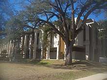
The Jackson County School Board operates public schools in the county. Jackson County is also home to Baptist College of Florida, an institution of higher education in Graceville affiliated with the Florida Baptist Convention,[21] and Chipola College, a state college in Marianna.
Libraries
The Jackson County Public Library System has three branches. Jackson County is also a part of the Panhandle Public Library Cooperative System. The PPLCS also includes Holmes, and Calhoun counties.
- Marianna
- Graceville
- Greenwood
Government and infrastructure
The Florida Department of Corrections operates Region I - Correctional Facility Office in an unincorporated area in Jackson County.[22]
The Florida Department of Juvenile Justice Dozier School for Boys, closed in 2011 after extensive investigations of abuse, was located in Marianna.
Sheriff Louis Roberts is the Sheriff of Jackson County and serves a population in over 955 square miles of area.
Jackson County Fire Rescue provides EMS and Fire Services with over 30 to 35 personnel.
Transportation
Airports
Jackson County's main airport is Marianna Municipal Airport, originally known as the Graham Air Base. Local and private airports also exist throughout the county.
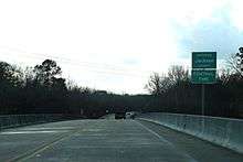
Major highways
Railroads
Jackson County has at least two existing railroad lines. The primary one is the CSX P&A Subdivision, a line formerly owned by the Louisville and Nashville Railroad that served Amtrak's Sunset Limited until it was truncated to New Orleans in 2005 by Hurricane Katrina. Another one is the Bay Line Railroad, a line that was originally the Atlanta and St. Andrews Bay Railway main line, and runs along US 231 from Panama City through Campbellton. The lines contain a junction with each other in Cottondale. Other lines within the county were abandoned.
Communities
Cities
Towns
Unincorporated communities
- Cypress, Florida
- Dellwood, Florida
- Two Egg, Florida
- Round Lake, Florida
- Compass Lake, Florida
- Oakdale, Florida
- Simsville, Florida
- Webbville, Florida
See also
References
- ↑ https://www.census.gov/quickfacts/fact/table/jacksoncountyflorida/PST045216
- 1 2 "State & County QuickFacts". United States Census Bureau. Retrieved February 14, 2014.
- ↑ "Find a County". National Association of Counties. Archived from the original on May 31, 2011. Retrieved 2011-06-07.
- ↑ Publications of the Florida Historical Society. Florida Historical Society. 1908. p. 32.
- ↑ Jackson County Information - accessed February 10, 2008
- ↑ Encyclopedia Americana - Jackson, Andrew Archived 2008-02-10 at the Wayback Machine. - accessed February 10, 2008
- ↑ Fernald, Edward A. (1981) Atlas of Florida. The Florida State University Foundation, Inc. ISBN 0-9606708-0-7
- ↑ Robin Gaby Fisher, Michael O'McCarthy, Robert W. Straley, The Boys of the Dark: A Story of Betrayal and Redemption in the Deep South (2010), p. 53.
- 1 2 3 4 Wasserman, Adam (2010). A People's History of Florida 1513–1876. How Africans, Seminoles, Women, and Lower Class Whites Shaped the Sunshine State (4th ed.). Sarasota, Florida. ISBN 9781442167094.
- ↑ Weitz, Seth. "Defending the Old South: The Myth of the Lost Cause and Political Immorality in Florida, 1885-1968," In The Historian, Vol. 71, No. 1 (Spring 2009), pg. 83.
- ↑ Youngblood, Joshua (Summer 2007). ""Haven't Quite Shaken the Horror": Howard Kester, the Lynching of Claude Neal, and Social Activism in the South During the 1930s". The Florida Historical Quarterly. 86 (1): 1, 3–4. JSTOR 30150098.
- ↑ Tameka Bradley Hobbs, Democracy Abroad, Lynching at Home, Oxford University Press, 2015
- ↑ "US Gazetteer files: 2010, 2000, and 1990". United States Census Bureau. 2011-02-12. Retrieved 2011-04-23.
- ↑ "Population and Housing Unit Estimates". Retrieved June 9, 2017.
- ↑ "U.S. Decennial Census". United States Census Bureau. Archived from the original on May 12, 2015. Retrieved June 14, 2014.
- ↑ "Historical Census Browser". University of Virginia Library. Retrieved June 14, 2014.
- ↑ "Population of Counties by Decennial Census: 1900 to 1990". United States Census Bureau. Retrieved June 14, 2014.
- ↑ "Census 2000 PHC-T-4. Ranking Tables for Counties: 1990 and 2000" (PDF). United States Census Bureau. Retrieved June 14, 2014.
- ↑ "American FactFinder". United States Census Bureau. Archived from the original on September 11, 2013. Retrieved 2011-05-14.
- ↑ Leip, David. "Dave Leip's Atlas of U.S. Presidential Elections". uselectionatlas.org. Retrieved 2018-06-15.
- ↑ "Baptist College of Florida Official Website". Baptist College of Florida. Retrieved 2017-03-05.
- ↑ "Region I - Correctional Facility Office." Florida Department of Corrections. Retrieved on January 8, 2010.
Further reading
- Daniel R. Weinfeld. The Jackson County War: Reconstruction and Resistance in Post-Civil War Florida (University of Alabama Press; 2012) 224 pages; covers the racial/political violence in the county 1869 to 1871.
External links
| Wikimedia Commons has media related to Jackson County, Florida. |
Government links/Constitutional offices
- Jackson County Board of County Commissioners
- Jackson County Supervisor of Elections
- Jackson County Property Appraiser
- Jackson County Sheriff's Office
- Jackson County Tax Collector
Special districts
Judicial branch
- Jackson County Clerk of Courts
- Circuit and County Court for the 14th Judicial Circuit of Florida serving Bay, Calhoun, Gulf, Holmes, Jackson and Washington counties
Tourism links
Places adjacent to Jackson County, Florida | ||||||||||
|---|---|---|---|---|---|---|---|---|---|---|
| ||||||||||
Municipalities and communities of Jackson County, Florida, United States | ||
|---|---|---|
| Cities | | |
| Towns | ||
| Unincorporated communities | ||
| Ghost town | ||

| Topics |  Map of North Florida | |
|---|---|---|
| Counties | ||
| Major cities | ||
| Cities and towns 100k+ | ||
| Cities and towns 25k–100k | ||
| Cities and towns 10k–25k | ||
| Metro areas | ||
| Regions | ||