St. Johns County, Florida
| St. Johns County, Florida | |||
|---|---|---|---|
.JPG) St. Johns County Courthouse | |||
| |||
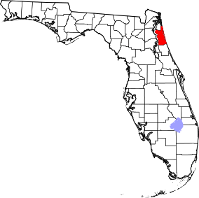 Location in the U.S. state of Florida | |||
 Florida's location in the U.S. | |||
| Founded | July 21, 1821 | ||
| Seat | St. Augustine | ||
| Largest city | St. Augustine | ||
| Area | |||
| • Total | 822 sq mi (2,129 km2) | ||
| • Land | 601 sq mi (1,557 km2) | ||
| • Water | 221 sq mi (572 km2), 26.9% | ||
| Population (est.) | |||
| • (2017) | 243,812[1] | ||
| • Density | 406/sq mi (157/km2) | ||
| Congressional districts | 4th, 6th | ||
| Time zone | Eastern: UTC−5/−4 | ||
| Website |
www | ||

St. Johns County is a county of the U.S. state of Florida. As of the 2010 United States Census, the county's population was 190,039.[2] The county seat and largest incorporated city is St. Augustine.[3] St. Johns County is part of the Jacksonville metropolitan area.
The county was established in 1821. It is one of the two original counties established after Florida was ceded to the United States, at the start of the Florida Territorial period, and corresponded roughly with the former colonial province of East Florida. It was named for the St. Johns River, which runs along its western border.
Today, St. Johns County is primarily made up of residential bedroom communities for those who commute to Jacksonville. Tourism, primarily associated with St. Augustine and the many golf courses in the area, is the chief economic industry.
History
St. Johns County’s history begins in 1821, when Colonel Robert Butler received Spanish East Florida from Captain-General Colonel José M. Coppinger. Butler represented Major General Andrew Jackson, federal military commissioner for the Florida provinces (las Floridas) with the powers of governor, exercising the powers of the Captain General and the Intendants of the Island of Cuba and the Governors of the said provinces, respectively, who ordained that all of that country lying east of the river Suwannee[4] should be designated as the County of St. Johns.
St. Johns was established, along with Escambia County (in the former West Florida province), on July 21, 1821, just eleven days after Butler received Florida for the United States, and only five days from the date that the city of St. Augustine was incorporated.
The name Saint John's was derived from the Spanish mission (c. 1580) San Juan del Puerto or Saint John of the Harbor. The apostrophe was dropped in 1932 by the U.S. Department of the Interior because an apostrophe implied ownership.
It was a huge county, encompassing most of peninsular Florida, or more than 39,000 square miles; it was 475 miles long by 165 miles wide. Much of the land was uninhabited. Saint Augustine (1565) was the oldest permanent European settlement, and there were Native Americans in the county as well.[4]
Geography
According to the U.S. Census Bureau, the county has a total area of 822 square miles (2,130 km2), of which 601 square miles (1,560 km2) is land and 221 square miles (570 km2) (26.9%) is water.[5]
Adjacent counties
- Duval County, Florida – north
- Flagler County, Florida – south
- Putnam County, Florida – southwest
- Clay County, Florida – west
National protected areas
Demographics
| Historical population | |||
|---|---|---|---|
| Census | Pop. | %± | |
| 1830 | 2,583 | — | |
| 1840 | 2,694 | 4.3% | |
| 1850 | 2,525 | −6.3% | |
| 1860 | 3,038 | 20.3% | |
| 1870 | 2,618 | −13.8% | |
| 1880 | 4,535 | 73.2% | |
| 1890 | 8,712 | 92.1% | |
| 1900 | 9,165 | 5.2% | |
| 1910 | 13,208 | 44.1% | |
| 1920 | 13,061 | −1.1% | |
| 1930 | 18,676 | 43.0% | |
| 1940 | 20,012 | 7.2% | |
| 1950 | 24,998 | 24.9% | |
| 1960 | 30,034 | 20.1% | |
| 1970 | 30,727 | 2.3% | |
| 1980 | 51,303 | 67.0% | |
| 1990 | 83,829 | 63.4% | |
| 2000 | 123,135 | 46.9% | |
| 2010 | 190,039 | 54.3% | |
| Est. 2017 | 243,812 | [6] | 28.3% |
| U.S. Decennial Census[7] 1790-1960[8] 1900-1990[9] 1990-2000[10] 2010-2015[2] | |||
As of the census[11] of 2000, there were 123,135 people, 49,614 households, and 34,084 families residing in the county. The population density was 202 people per square mile (78/km²). There were 58,008 housing units at an average density of 95 per square mile (37/km²). The racial makeup of the county was 90.92% White, 6.29% African American, 0.26% American Indian, 0.95% Asian, 0.05% Pacific Islander, 0.55% from other races, and 0.97% from two or more races. Hispanic or Latino of any race were 14.8% of the population. There is a Jewish community.[12]
There were 49,614 households out of which 29.20% had children under the age of 18 living with them, 56.80% were married couples living together, 8.90% had a female householder with no husband present, and 31.30% were non-families. 24.30% of all households were made up of individuals and 9.40% had someone living alone who was 65 years of age or older. The average household size was 2.44 and the average family size was 2.90.
The age of the population was spread out with 23.10% under the age of 18, 7.00% from 18 to 24, 27.60% from 25 to 44, 26.40% from 45 to 64, and 15.90% who were 65 years of age or older. The median age was 41 years. For every 100 females there were 94.50 males. For every 100 females age 18 and over, there were 91.50 males.
The median income for a household in the county was $50,099, and the median income for a family was $59,153. Males had a median income of $40,783 versus $27,240 for females. The per capita income for the county was $28,674. About 5.10% of families and 8.00% of the population were below the poverty line, including 9.30% of those under age 18 and 6.20% of those age 65 or over.
Government
The St. Johns County Board of County Commissioners is an elected five-member commission, which appoints a county administrator. The main environmental and agricultural body is the St. Johns County Soil and Water Conservation District, which works closely with other area agencies. In 2016 Donald Trump received 88,684 votes (64.34%) while Hillary Clinton received 43,099 votes (31.27%).[13]
| Year | Republican | Democratic | Third parties |
|---|---|---|---|
| 2016 | 64.34% 88,684 | 31.27% 43,099 | 4.40% 6,063 |
| 2012 | 68.25% 78,513 | 30.59% 35,190 | 1.16% 1,332 |
| 2008 | 65.25% 69,222 | 33.74% 35,791 | 1.01% 1,068 |
| 2004 | 68.60% 59,196 | 30.59% 26,399 | 0.81% 695 |
| 2000 | 65.10% 39,564 | 32.10% 19,509 | 2.79% 1,698 |
| 1996 | 56.27% 27,318 | 34.43% 16,716 | 9.30% 4,515 |
| 1992 | 50.49% 20,188 | 30.74% 12,291 | 18.78% 7,507 |
| 1988 | 70.14% 19,228 | 29.29% 8,029 | 0.58% 158 |
| 1984 | 71.26% 16,500 | 28.73% 6,652 | 0.01% 2 |
| 1980 | 59.67% 11,234 | 36.64% 6,898 | 3.68% 694 |
| 1976 | 46.34% 6,660 | 51.58% 7,412 | 2.08% 299 |
| 1972 | 77.48% 8,919 | 22.14% 2,549 | 0.37% 43 |
| 1968 | 34.31% 3,880 | 24.30% 2,748 | 41.40% 4,682 |
| 1964 | 63.10% 7,450 | 36.90% 4,357 | |
| 1960 | 42.49% 4,125 | 57.51% 5,583 | |
| 1956 | 56.44% 5,104 | 43.56% 3,940 | |
| 1952 | 51.85% 4,702 | 48.15% 4,366 | |
| 1948 | 29.18% 1,840 | 31.63% 1,994 | 39.19% 2,471 |
| 1944 | 29.59% 1,582 | 70.41% 3,764 | |
| 1940 | 24.02% 1,303 | 75.98% 4,122 | |
| 1936 | 24.13% 1,085 | 75.87% 3,411 | |
| 1932 | 27.45% 1,265 | 72.55% 3,344 | |
| 1928 | 36.65% 1,939 | 62.50% 3,307 | 0.85% 45 |
| 1924 | 27.44% 517 | 54.30% 1,023 | 18.26% 344 |
| 1920 | 37.98% 1,221 | 56.30% 1,810 | 5.72% 184 |
| 1916 | 19.03% 326 | 66.14% 1,133 | 14.83% 254 |
| 1912 | 3.93% 45 | 73.08% 836 | 22.99% 263 |
| 1908 | 25.44% 344 | 56.07% 758 | 18.49% 250 |
| 1904 | 21.05% 204 | 56.76% 550 | 22.19% 215 |
Animal control
St. Johns County Animal Control operates the St. Johns County Pet Adoption and Holding Center at 130 North Stratton Road.
Education
Primary and secondary education
Public schools are run by the St. Johns County School District, headed by the St. Johns County School Board, an elected five-member board which appoints a superintendent to administer schools' operations. The system has grown considerably since 2000 to accommodate the county's rapid population growth. It is Florida's top performing school district in Florida Comprehensive Assessment Test scores, the state's standardized test for public schools.[15] In addition, the district received 2011 Energy Star Top Performer and Leader from the EPA[16]
For the 2014–2015 school year the district comprised:
- 18 elementary schools (K–5)
- 3 K-8 school (K–8)
- 7 middle schools (6–8)
- 7 high schools (9–12)
- 1 alternative center (K-12)
- 6 charter schools (including a vocational-technical college)
- 1 virtual school
The St. Johns County School District has a robust special education department serving the needs of students with autism, cerebral palsy, and cognitive disabilities. Additionally, the Florida School for the Deaf and Blind is a residential school for deaf and blind students, funded and operated by the state of Florida.[17] The Catholic Diocese of St. Augustine operates St. Joseph Academy, a private high school in St. Augustine.
St. Johns County schools have received a state government grade of "A" for their work with the students and FCAT grading from 2004 to 2014.[18]
Higher education
St. Johns River State College, a state college in the Florida College System, has a campus in St. Johns County near St. Augustine. It is accredited by the Southern Association of Colleges and Schools to award associates degrees and two bachelor's degrees.
Flagler College is a private liberal arts institution located in downtown St. Augustine. It has been recognized as a "Best Value College" by U.S. News & World Report.[19]
University of St. Augustine for Health Sciences is a school for physical and occupational therapy education.[20]
Libraries
The St. Johns County Public Library has six branches:
- Anastasia Island Branch
- Bartram Trail Branch
- Hastings Branch
- Main Library
- Ponte Vedra Beach Branch
- Southeast Branch
St. Augustine Historical Society
- Research Library
Communities
Cities
Towns
Census-designated places
Other unincorporated communities
- Bakersville
- Elkton
- Hastings
- Julington Creek Plantation
- Mill Creek
- Ponte Vedra Beach
- St. Johns
- Spuds
- Summer Haven
- Switzerland
- Vermont Heights
Transportation
Airports
Highways
See also
References
- ↑ https://www.census.gov/quickfacts/fact/table/stjohnscountyflorida/PST045217
- 1 2 "State & County QuickFacts". United States Census Bureau. Retrieved February 15, 2014.
- ↑ "Find a County". National Association of Counties. Retrieved 2011-06-07.
- 1 2 http://www.sjso.org/?page_id=60
- ↑ "US Gazetteer files: 2010, 2000, and 1990". United States Census Bureau. 2011-02-12. Retrieved 2011-04-23.
- ↑ "Population and Housing Unit Estimates". Retrieved June 9, 2017.
- ↑ "U.S. Decennial Census". United States Census Bureau. Retrieved June 16, 2014.
- ↑ "Historical Census Browser". University of Virginia Library. Retrieved June 16, 2014.
- ↑ "Population of Counties by Decennial Census: 1900 to 1990". United States Census Bureau. Retrieved June 16, 2014.
- ↑ "Census 2000 PHC-T-4. Ranking Tables for Counties: 1990 and 2000" (PDF). United States Census Bureau. Retrieved June 16, 2014.
- ↑ "American FactFinder". United States Census Bureau. Retrieved 2011-05-14.
- ↑ "6-week course delves into 'The Journey of the Soul'". Florida Times-Union. Jacksonville.com. October 23, 2015.
- ↑ http://enrnow.votesjc.com/stjenr.php?election=1611
- ↑ Leip, David. "Dave Leip's Atlas of U.S. Presidential Elections". uselectionatlas.org. Retrieved 2018-06-15.
- ↑ "Current and Recent News". Fldoe.org. Retrieved 2013-06-29.
- ↑ 2011 Energy Star Top Performers Full List
- ↑ "FSDB website". Fsdb.k12.fl.us. 2013-01-18. Retrieved 2013-06-29.
- ↑ St. Johns School District Facts
- ↑ "National Liberal Arts College | Rankings | Data | US News". Colleges.usnews.rankingsandreviews.com. Retrieved 2013-06-29.
- ↑ "Educational Programs | University of St. Augustine". Usa.edu. Retrieved 2013-06-29.
External links
| Wikimedia Commons has media related to St. Johns County, Florida. |
Places adjacent to St. Johns County, Florida | ||||||||||
|---|---|---|---|---|---|---|---|---|---|---|
| ||||||||||
Municipalities and communities of St. Johns County, Florida, United States | ||
|---|---|---|
| Cities | | |
| Towns | ||
| CDPs | ||
| Unincorporated communities | ||
| Footnotes | ‡This populated place also has portions in an adjacent county or counties | |
| Counties | 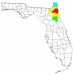 | |
|---|---|---|
| Cities, towns and CDPs | ||

| Topics |  Map of North Florida | |
|---|---|---|
| Counties | ||
| Major cities | ||
| Cities and towns 100k+ | ||
| Cities and towns 25k–100k | ||
| Cities and towns 10k–25k | ||
| Metro areas | ||
| Regions | ||