Clay County, Florida
| Clay County, Florida | |||
|---|---|---|---|
 Clay County Courthouse | |||
| |||
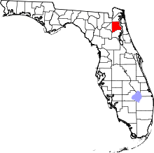 Location in the U.S. state of Florida | |||
 Florida's location in the U.S. | |||
| Founded | December 31, 1858 | ||
| Named for | Henry Clay | ||
| Seat | Green Cove Springs | ||
| Largest community | Lakeside | ||
| Area | |||
| • Total | 644 sq mi (1,668 km2) | ||
| • Land | 604 sq mi (1,564 km2) | ||
| • Water | 39 sq mi (101 km2), 6.1% | ||
| Population (est.) | |||
| • (2017) | 212,230[1] | ||
| • Density | 352/sq mi (136/km2) | ||
| Congressional district | 3rd | ||
| Time zone | Eastern: UTC−5/−4 | ||
| Website |
www | ||

Clay County is a county located in the U.S. state of Florida. As of the 2010 census, the population was 190,895.[2] Its county seat is Green Cove Springs.[3]
Clay County is included in the Jacksonville, FL Metropolitan Statistical Area.
History
Clay County was created on December 31, 1858, from a section of Duval County. Its name is in honor of Henry Clay, a famous American statesman, member of the United States Senate from Kentucky, and United States Secretary of State in the 19th century.[4][5]
Clay County was once a popular destination for tourists visiting from the northern states. The therapeutic, warm springs and mild climate were major draws for visitors. Steamboats brought them to various hotels in Green Cove Springs - the St. Elmo, Clarendon and the Oakland. President Grover Cleveland was the most prominent of such tourists; he had spring water shipped to the White House. Clay County's popularity among tourists peaked during the last three decades of the 19th century. It was later eclipsed by Henry Flagler's extension of the Florida East Coast Railway to points south such as Palm Beach and Miami.
The military has also played an important role in Clay County history. In 1939, Camp Blanding opened on Kingsley Lake in southwest Clay County. The Florida National Guard developed this 28,000 acres (110 km2) complex. During World War II, it trained over 90,000 troops and became the fourth largest "city" in the state. In Green Cove Springs, Lee Field was a flight training center. After World War II, Lee Field became a base for the mothball fleet. Although Lee Field closed in the early 1960s, Camp Blanding continues to operate today as a base for military training. Clay County is also a popular choice of residence for military personnel stationed on bases in nearby Duval County (NAS Jacksonville, NS Mayport, and, before it closed, NAS Cecil Field).
Geography
According to the U.S. Census Bureau, the county has a total area of 644 square miles (1,670 km2), of which 604 square miles (1,560 km2) is land and 39 square miles (100 km2) (6.1%) is water.[6]
Adjacent counties
- Alachua County, Florida - southwest
- Duval County, Florida - north
- St. Johns County, Florida - east
- Putnam County, Florida - south
- Bradford County, Florida - west
- Baker County, Florida - northwest
Transportation
Airports
Major highways
Demographics
| Historical population | |||
|---|---|---|---|
| Census | Pop. | %± | |
| 1860 | 1,914 | — | |
| 1870 | 2,098 | 9.6% | |
| 1880 | 2,838 | 35.3% | |
| 1890 | 5,154 | 81.6% | |
| 1900 | 5,635 | 9.3% | |
| 1910 | 6,116 | 8.5% | |
| 1920 | 5,621 | −8.1% | |
| 1930 | 6,859 | 22.0% | |
| 1940 | 6,468 | −5.7% | |
| 1950 | 14,323 | 121.4% | |
| 1960 | 19,535 | 36.4% | |
| 1970 | 32,059 | 64.1% | |
| 1980 | 67,052 | 109.2% | |
| 1990 | 105,986 | 58.1% | |
| 2000 | 140,814 | 32.9% | |
| 2010 | 190,865 | 35.5% | |
| Est. 2016 | 212,230 | [7] | 11.2% |
| U.S. Decennial Census[8] 1790-1960[9] 1900-1990[10] 1990-2000[11] 2010-2015[2] | |||
As of the census[12] of 2010, there were 190,865 people, 65,356 households, and 39,390 families residing in the county. The majority of Clay County's population is located in the northeastern part where large suburban communities have been built. Orange Park, Middleburg, and the surrounding area respectively share the majority of the population. Green Cove Springs area has the lower population spread west and south, along with the small city of Keystone Heights, which lies at the southwestern end of the county. Although the population of Clay County is relatively high, the majority of the county is still rural and consists of many farms and county roads less maintained. The population density was 234 people per square mile (90/km²). There were 73,208 housing units at an average density of 89 per square mile (35/km²). The racial makeup of the county was 81.8% White, 9.9% Black or African American, 0.5% Native American, 2.9% Asian, 0.1% Pacific Islander, 1.1% from other races, and 2.9% from two or more races. 7.7% of the population were Hispanic or Latino, with Puerto Ricans being the majority of the Hispanic population.
There were 50,243 households, out of which 39.60% had children under the age of 18 living with them, 63.80% were married couples living together, 10.70% had a female householder with no husband present, and 21.60% were non-families. 16.90% of all households were made up of individuals and 5.50% had someone living alone who was 65 years of age or older. The average household size was 2.77 and the average family size was 3.11.
In the county, the population was spread out with 28.00% under the age of 18, 7.90% from 18 to 24, 30.30% from 25 to 44, 24.00% from 45 to 64, and 9.80% who were 65 years of age or older. The median age was 36 years. For every 100 females, there were 97.00 males. For every 100 females age 18 and over, there were 94.20 males.
The median income for a household in the county was $48,854, and the median income for a family was $53,814. Males had a median income of $36,683 versus $25,488 for females. The per capita income for the county was $20,868. About 5.10% of families and 6.80% of the population were below the poverty line, including 8.90% of those under age 18 and 7.40% of those age 65 or over.
According to the Florida Times-Union, in October 2004, there were 106,114 registered voters in Clay County.
Politics
Voter registration
According to the Secretary of State's office, Republicans account for a majority of registered voters in Clay County.
| Clay County Voter Registration & Party Enrollment as of September 30, 2015[13] | |||||
|---|---|---|---|---|---|
| Political Party | Total Voters | Percentage | |||
| Republican | 73,489 | 53.14% | |||
| Democratic | 31,041 | 22.45% | |||
| Independent | 29,797 | 21.55% | |||
| Third Parties | 3,961 | 2.86% | |||
| Total | 138,288 | 100% | |||
Statewide elections
Clay County is one of the most reliably Republican counties in the state during presidential elections outside of the Panhandle, although it does support conservative Democrats for local and state offices.
| Year | Republican | Democratic | Third parties |
|---|---|---|---|
| 2016 | 69.85% 74,963 | 25.93% 27,822 | 4.22% 4,532 |
| 2012 | 72.33% 70,022 | 26.61% 25,759 | 1.06% 1,024 |
| 2008 | 70.95% 67,203 | 28.18% 26,697 | 0.87% 823 |
| 2004 | 76.17% 62,078 | 23.28% 18,971 | 0.55% 446 |
| 2000 | 72.80% 41,903 | 25.48% 14,668 | 1.71% 988 |
| 1996 | 64.49% 30,370 | 28.16% 13,259 | 7.35% 3,463 |
| 1992 | 57.95% 26,360 | 23.33% 10,610 | 18.72% 8,515 |
| 1988 | 76.67% 25,942 | 22.97% 7,773 | 0.36% 122 |
| 1984 | 79.72% 21,571 | 20.28% 5,489 | |
| 1980 | 64.85% 15,643 | 31.63% 7,630 | 3.52% 849 |
| 1976 | 49.38% 8,468 | 49.04% 8,410 | 1.57% 270 |
| 1972 | 85.53% 10,467 | 14.28% 1,748 | 0.19% 23 |
| 1968 | 35.14% 3,251 | 21.12% 1,954 | 43.74% 4,046 |
| 1964 | 54.99% 3,805 | 45.01% 3,114 | |
| 1960 | 47.97% 2,515 | 52.03% 2,728 | |
| 1956 | 53.67% 2,372 | 46.33% 2,048 | |
| 1952 | 49.07% 2,116 | 50.93% 2,196 | |
| 1948 | 26.33% 722 | 56.31% 1,544 | 17.36% 476 |
| 1944 | 29.36% 520 | 70.64% 1,251 | |
| 1940 | 25.08% 498 | 74.92% 1,488 | |
| 1936 | 31.00% 562 | 69.00% 1,251 | |
| 1932 | 30.20% 556 | 69.80% 1,285 | |
| 1928 | 72.05% 1,088 | 26.09% 394 | 1.85% 28 |
| 1924 | 28.84% 171 | 57.17% 339 | 13.99% 83 |
| 1920 | 43.28% 486 | 49.69% 558 | 7.03% 79 |
| 1916 | 14.29% 79 | 68.72% 380 | 17.00% 94 |
| 1912 | 6.67% 26 | 71.54% 279 | 21.79% 85 |
| 1908 | 21.86% 122 | 63.62% 355 | 14.52% 81 |
| 1904 | 15.38% 50 | 76.00% 247 | 8.62% 28 |
| Year | Republican | Democratic | Third parties |
|---|---|---|---|
| 2014 | 72.40% 49,330 | 23.41% 15,948 | 4.19% 2,861 |
| 2010 | 69.97% 44,547 | 27.09% 17,246 | 2.94% 1,874 |
| 2006 | 73.00% 37,632 | 24.46% 12,610 | 2.54% 1,309 |
| 2002 | 77.38% 39,347 | 22.09% 11,233 | 0.53% 272 |
| 1998 | 76.29% 26,585 | 23.71% 8,261 | 0.00% 2 |
| 1994 | 70.86% 24,290 | 29.13% 9,986 | 0.00% 1 |
Museums
- Clay County Historical and Railroad Museum, Green Cove Springs.
- Middleburg Historical Museum, Middleburg.
- Black Heritage Museum, Middleburg.
- Camp Blanding Museum, Camp Blanding.
Education
The Clay County School District operates 42 public schools. There are currently 28 elementary schools, six junior high schools and eight high schools.
Library
The Clay County Public Library System consists of five branches:
- Green Cove Springs Library
- Headquarters Library (Fleming Island)
- Keystone Heights Library
- Middleburg-Clay Hill Library
- Orange Park Library
The first public library in Clay County was made up of a small collection established by the Village Improvement Association within the county.[15] Other small libraries were established by other organizations within Clay County. In 1961, representatives from different women’s organizations in the county started a movement to establish a library system within the county, and resulted in the Clay County Board of County Commissioners beginning to set aside funds to create the county library system.[16] Due to their efforts, the first public library in Clay County was opened in 1961 in Green Cove Springs.[17] The Green Cove Springs Library purchased a bookmobile in 1962 and began to provide outreach services to different areas within Clay County that same year.[18] In 1962 two more public libraries opened in Clay County, the Keystone Heights Library and the Orange Park Library.[19] A fire destroyed the Keystone Heights Library in February 1962.[20] The Keystone Heights Library was relocated to a new building in Theme Park in 1964.[21] The Headquarters Library in Green Cove Springs became open to the public in 1970 after a population boom caused the need for a new library.[22] In 1976 the Orange Park Library moved to a larger location within the town of Orange Park.[23] The population growth experienced in the county during the late 1970s necessitated the development of the Middleburg-Clay Hill Library.[24] The Middleburg-Clay Hill Library first opened in a storefront in the late 1970s. The permanent facility for this library was completed and opened to the public in 1986.[25]
Communities
Cities
Towns
Census-designated places
Other unincorporated communities
See also
References
- ↑ https://www.census.gov/quickfacts/fact/table/claycountyflorida/PST045217
- 1 2 "State & County QuickFacts". United States Census Bureau. Retrieved June 13, 2014.
- ↑ "Find a County". National Association of Counties. Archived from the original on 2011-05-31. Retrieved 2011-06-07.
- ↑ Publications of the Florida Historical Society. Florida Historical Society. 1908. p. 30.
- ↑ Gannett, Henry (1905). The Origin of Certain Place Names in the United States. Govt. Print. Off. p. 83.
- ↑ "US Gazetteer files: 2010, 2000, and 1990". United States Census Bureau. 2011-02-12. Retrieved 2011-04-23.
- ↑ "Population and Housing Unit Estimates". Retrieved June 9, 2017.
- ↑ "U.S. Decennial Census". United States Census Bureau. Archived from the original on May 12, 2015. Retrieved June 13, 2014.
- ↑ "Historical Census Browser". University of Virginia Library. Retrieved June 13, 2014.
- ↑ "Population of Counties by Decennial Census: 1900 to 1990". United States Census Bureau. Retrieved June 13, 2014.
- ↑ "Census 2000 PHC-T-4. Ranking Tables for Counties: 1990 and 2000" (PDF). United States Census Bureau. Retrieved June 13, 2014.
- ↑ "American FactFinder". United States Census Bureau. Archived from the original on 2013-09-11. Retrieved 2011-05-14.
- ↑ "Archived copy". Archived from the original on 2016-10-24. Retrieved 2016-10-24.
- ↑ Leip, David. "Dave Leip's Atlas of U.S. Presidential Elections". uselectionatlas.org. Retrieved 2018-06-13.
- ↑ "Clay County Public Library System". Retrieved 16 November 2017.
- ↑ "Clay County Public Library System". Retrieved 16 November 2017.
- ↑ "Clay County Public Library System". Retrieved 16 November 2017.
- ↑ "Clay County Public Library System". Retrieved 16 November 2017.
- ↑ "Clay County Public Library System". Retrieved 16 November 2017.
- ↑ "Clay County Public Library System". Retrieved 16 November 2017.
- ↑ "Clay County Public Library System". Retrieved 16 November 2017.
- ↑ "Clay County Public Library System". Retrieved 16 November 2017.
- ↑ "Clay County Public Library System". Retrieved 16 November 2017.
- ↑ "Clay County Public Library System". Retrieved 16 November 2017.
- ↑ "Clay County Public Library System". Retrieved 16 November 2017.
External links
- Relocate in Clay Clay County Economic Development
- The Clay Today and The Clay County Crescent newspapers for Clay County, Florida are available in full-text with images in Florida Digital Newspaper Library
- Camp Blanding Museum
- Clay County & Orange Park FL Business Listings
- Clay County Historical Society
- Clay County Government
| Wikimedia Commons has media related to Clay County, Florida. |
Places adjacent to Clay County, Florida | ||||||||||
|---|---|---|---|---|---|---|---|---|---|---|
| ||||||||||
Municipalities and communities of Clay County, Florida, United States | ||
|---|---|---|
| Cities | | |
| Towns | ||
| CDPs | ||
| Unincorporated communities | ||
| Footnotes | ‡This populated place also has portions in an adjacent county or counties | |
| Counties |  | |
|---|---|---|
| Cities, towns and CDPs | ||

| Topics |  Map of North Florida | |
|---|---|---|
| Counties | ||
| Major cities | ||
| Cities and towns 100k+ | ||
| Cities and towns 25k–100k | ||
| Cities and towns 10k–25k | ||
| Metro areas | ||
| Regions | ||