Madison County, Florida
| Madison County, Florida | |
|---|---|
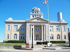 Madison County Courthouse | |
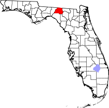 Location in the U.S. state of Florida | |
 Florida's location in the U.S. | |
| Founded | December 26, 1827 |
| Named for | James Madison |
| Seat | Madison |
| Largest city | Madison |
| Area | |
| • Total | 716 sq mi (1,854 km2) |
| • Land | 696 sq mi (1,803 km2) |
| • Water | 220 sq mi (570 km2), 2.8% |
| Population (est.) | |
| • (2017) | 18,449[1] |
| • Density | 26.5/sq mi (10.2/km2) |
| Congressional district | 5th |
| Time zone | Eastern: UTC−5/−4 |
| Website |
www |
Madison County is a county located in the state of Florida, in the center of its northern border with Georgia. As of the 2010 census, the population was 19,224.[2] Its county seat is also called Madison.[3] As of August 28, 2012, Madison became a wet county, meaning that voters had approved the legal sale, possession, or distribution of alcoholic beverages.[4]
History
Located in what is known as the Florida Panhandle, Madison County was created in 1827.[5] It was named for James Madison, fourth President of the United States of America, who served from 1809 to 1817.[6] It was developed as part of the plantation belt, with cotton cultivated and processed by enslaved African Americans.[7]
In the period after Reconstruction, racial violence rose in the state, reaching a peak at the end of the 19th century. According to the Equal Justice Institute's 2015 report, Lynching in America: Confronting Racial Terror, from 1877-1950, Madison County had 16 lynchings in this period, the 6th highest of any county in the state.[8] The county's economic and population growth was stagnant from the 1880s and for several decades into the early 20th century.[7]
In 1945, the county's population of 15,537 was divided evenly between black and white.[7] The last known lynching in the county was that in October 1945 of Jesse James Payne, a young married sharecropper with a child. He had been charged with sexual abuse of a young girl, but was innocent; the precipitating incident was a disagreement with the white landowner where he was sharecropping. The sheriff and others appeared implicated in his shooting death, as he was left in jail unguarded after mob action had been threatened. His was the only recorded lynching nationwide of that year, when World War II ended. The case received national attention and the governor was strongly criticized for failure to mount a true investigation or to take action against the sheriff.[7]
Geography
According to the U.S. Census Bureau, the county has a total area of 716 square miles (1,850 km2), of which 696 square miles (1,800 km2) is land and 20 square miles (52 km2) (2.8%) is water.[9]
Adjacent counties
- Brooks County, Georgia - north
- Lowndes County, Georgia - northeast
- Hamilton County - east
- Suwannee County - southeast
- Lafayette County - southeast
- Taylor County - southwest
- Jefferson County - west
Demographics
| Historical population | |||
|---|---|---|---|
| Census | Pop. | %± | |
| 1830 | 525 | — | |
| 1840 | 2,644 | 403.6% | |
| 1850 | 5,490 | 107.6% | |
| 1860 | 7,779 | 41.7% | |
| 1870 | 11,121 | 43.0% | |
| 1880 | 14,798 | 33.1% | |
| 1890 | 14,316 | −3.3% | |
| 1900 | 15,446 | 7.9% | |
| 1910 | 16,919 | 9.5% | |
| 1920 | 16,516 | −2.4% | |
| 1930 | 15,614 | −5.5% | |
| 1940 | 16,190 | 3.7% | |
| 1950 | 14,197 | −12.3% | |
| 1960 | 14,154 | −0.3% | |
| 1970 | 13,481 | −4.8% | |
| 1980 | 14,894 | 10.5% | |
| 1990 | 16,569 | 11.2% | |
| 2000 | 18,733 | 13.1% | |
| 2010 | 19,224 | 2.6% | |
| Est. 2017 | 18,449 | [10] | −4.0% |
| U.S. Decennial Census[11] 1790-1960[12] 1900-1990[13] 1990-2000[14] 2010-2015[2] | |||
As of the census[15] of 2000, there were 18,733 people, 6,629 households, and 4,680 families residing in the county. The population density was 27 people per square mile (10/km²). There were 7,836 housing units at an average density of 11 per square mile (4/km²). The racial makeup of the county was 57.49% Caucasian, 40.30% Black or African American, 0.32% Native American, 0.32% Asian, 0.02% Pacific Islander, 0.51% from other races, and 1.04% from two or more races. 3.20% of the population were Hispanic or Latino of any race.
There were 6,629 households out of which 31.90% had children under the age of 18 living with them, 48.90% were married couples living together, 17.50% had a female householder with no husband present, and 29.40% were non-families. 25.40% of all households were made up of individuals and 11.60% had someone living alone who was 65 years of age or older. The average household size was 2.57 and the average family size was 3.06.
In the county, the population was spread out with 25.30% under the age of 18, 9.20% from 18 to 24, 28.20% from 25 to 44, 22.70% from 45 to 64, and 14.60% who were 65 years of age or older. The median age was 36 years. For every 100 females there were 107.60 males. For every 100 females age 18 and over, there were 106.80 males.
The median income for a household in the county was $26,533, and the median income for a family was $31,753. Males had a median income of $25,255 versus $19,607 for females. The per capita income for the county was $12,511. About 18.90% of families and 23.10% of the population were below the poverty line, including 30.10% of those under age 18 and 22.50% of those age 65 or over.
Transportation
Major highways


Railroads
Madison County has at least two railroad lines. The primary one is a CSX line formerly owned by the Seaboard Air Line Railroad; it served Amtrak's Sunset Limited until it was truncated to New Orleans in 2005 by Hurricane Katrina. The station was Madison County's only active passenger railroad station until that point. The other line is owned by the Georgia and Florida Railway, and runs in close proximity to US 221 throughout Madison County.
Education
Madison County Schools operates public schools. Madison County High School is one of the two high schools in Madison, the other is a charter high school, James Madison Preparatory High School.
Libraries
Madison County is served by the Suwannee River Regional Library System, which contains eight branches and also serves Hamilton and Suwannee counties.
- Branford
- Greenville
- Jasper
- Jennings
- Lee
- Live Oak
- Madison
- White Springs
Communities

City
Towns
Unincorporated communities
- Cherry Lake
- Hamburg
- Hanson
- Hopewell
- Lamont
- Lovett
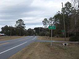
- Pinetta
- Sirmans
Politics
Since the late 20th century, most white conservatives have shifted from the Democratic to the Republican Party, which is reflected in county voting in presidential elections. African Americans have generally supported Democratic presidential candidates in that period, since the national party supported their regaining the power to exercise their constitutional right and vote.
| Year | GOP | DEM | Others |
|---|---|---|---|
| 2016 | 56.80% 4,851 | 41.29% 3,526 | 1.91% 163 |
| 2012 | 51.27% 4,474 | 47.85% 4,176 | 0.88% 77 |
| 2008 | 51.02% 4,544 | 47.94% 4,270 | 1.04% 93 |
| 2004 | 50.47% 4,191 | 48.77% 4,050 | 0.76% 63 |
| 2000 | 49.29% 3,038 | 48.92% 3,015 | 1.79% 110 |
| 1996 | 39.29% 2,195 | 50.01% 2,794 | 10.71% 598 |
| 1992 | 34.38% 2,007 | 45.36% 2,648 | 20.26% 1,183 |
| 1988 | 56.59% 2,563 | 43.08% 1,951 | 0.33% 15 |
| 1984 | 57.30% 2,819 | 42.70% 2,101 | |
| 1980 | 41.39% 2,280 | 56.89% 3,134 | 1.72% 95 |
| 1976 | 34.94% 1,761 | 63.85% 3,218 | 1.21% 61 |
| 1972 | 72.92% 3,236 | 26.75% 1,187 | 0.34% 15 |
| 1968 | 13.81% 654 | 29.10% 1,378 | 57.09% 2,703 |
| 1964 | 57.09% 2,822 | 42.91% 2,121 | |
| 1960 | 35.60% 1,152 | 64.40% 2,084 | |
| 1956 | 33.01% 1,017 | 66.99% 2,064 | |
| 1952 | 42.66% 1,209 | 57.34% 1,625 | |
| 1948 | 9.00% 207 | 51.70% 1,189 | 39.30% 904 |
| 1944 | 13.28% 293 | 86.72% 1,914 | |
| 1940 | 15.38% 440 | 84.62% 2,421 | |
| 1936 | 7.47% 184 | 92.53% 2,278 | |
| 1932 | 12.12% 221 | 87.88% 1,602 | |
| 1928 | 25.70% 266 | 74.30% 769 | |
| 1924 | 3.88% 23 | 90.73% 538 | 5.40% 32 |
| 1920 | 3.04% 30 | 93.31% 920 | 3.65% 36 |
| 1916 | 2.74% 22 | 89.79% 721 | 7.47% 60 |
| 1912 | 2.92% 16 | 87.59% 480 | 9.48% 52 |
| 1908 | 5.38% 32 | 85.88% 511 | 8.74% 52 |
| 1904 | 9.73% 66 | 87.76% 595 | 2.51% 17 |
Notable residents
The small town of Greenville was the childhood home of rhythm and blues giant Ray Charles. Also from Madison County are professional baseball player Lorenzo Cain and professional football player Chris Thompson.
See also
References
- ↑ https://www.census.gov/quickfacts/fact/table/madisoncountyflorida/PST045217
- 1 2 "State & County QuickFacts". United States Census Bureau. Retrieved February 14, 2014.
- ↑ "Find a County". National Association of Counties. Retrieved 2011-06-07.
- ↑
- ↑ Publications of the Florida Historical Society. Florida Historical Society. 1908. p. 32.
- ↑ Gannett, Henry (1905). The Origin of Certain Place Names in the United States. U.S. Government Printing Office. p. 196.
- 1 2 3 4 Jack E. Davis, " 'Whitewash' in Florida: The Lynching of Jesse James Payne and Its Aftermath", The Florida Historical Quarterly Vol. 68, No. 3 (Jan., 1990), pp. 277-298; accessed 19 March 2018
- ↑ [https://eji.org/sites/default/files/lynching-in-america-second-edition-supplement-by-county.pdf Lynching in America: Supplement: Lynchings by County, Equal Justice Institute, 2015; accessed 19 March 2018, p. 3
- ↑ "US Gazetteer files: 2010, 2000, and 1990". United States Census Bureau. 2011-02-12. Retrieved 2011-04-23.
- ↑ "Population and Housing Unit Estimates". Retrieved June 9, 2017.
- ↑ "U.S. Decennial Census". United States Census Bureau. Retrieved June 15, 2014.
- ↑ "Historical Census Browser". University of Virginia Library. Retrieved June 15, 2014.
- ↑ "Population of Counties by Decennial Census: 1900 to 1990". United States Census Bureau. Retrieved June 15, 2014.
- ↑ "Census 2000 PHC-T-4. Ranking Tables for Counties: 1990 and 2000" (PDF). United States Census Bureau. Retrieved June 15, 2014.
- ↑ "American FactFinder". United States Census Bureau. Retrieved 2011-05-14.
- ↑ Leip, David. "Dave Leip's Atlas of U.S. Presidential Elections". uselectionatlas.org. Retrieved 2018-06-15.
External links
| Wikimedia Commons has media related to Madison County, Florida. |
Government links/Constitutional offices
- Madison County Board of County Commissioners
- Madison County Supervisor of Elections
- Madison County Property Appraiser
- Madison County Sheriff's Office
- Madison County Tax Collector
Special districts
Judicial branch
Tourism links
- Madison County Chamber of Commerce
- Madison County Suwannee Online
Miscellaneous links
- Madison Collection Approximately 1,000 photographs of Madison County-area people, industries, and agriculture. From the State Library & Archives of Florida.
- North Florida Community College, Madison, Florida
- Senior Citizens Council of Madison County, Florida
- The New Enterprise, Online historical newspaper
- Madison Enterprise-Recorder, newspaper
- Madison County Carrier newspaper
- Artz, a community portal for the artists and writers of Madison County.
Places adjacent to Madison County, Florida | ||||||||||
|---|---|---|---|---|---|---|---|---|---|---|
| ||||||||||
Municipalities and communities of Madison County, Florida, United States | ||
|---|---|---|
| City | | |
| Towns | ||
| Unincorporated communities | ||

| Topics |  Map of North Florida | |
|---|---|---|
| Counties | ||
| Major cities | ||
| Cities and towns 100k+ | ||
| Cities and towns 25k–100k | ||
| Cities and towns 10k–25k | ||
| Metro areas | ||
| Regions | ||