| [3] |
Name on the Register[4] |
Image |
Date listed[5] |
Location |
City or town |
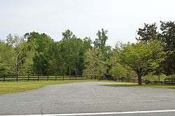
Description |
|---|
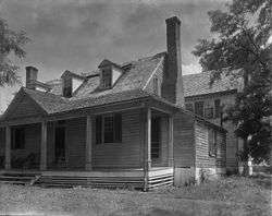
| 1 |
Advance Mills |
|
April 12, 2002
(#02000362) |
Junction of Advance Mills and Frays Mills Rds.
38°11′00″N 78°26′21″W / 38.183333°N 78.439167°W / 38.183333; -78.439167 (Advance Mills) |
Advance Mills |
|
| 2 |
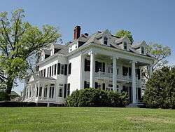
The Anchorage |
|
July 13, 2001
(#01000688) |
1864 Anchorage Farm
37°58′27″N 78°36′55″W / 37.974167°N 78.615278°W / 37.974167; -78.615278 (The Anchorage) |
Charlottesville |
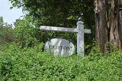
|
| 3 |
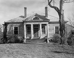
Arrowhead |
|
July 9, 1991
(#91000885) |
Eastern side of U.S. Route 29 at Arrowhead Farm Ln.
37°58′49″N 78°35′41″W / 37.980139°N 78.594722°W / 37.980139; -78.594722 (Arrowhead) |
Charlottesville |
|
| 4 |
The Aviator |
|
November 9, 2006
(#06000758) |
575 Alderman Rd.
38°02′11″N 78°30′21″W / 38.036361°N 78.505806°W / 38.036361; -78.505806 (The Aviator) |
Charlottesville |
|
| 5 |
Ballard-Maupin House |
|
February 5, 1999
(#99000142) |
4257 Ballard's Mill Rd.
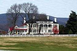
38°09′11″N 78°35′49″W / 38.153194°N 78.596806°W / 38.153194; -78.596806 (Ballard-Maupin House) |
Free Union |
|
| 6 |
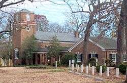
Batesville Historic District |
|
December 9, 1999
(#99001500) |
Junction of Plank and Craigs Store Rds.
37°59′44″N 78°43′21″W / 37.995556°N 78.722500°W / 37.995556; -78.722500 (Batesville Historic District) |
Batesville |
|
| 7 |
Bel Aire |
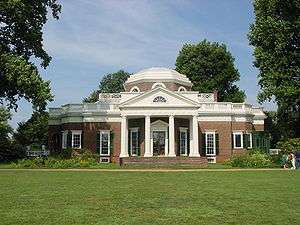
|
March 7, 2007
(#07000132) |
4710 Dickerson Rd.
38°09′46″N 78°25′38″W / 38.162778°N 78.427222°W / 38.162778; -78.427222 (Bel Aire) |
Charlottesville |
|
| 8 |
Bellair |
|
October 15, 1992
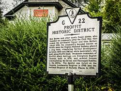
(#92001372) |
Southern side of Secretarys Rd., 3.8 miles (6.1 km) east of the junction with State Route 20
37°53′22″N 78°31′08″W / 37.889444°N 78.518889°W / 37.889444; -78.518889 (Bellair) |
Charlottesville |
|
| 9 |
Bellevue |
|
July 9, 1991
(#91000886) |
Southern side of Plank Rd., 3,500 feet (1,100 m) west of the Dick Woods Rd. junction
38°00′38″N 78°44′57″W / 38.010556°N 78.749167°W / 38.010556; -78.749167 (Bellevue) |
Batesville |
|
| 10 |
Bentivar |
|
April 20, 2005
(#05000333) |
1601 Bentivar Farm Rd.
38°04′59″N 78°26′05″W / 38.083056°N 78.434722°W / 38.083056; -78.434722 (Bentivar) |
Charlottesville |
|
| 11 |
Birdwood |
|
October 23, 2003
(#03001094) |
500 Birdwood Dr.
38°02′56″N 78°32′01″W / 38.048889°N 78.533611°W / 38.048889; -78.533611 (Birdwood) |
Charlottesville |
|
| 12 |
Blenheim |
|
May 17, 1976
(#76002089) |
South of Charlottesville on Blenheim Rd.
37°55′59″N 78°29′59″W / 37.932917°N 78.499722°W / 37.932917; -78.499722 (Blenheim) |
Blenheim |
|
| 13 |
Blue Ridge Farm |
|
January 25, 1991
(#90002163) |
South of the junction of Plank and Ortman Rds.
38°00′46″N 78°46′03″W / 38.012778°N 78.767500°W / 38.012778; -78.767500 (Blue Ridge Farm) |
Greenwood |
|
| 14 |
Blue Ridge Swim Club |
|
May 19, 2015
(#15000248) |
1275 Owensville Rd.
38°04′24″N 78°35′23″W / 38.073333°N 78.589722°W / 38.073333; -78.589722 (Blue Ridge Swim Club) |
Ivy |
|
| 15 |
Boyd Tavern |
|
November 12, 2009
(#09000919) |
Union Mills Rd.
37°59′05″N 78°20′20″W / 37.984722°N 78.338889°W / 37.984722; -78.338889 (Boyd Tavern) |
Boyd Tavern |
|
| 16 |
Carr's Hill |
|
April 23, 2008
(#08000340) |
1910 Carr's Hill Rd.
38°02′17″N 78°30′14″W / 38.038056°N 78.503889°W / 38.038056; -78.503889 (Carr's Hill) |
Charlottesville |
|
| 17 |
Carrsbrook |
|
July 8, 1982
(#82004532) |
Gloucester Ct.
38°05′37″N 78°27′18″W / 38.093611°N 78.455000°W / 38.093611; -78.455000 (Carrsbrook) |
Charlottesville |
|
| 18 |
Casa Maria |
|
December 28, 1990
(#90001999) |
Ortman Rd., south of the junction with U.S. Route 250
38°01′55″N 78°45′27″W / 38.031944°N 78.757500°W / 38.031944; -78.757500 (Casa Maria) |
Greenwood |
|
| 19 |
Castle Hill |
|
February 23, 1972
(#72001379) |
Northeast of Cismont near the junction of State Route 231 and Turkey Sag Rd.
38°05′08″N 78°17′53″W / 38.085694°N 78.298056°W / 38.085694; -78.298056 (Castle Hill) |
Cismont |
|
| 20 |
The Cedars |
|
December 27, 1990
(#89001909) |
U.S. Route 250, west of Interstate 64
38°02′29″N 78°44′18″W / 38.041250°N 78.738333°W / 38.041250; -78.738333 (The Cedars) |
Greenwood |
|
| 21 |
Christ Church Glendower |
|
July 2, 1971
(#71000974) |
On Glendower Rd., 0.4 miles (0.64 km) southwest of the junction with Coles Rolling Rd.
37°51′11″N 78°32′03″W / 37.853056°N 78.534167°W / 37.853056; -78.534167 (Christ Church Glendower) |
Keene |
|
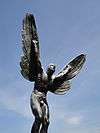
| 22 |
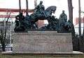
George Rogers Clark Sculpture |
|
May 16, 1997
(#97000448) |
Monument Square, bounded by University and Jefferson Park Aves. and the railroad tracks
38°02′00″N 78°29′56″W / 38.033333°N 78.498889°W / 38.033333; -78.498889 (George Rogers Clark Sculpture) |
Charlottesville |
|
| 23 |
Clark Hall, University of Virginia |
|
September 5, 2008
(#08000871) |
291 McCormick Rd.
38°01′59″N 78°30′28″W / 38.033111°N 78.507794°W / 38.033111; -78.507794 (Clark Hall, University of Virginia) |
Charlottesville |
|
| 24 |
Cliffside |
|
September 16, 1982
(#82004536) |
North of Scottsville on State Route 6
37°48′12″N 78°29′58″W / 37.803333°N 78.499444°W / 37.803333; -78.499444 (Cliffside) |
Scottsville |
|
| 25 |
Clifton |
|
November 2, 1989
(#89001922) |
Milton Rd. at the Rivanna River
38°00′25″N 78°23′50″W / 38.006944°N 78.397222°W / 38.006944; -78.397222 (Clifton) |
Shadwell |
|
| 26 |
Cobham Park |
|
July 18, 1974
(#74002101) |
South of State Route 22
38°03′31″N 78°15′44″W / 38.058611°N 78.262222°W / 38.058611; -78.262222 (Cobham Park) |
Cobham |
|
| 27 |
Cocke's Mill House and Mill Site |
|
December 6, 1990
(#90001828) |
Plank Rd. north of its junction with Alberene Rd.
37°54′30″N 78°37′02″W / 37.908333°N 78.617222°W / 37.908333; -78.617222 (Cocke's Mill House and Mill Site) |
North Garden |
|
| 28 |
Cove Presbyterian Church |
|
November 2, 1989
(#89001935) |
U.S. Route 29, north of Boaz Rd.
37°53′05″N 78°42′39″W / 37.884722°N 78.710917°W / 37.884722; -78.710917 (Cove Presbyterian Church) |
Covesville |
|
| 29 |
Covesville Historic District |
|
June 2, 2005
(#05000521) |
Roughly along the railroad tracks, U.S. Route 29, Covesville Ln., and Boaz Rd.
37°53′27″N 78°42′17″W / 37.890833°N 78.704722°W / 37.890833; -78.704722 (Covesville Historic District) |
Covesville |
|
| 30 |
Crossroads Tavern |
|
August 16, 1984
(#84003481) |
Plank Rd.
37°57′27″N 78°39′38″W / 37.957500°N 78.660556°W / 37.957500; -78.660556 (Crossroads Tavern) |
Crossroads |
|
| 31 |
Crozet Historic District |
|
November 28, 2012
(#12000985) |
Roughly Railroad, St. George, and Crozet Aves.
38°04′18″N 78°42′06″W / 38.071667°N 78.701667°W / 38.071667; -78.701667 (Crozet Historic District) |
Crozet |
|
| 32 |
D.S. Tavern |
|
September 29, 1983
(#83003255) |
U.S. Route 250
38°03′13″N 78°34′02″W / 38.053611°N 78.567222°W / 38.053611; -78.567222 (D.S. Tavern) |
Ivy |
|
| 33 |
Earlysville Union Church |
|
December 11, 1997
(#97001504) |
Advance Mills Rd., south of the junction with Buck Mountain Rd.
38°09′25″N 78°28′59″W / 38.156944°N 78.483194°W / 38.156944; -78.483194 (Earlysville Union Church) |
Earlysville |
|
| 34 |
East Belmont |
|
August 2, 1999
(#99000853) |
Junction of State Route 22 and Black Cat Rd.
38°01′58″N 78°22′03″W / 38.032778°N 78.367500°W / 38.032778; -78.367500 (East Belmont) |
Keswick |
|
| 35 |
Edge Hill |
|
September 9, 1982
(#82004537) |
North of Shadwell on State Route 22
38°01′05″N 78°23′41″W / 38.017917°N 78.394722°W / 38.017917; -78.394722 (Edge Hill) |
Shadwell |
|
| 36 |
Edgemont |
|
November 28, 1980
(#80004162) |
Southeast of Colesville on Plank Rd.
37°54′17″N 78°37′01″W / 37.904722°N 78.616944°W / 37.904722; -78.616944 (Edgemont) |
Covesville |
|
| 37 |
Ednam House |
|
July 8, 1982
(#82004533) |
U.S. Route 250
38°03′07″N 78°32′17″W / 38.051944°N 78.537917°W / 38.051944; -78.537917 (Ednam House) |
Ednam |
|
| 38 |
Emmanuel Church |
|
July 8, 1982
(#82004535) |
U.S. Route 250
38°02′00″N 78°45′47″W / 38.033333°N 78.763056°W / 38.033333; -78.763056 (Emmanuel Church) |
Greenwood |
|
| 39 |
Esmont |
|
May 6, 1980
(#80004163) |
North of Esmont
37°50′30″N 78°36′25″W / 37.841667°N 78.606944°W / 37.841667; -78.606944 (Esmont) |
Esmont |
|
| 40 |
Estes Farm |
|
May 17, 2006
(#06000409) |
6185 Estes Ln.
38°12′18″N 78°29′44″W / 38.205000°N 78.495556°W / 38.205000; -78.495556 (Estes Farm) |
Dyke |
|
| 41 |
Estouteville |
|
January 30, 1978
(#78003002) |
Southeast of Powell Corner off Plank Rd.
37°53′12″N 78°34′23″W / 37.886667°N 78.573056°W / 37.886667; -78.573056 (Estouteville) |
Powell Corner |
|
| 42 |
Farmington |
|
September 15, 1970
(#70000782) |
West of the junction of U.S. Routes 29 and 250
38°03′44″N 78°32′30″W / 38.062222°N 78.541667°W / 38.062222; -78.541667 (Farmington) |
Charlottesville |
|
| 43 |
Faulkner House |
|
May 3, 1984
(#84003484) |
2201 Old Ivy Rd.
38°02′52″N 78°30′49″W / 38.047778°N 78.513611°W / 38.047778; -78.513611 (Faulkner House) |
Charlottesville |
|
| 44 |
Gallison Hall |
|
December 28, 1990
(#90002013) |
24 Farmington Dr.
38°04′11″N 78°32′08″W / 38.069722°N 78.535556°W / 38.069722; -78.535556 (Gallison Hall) |
Charlottesville |
|
| 45 |
Grace Church |
|
October 21, 1976
(#76002091) |
Northeast of Cismont on State Route 231
38°03′39″N 78°18′30″W / 38.060833°N 78.308333°W / 38.060833; -78.308333 (Grace Church) |
Cismont |
|
| 46 |
Greenwood-Afton Rural Historic District |
|
May 6, 2011
(#11000258) |
Roughly 5 miles (8.0 km) to 7 miles (11 km) north and south of Interstate 64
38°03′21″N 78°46′12″W / 38.055833°N 78.770000°W / 38.055833; -78.770000 (Greenwood-Afton Rural Historic District) |
Greenwood |
Boundaries modified on February 8, 2016. Extends into Augusta and Nelson counties |
| 47 |
Guthrie Hall |
|
September 23, 1982
(#82004534) |
North of Esmont on Alberene Rd.
37°50′56″N 78°36′40″W / 37.848889°N 78.611111°W / 37.848889; -78.611111 (Guthrie Hall) |
Esmont |
|
| 48 |
Harris Farm |
|
May 18, 2015
(#15000249) |
2950 State Route 53
37°57′58″N 78°22′45″W / 37.966111°N 78.379167°W / 37.966111; -78.379167 (Harris Farm) |
Charlottesville |
|
| 49 |
High Meadows |
|
May 30, 1986
(#86001185) |
Off State Route 20
37°48′34″N 78°29′56″W / 37.809444°N 78.498889°W / 37.809444; -78.498889 (High Meadows) |
Scottsville |
|
| 50 |
Highland |
|
August 14, 1973
(#73001990) |
Southeast of Charlottesville off State Route 53
37°58′58″N 78°27′22″W / 37.982778°N 78.456111°W / 37.982778; -78.456111 (Highland) |
Simeon |
|
| 51 |
Home Tract |
|
December 9, 1999
(#99001501) |
699 Ivy Depot Rd.
38°03′20″N 78°35′52″W / 38.055694°N 78.597639°W / 38.055694; -78.597639 (Home Tract) |
Ivy |
|
| 52 |
Kenridge |
|
May 15, 2008
(#08000416) |
912 Marsh Ln.
38°03′10″N 78°32′00″W / 38.052778°N 78.533333°W / 38.052778; -78.533333 (Kenridge) |
Charlottesville |
|
| 53 |
Lewis Mountain |
|
December 7, 2009
(#09001052) |
1 Lewis Mountain Parkway
38°02′28″N 78°31′16″W / 38.041111°N 78.521111°W / 38.041111; -78.521111 (Lewis Mountain) |
Charlottesville |
|
| 54 |
Limestone |
|
May 10, 2006
(#06000366) |
4401 Limestone Rd.
37°59′29″N 78°21′12″W / 37.991389°N 78.353333°W / 37.991389; -78.353333 (Limestone) |
Keswick |
|
| 55 |
Longwood |
|
October 18, 1996
(#96001074) |
Northern side of Buck Mountain Rd. at its junction with Markwood and Simmons Gap Rds.
38°10′44″N 78°29′48″W / 38.178889°N 78.496667°W / 38.178889; -78.496667 (Longwood) |
Earlysville |
|
| 56 |
Malvern |
|
August 4, 1995
(#95000974) |
Western side of Taylors Gap Rd., 1,250 feet (380 m) north of the junction with Dick Woods Rd.
38°01′46″N 78°38′25″W / 38.029444°N 78.640278°W / 38.029444; -78.640278 (Malvern) |
Charlottesville |
|
| 57 |
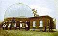
Leander McCormick Observatory |
|
November 19, 2004
(#04001245) |
600 McCormick Rd.
38°01′58″N 78°31′20″W / 38.032778°N 78.522222°W / 38.032778; -78.522222 (Leander McCormick Observatory) |
Charlottesville |
|
| 58 |
Mechum River Farm |
|
March 29, 2007
(#07000235) |
1207 Burchs Creek Rd.
38°00′32″N 78°43′08″W / 38.008889°N 78.718961°W / 38.008889; -78.718961 (Mechum River Farm) |
Charlottesville |
|
| 59 |
Memorial Gymnasium |
|
December 4, 2004
(#04001291) |
210 S. Emmett St.
38°02′15″N 78°30′26″W / 38.037500°N 78.507222°W / 38.037500; -78.507222 (Memorial Gymnasium) |
Charlottesville |
|
| 60 |
Midway |
|
February 28, 1979
(#79003152) |
Southeast of Millington off Ridge Rd.
38°06′34″N 78°35′56″W / 38.109444°N 78.598889°W / 38.109444; -78.598889 (Midway) |
Millington |
|
| 61 |
Miller School of Albemarle |
|
February 15, 1974
(#74002102) |
1000 Samuel Miller Loop
38°00′22″N 78°42′05″W / 38.006111°N 78.701389°W / 38.006111; -78.701389 (Miller School of Albemarle) |
Yancey Mills |
|
| 62 |
Mirador |
|
April 7, 1983
(#83003256) |
U.S. Route 250; also 7459 Mirador Farm Rd.
38°02′17″N 78°45′26″W / 38.038056°N 78.757222°W / 38.038056; -78.757222 (Mirador) |
Greenwood |
Second address represents a boundary increase of May 2, 2003 |
| 63 |
Monroe Hill |
|
June 2, 2004
(#04000575) |
252 and 256 McCormick Rd.
38°02′05″N 78°30′25″W / 38.034722°N 78.506944°W / 38.034722; -78.506944 (Monroe Hill) |
Charlottesville |
|
| 64 |
Monticello |
|
October 15, 1966
(#66000826) |
2 miles (3.2 km) south of Charlottesville on State Route 53
38°00′37″N 78°27′09″W / 38.010278°N 78.452500°W / 38.010278; -78.452500 (Monticello) |
Charlottesville |
|
| 65 |
Monticola |
|
June 22, 1990
(#90000872) |
Howardsville Turnpike north of the junction with Lewiston Ford Rd.
37°44′33″N 78°38′57″W / 37.742500°N 78.649167°W / 37.742500; -78.649167 (Monticola) |
Howardsville |
|
| 66 |
Morven |
|
April 24, 1973
(#73001991) |
West of Simeon off State Route 20
37°57′59″N 78°28′18″W / 37.966389°N 78.471667°W / 37.966389; -78.471667 (Morven) |
Simeon |
|
| 67 |
Mount Fair |
|
December 28, 1990
(#90001997) |
Junction of Slam Gate Rd. and Browns Gap Turnpike
38°09′52″N 78°40′40″W / 38.164444°N 78.677778°W / 38.164444; -78.677778 (Mount Fair) |
Browns Cove |
|
| 68 |
Mount Ida |
|
April 27, 1987
(#87000624) |
East of Blenheim Rd., about 4 miles (6.4 km) north of Scottsville
37°51′03″N 78°28′56″W / 37.850833°N 78.482222°W / 37.850833; -78.482222 (Mount Ida) |
Scottsville |
|
| 69 |
Mount Walla |
|
November 22, 2000
(#00001442) |
604 Poplar Springs Rd.
37°48′01″N 78°29′32″W / 37.800139°N 78.492222°W / 37.800139; -78.492222 (Mount Walla) |
Scottsville |
|
| 70 |
Mountain Grove |
|
September 8, 1980
(#80004164) |
Northwest of Esmont on Secretarys Sand Rd.
37°50′08″N 78°38′25″W / 37.835556°N 78.640278°W / 37.835556; -78.640278 (Mountain Grove) |
Esmont |
|
| 71 |
Pantops Farm |
|
May 7, 2014
(#05000483) |
400 Peter Jefferson St.
38°01′34″N 78°26′32″W / 38.026111°N 78.442222°W / 38.026111; -78.442222 (Pantops Farm) |
Charlottesville |
|
| 72 |
Piedmont |
|
February 1, 1991
(#90002184) |
Near the junction of Interstate 64 and Greenwood Rd.
38°02′46″N 78°46′32″W / 38.046111°N 78.775417°W / 38.046111; -78.775417 (Piedmont) |
Greenwood |
|
| 73 |
Pine Knot |
|
February 1, 1989
(#88003211) |
Coles Rolling Rd.
37°50′57″N 78°31′30″W / 37.849028°N 78.525000°W / 37.849028; -78.525000 (Pine Knot) |
Glendower |
|
| 74 |
Plain Dealing |
|
May 6, 1980
(#80004165) |
East of Keene
37°51′41″N 78°31′56″W / 37.861389°N 78.532222°W / 37.861389; -78.532222 (Plain Dealing) |
Keene |
|
| 75 |
Proffit Historic District |
|
February 5, 1999
(#99000145) |
Roughly the area around the junction of the Norfolk Southern railway tracks and Proffit Rd.
38°06′32″N 78°25′28″W / 38.108889°N 78.424444°W / 38.108889; -78.424444 (Proffit Historic District) |
Proffit |
|
| 76 |
Ramsay |
|
March 10, 2005
(#05000135) |
7760 Rockfish Gap Turnpike
38°02′06″N 78°46′04″W / 38.035000°N 78.767778°W / 38.035000; -78.767778 (Ramsay) |
Greenwood |
|
| 77 |
The Rectory |
|
November 7, 1991
(#91001579) |
Junction of Glendower and Coles Rolling Rds.
37°51′24″N 78°31′51″W / 37.856667°N 78.530833°W / 37.856667; -78.530833 (The Rectory) |
Keene |
|
| 78 |
Red Hills |
|
February 13, 1998
(#98000047) |
2051 Polo Grounds Rd.
38°05′44″N 78°25′40″W / 38.095556°N 78.427778°W / 38.095556; -78.427778 (Red Hills) |
Charlottesville |
|
| 79 |
Redlands |
|
November 12, 1969
(#69000218) |
Junction of Secretarys and Carters Mountain Rds.
37°54′44″N 78°31′47″W / 37.912222°N 78.529722°W / 37.912222; -78.529722 (Redlands) |
Covesville |
|
| 80 |
Rotunda, University of Virginia |
|
October 15, 1966
(#66000937) |
University of Virginia
38°02′08″N 78°30′12″W / 38.035556°N 78.503333°W / 38.035556; -78.503333 (Rotunda, University of Virginia) |
Charlottesville |
|
| 81 |
Rugby Road-University Corner Historic District |
|
February 16, 1984
(#84003523) |
Roughly bounded by University Ave., Wayside Pl., 14th St., and U.S. Route 29
38°02′17″N 78°30′11″W / 38.038056°N 78.503056°W / 38.038056; -78.503056 (Rugby Road-University Corner Historic District) |
Charlottesville |
Extends into Charlottesville |
| 82 |
St. James Church |
|
January 14, 2013
(#12001186) |
Garth Rd. east of Owensville Rd.
38°06′08″N 78°34′22″W / 38.102222°N 78.572778°W / 38.102222; -78.572778 (St. James Church) |
Charlottesville |
also known as Garth Chapel[6] |
| 83 |
Scottsville Historic District |
|
July 30, 1976
(#76002093) |
State Route 6; also roughly bounded by the James River, the town limits, and Riverview, Mount Walla, Oakwood, Cliffside, and Chester
37°48′00″N 78°29′46″W / 37.800000°N 78.496111°W / 37.800000; -78.496111 (Scottsville Historic District) |
Scottsville |
Second set of boundaries represents a boundary increase of February 11, 2004. Extends into Fluvanna County. |
| 84 |
Seven Oaks Farm and Black's Tavern |
|
December 26, 1989
(#89001906) |
U.S. Route 250, west of Interstate 64
38°02′31″N 78°44′47″W / 38.041944°N 78.746389°W / 38.041944; -78.746389 (Seven Oaks Farm and Black's Tavern) |
Greenwood |
|
| 85 |
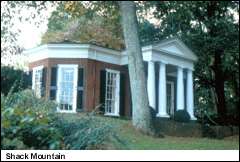
Shack Mountain |
|
September 1, 1976
(#76002090) |
2 miles (3.2 km) north-northwest of Charlottesville off Lambs Ln.
38°05′31″N 78°30′04″W / 38.091806°N 78.501111°W / 38.091806; -78.501111 (Shack Mountain) |
Charlottesville |
|
| 86 |
Skyline Drive Historic District |
|
April 28, 1997
(#97000375) |
Shenandoah National Park, from the north entrance station at Front Royal to the south entrance station at the Rockfish Gap
38°13′48″N 78°43′34″W / 38.230000°N 78.726111°W / 38.230000; -78.726111 (Skyline Drive Historic District) |
Luray |
|
| 87 |
Southern Albemarle Rural Historic District |
|
November 28, 2007
(#07001236) |
Roughly bounded by the Rivanna River, State Route 20, Green Mountain, the James River, Blenheim, Jefferson Mill, Rolling, and Milton Rds., and the Monroe Parkway
37°53′47″N 78°36′36″W / 37.896389°N 78.610000°W / 37.896389; -78.610000 (Southern Albemarle Rural Historic District) |
Charlottesville |
|
| 88 |
Southwest Mountains Rural Historic District |
|
February 27, 1992
(#92000054) |
Roughly bounded by Interstate 64, State Route 20, the Orange County line, and the CSX railroad tracks
38°04′49″N 78°16′36″W / 38.080278°N 78.276667°W / 38.080278; -78.276667 (Southwest Mountains Rural Historic District) |
Keswick |
|
| 89 |
Spring Hill |
|
November 21, 1983
(#83004232) |
Dick Woods Rd.
38°02′53″N 78°36′04″W / 38.048056°N 78.601111°W / 38.048056; -78.601111 (Spring Hill) |
Ivy |
|
| 90 |
Sunny Bank |
|
December 12, 1976
(#76002092) |
Northeast of Covesville, west of the junction of Plank and Old Lynchburg Rds.
37°55′14″N 78°38′56″W / 37.920694°N 78.648889°W / 37.920694; -78.648889 (Sunny Bank) |
South Garden |
|
| 91 |
Sunnyfields |
|
June 10, 1993
(#93000509) |
Western side of State Route 53, at the junction with Milton Rd.
37°59′32″N 78°27′14″W / 37.992222°N 78.453889°W / 37.992222; -78.453889 (Sunnyfields) |
Simeon |
|
| 92 |
University of Virginia Historic District |
|
November 20, 1970
(#70000865) |
Bounded by University and Jefferson Park Aves., and Hospital and McCormick Rds.
38°02′05″N 78°30′15″W / 38.034722°N 78.504167°W / 38.034722; -78.504167 (University of Virginia Historic District) |
Charlottesville |
Historic district on grounds of University of Virginia |
| 93 |
Walker House |
|
December 28, 1990
(#90002001) |
Warren Ferry Rd. south of the junction with James River Rd.
37°46′10″N 78°33′30″W / 37.769583°N 78.558472°W / 37.769583; -78.558472 (Walker House) |
Warren |
|
| 94 |
West Cote |
|
January 24, 2002
(#01001510) |
Off Howardsville Turnpike and James River Rd.
37°44′03″N 78°39′05″W / 37.734167°N 78.651389°W / 37.734167; -78.651389 (West Cote) |
Howardsville |
|
| 95 |
Woodburn |
|
January 28, 2000
(#00000029) |
Proffit Rd., 2 miles east of U.S. Route 29
38°07′00″N 78°25′31″W / 38.116667°N 78.425278°W / 38.116667; -78.425278 (Woodburn) |
Charlottesville |
|
| 96 |
Woodlands |
|
November 2, 1989
(#89001931) |
Woodlands Rd.
38°06′20″N 78°30′03″W / 38.105556°N 78.500833°W / 38.105556; -78.500833 (Woodlands) |
Charlottesville |
|
| 97 |
Woodstock Hall Tavern |
|
January 29, 1987
(#86003735) |
Dick Woods Rd.
38°01′37″N 78°37′52″W / 38.026944°N 78.631111°W / 38.026944; -78.631111 (Woodstock Hall Tavern) |
Ivy |
|
| 98 |
Woolen Mills Village Historic District |
|
April 12, 2010
(#10000196) |
Area includes parts of Chesapeake, Franklin, Steephill, 18th, NE., and E. Market Sts. and Riverside Ave. in the City of Charlottesville; and parts of Pireus Row and Marchant and E. Market Sts. in Albemarle County.[7]
38°01′15″N 78°27′20″W / 38.020833°N 78.455556°W / 38.020833; -78.455556 (Woolen Mills Village Historic District) |
Charlottesville |
Extends into the city of Charlottesville |

.JPG)
.jpg)
.jpg)
.png)
.jpg)

.tif.jpg)
.tif.jpg)
.png)
.png)
.tif.jpg)
%2C_Owensville%2C_Albemarle_County%2C_VA_HABS_VA%2C2-OWEN.V%2C1-_(sheet_3_of_5).png)
.jpg)

.tif.jpg)
_color.jpg)