Richmond County, Georgia
Richmond County is a county located in the U.S. state of Georgia. As of the 2010 census, the population was 200,549.[2] It is one of the original counties of Georgia, created February 5, 1777.
Richmond County | |
|---|---|
 Augusta-Richmond County Municipal Building | |
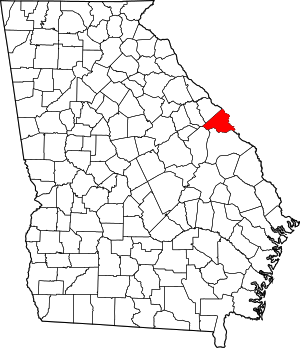 Location within the U.S. state of Georgia | |
 Georgia's location within the U.S. | |
| Coordinates: 33°22′N 82°04′W | |
| Country | |
| State | |
| Founded | February 5, 1777[1] |
| Named for | Charles Lennox, 3rd Duke of Richmond |
| Seat | Augusta |
| Largest city | Augusta |
| Area | |
| • Total | 329 sq mi (850 km2) |
| • Land | 324 sq mi (840 km2) |
| • Water | 4.3 sq mi (11 km2) 1.3%% |
| Population | |
| • Estimate (2019) | 202,518 |
| • Density | 618/sq mi (239/km2) |
| Time zone | UTC−5 (Eastern) |
| • Summer (DST) | UTC−4 (EDT) |
| Congressional district | 12th |
| Website | www |
Following an election in 1995, the city of Augusta (the county seat) consolidated governments with Richmond County. The consolidated entity is known as Augusta-Richmond County, or simply Augusta. Exempt are the cities of Hephzibah and Blythe, in southern Richmond County, which voted to remain separate.
Richmond County is included in the Augusta-Richmond County, GA-SC Metropolitan Statistical Area.
History
The county is named for Charles Lennox, 3rd Duke of Richmond, a British politician and office-holder sympathetic to the cause of the American colonies.[3] Richmond was also a first cousin to King George III.
Richmond County was established in 1777 by the first Constitution of the (newly independent) State of Georgia. As such, it is one of the original counties of the state. It was formed out of a portion of the colonial Parish of St. Paul, after the Revolution disestablished the Church of England in the (former) Royal Province of Georgia.
Geography
According to the U.S. Census Bureau, the county has a total area of 329 square miles (850 km2), of which 324 square miles (840 km2) is land and 4.3 square miles (11 km2) (1.3%) is water.[4]
The vast majority of Richmond County is located in the Middle Savannah River sub-basin of the Savannah River basin, with just the southwestern corner of the county, from a line running north from Blythe through the middle of Fort Gordon, located in the Brier Creek sub-basin of the Savannah River basin.[5]
Adjacent counties
- Edgefield County, South Carolina (north)
- Aiken County, South Carolina (northeast)
- Burke County (south)
- Jefferson County (southwest)
- McDuffie County (west)
- Columbia County (northwest)
Transportation
Major highways
.svg.png)
.svg.png)


Pedestrians and cycling
- Augusta Canal Historic Trail
- New Bartram Trail
- Phinizy Swamp Constructed Wetlands Trail
- River Levee Trail
- Riverwalk Augusta Trail
Demographics
| Historical population | |||
|---|---|---|---|
| Census | Pop. | %± | |
| 1790 | 11,317 | — | |
| 1800 | 5,475 | −51.6% | |
| 1810 | 6,189 | 13.0% | |
| 1820 | 8,608 | 39.1% | |
| 1830 | 11,644 | 35.3% | |
| 1840 | 11,932 | 2.5% | |
| 1850 | 16,246 | 36.2% | |
| 1860 | 21,284 | 31.0% | |
| 1870 | 25,724 | 20.9% | |
| 1880 | 34,665 | 34.8% | |
| 1890 | 45,194 | 30.4% | |
| 1900 | 53,735 | 18.9% | |
| 1910 | 58,886 | 9.6% | |
| 1920 | 63,692 | 8.2% | |
| 1930 | 72,990 | 14.6% | |
| 1940 | 81,863 | 12.2% | |
| 1950 | 108,876 | 33.0% | |
| 1960 | 135,601 | 24.5% | |
| 1970 | 162,437 | 19.8% | |
| 1980 | 181,629 | 11.8% | |
| 1990 | 189,719 | 4.5% | |
| 2000 | 199,775 | 5.3% | |
| 2010 | 200,549 | 0.4% | |
| Est. 2019 | 202,518 | [6] | 1.0% |
| U.S. Decennial Census[7] 1790-1960[8] 1900-1990[9] 1990-2000[10] 2010-2019[2] | |||
As of the 2010 United States Census, there were 200,549 people, 76,924 households, and 48,641 families residing in the county.[11] The population density was 618.4 inhabitants per square mile (238.8/km2). There were 86,331 housing units at an average density of 266.2 per square mile (102.8/km2).[12] The racial makeup of the county was 54.2% black or African American, 39.7% white, 1.7% Asian, 0.3% American Indian, 0.2% Pacific islander, 1.3% from other races, and 2.6% from two or more races. Those of Hispanic or Latino origin made up 4.1% of the population.[11] In terms of ancestry, 8.0% were American, 7.0% were Irish, 6.7% were German, and 5.3% were English.[13]
Of the 76,924 households, 33.6% had children under the age of 18 living with them, 35.6% were married couples living together, 22.6% had a female householder with no husband present, 36.8% were non-families, and 30.4% of all households were made up of individuals. The average household size was 2.47 and the average family size was 3.09. The median age was 33.2 years.[11]
The median income for a household in the county was $37,882 and the median income for a family was $45,220. Males had a median income of $37,368 versus $29,313 for females. The per capita income for the county was $20,604. About 19.4% of families and 23.3% of the population were below the poverty line, including 36.5% of those under age 18 and 12.1% of those age 65 or over.[14]
Notable person
Politics
Similar to most urban counties in the state with majority African American populations, Richmond County has backed the Democratic Party candidate by increasing margins since 1992. However in every presidential election from 1948 to 1988 which did not have Georgian Jimmy Carter on the ballot, the county backed the Republican candidate for president. Prior to 1948, the county voted like a typical Solid South county, voting for Democratic presidential candidates by landslide margins. 1928 was an exception to this rule with Herbert Hoover beating Al Smith handily due to anti-Catholic sentiment.
| Year | Republican | Democratic | Third parties |
|---|---|---|---|
| 2016 | 32.2% 24,461 | 64.2% 48,814 | 3.6% 2,750 |
| 2012 | 32.6% 25,845 | 66.4% 52,560 | 1.0% 769 |
| 2008 | 33.8% 26,842 | 65.6% 52,100 | 0.6% 480 |
| 2004 | 42.9% 29,764 | 56.6% 39,262 | 0.5% 350 |
| 2000 | 44.3% 25,485 | 54.6% 31,413 | 1.1% 640 |
| 1996 | 41.6% 23,670 | 54.1% 30,738 | 4.3% 2,461 |
| 1992 | 40.7% 24,227 | 48.6% 28,910 | 10.7% 6,386 |
| 1988 | 57.1% 27,566 | 42.5% 20,489 | 0.4% 203 |
| 1984 | 58.5% 29,869 | 41.5% 21,208 | |
| 1980 | 43.7% 19,619 | 53.7% 24,104 | 2.6% 1,148 |
| 1976 | 42.7% 17,893 | 57.3% 24,042 | |
| 1972 | 72.6% 24,362 | 27.5% 9,219 | |
| 1968 | 41.3% 14,993 | 32.4% 11777 | 26.3% 9,532 |
| 1964 | 61.3% 21,481 | 38.7% 13,545 | 0.0% 3 |
| 1960 | 54.8% 11,978 | 45.2% 9,868 | |
| 1956 | 60.1% 10,251 | 40.0% 6,819 | |
| 1952 | 52.1% 9,347 | 47.9% 8,584 | |
| 1948 | 68.6% 8,814 | 19.1% 2,450 | 12.3% 1,582 |
| 1944 | 14.3% 1,152 | 85.7% 6,918 | |
| 1940 | 9.9% 641 | 90.0% 5,855 | 0.2% 12 |
| 1936 | 7.1% 551 | 92.7% 7,239 | 0.3% 20 |
| 1932 | 13.0% 738 | 85.6% 4,873 | 1.5% 83 |
| 1928 | 71.0% 5,104 | 29.0% 2,086 | |
| 1924 | 33.7% 1,296 | 56.4% 2,169 | 9.9% 379 |
| 1920 | 16.1% 511 | 83.9% 2,656 | |
| 1916 | 15.1% 524 | 78.0% 2,708 | 6.9% 238 |
| 1912 | 10.3% 234 | 82.0% 1,871 | 7.8% 177 |
See also
Footnotes
- "Richmond County". New Georgia Encyclopedia.
- "State & County QuickFacts". United States Census Bureau. Retrieved June 25, 2014.
- Krakow, Kenneth K. (1975). Georgia Place-Names: Their History and Origins (PDF). Macon, GA: Winship Press. p. 188. ISBN 0-915430-00-2.
- "US Gazetteer files: 2010, 2000, and 1990". United States Census Bureau. February 12, 2011. Retrieved April 23, 2011.
- "Georgia Soil and Water Conservation Commission Interactive Mapping Experience". Georgia Soil and Water Conservation Commission. Retrieved November 20, 2015.
- "Population and Housing Unit Estimates". Retrieved May 21, 2020.
- "U.S. Decennial Census". United States Census Bureau. Retrieved June 25, 2014.
- "Historical Census Browser". University of Virginia Library. Retrieved June 25, 2014.
- "Population of Counties by Decennial Census: 1900 to 1990". United States Census Bureau. Retrieved June 25, 2014.
- "Census 2000 PHC-T-4. Ranking Tables for Counties: 1990 and 2000" (PDF). United States Census Bureau. Retrieved June 25, 2014.
- "DP-1 Profile of General Population and Housing Characteristics: 2010 Demographic Profile Data". United States Census Bureau. Archived from the original on February 13, 2020. Retrieved December 30, 2015.
- "Population, Housing Units, Area, and Density: 2010 - County". United States Census Bureau. Archived from the original on February 13, 2020. Retrieved December 30, 2015.
- "DP02 SELECTED SOCIAL CHARACTERISTICS IN THE UNITED STATES – 2006-2010 American Community Survey 5-Year Estimates". United States Census Bureau. Archived from the original on February 13, 2020. Retrieved December 30, 2015.
- "DP03 SELECTED ECONOMIC CHARACTERISTICS – 2006-2010 American Community Survey 5-Year Estimates". United States Census Bureau. Archived from the original on February 13, 2020. Retrieved December 30, 2015.
- Leip, David. "Dave Leip's Atlas of U.S. Presidential Elections". uselectionatlas.org. Retrieved March 22, 2018.
Further reading
- A. Ray Rowland (ed.), Historical Markers of Richmond County, Georgia. Augusta, GA: Richmond County Historical Society, 1966.
- Richmond County History. Augusta, GA: Richmond County Historical Society, 1969-date. —Journal, established Winter 1969.
External links
- Official website of Augusta-Richmond County consolidated government
- Documents from Richmond County in the Digital Library of Georgia
- Georgia Department of Transportation map of Richmond County (Note: map uses pre-consolidation city boundaries)
Places adjacent to Richmond County, Georgia | ||||||||||
|---|---|---|---|---|---|---|---|---|---|---|
| ||||||||||
Municipalities and communities of Richmond County, Georgia, United States | ||
|---|---|---|
| Cities | Map of Georgia highlighting Richmond County | |
| Communities of Augusta | ||
| Unincorporated communities | ||
| Ghost town | ||
| Footnotes | ‡This populated place also has portions in an adjacent county or counties | |

| Authority control |
|
|---|