Taylor County, Georgia
Taylor County is a county located in the central west of the U.S. state of Georgia. As of the 2010 census, the population was 8,906.[1] The county seat and largest city is Butler.[2]
Taylor County | |
|---|---|
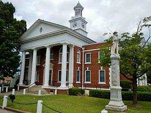 Taylor County Courthouse in Butler | |
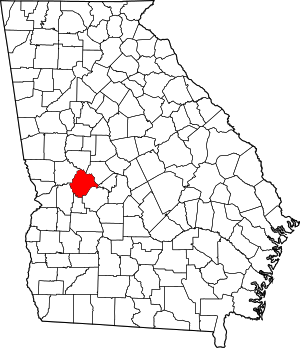 Location within the U.S. state of Georgia | |
 Georgia's location within the U.S. | |
| Coordinates: 32°33′N 84°15′W | |
| Country | |
| State | |
| Founded | January 15, 1852 |
| Named for | Zachary Taylor |
| Seat | Butler |
| Largest city | Butler |
| Area | |
| • Total | 380 sq mi (1,000 km2) |
| • Land | 377 sq mi (980 km2) |
| • Water | 3.0 sq mi (8 km2) 0.8%% |
| Population | |
| • Estimate (2018) | 8,039 |
| • Density | 24/sq mi (9/km2) |
| Time zone | UTC−5 (Eastern) |
| • Summer (DST) | UTC−4 (EDT) |
| Congressional district | 2nd |
History
Taylor County was created on January 15, 1852, by an act of the Georgia General Assembly from portions of Macon, Marion and Talbot counties. The County is named for Zachary Taylor, twelfth President of the United States.[3]
Geography
According to the U.S. Census Bureau, the county has a total area of 380 square miles (980 km2), of which 377 square miles (980 km2) is land and 3.0 square miles (7.8 km2) (0.8%) is water.[4]
Taylor County is dissected by the Fall Line geological formation. The upper half of the county is located in the Piedmont region and consists of gently rolling hills and clay-based soils. The lower half of the county is located in the Upper Atlantic Coastal Plain and is markedly flatter and the soil more sandy. The Flint River marks the entirety of the county's northeastern border.
The county is driven by a largely agricultural economy. Peaches, strawberries, pecans, peanuts, watermelons, and cotton are the most commonly raised crops. Lumbering is also important to the local economy. The county is heavily forested in most areas due in part to the many large plantation pine farms. There are also many desirable hardwood forests, especially along the Flint River basin and tributary streams. The southwestern portion of the county is covered with large sandhills that have given rise to several stable sand mining operations.
The county supports a very healthy population of animals, including white-tailed deer, wild turkey, eastern cottontail, raccoon, coyote, bobcat, nine-banded armadillo, Virginia opossum, red-tailed hawk, and the federally endangered Florida gopher tortoise. Taylor County is home to five of North America's venomous snakes (eastern diamondback rattlesnake, timber rattlesnake, Carolina pigmy rattlesnake, eastern coral snake, water moccasin, and copperhead), representing every North American family of venomous snake.
The dominant tree species are southern red oak, post oak, longleaf pine, loblolly pine, sweetgum, and red maple. Taylor County contains the largest stands of Atlantic white cedar in the state of Georgia. These stands can be found along much of Whitewater and Little Whitewater creeks and are at the heart of a growing movement to conserve these unique plant communities for posterity.
The vast majority of Taylor County is located in the Upper Flint River sub-basin of the ACF River Basin (Apalachicola-Chattahoochee-Flint River Basin), with the exception of a tiny corner of the county just north of Georgia, which is located in the Middle Chattahoochee River-Walter F. George Lake sub-basin of the same ACF River Basin.[5]
Major highways
Adjacent counties
- Upson County (north)
- Crawford County (northeast)
- Peach County (east)
- Macon County (southeast)
- Schley County (south)
- Marion County (southwest)
- Talbot County (northwest)
Demographics
| Historical population | |||
|---|---|---|---|
| Census | Pop. | %± | |
| 1860 | 5,998 | — | |
| 1870 | 7,143 | 19.1% | |
| 1880 | 8,597 | 20.4% | |
| 1890 | 8,666 | 0.8% | |
| 1900 | 9,846 | 13.6% | |
| 1910 | 10,839 | 10.1% | |
| 1920 | 11,473 | 5.8% | |
| 1930 | 10,617 | −7.5% | |
| 1940 | 10,768 | 1.4% | |
| 1950 | 9,113 | −15.4% | |
| 1960 | 8,311 | −8.8% | |
| 1970 | 7,865 | −5.4% | |
| 1980 | 7,902 | 0.5% | |
| 1990 | 7,642 | −3.3% | |
| 2000 | 8,815 | 15.3% | |
| 2010 | 8,906 | 1.0% | |
| Est. 2018 | 8,039 | [6] | −9.7% |
| U.S. Decennial Census[7] 1790-1960[8] 1900-1990[9] 1990-2000[10] 2010-2013[1] | |||
2000 census
As of the census[11] of 2000, there were 8,815 people, 3,281 households, and 2,283 families living in the county. The population density was 23 people per square mile (9/km2). There were 3,978 housing units at an average density of 10 per square mile (4/km2). The racial makeup of the county was 55.39% White, 42.56% Black or African American, 0.11% Native American, 0.18% Asian, 0.93% from other races, and 0.82% from two or more races. 1.85% of the population were Hispanic or Latino of any race.
There were 3,281 households out of which 30.80% had children under the age of 18 living with them, 45.50% were married couples living together, 20.10% had a female householder with no husband present, and 30.40% were non-families. 27.60% of all households were made up of individuals and 11.10% had someone living alone who was 65 years of age or older. The average household size was 2.56 and the average family size was 3.12.
In the county, the population was spread out with 26.90% under the age of 18, 9.00% from 18 to 24, 28.10% from 25 to 44, 22.80% from 45 to 64, and 13.30% who were 65 years of age or older. The median age was 36 years. For every 100 females there were 95.40 males. For every 100 females age 18 and over, there were 92.60 males.
The median income for a household in the county was $25,148, and the median income for a family was $30,000. Males had a median income of $30,278 versus $20,241 for females. The per capita income for the county was $13,432. About 20.20% of families and 26.00% of the population were below the poverty line, including 33.90% of those under age 18 and 24.70% of those age 65 or over.
In the mid-2000s, Taylor County was noted in national news media as being one of the last areas in the South to hold racially segregated proms. Taylor County High School's first integrated prom was held 2002, but was not repeated the following year.[12][13] The event was the basis for the 2006 movie For One Night.
2010 census
As of the 2010 United States Census, there were 8,906 people, 3,522 households, and 2,342 families living in the county.[14] The population density was 23.6 inhabitants per square mile (9.1/km2). There were 4,563 housing units at an average density of 12.1 per square mile (4.7/km2).[15] The racial makeup of the county was 58.5% white, 39.3% black or African American, 0.6% Asian, 0.1% American Indian, 0.7% from other races, and 0.8% from two or more races. Those of Hispanic or Latino origin made up 1.8% of the population.[14] In terms of ancestry, 17.3% were American, 10.9% were English, and 8.4% were Irish.[16]
Of the 3,522 households, 32.6% had children under the age of 18 living with them, 42.8% were married couples living together, 19.6% had a female householder with no husband present, 33.5% were non-families, and 30.1% of all households were made up of individuals. The average household size was 2.44 and the average family size was 3.04. The median age was 39.7 years.[14]
The median income for a household in the county was $25,237 and the median income for a family was $35,819. Males had a median income of $40,995 versus $25,919 for females. The per capita income for the county was $14,693. About 25.9% of families and 33.1% of the population were below the poverty line, including 39.9% of those under age 18 and 30.7% of those age 65 or over.[17]
Communities
City
Town
Census-designated place
Politics
| Year | Republican | Democratic | Third parties |
|---|---|---|---|
| 2016 | 60.6% 2,064 | 38.0% 1,296 | 1.4% 48 |
| 2012 | 55.0% 1,948 | 44.4% 1,572 | 0.6% 20 |
| 2008 | 56.3% 2,021 | 42.8% 1,536 | 0.8% 30 |
| 2004 | 56.5% 1,912 | 43.1% 1,458 | 0.4% 13 |
| 2000 | 50.8% 1,412 | 48.2% 1,340 | 1.0% 28 |
| 1996 | 37.8% 1,002 | 54.7% 1,450 | 7.6% 201 |
| 1992 | 37.5% 1,078 | 52.5% 1,508 | 10.0% 286 |
| 1988 | 50.1% 1,145 | 49.7% 1,134 | 0.2% 5 |
| 1984 | 49.1% 1,292 | 50.9% 1,340 | |
| 1980 | 30.2% 815 | 68.4% 1,845 | 1.4% 38 |
| 1976 | 20.4% 504 | 79.6% 1,962 | |
| 1972 | 75.5% 1,580 | 24.6% 514 | |
| 1968 | 14.5% 393 | 25.5% 691 | 60.0% 1,626 |
| 1964 | 55.6% 1,372 | 44.4% 1,097 | 0.0% 1 |
| 1960 | 23.3% 365 | 76.7% 1,201 | |
| 1956 | 16.9% 276 | 83.1% 1,359 | |
| 1952 | 14.2% 277 | 85.8% 1,679 | |
| 1948 | 32.7% 360 | 58.0% 638 | 9.4% 103 |
| 1944 | 25.8% 269 | 74.2% 773 | |
| 1940 | 21.1% 213 | 78.7% 796 | 0.2% 2 |
| 1936 | 16.0% 147 | 83.7% 771 | 0.3% 3 |
| 1932 | 6.0% 44 | 93.6% 685 | 0.4% 3 |
| 1928 | 37.4% 353 | 62.6% 590 | |
| 1924 | 19.8% 96 | 76.1% 370 | 4.1% 20 |
| 1920 | 30.1% 211 | 69.9% 491 | |
| 1916 | 19.7% 113 | 70.4% 405 | 9.9% 57 |
| 1912 | 21.4% 98 | 74.8% 342 | 3.7% 17 |
External links
- For One Night (2006) on IMDb
- Official Site: http://taylorcountyga.com
References
- "State & County QuickFacts". United States Census Bureau. Retrieved June 26, 2014.
- "Find a County". National Association of Counties. Retrieved June 7, 2011.
- Krakow, Kenneth K. (1975). Georgia Place-Names: Their History and Origins (PDF). Macon, GA: Winship Press. p. 222. ISBN 0-915430-00-2.
- "US Gazetteer files: 2010, 2000, and 1990". United States Census Bureau. February 12, 2011. Retrieved April 23, 2011.
- "Georgia Soil and Water Conservation Commission Interactive Mapping Experience". Georgia Soil and Water Conservation Commission. Retrieved November 22, 2015.
- "Population and Housing Unit Estimates". Retrieved July 31, 2019.
- "U.S. Decennial Census". United States Census Bureau. Retrieved June 26, 2014.
- "Historical Census Browser". University of Virginia Library. Retrieved June 26, 2014.
- "Population of Counties by Decennial Census: 1900 to 1990". United States Census Bureau. Retrieved June 26, 2014.
- "Census 2000 PHC-T-4. Ranking Tables for Counties: 1990 and 2000" (PDF). United States Census Bureau. Retrieved June 26, 2014.
- "U.S. Census website". United States Census Bureau. Retrieved January 31, 2008.
- "CNN".
- "Prom Night in Taylor County, Georgia: Separate and Equal?". Films Media Group.
- "DP-1 Profile of General Population and Housing Characteristics: 2010 Demographic Profile Data". United States Census Bureau. Archived from the original on February 13, 2020. Retrieved December 30, 2015.
- "Population, Housing Units, Area, and Density: 2010 - County". United States Census Bureau. Archived from the original on February 13, 2020. Retrieved December 30, 2015.
- "DP02 SELECTED SOCIAL CHARACTERISTICS IN THE UNITED STATES – 2006-2010 American Community Survey 5-Year Estimates". United States Census Bureau. Archived from the original on February 13, 2020. Retrieved December 30, 2015.
- "DP03 SELECTED ECONOMIC CHARACTERISTICS – 2006-2010 American Community Survey 5-Year Estimates". United States Census Bureau. Archived from the original on February 13, 2020. Retrieved December 30, 2015.
- Leip, David. "Dave Leip's Atlas of U.S. Presidential Elections". uselectionatlas.org.
Places adjacent to Taylor County, Georgia | ||||||||||
|---|---|---|---|---|---|---|---|---|---|---|
| ||||||||||
Municipalities and communities of Taylor County, Georgia, United States | ||
|---|---|---|
| City | Map of Georgia highlighting Taylor County | |
| Town | ||
| CDP | ||
| Unincorporated communities | ||

| Authority control |
|
|---|