Bacon County, Georgia
Bacon County is a county located in the southeastern part of the U.S. state of Georgia. As of the 2010 census, the population was 11,096.[1] The county seat is Alma.[2]
Bacon County | |
|---|---|
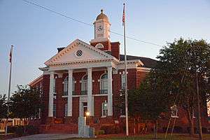 Bacon County Courthouse in Alma | |
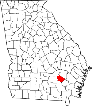 Location within the U.S. state of Georgia | |
 Georgia's location within the U.S. | |
| Coordinates: 31°34′N 82°27′W | |
| Country | |
| State | |
| Founded | July 27, 1914 |
| Named for | Augustus Octavius Bacon |
| Seat | Alma |
| Largest city | Alma |
| Area | |
| • Total | 286 sq mi (740 km2) |
| • Land | 259 sq mi (670 km2) |
| • Water | 27 sq mi (70 km2) 9.5%% |
| Population | |
| • Estimate (2019) | 11,164 |
| • Density | 43/sq mi (17/km2) |
| Time zone | UTC−5 (Eastern) |
| • Summer (DST) | UTC−4 (EDT) |
| Congressional district | 1st |
History
The constitutional amendment to create the county was proposed July 7, 1914, and ratified November 3, 1914. It is named after Augustus Bacon, a former United States Senator from Georgia.[3]
Geography
According to the U.S. Census Bureau, the county has a total area of 286 square miles (740 km2), of which 259 square miles (670 km2) is land and 27 square miles (70 km2) (9.5%) is water.[4]
The majority and western portion of Bacon County is located in the Satilla River sub-basin of the St. Marys River-Satilla River basin. The entire eastern and half of the southeastern edge of the county is located in the Little Satilla River sub-basin of the same St. Marys-Satilla River basin.[5]
Major highways


Adjacent counties
- Appling County (northeast)
- Pierce County (east)
- Ware County (south)
- Coffee County (west)
- Jeff Davis County (northwest)
Demographics
| Historical population | |||
|---|---|---|---|
| Census | Pop. | %± | |
| 1920 | 6,460 | — | |
| 1930 | 7,055 | 9.2% | |
| 1940 | 8,096 | 14.8% | |
| 1950 | 8,940 | 10.4% | |
| 1960 | 8,359 | −6.5% | |
| 1970 | 8,233 | −1.5% | |
| 1980 | 9,379 | 13.9% | |
| 1990 | 9,566 | 2.0% | |
| 2000 | 10,103 | 5.6% | |
| 2010 | 11,096 | 9.8% | |
| Est. 2019 | 11,164 | [6] | 0.6% |
| U.S. Decennial Census[7] 1790-1960[8] 1900-1990[9] 1990-2000[10] 2010-2019[1] | |||
2000 census
As of the census[11] of 2000, there were 10,103 people, 3,833 households, and 2,813 families living in the county. The population density was 36 people per square mile (14/km²). There were 4,464 housing units at an average density of 16 per square mile (6/km²). The racial makeup of the county was 81.48% White, 15.70% Black or African American, 0.15% Native American, 0.30% Asian, 1.46% from other races, and 0.91% from two or more races. 3.39% of the population were Hispanic or Latino of any race.
There were 3,833 households out of which 33.00% had children under the age of 18 living with them, 55.20% were married couples living together, 14.10% had a female householder with no husband present, and 26.60% were non-families. 23.60% of all households were made up of individuals and 9.50% had someone living alone who was 65 years of age or older. The average household size was 2.60 and the average family size was 3.03.
In the county, the population was spread out with 26.20% under the age of 18, 9.90% from 18 to 24, 28.00% from 25 to 44, 23.00% from 45 to 64, and 12.80% who were 65 years of age or older. The median age was 35 years. For every 100 females, there were 96.10 males. For every 100 females age 18 and over, there were 91.40 males.
The median income for a household in the county was $26,910, and the median income for a family was $32,579. Males had a median income of $27,780 versus $19,049 for females. The per capita income for the county was $14,289. About 20.20% of families and 23.70% of the population were below the poverty line, including 31.40% of those under age 18 and 25.70% of those age 65 or over.
2010 census
As of the 2010 United States Census, there were 11,096 people, 4,214 households, and 2,960 families living in the county.[12] The population density was 42.9 inhabitants per square mile (16.6/km2). There were 4,801 housing units at an average density of 18.6 per square mile (7.2/km2).[13] The racial makeup of the county was 78.6% white, 15.4% black or African American, 0.3% Asian, 0.2% American Indian, 0.1% Pacific islander, 4.1% from other races, and 1.3% from two or more races. Those of Hispanic or Latino origin made up 7.1% of the population.[12] In terms of ancestry, 15.3% were American, 10.9% were English, and 6.2% were Irish.[14]
Of the 4,214 households, 35.9% had children under the age of 18 living with them, 50.4% were married couples living together, 14.8% had a female householder with no husband present, 29.8% were non-families, and 25.7% of all households were made up of individuals. The average household size was 2.56 and the average family size was 3.05. The median age was 36.9 years.[12]
The median income for a household in the county was $31,429 and the median income for a family was $45,442. Males had a median income of $35,102 versus $25,384 for females. The per capita income for the county was $17,110. About 11.6% of families and 16.5% of the population were below the poverty line, including 18.8% of those under age 18 and 16.8% of those age 65 or over.[15]
Education
Politics
| Year | Republican | Democratic | Third parties |
|---|---|---|---|
| 2016 | 83.7% 3,364 | 15.1% 608 | 1.2% 48 |
| 2012 | 78.6% 3,093 | 20.1% 791 | 1.3% 52 |
| 2008 | 78.4% 3,089 | 20.7% 817 | 0.9% 36 |
| 2004 | 75.2% 2,853 | 24.5% 930 | 0.2% 9 |
| 2000 | 67.1% 2,010 | 31.9% 956 | 1.0% 29 |
| 1996 | 47.1% 1,580 | 40.5% 1,360 | 12.4% 417 |
| 1992 | 39.0% 1,301 | 42.7% 1,423 | 18.3% 611 |
| 1988 | 64.1% 1,407 | 35.6% 780 | 0.3% 7 |
| 1984 | 63.8% 1,778 | 36.2% 1,010 | |
| 1980 | 45.9% 1,427 | 52.2% 1,622 | 1.8% 57 |
| 1976 | 19.9% 594 | 80.1% 2,395 | |
| 1972 | 90.2% 1,771 | 9.8% 192 | |
| 1968 | 20.9% 586 | 10.0% 279 | 69.1% 1,935 |
| 1964 | 64.4% 2,136 | 35.6% 1,179 | |
| 1960 | 33.1% 579 | 66.9% 1,168 | |
| 1956 | 13.9% 394 | 86.1% 2,445 | |
| 1952 | 26.4% 543 | 73.6% 1,512 | |
| 1948 | 27.8% 343 | 63.6% 785 | 8.7% 107 |
| 1944 | 22.4% 220 | 77.6% 763 | |
| 1940 | 10.5% 97 | 89.0% 821 | 0.5% 5 |
| 1936 | 6.3% 62 | 93.7% 929 | |
| 1932 | 2.1% 11 | 97.5% 515 | 0.4% 2 |
| 1928 | 40.0% 203 | 60.0% 305 | |
| 1924 | 7.5% 79 | 91.1% 961 | 1.4% 15 |
| 1920 | 41.6% 219 | 58.4% 307 | |
| 1916 | 0.0% 0 | 86.2% 287 | 13.8% 46 |
See also
References
- "State & County QuickFacts". United States Census Bureau. Archived from the original on July 6, 2011. Retrieved June 17, 2014.
- "Find a County". National Association of Counties. Archived from the original on 2011-05-31. Retrieved 2011-06-07.
- "Bacon County". New Georgia Encyclopedia. Retrieved 2018-03-18.
- "US Gazetteer files: 2010, 2000, and 1990". United States Census Bureau. 2011-02-12. Retrieved 2011-04-23.
- "Georgia Soil and Water Conservation Commission Interactive Mapping Experience". Georgia Soil and Water Conservation Commission. Retrieved 2015-11-27.
- "Population and Housing Unit Estimates". Retrieved May 21, 2020.
- "U.S. Decennial Census". United States Census Bureau. Retrieved June 17, 2014.
- "Historical Census Browser". University of Virginia Library. Retrieved June 17, 2014.
- "Population of Counties by Decennial Census: 1900 to 1990". United States Census Bureau. Retrieved June 17, 2014.
- "Census 2000 PHC-T-4. Ranking Tables for Counties: 1990 and 2000" (PDF). United States Census Bureau. Retrieved June 17, 2014.
- "U.S. Census website". United States Census Bureau. Retrieved 2011-05-14.
- "DP-1 Profile of General Population and Housing Characteristics: 2010 Demographic Profile Data". United States Census Bureau. Archived from the original on 2020-02-13. Retrieved 2015-12-27.
- "Population, Housing Units, Area, and Density: 2010 - County". United States Census Bureau. Archived from the original on 2020-02-13. Retrieved 2015-12-27.
- "DP02 SELECTED SOCIAL CHARACTERISTICS IN THE UNITED STATES – 2006-2010 American Community Survey 5-Year Estimates". United States Census Bureau. Archived from the original on 2020-02-13. Retrieved 2015-12-27.
- "DP03 SELECTED ECONOMIC CHARACTERISTICS – 2006-2010 American Community Survey 5-Year Estimates". United States Census Bureau. Archived from the original on 2020-02-13. Retrieved 2015-12-27.
- Leip, David. "Dave Leip's Atlas of U.S. Presidential Elections". uselectionatlas.org. Retrieved 2018-03-18.
External links
- Description at georgia.gov
- Bacon County historical marker
Places adjacent to Bacon County, Georgia | ||||||||||
|---|---|---|---|---|---|---|---|---|---|---|
| ||||||||||
Municipalities and communities of Bacon County, Georgia, United States | ||
|---|---|---|
| City | Map of Georgia highlighting Bacon County | |
| CDP | ||
| Unincorporated community | ||

| Authority control |
|
|---|