Sharon, Georgia
Sharon is a city in Taliaferro County, Georgia, United States. The population was 105 at the 2000 census.
Sharon, Georgia | |
|---|---|
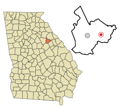 Location in Taliaferro County and the state of Georgia | |
| Coordinates: 33°33′31″N 82°47′38″W | |
| Country | United States |
| State | Georgia |
| County | Taliaferro |
| Incorporated (city) | 1884 |
| Area | |
| • Total | 0.78 sq mi (2.03 km2) |
| • Land | 0.78 sq mi (2.02 km2) |
| • Water | 0.00 sq mi (0.01 km2) |
| Elevation | 600 ft (183 m) |
| Population (2010) | |
| • Total | 140 |
| • Estimate (2018)[2] | 129 |
| • Density | 165.38/sq mi (63.83/km2) |
| Time zone | UTC-5 (Eastern (EST)) |
| • Summer (DST) | UTC-4 (EDT) |
| ZIP code | 30664 |
| Area code(s) | 706 |
| FIPS code | 13-69896[3] |
| GNIS feature ID | 0322779[4] |
History
The community of Sharon is visible on maps as early as 1865.[5] The Georgia General Assembly incorporated Sharon as a town in 1884.[6] The community is named after the Plain of Sharon, a place mentioned in the Hebrew Bible.[7]
Into the 1890s, Sharon was bustling with thousands of travelers who came there for the reputed healing powers of the nearby Electric Health Resort, where it was said that exposure to bedrock in a subterranean chamber provided electrical healing powers. The resort, which included a hotel, lake, and post office, eventually burned down.[8]
Geography
Sharon is located at 33°33′31″N 82°47′38″W (33.558724, -82.793784).[9]
According to the United States Census Bureau, the city has a total area of 0.8 square miles (2.1 km2), all land.
Demographics
| Historical population | |||
|---|---|---|---|
| Census | Pop. | %± | |
| 1890 | 172 | — | |
| 1900 | 319 | 85.5% | |
| 1910 | 293 | −8.2% | |
| 1920 | 282 | −3.8% | |
| 1930 | 253 | −10.3% | |
| 1940 | 282 | 11.5% | |
| 1950 | 224 | −20.6% | |
| 1960 | 264 | 17.9% | |
| 1970 | 160 | −39.4% | |
| 1980 | 140 | −12.5% | |
| 1990 | 94 | −32.9% | |
| 2000 | 105 | 11.7% | |
| 2010 | 140 | 33.3% | |
| Est. 2018 | 129 | [2] | −7.9% |
| U.S. Decennial Census[10] | |||
At the 2000 census there were 105 people in 46 households, including 28 families, in the city. The population density was 134.2 people per square mile (52.0/km²). There were 53 housing units at an average density of 67.7 per square mile (26.2/km²). The racial makeup of the city was 27.62% White, 71.43% African American and 0.95% Asian.[3] Of the 46 households 17.4% had children under the age of 18 living with them, 43.5% were married couples living together, 15.2% had a female householder with no husband present, and 37.0% were non-families. 32.6% of households were one person and 13.0% were one person aged 65 or older. The average household size was 2.28 and the average family size was 2.86.
The age distribution was 15.2% under the age of 18, 9.5% from 18 to 24, 22.9% from 25 to 44, 37.1% from 45 to 64, and 15.2% 65 or older. The median age was 46 years. For every 100 females, there were 133.3 males. For every 100 females age 18 and over, there were 128.2 males.
The median household income was $19,167 and the median family income was $17,500. Males had a median income of $24,375 versus $12,083 for females. The per capita income for the city was $10,519. There were 23.5% of families and 31.8% of the population living below the poverty line, including 65.0% of under eighteens and 41.2% of those over 64.
Notable person
Lloyd D. Brown, United States Army Major General who commanded 28th Infantry Division in World War II[11]
See also
References
- "2018 U.S. Gazetteer Files". United States Census Bureau. Retrieved Feb 12, 2020.
- "Population and Housing Unit Estimates". Retrieved June 4, 2019.
- "U.S. Census website". United States Census Bureau. Retrieved 2008-01-31.
- "US Board on Geographic Names". United States Geological Survey. 2007-10-25. Retrieved 2008-01-31.
- http://georgiainfo.galileo.usg.edu/histcountymaps/taliaferro1865map.htm
- Acts and Resolutions of the General Assembly of the State of Georgia. Clark & Hines, State Printers. 1885. p. 329.
- Krakow, Kenneth K. (1975). Georgia Place-Names: Their History and Origins (PDF). Macon, GA: Winship Press. p. 204. ISBN 0-915430-00-2.
- http://www.georgiaencyclopedia.org/nge/Article.jsp?id=h-2394
- "US Gazetteer files: 2010, 2000, and 1990". United States Census Bureau. 2011-02-12. Retrieved 2011-04-23.
- "Census of Population and Housing". Census.gov. Retrieved June 4, 2015.
- Sarah Cantey Whitaker Allen, Our Children's Ancestry, 1935, page 437
External links
Municipalities and communities of Taliaferro County, Georgia, United States | ||
|---|---|---|
| Cities | 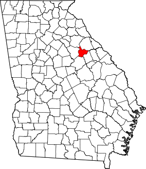 Map of Georgia highlighting Taliaferro County | |
| Unincorporated communities | ||