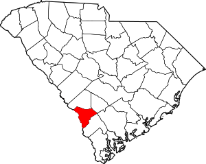
Allendale, South Carolina
Allendale is a town in Allendale County, South Carolina, United States. The population was 3,482 at the 2010 census,[4] a decline from 4,052 in 2000. It is the county seat of Allendale County.[5]
Allendale | |
|---|---|
Location of Allendale, South Carolina | |
 Allendale Location of Allendale, South Carolina  Allendale Allendale (the United States)  Allendale Allendale (North America) | |
| Coordinates: 33°0′32″N 81°18′31″W[1] | |
| Country | United States |
| State | South Carolina |
| County | Allendale |
| Government | |
| • Mayor | Ronnie Jackson (D) |
| • Police Chief | John Sullivan |
| Area | |
| • Total | 3.3 sq mi (8.6 km2) |
| • Land | 3.3 sq mi (8.6 km2) |
| • Water | 0.0 sq mi (0.0 km2) |
| Elevation | 187 ft (57 m) |
| Population (2010) | |
| • Total | 3,482 |
| • Density | 1,052/sq mi (406.1/km2) |
| Time zone | UTC-5 (Eastern (EST)) |
| • Summer (DST) | UTC-4 (EDT) |
| ZIP code | 29810 |
| Area code(s) | 803, 839 |
| FIPS code | 45-00955[2] |
| GNIS feature ID | 1220167[3] |
| Website | www |
History
The Allendale County Courthouse, Antioch Christian Church, Erwin House, Gravel Hill Plantation, Red Bluff Flint Quarries, Roselawn, and Smyrna Baptist Church are listed on the National Register of Historic Places.[6]
The artist Jasper Johns lived in Allendale during his childhood in the 1930s and 1940s. He was raised there by his grandfather, a farmer, and then with his aunt, the only teacher in a two-room school.
In his 2015 book entitled Deep South: Four Seasons on Back Roads, author Paul Theroux describes Allendale as a "ghost town", "poor, neglected, hopeless-looking, a vivid failure."[7]
Geography
According to the United States Census Bureau, the town has a total area of 3.3 square miles (8.5 km2), all land.
Demographics
| Historical population | |||
|---|---|---|---|
| Census | Pop. | %± | |
| 1900 | 1,030 | — | |
| 1910 | 1,453 | 41.1% | |
| 1920 | 1,893 | 30.3% | |
| 1930 | 2,068 | 9.2% | |
| 1940 | 2,217 | 7.2% | |
| 1950 | 2,474 | 11.6% | |
| 1960 | 3,114 | 25.9% | |
| 1970 | 3,620 | 16.2% | |
| 1980 | 4,400 | 21.5% | |
| 1990 | 4,410 | 0.2% | |
| 2000 | 4,052 | −8.1% | |
| 2010 | 3,482 | −14.1% | |
| Est. 2018 | 2,979 | [8] | −14.4% |
| U.S. Decennial Census | |||
At the 2000 census there were 4,052 people, 1,542 households, and 997 families in the town. The population density was 1,225.2 people per square mile (472.7/km²). There were 1,763 housing units at an average density of 533.1 per square mile (205.6/km²). The racial makeup of the town was 18.19% White, 80.03% African American, 0.17% Asian, 0.17% Pacific Islander, 0.96% from other races, and 0.47% from two or more races. Hispanic or Latino of any race were 2.25%.[2]
Of the 1,542 households 32.2% had children under the age of 18 living with them, 29.2% were married couples living together, 31.4% had a female householder with no husband present, and 35.3% were non-families. 31.4% of households were one person and 11.9% were one person aged 65 or older. The average household size was 2.61 and the average family size was 3.34.
The age distribution was 32.6% under the age of 18, 9.7% from 18 to 24, 24.0% from 25 to 44, 21.8% from 45 to 64, and 11.9% 65 or older. The median age was 32 years. For every 100 females, there were 84.9 males. For every 100 females age 18 and over, there were 73.7 males.
The median household income was $16,632 and the median family income was $21,167. Males had a median income of $22,800 versus $20,873 for females. The per capita income for the town was $10,433. About 36.7% of families and 41.2% of the population were below the poverty line, including 59.5% of those under age 18 and 21.1% of those age 65 or over.
Education
Allendale County Schools provides education for elementary, middle and high school students while the University of South Carolina Salkehatchie established in 1965 is the only college in the small town.
Allendale has a public library, a branch of the Allendale Hampton Jasper Regional Library.[9]
Media
WEBA-TV/DT, a PBS station serving the South Carolina side of the Central Savannah River Area, is located here.
References
- "US Gazetteer files: 2010, 2000, and 1990". United States Census Bureau. 2011-02-12. Retrieved 2011-04-23.
- "U.S. Census website". United States Census Bureau. Retrieved 2008-01-31.
- "US Board on Geographic Names". United States Geological Survey. 2007-10-25. Retrieved 2008-01-31.
- "Geographic Identifiers: 2010 Demographic Profile Data (G001): Allendale town, South Carolina". U.S. Census Bureau, American Factfinder. Archived from the original on February 12, 2020. Retrieved August 7, 2013.
- "Find a County". National Association of Counties. Archived from the original on 2011-05-31. Retrieved 2011-06-07.
- "National Register Information System". National Register of Historic Places. National Park Service. July 9, 2010.
- Theroux, Paul (2015). Deep South: Four Seasons on Back Roads. London, UK: Hamish Hamilton. p. 45. ISBN 9780241146729.
- "Population and Housing Unit Estimates". Retrieved November 13, 2019.
- "South Carolina libraries and archives". SCIWAY. Retrieved 7 June 2019.
External links
- History of Allendale, from Allendale County website
- Official website
