Stapleton, Georgia
Stapleton is a city in Jefferson County, Georgia, United States. The population was 438 at the 2010 census,[5] up from 318 at the 2000 census.
Stapleton, Georgia | |
|---|---|
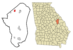 Location in Jefferson County and the state of Georgia | |
| Coordinates: 33°12′57″N 82°28′5″W | |
| Country | United States |
| State | Georgia |
| County | Jefferson |
| Area | |
| • Total | 1.74 sq mi (4.52 km2) |
| • Land | 1.74 sq mi (4.52 km2) |
| • Water | 0.00 sq mi (0.00 km2) |
| Elevation | 440 ft (134 m) |
| Population (2010) | |
| • Total | 438 |
| • Estimate (2018)[2] | 394 |
| • Density | 225.92/sq mi (87.23/km2) |
| Time zone | UTC-5 (Eastern (EST)) |
| • Summer (DST) | UTC-4 (EDT) |
| ZIP code | 30823 |
| Area code(s) | 706 |
| FIPS code | 13-73004[3] |
| GNIS feature ID | 0356555[4] |
History
An early variant name was "Spread".[6] The Georgia General Assembly incorporated the place as the "Town of Spread" in 1903.[7] Stapleton derives its current name from Colonel James Stapleton.[6]
Geography
Stapleton is located in northwestern Jefferson County at 33°12′57″N 82°28′5″W (33.215877, -82.468007).[8] Georgia State Route 102 passes through the center of town as Main Street, leading east 4.5 miles (7.2 km) to Wrens and west 4 miles (6 km) to Avera. State Route 296 (Harvey Street and George Street) crosses SR-102 in the center of Stapleton, leading northeast 5 miles (8 km) to SR-17 in Warren County and south 16 miles (26 km) to Louisville, the Jefferson county seat.
According to the United States Census Bureau, Stapleton has a total area of 1.7 square miles (4.5 km2), all land.[5]
Demographics
| Historical population | |||
|---|---|---|---|
| Census | Pop. | %± | |
| 1910 | 370 | — | |
| 1920 | 410 | 10.8% | |
| 1930 | 432 | 5.4% | |
| 1940 | 342 | −20.8% | |
| 1950 | 355 | 3.8% | |
| 1960 | 356 | 0.3% | |
| 1970 | 390 | 9.6% | |
| 1980 | 388 | −0.5% | |
| 1990 | 330 | −14.9% | |
| 2000 | 318 | −3.6% | |
| 2010 | 438 | 37.7% | |
| Est. 2018 | 394 | [2] | −10.0% |
| U.S. Decennial Census[9] | |||
At the 2000 census there were 318 people in 110 households, including 80 families, in the city. The population density was 182.1 people per square mile (70.2/km²). There were 117 housing units at an average density of 67.0 per square mile (25.8/km²). The racial makeup of the city was 70.13% White, 28.62% African American, and 1.26% from two or more races.[3] Of the 110 households 44.5% had children under the age of 18 living with them, 50.9% were married couples living together, 18.2% had a female householder with no husband present, and 26.4% were non-families. 23.6% of households were one person and 6.4% were one person aged 65 or older. The average household size was 2.78 and the average family size was 3.28.
The age distribution was 30.8% under the age of 18, 5.7% from 18 to 24, 27.4% from 25 to 44, 25.2% from 45 to 64, and 11.0% 65 or older. The median age was 34 years. For every 100 females, there were 102.5 males. For every 100 females age 18 and over, there were 84.9 males.
The median household income was $35,288 and the median family income was $37,083. Males had a median income of $35,208 versus $17,500 for females. The per capita income for the city was $15,829. About 17.1% of families and 20.4% of the population were below the poverty line, including 26.2% of those under age 18 and 33.3% of those age 65 or over.
See also
References
- "2018 U.S. Gazetteer Files". United States Census Bureau. Retrieved Feb 12, 2020.
- "Population and Housing Unit Estimates". Retrieved June 4, 2019.
- "U.S. Census website". United States Census Bureau. Retrieved 2008-01-31.
- "US Board on Geographic Names". United States Geological Survey. 2007-10-25. Retrieved 2008-01-31.
- "Geographic Identifiers: 2010 Census Summary File 1 (G001): Stapleton city, Georgia". American Factfinder. U.S. Census Bureau. Archived from the original on February 13, 2020. Retrieved May 4, 2018.
- Krakow, Kenneth K. (1975). Georgia Place-Names: Their History and Origins (PDF). Macon, GA: Winship Press. p. 211. ISBN 0-915430-00-2.
- Acts and Resolutions of the General Assembly of the State of Georgia. Clark & Hines, State Printers. 1903. p. 668.
- "US Gazetteer files: 2010, 2000, and 1990". United States Census Bureau. 2011-02-12. Retrieved 2011-04-23.
- "Census of Population and Housing". Census.gov. Retrieved June 4, 2015.
External links
- The News and Farmer and Wadley Herald/ Jefferson Reporter, the county's weekly newspaper and the oldest weekly newspaper in Georgia.
Municipalities and communities of Jefferson County, Georgia, United States | ||
|---|---|---|
| Cities | 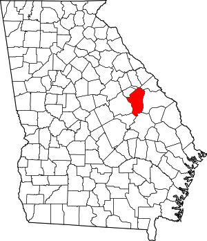 Map of Georgia highlighting Jefferson County | |
| Town | ||
| CDP | ||
| Unincorporated communities | ||
| Footnotes | ‡This populated place also has portions in an adjacent county or counties | |