Davisboro, Georgia
Davisboro is a city in Washington County, Georgia, United States. The population was 2,010 at the 2010 census.
Davisboro, Georgia | |
|---|---|
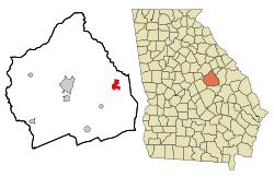 Location in Washington County and the state of Georgia | |
| Coordinates: 32°58′48″N 82°36′32″W | |
| Country | United States |
| State | Georgia |
| County | Washington |
| Area | |
| • Total | 3.06 sq mi (7.91 km2) |
| • Land | 3.05 sq mi (7.90 km2) |
| • Water | 0.00 sq mi (0.01 km2) |
| Elevation | 302 ft (92 m) |
| Population (2010) | |
| • Total | 2,010 |
| • Estimate (2018)[2] | 1,944 |
| • Density | 637.17/sq mi (245.97/km2) |
| Time zone | UTC-5 (Eastern (EST)) |
| • Summer (DST) | UTC-4 (EDT) |
| ZIP code | 31018 |
| Area code(s) | 478 |
| FIPS code | 13-21800[3] |
| GNIS feature ID | 0355454[4] |
History
A post office called Davisboro(ugh) has been in operation since 1821.[5] The community most likely was named after a pioneer settler with the surname Davis.[6] The Georgia General Assembly incorporated the place in 1894 as the "Town of Davisboro".[7]
Geography
Davisboro is located at 32°58′48″N 82°36′32″W (32.980128, -82.608892).[8]
According to the United States Census Bureau, the city has a total area of 3.1 square miles (8.0 km2), all land.
Demographics
| Historical population | |||
|---|---|---|---|
| Census | Pop. | %± | |
| 1880 | 131 | — | |
| 1890 | 224 | 71.0% | |
| 1900 | 387 | 72.8% | |
| 1910 | 589 | 52.2% | |
| 1920 | 653 | 10.9% | |
| 1930 | 654 | 0.2% | |
| 1940 | 533 | −18.5% | |
| 1950 | 469 | −12.0% | |
| 1960 | 417 | −11.1% | |
| 1970 | 476 | 14.1% | |
| 1980 | 433 | −9.0% | |
| 1990 | 407 | −6.0% | |
| 2000 | 1,544 | 279.4% | |
| 2010 | 2,010 | 30.2% | |
| Est. 2018 | 1,944 | [2] | −3.3% |
| U.S. Decennial Census[9] | |||
At the 2000 census there were 1,544 people in 140 households, including 102 families, in the city. The population density was 505.0 people per square mile (194.8 per km2). There were 158 housing units at an average density of 51.7 per square mile (19.9 per km2). The racial makeup of the city was 61.33% African American, 36.79% White, 0.45% Native American, 0.19% Asian, 0.06% from other races, and 1.17% from two or more races. Hispanic or Latino of any race were 1.10%.[3]
Of the 140 households 39.3% had children under the age of 18 living with them, 42.1% were married couples living together, 25.7% had a female householder with no husband present, and 27.1% were non-families. 25.0% of households were one person and 13.6% were one person aged 65 or older. The average household size was 2.99 and the average family size was 3.65.
The age distribution was 9.3% under the age of 18, 15.0% from 18 to 24, 57.8% from 25 to 44, 14.9% from 45 to 64, and 3.0% 65 or older. The median age was 35 years. For every 100 females, there were 26.6 males. For every 100 females age 18 and over, there were 23.5 males.
The median household income was $25,536 and the median family income was $30,625. Males had a median income of $37,750 versus $18,750 for females. The per capita income for the city was $7,090. About 32.4% of families and 47.9% of the population were below the poverty line, including 55.6% of those under age 18 and 22.4% of those age 65 or over.
See also
References
- "2018 U.S. Gazetteer Files". United States Census Bureau. Retrieved Feb 12, 2020.
- "Population and Housing Unit Estimates". Retrieved June 4, 2019.
- "U.S. Census website". United States Census Bureau. Retrieved 2008-01-31.
- "US Board on Geographic Names". United States Geological Survey. 2007-10-25. Retrieved 2008-01-31.
- "Post Offices". Jim Forte Postal History. Retrieved 17 April 2018.
- Krakow, Kenneth K. (1975). Georgia Place-Names: Their History and Origins (PDF). Macon, GA: Winship Press. p. 59. ISBN 0-915430-00-2.
- Acts Passed by the General Assembly of Georgia. J. Johnston. 1895. p. 164.
- "US Gazetteer files: 2010, 2000, and 1990". United States Census Bureau. 2011-02-12. Retrieved 2011-04-23.
- "Census of Population and Housing". Census.gov. Retrieved June 4, 2015.
Municipalities and communities of Washington County, Georgia, United States | ||
|---|---|---|
| Cities | 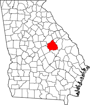 Map of Georgia highlighting Washington County | |
| Towns | ||
| Unincorporated communities | ||
| Authority control |
|
|---|