Dearing, Georgia
Dearing is a town in McDuffie County, Georgia, United States. The population was 549 at the 2010 census. It is part of the Augusta metropolitan area.
Dearing, Georgia | |
|---|---|
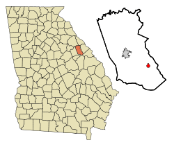 Location in McDuffie County and the state of Georgia | |
| Coordinates: 33°24′48″N 82°23′5″W | |
| Country | United States |
| State | Georgia |
| County | McDuffie |
| Area | |
| • Total | 0.82 sq mi (2.13 km2) |
| • Land | 0.81 sq mi (2.11 km2) |
| • Water | 0.01 sq mi (0.02 km2) |
| Elevation | 469 ft (143 m) |
| Population (2010) | |
| • Total | 549 |
| • Estimate (2018)[2] | 539 |
| • Density | 661.35/sq mi (255.34/km2) |
| Time zone | UTC-5 (Eastern (EST)) |
| • Summer (DST) | UTC-4 (EDT) |
| ZIP code | 30808 |
| Area code(s) | 706 |
| FIPS code | 13-22024[3] |
| GNIS feature ID | 0355471[4] |
History
An early variant name was "Lombardy".[5] A post office called Lombardy was established in 1823, and the name was changed to Dearing in 1893.[6] The Georgia General Assembly incorporated the place in 1910 as the "Town of Dearing".[7] The present name is after William Dearing, a railroad official.[8]
Geography
Dearing is located at 33°24′48″N 82°23′5″W (33.413425, -82.384781).[9]
According to the United States Census Bureau, the town has a total area of 0.8 square miles (2.1 km2), all land.
Demographics
| Historical population | |||
|---|---|---|---|
| Census | Pop. | %± | |
| 1920 | 256 | — | |
| 1930 | 246 | −3.9% | |
| 1940 | 273 | 11.0% | |
| 1950 | 325 | 19.0% | |
| 1960 | 403 | 24.0% | |
| 1970 | 555 | 37.7% | |
| 1980 | 539 | −2.9% | |
| 1990 | 547 | 1.5% | |
| 2000 | 441 | −19.4% | |
| 2010 | 549 | 24.5% | |
| Est. 2018 | 539 | [2] | −1.8% |
| U.S. Decennial Census[10] | |||
At the 2000 census there were 441 people in 178 households, including 126 families, in the town. The population density was 528.9 people per square mile (205.1/km²). There were 206 housing units at an average density of 247.0 per square mile (95.8/km²). The racial makeup of the town was 95.01% White, 4.54% African American, 0.23% from other races, and 0.23% from two or more races. Hispanic or Latino of any race were 0.91%.[3]
Of the 178 households 31.5% had children under the age of 18 living with them, 58.4% were married couples living together, 9.0% had a female householder with no husband present, and 28.7% were non-families. 24.7% of households were one person and 15.2% were one person aged 65 or older. The average household size was 2.48 and the average family size was 2.98.
The age distribution was 34.0% under the age of 18, 9.5% from 18 to 24, 28.6% from 25 to 44, 24.9% from 45 to 64, and 15.0% 65 or older. The median age was 36 years. For every 150 females there were 290.9 males. For every 200 females age 18 and over, there were 388.2 males.
The median household income was $27,917 and the median family income was $38,438. Males had a median income of $27,083 versus $19,375 for females. The per capita income for the town was $12,728. About 11.3% of families and 18.6% of the population were below the poverty line, including 18.8% of those under age 18 and 32.6% of those age 65 or over.
See also
References
- "2018 U.S. Gazetteer Files". United States Census Bureau. Retrieved Feb 12, 2020.
- "Population and Housing Unit Estimates". Retrieved June 4, 2019.
- "U.S. Census website". United States Census Bureau. Retrieved 2008-01-31.
- "US Board on Geographic Names". United States Geological Survey. 2007-10-25. Retrieved 2008-01-31.
- Krakow, Kenneth K. (1975). Georgia Place-Names: Their History and Origins (PDF). Macon, GA: Winship Press. p. 60. ISBN 0-915430-00-2.
- "Post Offices". Jim Forte Postal History. Retrieved 17 April 2018.
- Acts and Resolutons of the General Assembly of the State of Georgia. State printer. 1910. p. 583.
- "McDuffie County". New Georgia Encyclopedia. Retrieved 18 April 2018.
- "US Gazetteer files: 2010, 2000, and 1990". United States Census Bureau. 2011-02-12. Retrieved 2011-04-23.
- "Census of Population and Housing". Census.gov. Retrieved June 4, 2015.
Municipalities and communities of McDuffie County, Georgia, United States | ||
|---|---|---|
| City |  Map of Georgia highlighting McDuffie County | |
| Town | ||
| Unincorporated communities | ||
| Authority control |
|
|---|