DeKalb County, Georgia
DeKalb County (/dəˈkæb/, /ˌdiːˈkæb/ də-KAB, DEE-KAB) is a county located in the north central portion of the U.S. state of Georgia. As of the 2010 census, the population was 691,893,[1] making it Georgia's fourth-most populous county. Its county seat is Decatur.[2]
DeKalb County | |
|---|---|
 | |
 Seal | |
 Location within the U.S. state of Georgia | |
 Georgia's location within the U.S. | |
| Coordinates: 33°46′N 84°14′W | |
| Country | |
| State | |
| Founded | December 9, 1822 |
| Named for | Johann de Kalb |
| Seat | Decatur |
| Largest city | Atlanta (mostly in Fulton County) |
| Area | |
| • Total | 271 sq mi (700 km2) |
| • Land | 268 sq mi (690 km2) |
| • Water | 3.6 sq mi (9 km2) 1.3%% |
| Population | |
| • Estimate (2019) | 759,297 |
| • Density | 2,792/sq mi (1,078/km2) |
| Time zone | UTC−5 (Eastern) |
| • Summer (DST) | UTC−4 (EDT) |
| Congressional districts | 4th, 5th, 6th |
| Website | www |
DeKalb County is included in the Atlanta-Sandy Springs-Roswell, GA Metropolitan Statistical Area. It contains roughly 10% of the city of Atlanta (the other 90% lies in Fulton County). It is Georgia's most diverse county. DeKalb is primarily a suburban county, and is the second-most-affluent county with an African-American majority in the United States, behind Prince George's County, Maryland, in suburban Washington, D.C.
In 2009, DeKalb earned the Atlanta Regional Commission's "Green Communities" designation for its efforts in conserving energy, water and fuel; investing in renewable energy; reducing waste; and protecting and restoring natural resources.
In recent years, some communities in North DeKalb have incorporated, following a trend in other suburban areas around Metro Atlanta. Dunwoody and Brookhaven are now the largest cities entirely within the county.
History
DeKalb County, formed in 1822 from Henry, Gwinnett and Fayette counties, took its name from Baron Johann de Kalb (1721-1780), a Bavarian-born former officer in the French Army, who fought for the Continental Army in the American Revolutionary War.[3] The oldest existing house in the county is the 1831 Goodwin House along Peachtree Road in Brookhaven.
In 1853, Fulton County formed from the western half of DeKalb, divided along a perfectly straight and due north/south line down the middle (along which Moreland Avenue now runs). Until this time, the growing city of Atlanta had been inside DeKalb. Atlanta grew because the city of Decatur did not want to become the railroad terminus in the 1830s, thus a spot at the Thrasherville encampment in western DeKalb was picked to become Terminus and then Marthasville, before becoming Atlanta a few years after its founding. North and southwest Fulton came from two other counties: Milton and southeast Campbell, respectively. DeKalb once extended slightly further north to the Chattahoochee River, but this strip was later given to Milton, and is now the panhandle of Sandy Springs (though residents there identify with Dunwoody).
During the Civil War, much of the Battle of Atlanta took place in DeKalb.
Until the 1960s, DeKalb was a mainly agricultural county, but as the sprawl of the metropolitan Atlanta region expanded, DeKalb became increasingly urbanized. Finished in 1969, the eastern half of the Interstate 285 beltway, called "the Perimeter", ringed the northeastern and southern edges of the county, placing most of it "inside the Perimeter" along with nearly all of Atlanta. Interstate 675 and Georgia 400 were originally planned to connect inside the Perimeter, along with the Stone Mountain Freeway (U.S. Highway 78) connecting with the Downtown Connector (a co-signment of I-75/I-85) near Moreland Avenue, destroying many neighborhoods in western DeKalb, but community opposition in the early 1970s spared them this fate of urbanization, although part of the proposed Stone Mountain Tollway later became the Freedom Parkway. Only Interstate 20 and Interstate 85 were successfully built through the county. DeKalb also became one of only two counties to approve MARTA rapid transit in the 1970s; the county now contains the east and northeast heavy rail lines.
In April 2018, more than 350 bus drivers for DeKalb County School District went on strike over low pay and poor working conditions, resulting in seven bus drivers being fired.[4]
Geography
According to the U.S. Census Bureau, the county has a total area of 271 square miles (700 km2), of which 268 square miles (690 km2) is land and 3.6 square miles (9.3 km2) (1.3%) is water.[5] The county is located within the upper Piedmont region of the state.
The county is crossed by the South River and numerous creeks, including Nancy Creek, Snapfinger Creek and two forks of Peachtree Creek. Peachtree Creek and Nancy Creek drain into the Chattahoochee River and eventually to the Gulf of Mexico. South River drains into the Ocmulgee River and ultimately into the Atlantic Ocean.
The southern two-thirds of DeKalb County, in a line from Druid Hills northeast to Tucker, is located in the Upper Ocmulgee River sub-basin of the Altamaha River basin, while the portion of the county north of that line is located in the Upper Chattahoochee River sub-basin of the ACF River Basin (Apalachicola-Chattahoochee-Flint River Basin).[6]
Stone Mountain lies near the eastern border of the county. Soapstone Ridge, parallel to the southern border, was heavily quarried between 1400 and 100 B.C. and objects made from the soapstone have been found as far away as the Great Lakes.
Adjacent counties
- Gwinnett County – north
- Rockdale County – east
- Henry County – south
- Clayton County – southwest
- Fulton County – west
Demographics
| Historical population | |||
|---|---|---|---|
| Census | Pop. | %± | |
| 1830 | 10,042 | — | |
| 1840 | 10,467 | 4.2% | |
| 1850 | 14,328 | 36.9% | |
| 1860 | 7,806 | −45.5% | |
| 1870 | 10,014 | 28.3% | |
| 1880 | 14,497 | 44.8% | |
| 1890 | 17,189 | 18.6% | |
| 1900 | 21,112 | 22.8% | |
| 1910 | 27,881 | 32.1% | |
| 1920 | 44,051 | 58.0% | |
| 1930 | 70,278 | 59.5% | |
| 1940 | 86,942 | 23.7% | |
| 1950 | 136,395 | 56.9% | |
| 1960 | 256,782 | 88.3% | |
| 1970 | 415,387 | 61.8% | |
| 1980 | 483,024 | 16.3% | |
| 1990 | 545,837 | 13.0% | |
| 2000 | 665,865 | 22.0% | |
| 2010 | 691,893 | 3.9% | |
| Est. 2019 | 759,297 | [7] | 9.7% |
| U.S. Decennial Census[8] 1790-1960[9] 1900-1990[10] 1990-2000[11] 2010-2019[1] | |||
As of the 2010 United States Census, there were 691,893 people, 271,809 households, and 161,453 families residing in the county.[12] The population density was 2,585.7 inhabitants per square mile (998.3/km2). There were 304,968 housing units at an average density of 1,139.7 per square mile (440.0/km2).[13] The racial makeup of the county was 54.3% black or African American, 33.26% white, 5.12% Asian, 0.4% American Indian, 4.5% from other races, and 2.39% from two or more races. Those of Hispanic or Latino origin made up 9.8% of the population.[12] In terms of ancestry, 5.9% were English, 5.2% were German, and 3.5% were American.[14]
Of the 271,809 households, 32.6% had children under the age of 18 living with them, 35.8% were married couples living together, 18.3% had a female householder with no husband present, 40.6% were non-families, and 31.4% of all households were made up of individuals. The average household size was 2.50 and the average family size was 3.18. The median age was 34.3 years.[12]
The median income for a household in the county was $51,349 and the median income for a family was $60,718. Males had a median income of $43,663 versus $40,288 for females. The per capita income for the county was $28,412. About 12.4% of families and 16.1% of the population were below the poverty line, including 24.2% of those under age 18 and 11.2% of those age 65 or over.[15]
Although Fulton County is more populous, DeKalb has the highest population density of any county in the Atlanta metropolitan area.
Economy
Major employers in DeKalb County include:
- AT&T Mobility, headquartered in the Lenox Park neighborhood of Brookhaven
- Emory Healthcare, located off of Clifton Road[16]
- Emory University, located off of Clifton Road[16]
- Kroger, which operates its Atlanta-area offices at 2175 Parklake Drive NE in Northlake [17]
- DeKalb County School District, headquartered in Stone Mountain
Culture
Visitor attractions
DeKalb County 9/11 Memorial
The DeKalb County 9/11 Memorial[24] was dedicated on September 11, 2011.
U.S. Marine and sculptor Curtis James Miller designed a memorial that is located in front of the Dekalb County Fire and Police Headquarters. The memorial pays homage to the 343 New York Firefighters, 60 New York and Port Authority Police Officers and the more than 2800 civilian victims of the terrorist attacks in New York, Washington, D.C. and Shanksville, Pennsylvania on September 11, 2001.
A piece of steel from one of the World Trade Center Towers in New York City is the centerpiece of this monument.
Government
In recent years, along with many other counties in the Atlanta area, DeKalb County has voted strongly Democratic in presidential elections, while in the past it was more of a swing county, voting Democratic and Republican an equal number of times from 1960 until 1988. Following 2018 midterm elections, there are no elected Republicans above the county level for the first time since the breakdown of the old Solid South.
| Year | Democratic | Republican | Others |
|---|---|---|---|
| 2016[26] | 79.1% 251,370 | 16.2% 51,468 | 4.7% 15,011 |
| 2012 | 77.63% 238,224 | 20.98% 64,392 | 1.38% 4,242 |
| 2008 | 78.86% 254,594 | 20.31% 65,581 | 0.86% 2,671 |
| 2004 | 72.61% 200,787 | 26.61% 73,570 | 0.77% 2,152 |
| 2000 | 70.24% 154,509 | 26.73% 58,807 | 3.03% 6,664 |
| 1996 | 66.5% 137,903 | 29.1% 60,255 | 4.4% 9,071 |
| 1992 | 57.8% 124,559 | 32.6% 70,282 | 9.6% 20,594 |
| 1988 | 50.2% 92,521 | 48.9% 90,179 | 0.8% 1,550 |
| 1984 | 42.5% 77,329 | 57.5% 104,697 | 0.0% 0 |
| 1980 | 49.4% 82,743 | 44.7% 74,904 | 5.8% 9,758 |
| 1976 | 56.4% 86,872 | 43.6% 67,160 | 0.0% 0 |
| 1972 | 22.6% 30,671 | 77.4% 104,750 | 0.0% 0 |
| 1968 | 26.7% 27,796 | 50.4% 52,485 | 23.0% 23,956 |
| 1964 | 42.9% 37,154 | 57.1% 49,448 | 0.0% 11 |
| 1960 | 50.1% 24,116 | 49.9% 24,046 | 0.0% 0 |
| 1956 | 65.6% 29,915 | 34.4% 15,718 | |
| 1952 | 57.2% 20,865 | 42.8% 15,588 | |
| 1948 | 55.5% 10,826 | 14.6% 2,845 | 30.0% 5850 |
| 1944 | 82.5% 12,069 | 17.5% 2,555 | 0.0% 1 |
| 1940 | 80.7% 8,862 | 18.9% 2,081 | 0.4% 45 |
| 1936 | 86.3% 7,391 | 13.3% 1,137 | 0.4% 32 |
| 1932 | 88.1% 5,323 | 10.5% 633 | 1.4% 83 |
| 1928 | 49.1% 2,293 | 50.9% 2,378 | |
| 1924 | 70.3% 2,277 | 18.2% 590 | 11.5% 374 |
| 1920 | 69.7% 1,847 | 30.3% 803 | |
| 1916 | 89.0% 1,690 | 10.4% 197 | 0.6% 12 |
| 1912 | 79.8% 1,888 | 18.2% 431 | 2.0% 48 |
The current Chief Executive Officer of DeKalb County is Michael Thurmond. He took office on January 1, 2017.
Current County Commissioners as of January 2019:
| Name | District | Political Party | Next Election |
|---|---|---|---|
| Nancy Jester | 1 | Republican | 2020 |
| Jeff Rader | 2 | Democratic | 2018 |
| Larry Johnson | 3 | Democratic | 2018 |
| Steve Bradshaw | 4 | Democratic | 2020 |
| Mereda Davis- Johnson | 5 | Democratic | 2020 |
| Kathie Gannon | 6 | Democratic | 2020 |
| Lorraine Cochran- Johnson | 7 | Democratic | 2018 |
Public safety

Unincorporated DeKalb County is policed by the DeKalb County Police Department; the DeKalb Sheriff's Office,[27] which is responsible for serving criminal warrants and securing the courts and county jail; and the DeKalb Marshal's Office, which serves civil processes issued through state court, such as evictions.
Fire services are provided throughout the county by DeKalb County Fire and Rescue.[28] Previously, DeKalb County Fire and Rescue also provided emergency medical services throughout the county; however, in 2013, DeKalb County signed a contract with American Medical Response to provide emergency medical services to the county.[29]
Federal representation
The Centers for Disease Control and Prevention is based in the Druid Hills CDP in an unincorporated area in the county.[30][31] The Federal Bureau of Investigation Atlanta Field Office is located in Chamblee.[32][33]
State representation
The Georgia Department of Juvenile Justice has its headquarters in Avondale Estates, near Decatur.[34][35] The Georgia Bureau of Investigation has its headquarters near Decatur, in an unincorporated area.[36]
The Metro State Prison of the Georgia Department of Corrections was formerly located in an unincorporated area in DeKalb County.[37] Female death row inmates (UDS, "under death sentence") resided in the Metro State Prison.[38] The prison was closed in 2011.[39]
United States Congress
| Senators | Name | Party | Assumed Office | Level | |
|---|---|---|---|---|---|
| Senate Class 2 | David Perdue | Republican | 2015 | Senior Senator | |
| Senate Class 3 | Kelly Loeffler | Republican | 2020 | Junior Senator | |
| Representatives | Name | Party | Assumed Office | ||
| District 4 | Hank Johnson | Democratic | 2007 | ||
| District 5 | John Lewis | Democratic | 1987 | ||
| District 6 | Lucy McBath | Democratic | 2019 | ||
Georgia General Assembly
Georgia State Senate
| District | Name | Party | Assumed Office | |
|---|---|---|---|---|
| 10 | Emanuel Jones | Democratic | 2005 | |
| 40 | Sally Harrell | Democratic | 2019 | |
| 41 | Steve Henson | Democratic | 2003 | |
| 42 | Elena Parent | Democratic | 2015 | |
| 43 | Tonya Anderson | Democratic | 2017 | |
| 44 | Gail Davenport | Democratic | 2011 | |
| 55 | Gloria Butler | Democratic | 1999 | |
Georgia House of Representatives
| District | Name | Party | Assumed Office | |
|---|---|---|---|---|
| 79 | Mike Wilensky | Democratic | 2019 | |
| 80 | Matthew Wilson | Democratic | 2019 | |
| 81 | Scott Holcomb | Democratic | 2011 | |
| 82 | Mary Margaret Oliver | Democratic | 2002 | |
| 83 | Becky Evans | Democratic | 2019 | |
| 84 | Renitta Shannon | Democratic | 2017 | |
| 85 | Karla Drenner | Democratic | 2001 | |
| 86 | Michele Henson | Democratic | 1991 | |
| 87 | Viola Davis | Democratic | 2019 | |
| 88 | Billy Mitchell | Democratic | 2003 | |
| 89 | Bee Nguyen | Democratic | 2017 | |
| 90 | Pam Stephenson | Democratic | 2003 | |
| 91 | Vernon Jones | Democratic | 2017 | |
| 92 | Doreen Carter | Democratic | 2015 | |
| 93 | Dar'shun Kendrick | Democratic | 2011 | |
| 94 | Karen Bennett | Democratic | 2013 | |
Diplomatic missions
The Consulate-General of Mexico in Atlanta is located in the North Druid Hills CDP.[40][41] The Consulate-General of Guatemala in Atlanta is located in the North Atlanta CDP.[42][43] The Consulate-General of Peru in Atlanta is located in an unincorporated section of DeKalb County.[44]
Transportation
Major roads and expressways
Mass transit
Xpress GA / RTA commuter buses and MARTA heavy rail subway and buses serve the county.
Pedestrians and cycling
Currently, there are plans for the construction of a multi-use trail, known as the Peachtree Creek Greenway. The goal of the greenway is to provide residents with close-to-home and close-to-work access to bicycle and pedestrian trails, serve transportation and recreation needs, and help encourage quality of life and sustainable economic growth. The trail will connect the cities of Atlanta, Brookhaven, Chamblee and Doraville.
- Arabia Mountain Path
- Chamblee Rail Trail
- Hill Loop Trail
- Nancy Creek Trail
- Peachtree Creek Greenway (Under construction)
- South Peachtree Creek Trail
- Stone Mountain Trail (Under construction)
Education
Primary and secondary education
Public schools
The portion of DeKalb County not within the city of Atlanta or the city of Decatur is served by DeKalb County School District (formerly DeKalb County School System). The Atlanta portion is served by Atlanta Public Schools. The Decatur portion is served by Decatur City School District.
On December 17, 2012, the Southern Association of Colleges and Schools announced that it had downgraded the DeKalb County Schools System's status from "on advisement" to "on probation" and warned the school system that the loss of their accreditation was "imminent."[45]
Private schools
Private schools in DeKalb County include:
- Atlanta Jewish Academy Upper School (former Yeshiva Atlanta) in Doraville[46][47]
- Benjamin Franklin Academy (unincorporated area)
- Marist School (Brookhaven)
- Mohammed Schools (unincorporated area)[48]
- Paideia School (Atlanta)
- Saint Thomas More Catholic Elementary & Middle School (Decatur)
- St. Pius X Catholic High School (unincorporated area)
- Friends School of Atlanta (Decatur)
- Waldorf School of Atlanta (Decatur)
- Academe of the Oaks (Decatur)
From its opening in 1990 until 2003,[49] the Seigakuin Atlanta International School was located on the property of Oglethorpe University in Brookhaven, an unincorporated area.[50]
Higher education
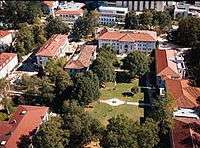
Agnes Scott College is a private, all female, undergraduate liberal arts college in Decatur.
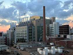
Emory University is a private, coeducational, liberal arts university. It is a member of the Association of American Universities, an association of leading research universities in the US and Canada. The university consists of the following divisions: Emory College of Arts and Science, the Laney Graduate School, Candler School of Theology, Goizueta Business School, Emory University School of Law, Rollins School of Public Health, and the Nell Hodgson Woodruff School of Nursing.
Mercer University is a private, coeducational, faith-based university with a Baptist heritage. Its main campus is in Macon. The Cecil B. Day Graduate and Professional Campus is in DeKalb County; it houses the College of Nursing, the College of Pharmacy and Health Sciences, and the James and Carolyn McAfee School of Theology along with programs of the Eugene W. Stetson School of Business and Economics, the School of Medicine, and the Tift College of Education.
Oglethorpe University is a private, coeducational, liberal arts school in Brookhaven and is named after James Oglethorpe, founder of the Georgia Colony.
Georgia Perimeter College (formerly DeKalb College) has three campuses within the county and offers two-year associate degrees.
Georgia Military College (GMC) has a satellite campus in Stone Mountain Village.
Georgia Piedmont Technical College[51] (formerly DeKalb Technical College) is the largest vocational institution in Georgia. Georgia Piedmont Technical College trains students in business, engineering, technologies, health, human services, industrial arts, information systems, and transportation.
DeVry University offers bachelor's and master's degrees in healthcare, accounting, business, and management technology.
Columbia Theological Seminary is a theological institution of the Presbyterian Church (USA) in Decatur. More than 640 students are enrolled at Columbia in one of five degree programs: Master of Divinity, Master of Arts in Theological Studies, Master of Theology, Doctor of Ministry, and Doctor of Theology.
Luther Rice College and Seminary is a private Christian college and seminary in Lithonia. It offers bachelors, masters, and doctoral programs in ministry and ministry-related programs.
Public libraries
The DeKalb County Public Library has 22 branches throughout the county.
Communities
Cities
Census-designated places
- Belvedere Park
- Candler-McAfee
- Druid Hills
- Gresham Park
- North Decatur
- North Druid Hills (also known as Briarcliff or Toco Hills)
- Panthersville
- Redan
- Scottdale
Unincorporated communities
- Buford Highway
- Collinsville
- Conley (partly)
- Ellenwood
- Embry Hills
- Flair Forest
- Lenox Park (neighborhood in Brookhaven)
- Mountain View
- Northlake
- Pittsburg
- Smoke Rise
- Snapfinger
Ghost town
See also
Bibliography
- DeKalb Historical Society. Vanishing DeKalb: A Pictoral History. Decatur, Ga.: DeKalb Historical Society, 1985. ISBN 0-9615459-0-9
- Mason, Herman. "Skip" Jr. African-American Life in DeKalb County, 1821–1970. Charleston, S.C.: Arcadia Publishing, 1998. ISBN 0-7385-0034-8
- Owens, Sue Ellen, and Megan Milford. DeKalb County in Vintage Postcards. Charleston, S.C.: Arcadia Publishing, 2001. ISBN 0-7385-1401-2
- Price, Vivian. The History of DeKalb County, Georgia, 1822–1900. Fernandina Beach, Fla.: Wolfe Publishing Company, 1997. ISBN 1-883793-27-0
References
- "State & County QuickFacts". United States Census Bureau. Archived from the original on July 3, 2011. Retrieved June 21, 2014.
- "Find a County". National Association of Counties. Archived from the original on May 31, 2011. Retrieved June 7, 2011.
- Gannett, Henry (1905). The Origin of Certain Place Names in the United States. Govt. Print. Off. pp. 103.
- Wilson, Lori (April 20, 2018). "At least 7 bus drivers fired over DeKalb schools 'sick out'". WSB-TV. Cox Media Group. Retrieved May 2, 2018.
- "US Gazetteer files: 2010, 2000, and 1990". United States Census Bureau. February 12, 2011. Retrieved April 23, 2011.
- "Georgia Soil and Water Conservation Commission Interactive Mapping Experience". Georgia Soil and Water Conservation Commission. Retrieved November 18, 2015.
- "Population and Housing Unit Estimates". Retrieved March 26, 2020.
- "U.S. Decennial Census". United States Census Bureau. Retrieved June 21, 2014.
- "Historical Census Browser". University of Virginia Library. Retrieved June 21, 2014.
- "Population of Counties by Decennial Census: 1900 to 1990". United States Census Bureau. Retrieved June 21, 2014.
- "Census 2000 PHC-T-4. Ranking Tables for Counties: 1990 and 2000" (PDF). United States Census Bureau. Retrieved June 21, 2014.
- "DP-1 Profile of General Population and Housing Characteristics: 2010 Demographic Profile Data". United States Census Bureau. Archived from the original on February 13, 2020. Retrieved December 29, 2015.
- "Population, Housing Units, Area, and Density: 2010 - County". United States Census Bureau. Archived from the original on February 13, 2020. Retrieved December 29, 2015.
- "DP02 SELECTED SOCIAL CHARACTERISTICS IN THE UNITED STATES – 2006-2010 American Community Survey 5-Year Estimates". United States Census Bureau. Archived from the original on February 13, 2020. Retrieved December 29, 2015.
- "DP03 SELECTED ECONOMIC CHARACTERISTICS – 2006-2010 American Community Survey 5-Year Estimates". United States Census Bureau. Archived from the original on February 13, 2020. Retrieved December 29, 2015.
- "A Major Employer". Archived from the original on December 12, 2013.
- "Contact Us Archived 2009-04-22 at the Wayback Machine." Kroger. Retrieved on April 30, 2009.
- "Hike, Bike, Historic - Arabia Mountain National Heritage Area".
- "Stone Mountain Theme Park - Atlanta Attractions & Events".
- "Fernbank Museum of Natural History - Atlanta, GA".
- "Fernbank Science Center...Where Science Becomes an Adventure".
- "Emory - Michael C. Carlos Museum".
- "Home - Callanwolde Fine Arts Center". Callanwolde.
- "Security Check Required".
- Dave Leip's Atlas of U.S. Presidential Elections.
- "DeKalb - Election Results". results.enr.clarityelections.com.
- "DeKalb County Sheriff Office". Dekalbsheriff.org. Retrieved December 22, 2012.
- "DeKalb County fire & Rescue". Web.co.dekalb.ga.us. April 1, 2005. Archived from the original on October 27, 2012. Retrieved December 22, 2012.
- "DeKalb keeps sanitation rates and service". Dunwoody Crier.
- Home Page. Centers for Disease Control and Prevention. Retrieved on November 19, 2008.
- "Druid Hills CDP, GA Archived November 25, 2011, at the Wayback Machine." United States Census Bureau. Retrieved on May 5, 2009.
- "Atlanta Division." Federal Bureau of Investigation. Retrieved on June 9, 2015. "2635 Century Parkway N.E., Suite 400 Atlanta, GA 30345"
- "City of Chamblee Street Map" (Archive). City of Chamblee. Retrieved on June 9, 2015.
- "Contact." Georgia Department of Juvenile Justice. Retrieved on August 8, 2010.
- "Official Zoning Map." City of Avondale Estates. Retrieved on August 8, 2010.
- "Directions." Georgia Bureau of Investigation. Retrieved on March 4, 2014. "The GBI Headquarters is located at: 3121 Panthersville Road Decatur GA, 30034"
- "Metro State Prison Archived May 23, 2010, at the Wayback Machine." Georgia Department of Corrections. Retrieved on July 18, 2010.
- "Inmates Under Death Sentence January 1, 2010 Changes to UDS Population During 2009." Georgia Department of Corrections. 3/7. Retrieved on July 18, 2010.
- Cook, Rhonda. "State closed DeKalb County prison." Atlanta Journal-Constitution. Friday April 1, 2011. Retrieved on November 18, 2012.
- "North Druid Hills CDP, GA." United States Census Bureau. Retrieved on May 5, 2009.
- Home Page." Consulate-General of Mexico in Atlanta. Accessed October 26, 2008.
- "Consulates Archived 2008-12-21 at the Wayback Machine." Georgia Department of Economic Development. Accessed October 26, 2008.
- "North Atlanta CDP, GA." United States Census Bureau. Retrieved on May 5, 2009.
- "Atlanta Archived 2008-10-06 at the Wayback Machine." Consulado General del Peru. Accessed October 26, 2008.
- "DeKalb school district in 'conflict and crisis,' put on probation by accreditation agency". The Atlanta Journal and Constitution. December 17, 2012. Retrieved December 19, 2012.
- Home. Atlanta Jewish Academy. Retrieved on June 1, 2017. "Lower School 5200 Northland Drive Atlanta, GA 30342" and "Upper School 3130 Raymond Drive Atlanta, GA 30340"
- "Zoning Map." City of Doraville. September 6, 2016. Retrieved on June 1, 2017.
- "Contact Us." Mohammed Schools. Retrieved on September 28, 2011. "735 Fayetteville Road, Atlanta, Georgia 30316"
- "History Archived November 4, 2005, at the Wayback Machine." Seigakuin Atlanta International School. Retrieved on January 11, 2012.
- "SCHOOL MATTERS Former U.N. diplomat heads Japanese school here." Atlanta Journal-Constitution. July 26, 1994. C2. Retrieved on January 11, 2012.
- "Georgia Piedmont Technical College – Georgia Piedmont Tech is one of Georgia's oldest and most respected technical colleges". www.gptc.edu.
External links
| Wikimedia Commons has media related to DeKalb County, Georgia. |
- DeKalb County official web site
- DeKalb History Center
- DeKalb Convention and Visitors Bureau
- DeKalb Elections Research Guide
- DeKalb County historical marker
Places adjacent to DeKalb County, Georgia | ||||||||||
|---|---|---|---|---|---|---|---|---|---|---|
| ||||||||||
Municipalities and communities of DeKalb County, Georgia, United States | ||
|---|---|---|
| Cities | Map of Georgia highlighting DeKalb County | |
| CDPs | ||
| Neighborhoods and unincorporated communities |
| |
| Ghost town | ||
| Footnotes | ‡This populated place also has portions in an adjacent county or counties | |
|  | |||||
|
| ||||||
| ||||||

| Authority control |
|
|---|
- "DeKalb - Election Results". results.enr.clarityelections.com.
- "DeKalb - Election Results". results.enr.clarityelections.com.
- "Board of Commissioners - DeKalb County, GA". www.dekalbcountyga.gov.