Trenton, South Carolina
Trenton is a town in Edgefield County, South Carolina, United States. The population was 196 at the 2010 census,[3] down from 226 in 2000.[4]
Trenton, South Carolina | |
|---|---|
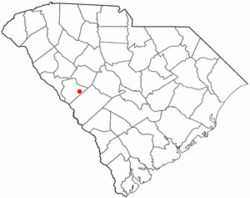 Location of Trenton, South Carolina | |
| Coordinates: 33°44′23″N 81°50′25″W | |
| Country | United States |
| State | South Carolina |
| County | Edgefield |
| Area | |
| • Total | 1.27 sq mi (3.30 km2) |
| • Land | 1.26 sq mi (3.27 km2) |
| • Water | 0.02 sq mi (0.04 km2) |
| Elevation | 620 ft (189 m) |
| Population (2010) | |
| • Total | 196 |
| • Density | 155/sq mi (60.0/km2) |
| Time zone | UTC-5 (Eastern (EST)) |
| • Summer (DST) | UTC-4 (EDT) |
| ZIP code | 29847 |
| Area code(s) | 803, 839 |
| FIPS code | 45-72520[1] |
| GNIS feature ID | 1251201[2] |
| Website | www |
History
Bettis Academy and Junior College and Marshfield, a historic plantation house with outbuilding and cemetery, are listed on the National Register of Historic Places.[5]
Painter Wenonah Bell was born in Trenton.[6]
Geography
Trenton is located in eastern Edgefield County at 33°44′23″N 81°50′25″W (33.739721, -81.840208).[7] South Carolina Highway 121 passes through the western side of the town, intersecting U.S. Route 25 at the southwest corner of the town. US 25 leads northwest 6 miles (10 km) to Edgefield, the county seat, and southwest 20 miles (32 km) to Augusta, Georgia, while SC 121 leads northeast 8 miles (13 km) to Johnston.
According to the United States Census Bureau, Trenton has a total area of 1.27 square miles (3.30 km2), of which 0.02 square miles (0.04 km2), or 1.17%, is water.[3]
Demographics
| Historical population | |||
|---|---|---|---|
| Census | Pop. | %± | |
| 1890 | 302 | — | |
| 1900 | 266 | −11.9% | |
| 1910 | 257 | −3.4% | |
| 1920 | 271 | 5.4% | |
| 1930 | 369 | 36.2% | |
| 1940 | 408 | 10.6% | |
| 1950 | 296 | −27.5% | |
| 1960 | 314 | 6.1% | |
| 1970 | 362 | 15.3% | |
| 1980 | 404 | 11.6% | |
| 1990 | 303 | −25.0% | |
| 2000 | 226 | −25.4% | |
| 2010 | 196 | −13.3% | |
| Est. 2018 | 252 | [8] | 28.6% |
| U.S. Decennial Census[9] | |||
2000 census
At the 2000 census there were 226 people, 103 households, and 67 families in the town. The population density was 173.9 people per square mile (67.1/km²). There were 115 housing units at an average density of 88.5 per square mile (34.2/km²). The racial makeup of the town was 69.47% White and 30.53% African American. Hispanic or Latino of any race were 3.10%.[1]
Of the 103 households 19.4% had children under the age of 18 living with them, 42.7% were married couples living together, 19.4% had a female householder with no husband present, and 34.0% were non-families. 32.0% of households were one person and 15.5% were one person aged 65 or older. The average household size was 2.19 and the average family size was 2.69.
The age distribution was 18.6% under the age of 18, 7.1% from 18 to 24, 23.5% from 25 to 44, 31.4% from 45 to 64, and 19.5% 65 or older. The median age was 45 years. For every 100 females, there were 93.2 males. For every 100 females age 18 and over, there were 93.7 males.
The median household income was $26,250 and the median family income was $41,667. Males had a median income of $31,875 versus $29,583 for females. The per capita income for the town was $17,352. About 30.8% of families and 27.1% of the population were below the poverty line, including 41.7% of those under the age of eighteen and 20.0% of those sixty five or over.
2010 census
According to the 2010 census, Trenton has a population of 196. Of the population, 129 (65.8%) were White, 62 (31.6%) were Black or African American, 0 (0%) were American Indian or Alaska Native, 0 (0%) were Asian, 0 (0%) were Pacific Islanders, 5 (2.6%),some other race, 0 (0%) Two or more races. 8 (4.1%) were Hispanic or Latino (of any race) [10]
References
- "U.S. Census website". United States Census Bureau. Retrieved 2008-01-31.
- "US Board on Geographic Names". United States Geological Survey. 2007-10-25. Retrieved 2008-01-31.
- "Geographic Identifiers: 2010 Census Summary File 1 (G001): Trenton town, South Carolina". American Factfinder. U.S. Census Bureau. Archived from the original on February 13, 2020. Retrieved March 22, 2016.
- "U.S. Census website". United States Census Bureau. Retrieved 2016-05-31.
- "National Register Information System". National Register of Historic Places. National Park Service. July 9, 2010.
- "Wenonah Bell - Artist, Fine Art Prices, Auction Records for Wenonah Bell". Retrieved 19 March 2017.
- "US Gazetteer files: 2010, 2000, and 1990". United States Census Bureau. 2011-02-12. Retrieved 2011-04-23.
- "Population and Housing Unit Estimates". Retrieved March 14, 2020.
- "Census of Population and Housing". Census.gov. Retrieved June 4, 2015.
- http://censusviewer.com/city/SC/trenton/2010
External links
Municipalities and communities of Edgefield County, South Carolina, United States | ||
|---|---|---|
| City |  Map of South Carolina highlighting Edgefield County | |
| Towns | ||
| CDP | ||
| Footnotes | ‡This populated place also has portions in an adjacent county or counties | |