Habersham County, Georgia
Habersham County is a county located in the northeastern part of the U.S. state of Georgia. As of the 2010 census, the population was 43,041.[1] The county seat is Clarkesville.[2] The county was created on December 15, 1817, and named for Colonel Joseph Habersham of the Continental Army in the Revolutionary War.[3]
Habersham County | |
|---|---|
 | |
 Seal | |
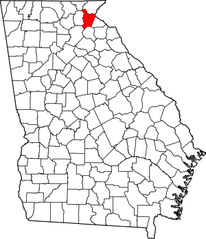 Location within the U.S. state of Georgia | |
 Georgia's location within the U.S. | |
| Coordinates: 34°38′N 83°32′W | |
| Country | |
| State | |
| Founded | 1818 |
| Named for | Joseph Habersham |
| Seat | Clarkesville |
| Largest city | Cornelia |
| Area | |
| • Total | 279 sq mi (720 km2) |
| • Land | 277 sq mi (720 km2) |
| • Water | 2.3 sq mi (6 km2) 0.8%% |
| Population | |
| • Estimate (2018) | 45,288 |
| • Density | 156/sq mi (60/km2) |
| Time zone | UTC−5 (Eastern) |
| • Summer (DST) | UTC−4 (EDT) |
| Congressional district | 9th |
| Website | www |
Habersham County comprises the Cornelia, GA Micropolitan Statistical Area.
Geography
According to the U.S. Census Bureau, the county has a total area of 279 square miles (720 km2), of which 277 square miles (720 km2) is land and 2.3 square miles (6.0 km2) (0.8%) is water.[4] The county is located within the Blue Ridge Mountains, a segment of the Appalachian Mountains. The county also includes part of the Chattahoochee National Forest.
The highest point in the county is a 4,400-foot (1,300 m) knob less than 700 feet (210 m) southeast of the top of Tray Mountain, the seventh-highest mountain in Georgia. Habersham shares this portion of Tray Mountain, just 30 vertical feet shy of the peak's 4,430-foot summit, with White County to the west and Towns County to the north. 2.4 miles to the northeast of Tray Mountain is Young Lick (elevation 3,809 feet (1,161 m)). The Appalachian Trail runs along the top of the high ridge between Young Lick and Tray, a part of the Blue Ridge Mountain crest.
Habersham is mostly located in the Upper Chattahoochee River sub-basin of the ACF River Basin (Apalachicola-Chattahoochee-Flint River Basin), with the northeastern corner of the county located in the Tugaloo River sub-basin in the larger Savannah River basin, and the southeastern portion located in the Broad River sub-basin of the same Savannah River basin.[5]
The Chattahoochee River rises in what used to be Habersham County, as portrayed in Sidney Lanier's poem "Song of the Chattahoochee":
- Out of the hills of Habersham,
- Down the valleys of Hall,
- I hurry amain to reach the plain,
- Run the rapid and leap the fall,
- Split at the rock and together again.
The county, originally comprising much of Northeast Georgia, was cut up dramatically in the latter half of the 19th century and the first years of the 20th century; as population increased in the area, new counties were organized from it and borders were changed. In 1857, its most western part was added to Lumpkin County, which had been created in 1832. That same year, the area east of Lumpkin and west of present-day Habersham became White County. In 1859, Banks County was carved from Habersham's southern-most territory. Finally, in 1905, Stephens County was formed from parts of Habersham and Banks.
Major highways


Adjacent counties
- Rabun County - north
- Oconee County, South Carolina - east
- Stephens County - east
- Banks County - south
- Hall County - southwest
- White County - west
- Towns County - northwest
Education
Habersham county is served by the Habersham County School District. The Tallulah Falls School is located in Tallulah Falls. Piedmont College and North Georgia Technical College are also located in Habersham county.
Demographics
| Historical population | |||
|---|---|---|---|
| Census | Pop. | %± | |
| 1820 | 3,145 | — | |
| 1830 | 10,671 | 239.3% | |
| 1840 | 7,961 | −25.4% | |
| 1850 | 8,895 | 11.7% | |
| 1860 | 5,966 | −32.9% | |
| 1870 | 6,322 | 6.0% | |
| 1880 | 8,718 | 37.9% | |
| 1890 | 11,573 | 32.7% | |
| 1900 | 13,604 | 17.5% | |
| 1910 | 10,134 | −25.5% | |
| 1920 | 10,730 | 5.9% | |
| 1930 | 12,748 | 18.8% | |
| 1940 | 14,771 | 15.9% | |
| 1950 | 16,553 | 12.1% | |
| 1960 | 18,116 | 9.4% | |
| 1970 | 20,691 | 14.2% | |
| 1980 | 25,020 | 20.9% | |
| 1990 | 27,621 | 10.4% | |
| 2000 | 35,902 | 30.0% | |
| 2010 | 43,041 | 19.9% | |
| Est. 2018 | 45,288 | [6] | 5.2% |
| U.S. Decennial Census[7] 1790-1960[8] 1900-1990[9] 1990-2000[10] 2010-2013[1] | |||
2000 census
As of the census[11] of 2000, there were 35,902 people, 13,259 households, and 9,851 families living in the county. The population density was 129 people per square mile (50/km²). There were 14,634 housing units at an average density of 53 per square mile (20/km²). The racial makeup of the county was 88.88% White, 4.48% Black or African American, 1.89% Asian, 0.29% Native American, 0.10% Pacific Islander, 2.99% from other races, and 1.36% from two or more races. 7.66% of the population were Hispanic or Latino of any race.
There were 13,259 households out of which 32.00% had children under the age of 18 living with them, 60.90% were married couples living together, 9.30% had a female householder with no husband present, and 25.70% were non-families. 22.40% of all households were made up of individuals and 9.60% had someone living alone who was 65 years of age or older. The average household size was 2.57 and the average family size was 2.98.
In the county, the population was spread out with 23.50% under the age of 18, 11.10% from 18 to 24, 28.50% from 25 to 44, 23.10% from 45 to 64, and 13.80% who were 65 years of age or older. The median age was 36 years. For every 100 females there were 105.50 males. For every 100 females age 18 and over, there were 103.00 males.
The median income for a household in the county was $36,321, and the median income for a family was $42,235. Males had a median income of $28,803 versus $23,046 for females. The per capita income for the county was $17,706. About 8.80% of families and 12.20% of the population were below the poverty line, including 14.40% of those under age 18 and 15.00% of those age 65 or over.
2010 census
As of the 2010 United States Census, there were 43,041 people, 15,472 households, and 11,307 families living in the county.[12] The population density was 155.5 inhabitants per square mile (60.0/km2). There were 18,146 housing units at an average density of 65.6 per square mile (25.3/km2).[13] The racial makeup of the county was 85.7% white, 3.4% black or African American, 2.2% Asian, 0.5% American Indian, 0.2% Pacific islander, 6.3% from other races, and 1.8% from two or more races. Those of Hispanic or Latino origin made up 12.4% of the population.[12] In terms of ancestry, 15.6% were English, 13.9% were Irish, 13.7% were American, and 9.9% were German.[14]
Of the 15,472 households, 34.4% had children under the age of 18 living with them, 57.8% were married couples living together, 10.5% had a female householder with no husband present, 26.9% were non-families, and 23.2% of all households were made up of individuals. The average household size was 2.63 and the average family size was 3.08. The median age was 38.6 years.[12]
The median income for a household in the county was $40,192 and the median income for a family was $49,182. Males had a median income of $35,974 versus $27,971 for females. The per capita income for the county was $19,286. About 15.7% of families and 19.6% of the population were below the poverty line, including 31.2% of those under age 18 and 12.5% of those age 65 or over.[15]
Politics
As of 2012, the county is split into 14 voting precincts:[16]
- North: Batesville, Cool Springs, Fair Play, Deep Creek, Glade Creek, Fork, Falling Water, Clarkesville
- South: Demorest, Center Hill, Cornelia, View, Mud Creek and Baldwin
Stacy Hall serves as Chairman of the Board of County Commissioners as of January 2019. Since 2011, Habersham County has been represented in the Georgia House of Representatives by Republican member Terry Rogers. Habersham County was represented in the US House of Representatives as part of the 10th District. Representative Charlie Norwood represented the county for one month, until his death (February 13, 2007). The seat remained vacant until a special election in July 2007, which was won by Republican Paul Broun, an Athens physician. Broun served in the House until 2014, when he ran unsuccessfully for the Republican nomination for the U.S. Senate seat vacated by the retiring Saxby Chambliss.
With the 2012 reapportionment, Habersham County became part of the 9th congressional district. Former Georgia House of Representatives member Doug Collins won the seat in the 2016 election.
Habersham County became the first Second Amendment sanctuary county in Georgia on January 13, 2020.
| Year | Republican | Democratic | Third parties |
|---|---|---|---|
| 2016 | 80.8% 13,190 | 15.2% 2,483 | 4.0% 660 |
| 2012 | 82.9% 12,166 | 15.7% 2,301 | 1.4% 209 |
| 2008 | 79.2% 11,766 | 19.5% 2,900 | 1.3% 193 |
| 2004 | 78.6% 10,434 | 20.7% 2,750 | 0.7% 92 |
| 2000 | 71.9% 6,964 | 26.1% 2,530 | 2.0% 197 |
| 1996 | 51.9% 4,730 | 34.8% 3,170 | 13.3% 1208 |
| 1992 | 50.0% 4,569 | 33.9% 3,098 | 16.1% 1467 |
| 1988 | 69.5% 4,871 | 30.1% 2,114 | 0.4% 29 |
| 1984 | 68.6% 4,647 | 31.4% 2,125 | |
| 1980 | 32.8% 2,224 | 64.8% 4,394 | 2.4% 163 |
| 1976 | 20.4% 1,315 | 79.6% 5,120 | |
| 1972 | 85.0% 971 | 15.1% 172 | |
| 1968 | 28.3% 1,611 | 18.8% 1,070 | 52.9% 3,008 |
| 1964 | 31.8% 1,595 | 68.1% 3,412 | 0.0% 2 |
| 1960 | 26.1% 895 | 73.9% 2,530 | |
| 1956 | 27.3% 855 | 72.7% 2,276 | |
| 1952 | 25.8% 921 | 74.2% 2,647 | |
| 1948 | 10.2% 212 | 71.3% 1,477 | 18.5% 382 |
| 1944 | 21.5% 504 | 78.5% 1,842 | |
| 1940 | 18.6% 421 | 81.1% 1,840 | 0.4% 9 |
| 1936 | 18.2% 424 | 80.9% 1,884 | 0.9% 20 |
| 1932 | 11.6% 225 | 87.0% 1,693 | 1.5% 29 |
| 1928 | 56.0% 1,404 | 44.0% 1,105 | |
| 1924 | 27.0% 322 | 67.8% 808 | 5.2% 62 |
| 1920 | 55.5% 626 | 44.6% 503 | |
| 1916 | 27.3% 406 | 69.5% 1,032 | 3.2% 48 |
| 1912 | 37.4% 317 | 57.3% 485 | 5.3% 45 |
Prison
The Georgia Department of Corrections operates the Arrendale State Prison in an unincorporated area in the county, near Alto.[18]
Lee Arrendale State Prison was built in 1926. The prison was named after Lee Arrendale, former Chairman of the Georgia Board of Corrections, after he and his wife were killed in a plane crash. The facility was originally constructed as a tuberculosis (TB) hospital, when treatment consisted primarily of rest in sanatoriums. It operated until the mid-1950s; with antibiotics, TB was better controlled and such hospitals were no longer needed. The facility was transferred to the Georgia Prison system.
Once acquired by the Georgia Department of Corrections, it was first used to house youthful offenders from ages 18–25. Over a short amount of time, Lee Arrendale prison gained a bad reputation as the second most violent all-male prison in the state. In 2005, however the Department of Corrections decided to make the prison an exclusive general purpose women's prison. As a result of the prison's past troubles and reputation for violence, the state decided to make this change to improve the prison's status in the state. In March 2006, the prison took in 350 women prisoners from Georgia's overflowing jail system to start this process.
Lee Arrendale is also home to the United States' first all-female fire department and the state's first inmate fire department,, thanks to the Georgia Department of Corrections' (GDC) Fire Services Division. The GDC operates many fire departments throughout the state, staffed solely by inmates, who are supervised by GDC employees. Such inmates are trained as certified officers but as professional firefighters. The inmate firefighter program provides fire protection to the largely rural communities without local or volunteer fire departments near the prisons, as well as to other locations in Georgia during emergencies. Inmates are trained and certified in accordance with Georgia law and the Georgia Firefighter Standards and Training Council, as with any regular fire department. In 2007, inmate fire squads responded to the wildfires in South Georgia near Waycross, Georgia, in addition to the hundreds of other alarms they received statewide.
Communities
Census-designated place
Other unincorporated communities
- Batesville
- Habersham Mills
- Hollywood
- Turnerville
See also
References
- "State & County QuickFacts". United States Census Bureau. Archived from the original on July 2, 2011. Retrieved June 23, 2014.
- "Find a County". National Association of Counties. Retrieved June 7, 2011.
- Krakow, Kenneth K. (1975). Georgia Place-Names: Their History and Origins (PDF). Macon, GA: Winship Press. p. 101. ISBN 0-915430-00-2.
- "US Gazetteer files: 2010, 2000, and 1990". United States Census Bureau. February 12, 2011. Retrieved April 23, 2011.
- "Georgia Soil and Water Conservation Commission Interactive Mapping Experience". Georgia Soil and Water Conservation Commission. Retrieved November 18, 2015.
- "Population and Housing Unit Estimates". Retrieved July 30, 2019.
- "U.S. Decennial Census". United States Census Bureau. Retrieved June 23, 2014.
- "Historical Census Browser". University of Virginia Library. Retrieved June 23, 2014.
- "Population of Counties by Decennial Census: 1900 to 1990". United States Census Bureau. Retrieved June 23, 2014.
- "Census 2000 PHC-T-4. Ranking Tables for Counties: 1990 and 2000" (PDF). United States Census Bureau. Retrieved June 23, 2014.
- "U.S. Census website". United States Census Bureau. Retrieved May 14, 2011.
- "DP-1 Profile of General Population and Housing Characteristics: 2010 Demographic Profile Data". United States Census Bureau. Archived from the original on February 13, 2020. Retrieved December 29, 2015.
- "Population, Housing Units, Area, and Density: 2010 - County". United States Census Bureau. Archived from the original on February 13, 2020. Retrieved December 29, 2015.
- "DP02 SELECTED SOCIAL CHARACTERISTICS IN THE UNITED STATES – 2006-2010 American Community Survey 5-Year Estimates". United States Census Bureau. Archived from the original on February 13, 2020. Retrieved December 29, 2015.
- "DP03 SELECTED ECONOMIC CHARACTERISTICS – 2006-2010 American Community Survey 5-Year Estimates". United States Census Bureau. Archived from the original on February 13, 2020. Retrieved December 29, 2015.
- Habersham delays consolidation of voting precincts, a June 19, 2012 article by Rob Moore from AccessNorthGa.com. Retrieved 2012-09-14.
- Leip, David. "Dave Leip's Atlas of U.S. Presidential Elections". uselectionatlas.org. Retrieved March 20, 2018.
- "Arrendale State Prison Archived 2014-01-16 at the Wayback Machine." Georgia Department of Corrections. Retrieved on November 15, 2010. "ADDRESS: 2023 GAINESVILLE HWY, SOUTH POST OFFICE BOX 709, ALTO, GA 30510."
External links
- Chamber of Commerce, local web site from local Chamber of Commerce
- Habersham County, Roadside Georgia
- Habersham County website
- Habersham County historical marker, Georgia Info
- Habersham Iron Works Manufacturing Company, historical marker, Georgia Info
Places adjacent to Habersham County, Georgia | ||||||||||
|---|---|---|---|---|---|---|---|---|---|---|
| ||||||||||
Municipalities and communities of Habersham County, Georgia, United States | ||
|---|---|---|
| Cities | Map of Georgia highlighting Habersham County | |
| Towns | ||
| CDP | ||
| Unincorporated communities | ||
| Footnotes | ‡This populated place also has portions in an adjacent county or counties | |

| Authority control |
|
|---|