Oconee County, Georgia
Oconee County is a county located in the northeastern part of the U.S. state of Georgia. As of the 2010 census, the population was 32,808.[2] The county seat is Watkinsville.[3]
Oconee County | |
|---|---|
 Oconee County Courthouse in Watkinsville | |
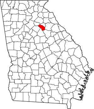 Location within the U.S. state of Georgia | |
 Georgia's location within the U.S. | |
| Coordinates: 33°50′N 83°26′W | |
| Country | |
| State | |
| Founded | February 24, 1875 |
| Named for | Oconee River |
| Seat | Watkinsville |
| Largest town | Watkinsville |
| Area | |
| • Total | 186 sq mi (480 km2) |
| • Land | 184 sq mi (480 km2) |
| • Water | 2.1 sq mi (5 km2) 1.1%% |
| Population | |
| • Estimate (2018) | 39,272[1] |
| • Density | 178/sq mi (69/km2) |
| Time zone | UTC−5 (Eastern) |
| • Summer (DST) | UTC−4 (EDT) |
| Congressional district | 10th |
| Website | www |
Oconee County is included in the Athens-Clarke County, GA Metropolitan Statistical Area.
History
Oconee County was created from the southwestern part of Clarke County in 1875 by the Georgia General Assembly. The new county was created to satisfy southwestern Clarke County residents' demand for their own county after the county seat was moved from Watkinsville to Athens by the General Assembly in 1872. It is named for the river flowing along part of its eastern border.[4]
The county was ranked as the third-best rural county to live in by Progressive Farmer magazine in 2006.[5]
Geography
According to the U.S. Census Bureau, the county has a total area of 186 square miles (480 km2), of which 184 square miles (480 km2) is land and 2.1 square miles (5.4 km2) (1.1%) is water.[6] The county is located in the Piedmont region of the state.
The entirety of Oconee County is located in the Upper Oconee River sub-basin of the Altamaha River basin.[7]
Adjacent counties
- Clarke County (north)
- Oglethorpe County (east)
- Greene County (southeast)
- Morgan County (south)
- Walton County (west)
- Barrow County (northwest)
National protected area
- Oconee National Forest (part)
Transportation
Major highways


Pedestrians and cycling
The city has limited walkability options available. However, since 2017 plans are being discussed to develop a multi-use trail network.[8]
Demographics
| Historical population | |||
|---|---|---|---|
| Census | Pop. | %± | |
| 1880 | 6,351 | — | |
| 1890 | 7,713 | 21.4% | |
| 1900 | 8,602 | 11.5% | |
| 1910 | 11,104 | 29.1% | |
| 1920 | 11,067 | −0.3% | |
| 1930 | 8,082 | −27.0% | |
| 1940 | 7,576 | −6.3% | |
| 1950 | 7,009 | −7.5% | |
| 1960 | 6,304 | −10.1% | |
| 1970 | 7,915 | 25.6% | |
| 1980 | 12,427 | 57.0% | |
| 1990 | 17,618 | 41.8% | |
| 2000 | 26,225 | 48.9% | |
| 2010 | 32,666 | 24.6% | |
| Est. 2017 | 39,272 | [9] | 20.2% |
| U.S. Decennial Census[10] 1790-1960[11] 1900-1990[12] 1990-2000[13] 2010-2013[2] | |||
As of the 2010 United States Census, there were 32,808 people, 11,622 households, and 9,346 families residing in the county.[14] The population density was 178.0 inhabitants per square mile (68.7/km2). There were 12,383 housing units at an average density of 67.2 per square mile (25.9/km2).[15] The racial makeup of the county was 88.4% white, 5.0% black or African American, 3.1% Asian, 0.1% American Indian, 2.0% from other races, and 1.4% from two or more races. Those of Hispanic or Latino origin made up 4.4% of the population.[14] In terms of ancestry, 19.9% were English, 14.7% were American, 13.3% were Irish, and 12.2% were German.[16]
Of the 11,622 households, 43.4% had children under the age of 18 living with them, 67.4% were married couples living together, 9.5% had a female householder with no husband present, 19.6% were non-families, and 16.3% of all households were made up of individuals. The average household size was 2.81 and the average family size was 3.16. The median age was 39.1 years.[14]
The median income for a household in the county was $74,352 and the median income for a family was $85,371. Males had a median income of $57,303 versus $39,375 for females. The per capita income for the county was $34,271. About 6.3% of families and 7.4% of the population were below the poverty line, including 9.1% of those under age 18 and 8.4% of those age 65 or over.[17]
In 2012, the Wisconsin Population Health Institute ranked Oconee County as one of the top 3 healthiest counties in Georgia. The study ranked the county second in the state in "Overall Health Factors" and third in "Overall Health Outcomes."[18]
Government
Oconee County is governed by a four-member Board of Commissioners, which holds legislative power. The Board is led by a separately-elected Chairman, who holds executive power. The Board is vested with budget and taxing authority, ordinance making authority, and control of county property, roads and facilities. The chairman and all members of the board are elected from at-large districts (called "posts") to staggered terms of four years.[19]
The Chairman of the Board is the county's Chief Executive Officer who, in consultation with the Commissioners, appoints officers and staff as needed to administer the responsibilities of the Board.
The current members of the Board are:[19]
- Chairman: John Daniell
- Post 1: Mark Thomas
- Post 2: Chuck Horton
- Post 3: W.E. "Bubber" Wilkes
- Post 4: Mark Saxon
The judicial branch of government is administered through the Georgia court system as a part of the 10th Judicial District, Western Circuit.[20]
Primary law enforcement services in the portion of the county outside the City of Watkinsville are provided by the Sheriff's office. (Law enforcement within the Watkinsville City Limits is the jurisdiction of the Watkinsville Police Department.)[21] The office of Sheriff is an elected position; since 1992, the office has been held by Scott Berry.[22] Berry is also the current President of the Georgia Sheriff's Association.[23]
Politics
| Year | Republican | Democratic | Third parties |
|---|---|---|---|
| 2016 | 66.6% 13,425 | 27.7% 5,581 | 5.7% 1,143 |
| 2012 | 73.3% 13,098 | 24.8% 4,421 | 1.9% 340 |
| 2008 | 70.6% 12,120 | 28.1% 4,825 | 1.3% 229 |
| 2004 | 72.4% 10,276 | 26.7% 3,789 | 0.9% 134 |
| 2000 | 68.2% 7,611 | 28.5% 3,184 | 3.3% 373 |
| 1996 | 58.1% 5,116 | 34.0% 2,992 | 8.0% 705 |
| 1992 | 51.1% 4,125 | 34.0% 2,745 | 14.9% 1,206 |
| 1988 | 67.9% 4,265 | 31.7% 1,990 | 0.4% 27 |
| 1984 | 70.3% 3,471 | 29.7% 1,467 | |
| 1980 | 47.3% 2,065 | 49.0% 2,141 | 3.7% 161 |
| 1976 | 34.7% 1,184 | 65.3% 2,228 | |
| 1972 | 81.4% 2,029 | 18.6% 464 | |
| 1968 | 28.2% 713 | 16.4% 414 | 55.5% 1,405 |
| 1964 | 53.6% 1,241 | 46.4% 1,073 | |
| 1960 | 19.6% 297 | 80.4% 1,218 | |
| 1956 | 21.4% 314 | 78.6% 1,156 | |
| 1952 | 22.2% 337 | 77.8% 1,182 | |
| 1948 | 27.2% 254 | 61.9% 579 | 10.9% 102 |
| 1944 | 25.5% 195 | 74.5% 570 | |
| 1940 | 21.7% 177 | 77.7% 635 | 0.6% 5 |
| 1936 | 26.3% 173 | 73.3% 483 | 0.5% 3 |
| 1932 | 5.4% 39 | 92.5% 664 | 2.1% 15 |
| 1928 | 46.6% 300 | 53.4% 344 | |
| 1924 | 11.9% 46 | 72.1% 279 | 16.0% 62 |
| 1920 | 24.1% 108 | 76.0% 341 | |
| 1916 | 25.0% 166 | 75.0% 497 | |
| 1912 | 46.3% 180 | 53.5% 208 | 0.3% 1 |
Education
Oconee County School District
The Oconee County School District provides education for grades pre-school to twelve and consists of six elementary schools, two middle schools, and two high schools.[25] The district has 361 full-time teachers and over 5,615 students.[26]
Private Schools
There are currently three private schools located in the county. They are:
Colleges and Universities
The University of North Georgia maintains a satellite campus near Watkinsville. It was a Gainesville State College campus until the 2012 merger of Gainesville State College with North Georgia College and State University.[30]
Media
There is one weekly-published newspaper in Oconee County: The Oconee Enterprise. Oconee Patch is a community website offering daily news and events.
Cox Media Group also operates a radio broadcast facility on Tower Place in northeast Oconee County. Four radio stations are operated from this facility:[31]
- WNGC 106.1 FM
- WGMG 102.1 FM (Magic 102.1)
- WPUP 100.1 FM (Power 100.1)
- WRFC 960 AM (The Ref)
Communities
Notable people
- Nathan Crawford Barnett, member of the Georgia House of Representatives and Georgia Secretary of State for more than 30 years.
- John Berry, country music singer
- Phil Campbell, farmer
- Colt Ford, county music singer and professional golfer
- Lottie Moon, Southern Baptist missionary who spend nearly 40 years working in China
References
- "State & County QuickFacts". United States Census Bureau. Retrieved June 22, 2019.
- "State & County QuickFacts". United States Census Bureau. Archived from the original on June 7, 2011. Retrieved June 25, 2014.
- "Find a County". National Association of Counties. Retrieved June 7, 2011.
- Oconee County Chamber of Commerce, "History of Oconee County" Archived 2012-04-26 at the Wayback Machine
- Steve Hargreaves (February 2, 2006). "Best places to live: Rural America". CNNMoney.com. Retrieved April 2, 2012.
- "US Gazetteer files: 2010, 2000, and 1990". United States Census Bureau. February 12, 2011. Retrieved April 23, 2011.
- "Georgia Soil and Water Conservation Commission Interactive Mapping Experience". Georgia Soil and Water Conservation Commission. Retrieved November 19, 2015.
- "Plans for Oconee County taking shape". Gate House Media LLC. June 14, 2017. Retrieved May 21, 2018.
- "Population and Housing Unit Estimates". Retrieved July 31, 2019.
- "U.S. Decennial Census". United States Census Bureau. Retrieved June 25, 2014.
- "Historical Census Browser". University of Virginia Library. Retrieved June 25, 2014.
- "Population of Counties by Decennial Census: 1900 to 1990". United States Census Bureau. Retrieved June 25, 2014.
- "Census 2000 PHC-T-4. Ranking Tables for Counties: 1990 and 2000" (PDF). United States Census Bureau. Retrieved June 25, 2014.
- "DP-1 Profile of General Population and Housing Characteristics: 2010 Demographic Profile Data". United States Census Bureau. Archived from the original on February 13, 2020. Retrieved December 30, 2015.
- "Population, Housing Units, Area, and Density: 2010 - County". United States Census Bureau. Archived from the original on February 13, 2020. Retrieved December 30, 2015.
- "DP02 SELECTED SOCIAL CHARACTERISTICS IN THE UNITED STATES – 2006-2010 American Community Survey 5-Year Estimates". United States Census Bureau. Archived from the original on February 13, 2020. Retrieved December 30, 2015.
- "DP03 SELECTED ECONOMIC CHARACTERISTICS – 2006-2010 American Community Survey 5-Year Estimates". United States Census Bureau. Archived from the original on February 13, 2020. Retrieved December 30, 2015.
- Stephanie Gross (April 3, 2012). "Oconee Among Top 3 Healthiest Georgia Counties". Oconee Patch. Patch Network. Retrieved April 4, 2012.
- Board Of Commissioners Archived 2012-03-20 at the Wayback Machine section of Oconee County website. Last accessed 2012-04-04.
- Official website Archived 2013-08-12 at the Wayback Machine of the 10th Judicial District of Georgia, Western Circuit
- 2011 Official Oconee County Newcomer's Guide Last accessed 2012-04-04.
- Ryan Blackburn (July 24, 2011). "Sheriff Berry To Tackle Big Issues As Head of State Law Enforcement Group". Oconee Patch. Patch Network. Archived from the original on January 31, 2013. Retrieved April 4, 2012.
- Board of Directors Archived 2010-12-15 at the Wayback Machine section of Georgia Sheriff's Association official website. Last accessed 2012-04-04.
- Leip, David. "Dave Leip's Atlas of U.S. Presidential Elections". uselectionatlas.org. Retrieved March 22, 2018.
- Georgia Board of Education, Retrieved June 24, 2010.
- School Stats Archived April 5, 2012, at the Wayback Machine, Retrieved June 24, 2010.
- Founding Principles Archived 2011-02-13 at the Wayback Machine section of Westminster Christian Academy website. Last accessed 2012-04-04.
- Who we are Archived 2012-03-31 at the Wayback Machine section of Prince Avenue website. Last accessed 2012-04-04.
- History Archived 2012-02-27 at the Wayback Machine section of Athens Academy website. Last accessed 2012-04-04.
- History of GSC Archived 2013-04-01 at the Wayback Machine section of Gainesville State College website. Last accessed 2012-04-04.
- Athens location information Archived 2012-04-23 at the Wayback Machine, Cox Media Group website. Last accessed 2012-04-04.
External links
Places adjacent to Oconee County, Georgia | ||||||||||
|---|---|---|---|---|---|---|---|---|---|---|
| ||||||||||
Municipalities and communities of Oconee County, Georgia, United States | ||
|---|---|---|
| Towns | Map of Georgia highlighting Oconee County | |
| Unincorporated communities | ||
| Ghost town | ||
| Footnotes | ‡This populated place also has portions in an adjacent county or counties | |

| Authority control |
|
|---|