Glynn County, Georgia
Glynn County is located in the southeastern part of the U.S. state of Georgia. As of the 2010 census, the population was 79,626.[2] The county seat is Brunswick.[3] Glynn County is part of the Brunswick, Georgia Metropolitan Statistical Area.
Glynn County | |
|---|---|
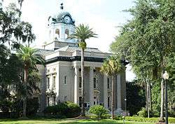
 Glynn County Courthouse | |
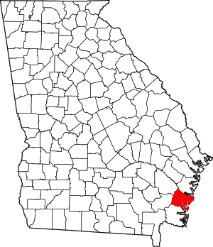 Location within the U.S. state of Georgia | |
 Georgia's location within the U.S. | |
| Coordinates: 31°13′N 81°29′W | |
| Country | |
| State | |
| Founded | 1777 |
| Named for | John Glynn |
| Seat | Brunswick |
| Largest city | Brunswick |
| Government | |
| • Mayor | Cornell Harvey |
| Area | |
| • Total | 585 sq mi (1,520 km2) |
| • Land | 420 sq mi (1,100 km2) |
| • Water | 165 sq mi (430 km2) 28.3%% |
| Population | |
| • Estimate (2018) | 85,219[1] |
| • Density | 190/sq mi (70/km2) |
| Time zone | UTC−5 (Eastern) |
| • Summer (DST) | UTC−4 (EDT) |
| Congressional district | 1st |
| Website | www |
History
Glynn County, one of the original eight counties in the state created on February 5, 1777, was named after John Glynn,[4] a member of the British House of Commons who defended the cause of the American Colonies before the American Revolution. The Battle of Bloody Marsh was fought in Glynn County. James Oglethorpe built Fort Frederica which was used a base in the American Revolutionary War. Glynn Academy is the second oldest school in Georgia.
Glynn County includes the most prominent of the Sea Islands of Georgia, including Jekyll Island, St. Simons Island, and Sea Island. The Georgia poet Sidney Lanier immortalized the seacoast there in his poem, "The Marshes of Glynn", which begins:
- Glooms of the live-oaks, beautiful-braided and woven
- With intricate shades of the vines that myriad-cloven
- Clamber the forks of the multiform boughs,--
- Emerald twilights,--
- Virginal shy lights,
- Wrought of the leaves to allure to the whisper of vows,
- When lovers pace timidly down through the green colonnades
- Of the dim sweet woods, of the dear dark woods,
- Of the heavenly woods and glades,
- That run to the radiant marginal sand-beach within
- The wide sea-marshes of Glynn;--
The former Naval Air Station Glynco, named for the county, was a major base for blimps and anti-submarine warfare during World War II. The Federal Law Enforcement Training Center (FLETC) now uses a substantial part of the former NAS as its main campus.
Geography

According to the U.S. Census Bureau, the county has a total area of 585 square miles (1,520 km2), of which 420 square miles (1,100 km2) is land and 165 square miles (430 km2) (28.3%) is water.[5]
The majority of Glynn County is located in the Cumberland-St. Simons sub-basin of the St. Marys-Satilla River basin. Most of the county's northern and northwestern border area is located in the Altamaha River sub-basin of the basin by the same name.[6]
Major highways


Adjacent counties
- McIntosh County - north
- Camden County - southwest
- Brantley County - west
- Wayne County - northwest
Demographics
| Historical population | |||
|---|---|---|---|
| Census | Pop. | %± | |
| 1790 | 413 | — | |
| 1800 | 1,874 | 353.8% | |
| 1810 | 3,417 | 82.3% | |
| 1820 | 3,418 | 0.0% | |
| 1830 | 4,567 | 33.6% | |
| 1840 | 5,302 | 16.1% | |
| 1850 | 4,933 | −7.0% | |
| 1860 | 3,889 | −21.2% | |
| 1870 | 5,376 | 38.2% | |
| 1880 | 6,497 | 20.9% | |
| 1890 | 13,420 | 106.6% | |
| 1900 | 14,317 | 6.7% | |
| 1910 | 15,720 | 9.8% | |
| 1920 | 19,370 | 23.2% | |
| 1930 | 19,400 | 0.2% | |
| 1940 | 21,920 | 13.0% | |
| 1950 | 29,046 | 32.5% | |
| 1960 | 41,954 | 44.4% | |
| 1970 | 50,528 | 20.4% | |
| 1980 | 54,981 | 8.8% | |
| 1990 | 62,496 | 13.7% | |
| 2000 | 67,568 | 8.1% | |
| 2010 | 79,626 | 17.8% | |
| Est. 2018 | 85,219 | [7] | 7.0% |
| U.S. Decennial Census[8] 1790-1960[9] 1900-1990[10] 1990-2000[11] 2010-2013[2] | |||
2000 census
As of the census[12] of 2000, there were 67,568 people, 27,208 households, and 18,392 families living in the county. The population density was 160 per square mile (62/km2). There were 32,636 housing units at an average density of 77 per square mile (30/km2). The racial makeup of the county was 70.66% White, 26.45% Black or African American, 0.26% Native American, 0.60% Asian, 0.05% Pacific Islander, 0.88% from other races, and 1.09% from two or more races. 2.99% of the population were Hispanic or Latino of any race.
According to census 2000 the largest European ancestry groups in Glynn County are:
- 45.5% English
- 10.1% Irish
- 8.0% German
- 3.0% Scots-Irish
- 2.2% Scottish
- 1.0% Polish
- 1.0% Welsh
There were 27,208 households out of which 30.20% had children under the age of 18 living with them, 49.50% were married couples living together, 14.60% had a female householder with no husband present, and 32.40% were non-families. 27.20% of all households were made up of individuals and 10.10% had someone living alone who was 65 years of age or older. The average household size was 2.44 and the average family size was 2.95.
In the county, the population was spread out with 25.30% under the age of 18, 8.20% from 18 to 24, 27.60% from 25 to 44, 24.50% from 45 to 64, and 14.40% who were 65 years of age or older. The median age was 38 years. For every 100 females, there were 91.70 males. For every 100 females age 18 and over, there were 87.50 males.
The median income for a household in the county was $38,765, and the median income for a family was $46,984. Males had a median income of $34,363 versus $23,558 for females. The per capita income for the county was $21,707. About 11.60% of families and 15.10% of the population were below the poverty line, including 22.10% of those under age 18 and 11.90% of those age 65 or over.
2010 census
As of the 2010 United States Census, there were 79,626 people, 31,774 households, and 21,259 families living in the county.[13] The population density was 189.7 inhabitants per square mile (73.2/km2). There were 40,716 housing units at an average density of 97.0 per square mile (37.5/km2).[14] The racial makeup of the county was 67.6% white, 26.0% black or African American, 1.2% Asian, 0.3% American Indian, 0.1% Pacific islander, 3.0% from other races, and 1.8% from two or more races. Those of Hispanic or Latino origin made up 6.4% of the population.[13]
2015
In terms of ancestry, 46.5% were English, 10.6% were American, 10.2% were Irish, and 7.9% were German.[15]
Of the 31,774 households, 32.5% had children under the age of 18 living with them, 46.4% were married couples living together, 16.2% had a female householder with no husband present, 33.1% were non-families, and 27.5% of all households were made up of individuals. The average household size was 2.46 and the average family size was 2.98. The median age was 39.4 years.[13]
The median income for a household in the county was $50,337 and the median income for a family was $62,445. Males had a median income of $43,240 versus $32,112 for females. The per capita income for the county was $28,040. About 11.7% of families and 15.2% of the population were below the poverty line, including 24.9% of those under age 18 and 9.0% of those age 65 or over.[16]
Education
Glynn County's public schools are operated by Glynn County School System.
Superfund sites
Glynn County is home to four Superfund sites. Those include the "LCP Chemicals Georgia" site,[17] the "Brunswick Wood Preserving" site,[18] the "Hercules 009 Landfill" site,[19] and the "Terry Creek Dredge Spoil Areas/Hercules Outfall" site.[20]
The Hanlin Group, Inc., which maintained a facility named "LCP Chemicals" in Glynn County just outside the corporate limits of Brunswick, was convicted of dumping 150 tons of mercury into Purvis Creek, a tributary of the Turtle River and surrounding tidal marshes between the mid-1980s and its closure in 1994. Three executives were sentenced to prison time over the incident.[21]
The LCP facility had been declared a Superfund site when it closed in 1994 and was already under scrutiny by the EPA when Service biologists discovered mercury poisoning in endangered wood storks on St. Simons Island. Fish, shellfish, crabs, and shrimps taken in coastal waters as well as other bird species also contained the toxic metal. The Service traced the source of the contamination to the LCP plant and documented the extent of the damage to wildlife resources–an effort that resulted in the addition of Endangered Species Act charges to those that would be brought against Hanlin and its officers.[22]
Mass murder in 2009
On August 29, 2009, the county suffered the worst mass murder in Georgia state history, when seven individuals were found dead at a trailer in New Hope Mobile Home Park. Two others were critically injured, one of them dying later in hospital. Guy Heinze, Jr. was later convicted of the murders.
Shooting of Ahmaud Arbery
On the afternoon of February 23, 2020, Ahmaud Marquez Arbery, an unarmed 25-year-old African-American man, was fatally shot after being pursued and confronted by Travis McMichael and his father Gregory McMichael.[23] The incident took place in Satilla Shores, a community near Brunswick.[24]
Communities
City
Census-designated places
Unincorporated community
Ghost towns
- Belle Vista
- Bladen
- Thalmann[25]
Politics
| Year | Republican | Democratic | Third parties |
|---|---|---|---|
| 2016 | 62.5% 21,512 | 34.2% 11,775 | 3.3% 1,150 |
| 2012 | 63.0% 20,893 | 36.0% 11,950 | 1.1% 348 |
| 2008 | 61.3% 20,479 | 38.0% 12,676 | 0.7% 248 |
| 2004 | 67.1% 18,608 | 32.3% 8,962 | 0.6% 169 |
| 2000 | 64.1% 14,346 | 34.8% 7,778 | 1.2% 260 |
| 1996 | 57.0% 12,305 | 37.3% 8,058 | 5.7% 1,239 |
| 1992 | 49.0% 11,242 | 37.4% 8,581 | 13.6% 3,109 |
| 1988 | 63.2% 11,126 | 36.0% 6,339 | 0.8% 146 |
| 1984 | 64.1% 11,724 | 35.9% 6,574 | |
| 1980 | 47.5% 7,214 | 49.7% 7,540 | 2.8% 419 |
| 1976 | 36.4% 5,403 | 63.7% 9,459 | |
| 1972 | 75.9% 9,443 | 24.1% 3,002 | |
| 1968 | 30.2% 3,725 | 26.4% 3,251 | 43.4% 5,341 |
| 1964 | 56.2% 7,341 | 43.8% 5,712 | 0.0% 4 |
| 1960 | 45.0% 2,926 | 55.1% 3,584 | |
| 1956 | 50.2% 3,098 | 49.8% 3,071 | |
| 1952 | 43.5% 2,575 | 56.5% 3,348 | |
| 1948 | 21.7% 992 | 53.4% 2,444 | 25.0% 1,144 |
| 1944 | 16.2% 385 | 83.8% 1,995 | |
| 1940 | 11.9% 274 | 87.8% 2,014 | 0.3% 7 |
| 1936 | 11.9% 260 | 88.0% 1,925 | 0.1% 3 |
| 1932 | 12.8% 186 | 86.9% 1,262 | 0.3% 4 |
| 1928 | 59.3% 799 | 40.7% 549 | |
| 1924 | 29.2% 283 | 63.1% 612 | 7.7% 75 |
| 1920 | 23.8% 132 | 76.2% 422 | |
| 1916 | 6.5% 36 | 85.5% 477 | 8.1% 45 |
| 1912 | 3.2% 16 | 94.2% 470 | 2.6% 13 |
See also
References
- "State & County QuickFacts". United States Census Bureau. Retrieved June 22, 2019.
- "State & County QuickFacts". United States Census Bureau. Archived from the original on July 3, 2011. Retrieved June 22, 2014.
- "Find a County". National Association of Counties. Archived from the original on May 31, 2011. Retrieved June 7, 2011.
- Gannett, Henry (1905). The Origin of Certain Place Names in the United States. Govt. Print. Off. pp. 139.
- "US Gazetteer files: 2010, 2000, and 1990". United States Census Bureau. February 12, 2011. Retrieved April 23, 2011.
- "Georgia Soil and Water Conservation Commission Interactive Mapping Experience". Georgia Soil and Water Conservation Commission. Retrieved November 27, 2015.
- "Population and Housing Unit Estimates". Retrieved July 30, 2019.
- "U.S. Decennial Census". United States Census Bureau. Retrieved June 22, 2014.
- "Historical Census Browser". University of Virginia Library. Retrieved June 22, 2014.
- "Population of Counties by Decennial Census: 1900 to 1990". United States Census Bureau. Retrieved June 22, 2014.
- "Census 2000 PHC-T-4. Ranking Tables for Counties: 1990 and 2000" (PDF). United States Census Bureau. Retrieved June 22, 2014.
- "U.S. Census website". United States Census Bureau. Retrieved May 14, 2011.
- "DP-1 Profile of General Population and Housing Characteristics: 2010 Demographic Profile Data". United States Census Bureau. Archived from the original on February 13, 2020. Retrieved December 29, 2015.
- "Population, Housing Units, Area, and Density: 2010 - County". United States Census Bureau. Archived from the original on February 13, 2020. Retrieved December 29, 2015.
- "DP02 SELECTED SOCIAL CHARACTERISTICS IN THE UNITED STATES – 2011-2015 American Community Survey 5-Year Estimates". United States Census Bureau. Archived from the original on February 13, 2020. Retrieved December 31, 2017.
- "DP03 SELECTED ECONOMIC CHARACTERISTICS – 2006-2010 American Community Survey 5-Year Estimates". United States Census Bureau. Archived from the original on February 13, 2020. Retrieved December 29, 2015.
- "LCP Chemicals Georgia". EPA. Retrieved May 31, 2017.
- "Brunswick Wood Preserving". EPA. Retrieved May 31, 2017.
- "Hercules 009 Landfill". EPA. Retrieved May 31, 2017.
- "Terry Creek Dredge Spoil Areas/Hercules Outfall". EPA. Retrieved May 31, 2017.
- "Former LCP Official Gets Jail Time, Fine". Savannah Morning News. Retrieved May 31, 2017.
- "LCP Chemicals Georgia - Site Details". EPA. Retrieved May 31, 2017.
- Rojas, Rick; Fausset, Richard; Kovaleski, Serge F. (May 8, 2020). "Georgia Killing Puts Spotlight on a Police Force's Troubled History". The New York Times.
- Ellis, Nicquel Terry (May 8, 2020). "What we know about Satilla Shores, the community where Ahmaud Arbery was killed". USA Today. Archived from the original on May 9, 2020. Retrieved May 9, 2020.
- Thalmann, Georgia Amtrak Station (USA Rail Guide -- Train Web)
- Leip, David. "Dave Leip's Atlas of U.S. Presidential Elections". uselectionatlas.org. Retrieved March 20, 2018.
External links
- Glynn County
- GlynnCounty.com
- Coastal Georgia in Photographs and much more
- Sherpa Guide
- Glynn County historical marker
- Emanuel United Methodist Church historical marker
- Needwood Baptist Church and Needwood School historical marker
Municipalities and communities of Glynn County, Georgia, United States | ||
|---|---|---|
| City | Map of Georgia highlighting Glynn County | |
| CDPs | ||
| Unincorporated communities | ||
| Ghost towns | ||

| Authority control |
|
|---|