Miller County, Georgia
Miller County is a county located in the U.S. state of Georgia. As of the 2010 census, the population was 6,125.[1] The county seat is Colquitt.[2] The county was created on February 26, 1856 and named after Andrew Jackson Miller (1806–56), president of the Medical College of Georgia.[3]
Miller County | |
|---|---|
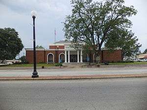 Miller County Courthouse in Colquitt | |
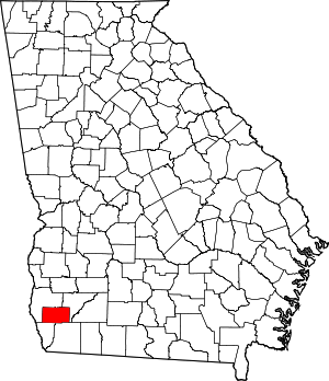 Location within the U.S. state of Georgia | |
 Georgia's location within the U.S. | |
| Coordinates: 31°10′N 84°44′W | |
| Country | |
| State | |
| Founded | 1856 |
| Seat | Colquitt |
| Largest city | Colquitt |
| Area | |
| • Total | 284 sq mi (740 km2) |
| • Land | 282 sq mi (730 km2) |
| • Water | 1.2 sq mi (3 km2) 0.4%% |
| Population | |
| • Estimate (2018) | 5,686 |
| • Density | 22/sq mi (8/km2) |
| Time zone | UTC−5 (Eastern) |
| • Summer (DST) | UTC−4 (EDT) |
| Congressional district | 2nd |
| Website | www |

Geography
According to the U.S. Census Bureau, the county has a total area of 284 square miles (740 km2), of which 282 square miles (730 km2) is land and 1.2 square miles (3.1 km2) (0.4%) is water.[4]
The majority of Miller County, west of a north-to-south line made as a continuation of the eastern Early County border, is located in the Spring Creek sub-basin of the ACF River Basin (Apalachicola-Chattahoochee-Flint River Basin). The county's very northeastern corner is located in the Ichawaynochaway Creek sub-basin of the same ACF River Basin, while the southeastern portion, from just north of State Route 91 going south, is located in the Lower Flint River sub-basin of the same larger ACF River Basin.[5]
Major highways


Adjacent counties
- Baker County (northeast)
- Decatur County (southeast)
- Seminole County (southwest)
- Early County (northwest)
Demographics
| Historical population | |||
|---|---|---|---|
| Census | Pop. | %± | |
| 1860 | 1,791 | — | |
| 1870 | 3,091 | 72.6% | |
| 1880 | 3,720 | 20.3% | |
| 1890 | 4,275 | 14.9% | |
| 1900 | 6,319 | 47.8% | |
| 1910 | 7,986 | 26.4% | |
| 1920 | 9,565 | 19.8% | |
| 1930 | 9,076 | −5.1% | |
| 1940 | 9,998 | 10.2% | |
| 1950 | 9,023 | −9.8% | |
| 1960 | 6,908 | −23.4% | |
| 1970 | 6,397 | −7.4% | |
| 1980 | 7,038 | 10.0% | |
| 1990 | 6,280 | −10.8% | |
| 2000 | 6,383 | 1.6% | |
| 2010 | 6,125 | −4.0% | |
| Est. 2018 | 5,686 | [6] | −7.2% |
| U.S. Decennial Census[7] 1790-1960[8] 1900-1990[9] 1990-2000[10] 2010-2013[1] | |||
2000 census
As of the census[11] of 2000, there were 6,383 people, 2,487 households, and 1,765 families living in the county. The population density was 9/km² (23/mi²). There were 2,770 housing units at an average density of 4/km² (10/mi²). The racial makeup of the county was 70.26% White, 28.90% Black or African American, 0.17% Native American, 0.05% Asian, 0.08% Pacific Islander, 0.20% from other races, and 0.33% from two or more races. 0.69% of the population were Hispanic or Latino of any race.
There were 2,487 households out of which 31.50% had children under the age of 18 living with them, 50.70% were married couples living together, 15.50% had a female householder with no husband present, and 29.00% were non-families. 26.70% of all households were made up of individuals and 13.60% had someone living alone who was 65 years of age or older. The average household size was 2.51 and the average family size was 3.03.
In the county, the population was spread out with 26.30% under the age of 18, 7.00% from 18 to 24, 26.20% from 25 to 44, 23.40% from 45 to 64, and 17.10% who were 65 years of age or older. The median age was 38 years. For every 100 females there were 89.10 males. For every 100 females age 18 and over, there were 83.90 males.
The median income for a household in the county was $27,335, and the median income for a family was $31,866. Males had a median income of $25,995 versus $20,886 for females. The per capita income for the county was $15,435. About 16.90% of families and 21.20% of the population were below the poverty line, including 28.70% of those under age 18 and 21.10% of those age 65 or over.
2010 census
As of the 2010 United States Census, there were 6,125 people, 2,426 households, and 1,674 families living in the county.[12] The population density was 21.7 inhabitants per square mile (8.4/km2). There were 2,791 housing units at an average density of 9.9 per square mile (3.8/km2).[13] The racial makeup of the county was 69.6% white, 28.1% black or African American, 0.5% Asian, 0.2% American Indian, 0.4% from other races, and 1.2% from two or more races. Those of Hispanic or Latino origin made up 1.5% of the population.[12] In terms of ancestry, 14.2% were American, and 5.2% were Irish.[14]
Of the 2,426 households, 32.2% had children under the age of 18 living with them, 49.1% were married couples living together, 15.6% had a female householder with no husband present, 31.0% were non-families, and 27.3% of all households were made up of individuals. The average household size was 2.46 and the average family size was 3.00. The median age was 41.7 years.[12]
The median income for a household in the county was $33,196 and the median income for a family was $40,685. Males had a median income of $31,985 versus $29,110 for females. The per capita income for the county was $19,895. About 18.9% of families and 18.2% of the population were below the poverty line, including 22.3% of those under age 18 and 16.1% of those age 65 or over.[15]
Education

The Miller County School District operates public schools serving residents of the county.
Communities
- Boykin (a census-designated place)
- Colquitt (a city)
Politics
| Year | Republican | Democratic | Third parties |
|---|---|---|---|
| 2016 | 74.3% 1,891 | 24.5% 623 | 1.2% 30 |
| 2012 | 68.5% 1,905 | 30.7% 852 | 0.8% 23 |
| 2008 | 69.3% 1,899 | 29.9% 818 | 0.8% 23 |
| 2004 | 69.4% 1,694 | 30.1% 736 | 0.5% 12 |
| 2000 | 62.7% 1,349 | 36.4% 783 | 0.8% 18 |
| 1996 | 42.4% 847 | 45.5% 909 | 12.0% 240 |
| 1992 | 37.3% 826 | 42.1% 934 | 20.6% 457 |
| 1988 | 68.0% 1,105 | 31.7% 515 | 0.3% 5 |
| 1984 | 71.9% 1,348 | 28.1% 526 | |
| 1980 | 43.8% 900 | 54.9% 1,127 | 1.3% 26 |
| 1976 | 23.7% 476 | 76.3% 1,536 | |
| 1972 | 91.5% 1,269 | 8.5% 118 | |
| 1968 | 10.9% 249 | 7.5% 171 | 81.6% 1,862 |
| 1964 | 85.8% 1,658 | 14.2% 274 | |
| 1960 | 5.3% 62 | 94.7% 1,116 | |
| 1956 | 22.0% 441 | 78.0% 1,563 | |
| 1952 | 12.1% 223 | 87.9% 1,617 | |
| 1948 | 10.9% 94 | 84.0% 723 | 5.1% 44 |
| 1944 | 6.8% 59 | 93.2% 809 | |
| 1940 | 6.1% 50 | 93.9% 775 | |
| 1936 | 5.2% 36 | 94.6% 653 | 0.1% 1 |
| 1932 | 0.0% 0 | 99.0% 392 | 1.0% 4 |
| 1928 | 23.9% 101 | 76.1% 322 | |
| 1924 | 24.6% 45 | 68.9% 126 | 6.6% 12 |
| 1920 | 16.2% 30 | 83.8% 155 | |
| 1916 | 1.4% 7 | 95.5% 464 | 3.1% 15 |
| 1912 | 5.5% 9 | 92.0% 150 | 2.5% 4 |
References
- "State & County QuickFacts". United States Census Bureau. Archived from the original on June 7, 2011. Retrieved June 24, 2014.
- "Find a County". National Association of Counties. Retrieved June 7, 2011.
- Krakow, Kenneth K. (1975). Georgia Place-Names: Their History and Origins (PDF). Macon, GA: Winship Press. p. 148. ISBN 0-915430-00-2.
- "US Gazetteer files: 2010, 2000, and 1990". United States Census Bureau. February 12, 2011. Retrieved April 23, 2011.
- "Georgia Soil and Water Conservation Commission Interactive Mapping Experience". Georgia Soil and Water Conservation Commission. Retrieved November 24, 2015.
- "Population and Housing Unit Estimates". Retrieved July 31, 2019.
- "U.S. Decennial Census". United States Census Bureau. Retrieved June 24, 2014.
- "Historical Census Browser". University of Virginia Library. Retrieved June 24, 2014.
- "Population of Counties by Decennial Census: 1900 to 1990". United States Census Bureau. Retrieved June 24, 2014.
- "Census 2000 PHC-T-4. Ranking Tables for Counties: 1990 and 2000" (PDF). United States Census Bureau. Retrieved June 24, 2014.
- "U.S. Census website". United States Census Bureau. Retrieved May 14, 2011.
- "DP-1 Profile of General Population and Housing Characteristics: 2010 Demographic Profile Data". United States Census Bureau. Archived from the original on February 13, 2020. Retrieved December 30, 2015.
- "Population, Housing Units, Area, and Density: 2010 - County". United States Census Bureau. Archived from the original on February 13, 2020. Retrieved December 30, 2015.
- "DP02 SELECTED SOCIAL CHARACTERISTICS IN THE UNITED STATES – 2006-2010 American Community Survey 5-Year Estimates". United States Census Bureau. Archived from the original on February 13, 2020. Retrieved December 30, 2015.
- "DP03 SELECTED ECONOMIC CHARACTERISTICS – 2006-2010 American Community Survey 5-Year Estimates". United States Census Bureau. Archived from the original on February 13, 2020. Retrieved December 30, 2015.
- Leip, David. "Dave Leip's Atlas of U.S. Presidential Elections". uselectionatlas.org. Retrieved March 22, 2018.
External links
- Miller County Board of Commissioners Official Website
- Miller County Liberal official website of newspaper founded in 1897 by Zula Cook Brown Toole
Places adjacent to Miller County, Georgia | ||||||||||
|---|---|---|---|---|---|---|---|---|---|---|
| ||||||||||
Municipalities and communities of Miller County, Georgia, United States | ||
|---|---|---|
| City | Map of Georgia highlighting Miller County | |
| Unincorporated communities | ||
| Ghost town | ||
| Footnotes | ‡This populated place also has portions in an adjacent county or counties | |

| Authority control |
|
|---|