Lincolnton, Georgia
The city of Lincolnton is the county seat of Lincoln County, Georgia, United States.[5] The population was 1,566 at the 2010 census.[6] It contains numerous houses and historic districts listed on the National Register of Historic Places. Both the city and the county were named for General Benjamin Lincoln, who served in the Continental Army during the American Revolution.[7]
Lincolnton, Georgia | |
|---|---|
 Lincoln County Courthouse | |
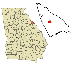 Location in Lincoln County and the state of Georgia | |
| Coordinates: 33°47′40″N 82°28′35″W | |
| Country | United States |
| State | Georgia |
| County | Lincoln |
| Area | |
| • Total | 3.53 sq mi (9.13 km2) |
| • Land | 3.51 sq mi (9.10 km2) |
| • Water | 0.01 sq mi (0.03 km2) |
| Elevation | 469 ft (143 m) |
| Population (2010) | |
| • Total | 1,566 |
| • Estimate (2018)[2] | 1,500 |
| • Density | 426.86/sq mi (164.81/km2) |
| Time zone | UTC-5 (Eastern (EST)) |
| • Summer (DST) | UTC-4 (EDT) |
| ZIP code | 30817 |
| Area code(s) | 706 |
| FIPS code | 13-46552[3] |
| GNIS feature ID | 0328514[4] |
History
Lincolnton was founded in 1798 as seat of the newly formed Lincoln County. It was incorporated as a town in 1817 and as a city in 1953.[8]
Geography
Lincolnton is located in central Lincoln County at 33°47′40″N 82°28′35″W (33.794414, -82.476450).[9] U.S. Route 378 passes through the center of town as Washington Street, leading southwest 17 miles (27 km) to Washington, Georgia, and northeast 14 miles (23 km) to McCormick, South Carolina. Georgia State Route 79 leads northwest 38 miles (61 km) to Elberton, while State Route 43 leads south 24 miles (39 km) to Thomson. Augusta is 39 miles (63 km) to the southeast via State Routes 47 and 104. A historical site, Elijah Clark State Park, is 7 miles (11 km) northeast of Lincolnton at the Savannah River.
According to the United States Census Bureau, Lincolnton has a total area of 3.5 square miles (9.1 km2), of which 0.01 square miles (0.03 km2), or 0.35%, are water.[10] The west side of the city drains to Florence Creek, while the east side drains to Dry Fork Creek, both of which flow to Soap Creek, an arm of the Savannah River within Lake Strom Thurmond (Clarks Hill Lake).
Demographics
| Historical population | |||
|---|---|---|---|
| Census | Pop. | %± | |
| 1810 | 106 | — | |
| 1870 | 92 | — | |
| 1880 | 70 | −23.9% | |
| 1890 | 220 | 214.3% | |
| 1900 | 221 | 0.5% | |
| 1910 | 375 | 69.7% | |
| 1920 | 657 | 75.2% | |
| 1930 | 916 | 39.4% | |
| 1940 | 894 | −2.4% | |
| 1950 | 1,315 | 47.1% | |
| 1960 | 1,450 | 10.3% | |
| 1970 | 1,442 | −0.6% | |
| 1980 | 1,406 | −2.5% | |
| 1990 | 1,476 | 5.0% | |
| 2000 | 1,595 | 8.1% | |
| 2010 | 1,566 | −1.8% | |
| Est. 2018 | 1,500 | [2] | −4.2% |
| U.S. Decennial Census[11] | |||
As of the census[3] of 2000, there were 1,595 people, 657 households, and 428 families residing in the city. The population density was 498.6 people per square mile (192.4/km²). There were 657 housing units at an average density of 205.4 per square mile (79.3/km²). The racial makeup of the city was 56.80% White, 42.19% Black, 0.06% American Indian, 0.38% Asian, 0.13% from other races, and 0.44% from two or more races. Hispanic or Latino of any race were 1.13% of the population.
There were 610 households out of which 32.3% had children under the age of 18 living with them, 43.8% were married couples living together, 22.8% had a female householder with no husband present, and 29.8% were non-families. 27.7% of all households were made up of individuals and 15.9% had someone living alone who was 65 years of age or older. The average household size was 2.50 and the average family size was 3.05.
In the city, the population was spread out with 26.1% under the age of 18, 8.5% from 18 to 24, 28.0% from 25 to 44, 21.4% from 45 to 64, and 16.0% who were 65 years of age or older. The median age was 36 years. For every 100 females, there were 83.1 males. For every 100 females age 18 and over, there were 78.9 males.
The median income for a household in the city was $30,074, and the median income for a family was $34,943. Males had a median income of $28,750 versus $19,375 for females. The per capita income for the city was $15,428. About 15.8% of families and 19.2% of the population were below the poverty line, including 27.1% of those under age 18 and 21.1% of those age 65 or over.
Education
Lincoln County School District
The Lincoln County School District holds pre-school to grade twelve, and consists of an elementary school, a middle school, and a high school.[12] The district has 98 full-time teachers and over 1,450 students.[13]
- Lincoln County Elementary School
- Lincoln County Middle School
- Lincoln County High School
Notable people
- Barney Bussey, former NFL player
- Jeff and Sheri Easter, musicians
- Garrison Hearst, former NFL player
- Little Roy Lewis and The Lewis Family, gospel bluegrass musicians
- Lizzy Long, bluegrass/gospel musician, The Little Roy and Lizzy Show
- Pettis Norman, former NFL player
- Jarius Wynn, Buffalo Bills defensive end
References
- "2018 U.S. Gazetteer Files". United States Census Bureau. Retrieved Feb 12, 2020.
- "Population and Housing Unit Estimates". Retrieved June 4, 2019.
- "U.S. Census website". United States Census Bureau. Retrieved 2008-01-31.
- "US Board on Geographic Names". United States Geological Survey. 2007-10-25. Retrieved 2008-01-31.
- "Find a County". National Association of Counties. Retrieved 2011-06-07.
- "Profile of General Population and Housing Characteristics: 2010 Census Summary File 1 (DP-1), Lincolnton city, Georgia". American FactFinder. U.S. Census Bureau. Archived from the original on February 13, 2020. Retrieved December 16, 2019.
- Gannett, Henry (1905). The Origin of Certain Place Names in the United States. U.S. Government Printing Office. p. 187.
- Hellmann, Paul T. (May 13, 2013). Historical Gazetteer of the United States. Routledge. p. 236. Retrieved 30 November 2013.
- "US Gazetteer files: 2010, 2000, and 1990". United States Census Bureau. 2011-02-12. Retrieved 2011-04-23.
- "U.S. Gazetteer Files: 2019: Places: Georgia". U.S. Census Bureau Geography Division. Retrieved December 16, 2019.
- "Census of Population and Housing". Census.gov. Retrieved June 4, 2015.
- Georgia Board of Education, Retrieved June 23, 2010.
- School Stats, Retrieved June 23, 2010.
External links
| Wikimedia Commons has media related to Lincolnton, Georgia. |
Municipalities and communities of Lincoln County, Georgia, United States | ||
|---|---|---|
| Cities | 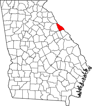 Map of Georgia highlighting Lincoln County | |
| Unincorporated communities | ||
| Ghost town | ||
| Authority control |
|---|