National Register of Historic Places listings in Prince William County, Virginia
This is a list of the National Register of Historic Places listings in Prince William County, Virginia.
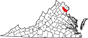
Location of Prince William County in Virginia
This is intended to be a complete list of the properties and districts on the National Register of Historic Places in Prince William County, Virginia, United States. The locations of National Register properties and districts for which the latitude and longitude coordinates are included below, may be seen in a Google map.[1]
There are 44 properties and districts listed on the National Register in the county.
- This National Park Service list is complete through NPS recent listings posted June 19, 2020.[2]
Current listings
| [3] | Name on the Register[4] | Image | Date listed[5] | Location | City or town | Description |
|---|---|---|---|---|---|---|
| 1 | Bel Air | 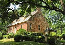 Bel Air |
February 26, 1970 (#70000823) |
General Washington Dr. 38°38′26″N 77°21′47″W |
Woodbridge | Historic plantation manor house built c. 1740 by Charles Ewell. It was the home of Mason Locke Weems (1759 – 1825), the first biographer of George Washington and the creator of the cherry tree story ("I cannot tell a lie, I did it with my little hatchet"). It is one of the few remaining colonial era plantation homes in northern Virginia. |
| 2 | Ben Lomond | 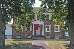 Ben Lomond |
July 30, 1980 (#80004214) |
Northwest of Manassas at 10914 Sudley Manor Dr.[6] 38°47′20″N 77°30′23″W |
Bull Run | |
| 3 | Beverley Mill | .jpg) Beverley Mill |
February 23, 1972 (#72001411) |
Junction of State Route 55 and Beverleys Mill Rd. 38°49′28″N 77°42′38″W |
The Plains | |
| 4 | Brentsville Courthouse and Jail | %2C_Brentsville_(Prince_William_County%2C_Virginia).jpg) Brentsville Courthouse and Jail |
August 18, 1989 (#89001060) |
12239 and 12249 Bristow Rd. 38°41′23″N 77°30′00″W |
Brentsville | |
| 5 | Brentsville Historic District | 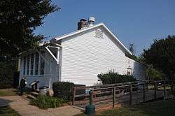 Brentsville Historic District |
December 21, 1990 (#90001829) |
Roughly Bristow Rd. from Old Church Rd. to Isaac Walton Rd. 38°41′23″N 77°30′06″W |
Bristow | |
| 6 | Broad Run-Little Georgetown Rural Historic District | 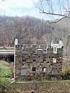 Broad Run-Little Georgetown Rural Historic District |
April 21, 2016 (#16000205) |
Roughly bounded by The Plains, Bull Run Mountains, State Route 55, Bust Head Rd., and Hopewell Rd. 38°49′28″N 77°42′37″W |
Broad Run | Extends into Fauquier County; only a small portion is in Prince William County. |
| 7 | Buckland Historic District | 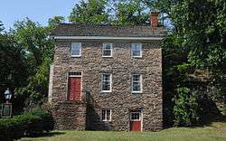 Buckland Historic District |
June 17, 1988 (#88000681) |
7980-8205 Buckland Mill Rd. and 16206, 16208, 16210, and 16211 U.S. Routes 15/29; also parts of Buckland Mill and Cerro Gordo Rds., and U.S. Routes 15/29 38°46′50″N 77°40′29″W |
Buckland | Second set of addresses represents a boundary increase of March 27, 2008 |
| 8 | Cabin Branch Pyrite Mine Historic District | 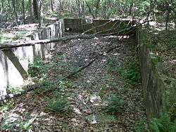 Cabin Branch Pyrite Mine Historic District |
December 12, 2002 (#02001517) |
Prince William Forest Park 38°34′39″N 77°21′13″W |
Triangle | |
| 9 | Camp French | November 12, 2008 (#08001055) |
Fuller Rd. on the Medal of Honor Golf Course[7] 38°31′48″N 77°18′20″W |
Marine Corps Base Quantico | ||
| 10 | Commanding General's Quarters, Quantico Marine Base | 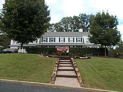 Commanding General's Quarters, Quantico Marine Base |
July 17, 2009 (#09000540) |
100 block of Neville Rd. at Quantico Marine Base 38°31′36″N 77°18′01″W |
Quantico | |
| 11 | Davis-Beard House |  Davis-Beard House |
November 9, 1989 (#89001794) |
10726 Bristow Rd. 38°43′24″N 77°32′13″W |
Bristow | |
| 12 | Effingham | .jpg) Effingham |
November 9, 1989 (#89001793) |
14103 Aden Rd. 38°38′17″N 77°31′20″W |
Aden | |
| 13 | Evergreen | .jpg) Evergreen |
March 27, 2008 (#08000247) |
15900 Berkeley Dr. 38°53′02″N 77°39′42″W |
Haymarket | |
| 14 | Freestone Point Confederate Battery | 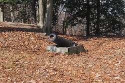 Freestone Point Confederate Battery |
August 18, 1989 (#89001059) |
At the Potomac River off Neabsco Rd. in Leesylvania State Park 38°35′34″N 77°14′57″W |
Woodbridge | |
| 15 | Goodwill Historic District, Chopawamsic RDA Camp 1 | 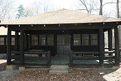 Goodwill Historic District, Chopawamsic RDA Camp 1 |
June 12, 1989 (#89000456) |
Off State Route 234 west of Interstate 95 38°35′49″N 77°21′23″W |
Triangle | |
| 16 | Greenwich Presbyterian Church and Cemetery | 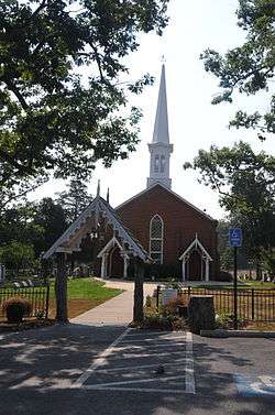 Greenwich Presbyterian Church and Cemetery |
August 18, 1989 (#89001065) |
9510 Burwell Rd. 38°44′56″N 77°38′52″W |
Greenwich | |
| 17 | The Lawn | 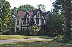 The Lawn |
October 30, 1989 (#89001798) |
15027 State Route 215 38°44′59″N 77°38′43″W |
Nokesville | |
| 18 | Leesylvania Archeological Site (44PW7) | %2C_State_Route_610%2C_Dumfries_vicinity_(Prince_William_County%2C_Virginia).jpg) Leesylvania Archeological Site (44PW7) |
September 13, 1984 (#84003565) |
Leesylvania State Park[8] 38°35′39″N 77°15′21″W |
Dumfries | |
| 19 | Locust Bottom | 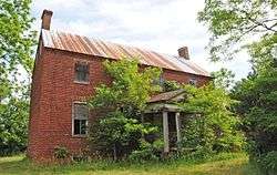 Locust Bottom |
February 11, 1991 (#89001796) |
2520 Logmill Rd. 38°53′38″N 77°38′27″W |
Haymarket | |
| 20 | Manassas National Battlefield Park |  Manassas National Battlefield Park |
October 15, 1966 (#66000039) |
Less than 1 mile (1.6 km) east of Gainesville, approximately 5 miles (8.0 km) northwest of Manassas off State Route 215 38°48′46″N 77°31′18″W |
Gainesville | Extends into Fairfax County |
| 21 | Mawavi Historic District, Chopawamsic RDA Camp 2 |  Mawavi Historic District, Chopawamsic RDA Camp 2 |
June 12, 1989 (#89000457) |
Off Joplin Rd. west of Interstate 95 38°34′53″N 77°24′57″W |
Triangle | |
| 22 | Mitchell's Ford Entrenchments |  Mitchell's Ford Entrenchments |
August 8, 1989 (#89001064) |
Bull Run east of Manassas Park[9] 38°47′45″N 77°27′13″W |
Manassas Park | Near Manassas Park, but in the county |
| 23 | Moor Green | .jpg) Moor Green |
November 17, 1978 (#78003039) |
1.3 miles (2.1 km) north of Brentsville off Lucasville Rd. 38°42′26″N 77°29′47″W |
Brentsville | |
| 24 | Mt. Atlas | .jpg) Mt. Atlas |
October 30, 1989 (#89001799) |
4105 Mt. Atlas Ln. 38°52′07″N 77°39′46″W |
Haymarket | |
| 25 | Nokesville Truss Bridge | 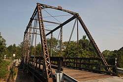 Nokesville Truss Bridge |
April 15, 1978 (#78003040) |
Northeast of Nokesville on Aden Rd. 38°42′25″N 77°33′52″W |
Nokesville | |
| 26 | Occoquan Historic District | 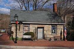 Occoquan Historic District |
October 6, 1983 (#83004255) |
Roughly bounded by the Occoquan River, Center Lane, Washington St., and the western end of Mill St. 38°41′02″N 77°15′41″W |
Occoquan | |
| 27 | Old Hotel | 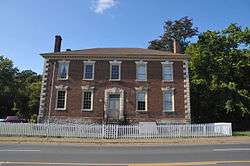 Old Hotel |
November 12, 1969 (#69000273) |
U.S. Route 1 38°34′09″N 77°19′23″W |
Dumfries | |
| 28 | Old Town Hall and School | 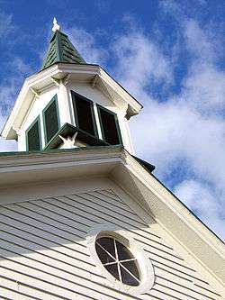 Old Town Hall and School |
March 1, 2011 (#11000063) |
15025 Washington St. 38°48′44″N 77°38′14″W |
Haymarket | Now the Haymarket Museum |
| 29 | Orange and Alexandria Railroad Bridge Piers | .jpg) Orange and Alexandria Railroad Bridge Piers |
August 8, 1989 (#89001061) |
Both sides of Bull Run just east of Manassas Park[10] 38°46′36″N 77°25′19″W |
Manassas Park | Extends into Fairfax County |
| 30 | Orenda/SP-26 Historic District, Chopawamsic RDA Camp 3 |  Orenda/SP-26 Historic District, Chopawamsic RDA Camp 3 |
June 12, 1989 (#89000458) |
Off Joplin Rd. west of Interstate 95 38°33′48″N 77°21′34″W |
Triangle | |
| 31 | Park Gate | .jpg) Park Gate |
April 3, 1987 (#87000580) |
11508 Park Gate Dr. 38°40′45″N 77°32′38″W |
Nokesville | |
| 32 | Pilgrim's Rest | .jpg) Pilgrim's Rest |
October 30, 1989 (#89001797) |
14102 Carriage Ford Rd.; also 2101 Belmont Grove Rd. 38°39′00″N 77°35′34″W |
Nokesville | Belmont Grove represents a boundary increase of January 16, 2004 |
| 33 | Pleasant Historic District, Chopawamsic RDA Camp 4 |  Pleasant Historic District, Chopawamsic RDA Camp 4 |
June 12, 1989 (#89000459) |
Off State Route 234 west of Interstate 95 38°35′25″N 77°21′18″W |
Triangle | |
| 34 | Prince William County Courthouse |  Prince William County Courthouse |
February 11, 2004 (#04000039) |
9248 Lee Ave. 38°45′09″N 77°28′34″W |
Manassas | In a small county enclave surrounded by the city of Manassas |
| 35 | Prince William Forest Park Historic District |  Prince William Forest Park Historic District |
April 3, 2012 (#12000179) |
18100 Park Headquarters Rd. 38°33′36″N 77°20′50″W |
Triangle | |
| 36 | Quantico Marine Corps Base Historic District | 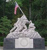 Quantico Marine Corps Base Historic District |
March 26, 2001 (#01000260) |
Marine Corps Base Quantico 38°31′20″N 77°17′24″W |
Quantico | Extends into Stafford County |
| 37 | Rippon Lodge | 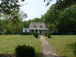 Rippon Lodge |
July 2, 1971 (#71000988) |
0.8 miles (1.3 km) south of the junction of U.S. Route 1 and Rippon Boulevard 38°36′53″N 77°16′42″W |
Woodbridge | |
| 38 | Rising Hill Camp | November 12, 2008 (#08001057) |
West of the junction of Neville Rd. and Draper St.[11] 38°31′25″N 77°17′53″W |
Marine Corps Base Quantico | ||
| 39 | Rockledge | 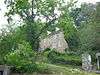 Rockledge |
June 25, 1973 (#73002051) |
Telegraph Rd. 38°41′06″N 77°15′44″W |
Occoquan | |
| 40 | St. Paul's Episcopal Church | 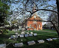 St. Paul's Episcopal Church |
January 20, 1975 (#75002031) |
Off State Route 55 38°48′38″N 77°38′21″W |
Haymarket | |
| 41 | Signal Hill |  Signal Hill |
August 8, 1989 (#89001062) |
9301 Signal View Rd. 38°45′05″N 77°26′18″W |
Manassas | Near Manassas, but east of the city limits. Across from Signal Hill Park. |
| 42 | Thoroughfare Gap Battlefield | 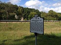 Thoroughfare Gap Battlefield |
November 18, 1999 (#99001374) |
Junction of Interstate 66 and State Route 55 38°49′27″N 77°42′30″W |
Broad Run | Extends into Fauquier County |
| 43 | Weems-Botts House | _001.jpg) Weems-Botts House |
May 12, 1975 (#75002029) |
Southwestern corner of the junction of Duke and Cameron Sts. 38°34′07″N 77°19′45″W |
Dumfries | |
| 44 | White House | 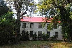 White House |
October 30, 1989 (#89001795) |
12320 Bristow Rd. 38°41′19″N 77°29′58″W |
Brentsville |
See also
| Wikimedia Commons has media related to National Register of Historic Places in Prince William County, Virginia. |
References
- The latitude and longitude information provided in this table was derived originally from the National Register Information System, which has been found to be fairly accurate for about 99% of listings. Some locations in this table may have been corrected to current GPS standards.
- "National Register of Historic Places: Weekly List Actions". National Park Service, United States Department of the Interior. Retrieved on June 19, 2020.
- Numbers represent an ordering by significant words. Various colorings, defined here, differentiate National Historic Landmarks and historic districts from other NRHP buildings, structures, sites or objects.
- "National Register Information System". National Register of Historic Places. National Park Service. April 24, 2008.
- The eight-digit number below each date is the number assigned to each location in the National Register Information System database, which can be viewed by clicking the number.
- "National Register of Historic Places Inventory - Nomination Form (Ben Lomond)" (PDF).
- Haynes, John H., Jr. National Register of Historic Places Inventory/Nomination: Camp French. National Park Service, 2005-07-22, 39.
- Jones, Frances. Virginia Historic Landmarks Commission Survey Form: Fairfax House Site. January 1980, 6.
- Prince William County 2008 Comprehensive Plan High Sensitivity Areas and County Registered Historic Sites, Prince William County, 2009-03-11. Accessed 2017-01-18.
- Myers, L. Daniel. National Register of Historic Places Inventory/Nomination: Orange and Alexandria Railroad Bridge Piers. National Park Service, 1989-05, 11.
- Haynes, John H., Jr. National Register of Historic Places Inventory/Nomination: Rising Hill Camp - 44PW1412. National Park Service, 2005-07-22, 13.

Municipalities and communities of Prince William County, Virginia, United States | ||
|---|---|---|
| Towns | Map of Virginia highlighting Prince William County | |
| CDPs | ||
| Unincorporated communities | ||
| Footnotes | ‡This populated place also has portions in an adjacent county or counties | |
This article is issued from Wikipedia. The text is licensed under Creative Commons - Attribution - Sharealike. Additional terms may apply for the media files.