National Register of Historic Places listings in Nelson County, Virginia
This is a list of the National Register of Historic Places listings in Nelson County, Virginia.

Location of Nelson County in Virginia
This is intended to be a complete list of the properties and districts on the National Register of Historic Places in Nelson County, Virginia, United States. The locations of National Register properties and districts for which the latitude and longitude coordinates are included below, may be seen in an online map.[1]
There are 26 properties and districts listed on the National Register in the county. Another property was once listed but has been removed.
- This National Park Service list is complete through NPS recent listings posted June 19, 2020.[2]
Current listings
| [3] | Name on the Register | Image | Date listed[4] | Location | City or town | Description |
|---|---|---|---|---|---|---|
| 1 | Arrowhead |  Arrowhead |
April 15, 2019 (#100003613) |
115 Arrowhead Ln. 37°38′32″N 78°44′59″W |
Wingina | |
| 2 | Bon Aire | 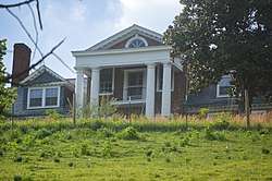 Bon Aire |
July 30, 1980 (#80004203) |
East of Shipman on Cabell Rd. 37°40′53″N 78°43′11″W |
Shipman | |
| 3 | Edgewood |  Edgewood |
May 2, 2006 (#06000354) |
3008 Warminster Dr. 37°41′21″N 78°42′23″W |
Wingina | |
| 4 | Elk Hill | 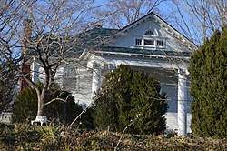 Elk Hill |
March 27, 2007 (#07000220) |
511 State Route 151 37°52′37″N 78°54′38″W |
Nellysford | |
| 5 | Greenwood-Afton Rural Historic District |  Greenwood-Afton Rural Historic District |
May 6, 2011 (#11000258) |
Roughly 5 miles (8.0 km) to 7 miles (11 km) north and south of Interstate 64 38°01′56″N 78°50′24″W |
Greenwood | Boundaries modified on February 8, 2016. Extends into Albemarle and Augusta counties |
| 6 | Haines Chapel and Cemetery | 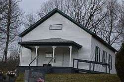 Haines Chapel and Cemetery |
February 10, 2014 (#13001174) |
2600 State Route 56 37°53′19″N 79°09′16″W |
Vesuvius | Extends into Rockbridge County |
| 7 | Lovingston High School | 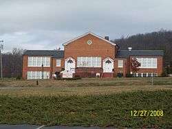 Lovingston High School |
June 23, 2003 (#03000567) |
8445 U.S. Route 29 37°45′01″N 78°52′47″W |
Lovingston | |
| 8 | Lovingston Historic District |  Lovingston Historic District |
November 9, 2005 (#05001232) |
State Route 56 (Front St.) from Orchard Rd. in the north to Sunset Ln. in the south, parallel to U.S. Route 29 37°45′35″N 78°52′15″W |
Lovingston | |
| 9 | Mill Hill |  Mill Hill |
January 14, 2019 (#100003310) |
524 Winery Rd. 37°52′43″N 78°55′36″W |
Roseland | |
| 10 | Mitchell's Brick House Tavern | 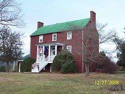 Mitchell's Brick House Tavern |
May 3, 2006 (#06000355) |
5365 U.S. Route 29 37°42′56″N 78°54′44″W |
Arrington | |
| 11 | Montezuma | 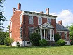 Montezuma |
July 30, 1980 (#80004202) |
Northeast of Norwood on Norwood Rd. 37°38′55″N 78°48′04″W |
Norwood | |
| 12 | Nelson County Courthouse |  Nelson County Courthouse |
May 17, 1973 (#73002041) |
Off U.S. Route 29 37°45′36″N 78°52′09″W |
Lovingston | |
| 13 | Norwood-Wingina Rural Historic District | 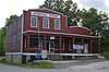 Norwood-Wingina Rural Historic District |
August 20, 2019 (#100004305) |
Arrowhead Ln., Capel Ln., Findlay Gap Rd., James River Rd., Norwood Rd., Pine Hill Ln., Round Top Ln., Taylors Store Loop, Union Hill Rd., Variety Mills Rd. 37°38′54″N 78°47′39″W |
Wingina | |
| 14 | Oak Ridge Railroad Overpass | .jpg) Oak Ridge Railroad Overpass |
April 15, 1978 (#78003033) |
Southwest of Shipman on Wilson Rd. 37°42′12″N 78°52′15″W |
Shipman | |
| 15 | Pharsalia |  Pharsalia |
June 3, 2009 (#09000395) |
2325 Pharsalia Rd. 37°48′05″N 79°01′41″W |
Tyro | |
| 16 | River Bluff | 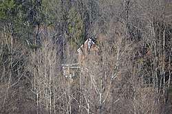 River Bluff |
July 30, 1980 (#80004205) |
South of Wintergreen on State Route 151 37°52′49″N 78°54′38″W |
Wintergreen | |
| 17 | Riverside Farm | 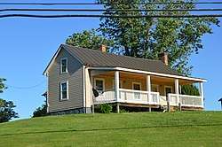 Riverside Farm |
February 2, 2016 (#15001040) |
6840 State Route 151 37°45′09″N 78°59′14″W |
Roseland | |
| 18 | Rock Cliff | 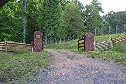 Rock Cliff |
December 22, 2015 (#15000927) |
12615 Norwood Rd. 37°38′29″N 78°44′37″W |
Wingina | |
| 19 | Schuyler Historic District |  Schuyler Historic District |
March 21, 2007 (#07000195) |
Crossroads of Schuyler Rd., Salem Rd., and Rockfish River Rd. 37°47′29″N 78°42′06″W |
Schuyler | |
| 20 | Soldier's Joy | 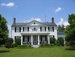 Soldier's Joy |
November 28, 1980 (#80004204) |
Southeast of Shipman on Norwood Rd. 37°38′32″N 78°43′56″W |
Wingina | |
| 21 | South Rockfish Valley Rural Historic District | 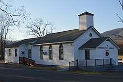 South Rockfish Valley Rural Historic District |
August 15, 2016 (#16000534) |
State Route 151 and feeder roads 37°53′42″N 78°51′58″W |
Nellysford | |
| 22 | Swannanoa |  Swannanoa |
October 1, 1969 (#69000221) |
West of the junction of U.S. Route 250 and the Howardsville Turnpike 38°01′41″N 78°52′08″W |
Waynesboro | Extends into Augusta County |
| 23 | Tyro Mill | 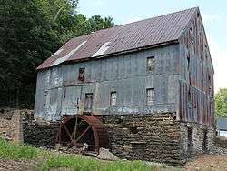 Tyro Mill |
August 30, 2006 (#06000749) |
State Route 56 37°49′06″N 79°00′19″W |
Tyro | |
| 24 | Wintergreen Country Store | 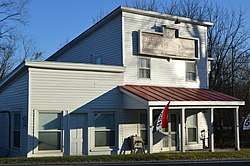 Wintergreen Country Store |
November 9, 2005 (#05001233) |
1368 State Route 151, at the Spruce Creek Ln. junction 37°53′07″N 78°53′56″W |
Nellysford | |
| 25 | Major James Woods House | 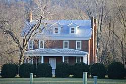 Major James Woods House |
December 24, 2013 (#13000991) |
3042 State Route 151 37°53′27″N 78°52′12″W |
Nellysford | |
| 26 | Woodson's Mill | 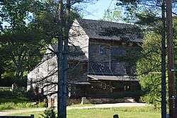 Woodson's Mill |
December 17, 1992 (#92001703) |
Lowesville Rd. east of its junction with Woodson Rd. 37°43′04″N 79°03′41″W |
Lowesville |
Former listing
| [3] | Name on the Register | Image | Date listed | Date removed | Location | City or town | Summary |
|---|---|---|---|---|---|---|---|
| 1 | Midway Mill | April 11, 1973 (#73002042) | March 19, 2001 | On the James River at the end of Midway Mills Ln. |
Midway Mills | Demolished in 1998 |
See also
| Wikimedia Commons has media related to National Register of Historic Places in Nelson County, Virginia. |
References
- The latitude and longitude information provided in this table was derived originally from the National Register Information System, which has been found to be fairly accurate for about 99% of listings. Some locations in this table may have been corrected to current GPS standards.
- "National Register of Historic Places: Weekly List Actions". National Park Service, United States Department of the Interior. Retrieved on June 19, 2020.
- Numbers represent an ordering by significant words. Various colorings, defined here, differentiate National Historic Landmarks and historic districts from other NRHP buildings, structures, sites or objects.
- The eight-digit number below each date is the number assigned to each location in the National Register Information System database, which can be viewed by clicking the number.

Municipalities and communities of Nelson County, Virginia, United States | ||
|---|---|---|
| CDPs | Map of Virginia highlighting Nelson County | |
| Unincorporated communities |
| |
| Footnotes | ‡This populated place also has portions in an adjacent county or counties | |
This article is issued from Wikipedia. The text is licensed under Creative Commons - Attribution - Sharealike. Additional terms may apply for the media files.