National Register of Historic Places listings in Charlottesville, Virginia
This is a list of the National Register of Historic Places listings in Charlottesville, Virginia.
Location of Charlottesville in Virginia
This is intended to be a complete list of the properties and districts on the National Register of Historic Places in the independent city of Charlottesville, Virginia, United States. The locations of National Register properties and districts for which the latitude and longitude coordinates are included below, may be seen in an online map.[1]
There are 65 properties and districts listed on the National Register in the city.
- This National Park Service list is complete through NPS recent listings posted June 19, 2020.[2]
Current listings
| [3] | Name on the Register[4] | Image | Date listed[5] | Location | Description |
|---|---|---|---|---|---|
| 1 | Abell-Gleason House | 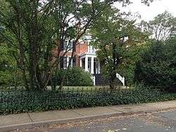 Abell-Gleason House |
February 16, 2001 (#01000151) |
521 N. 1st St. 38°02′07″N 78°28′47″W |
|
| 2 | Albemarle County Courthouse Historic District | 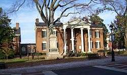 Albemarle County Courthouse Historic District |
June 30, 1972 (#72001503) |
Courthouse Sq. and surrounding properties 38°01′54″N 78°28′39″W |
|
| 3 | Anderson Brothers Building | 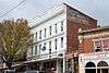 Anderson Brothers Building |
October 21, 1982 (#82001797) |
1417-1427 University Ave. 38°02′04″N 78°30′01″W |
|
| 4 | Armstrong Knitting Factory |  Armstrong Knitting Factory |
October 21, 1982 (#82001798) |
700 Harris St. 38°02′09″N 78°29′03″W |
|
| 5 | Barringer Mansion | .jpg) Barringer Mansion |
October 21, 1982 (#82001799) |
1404 Jefferson Park Ave. 38°01′54″N 78°30′08″W |
|
| 6 | Belmont | 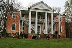 Belmont |
October 21, 1982 (#82001800) |
759 Belmont Ave. 38°01′29″N 78°28′38″W |
|
| 7 | Carter-Gilmer House | 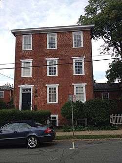 Carter-Gilmer House |
October 21, 1982 (#82001801) |
802 E. Jefferson St. 38°01′51″N 78°28′32″W |
|
| 8 | Charlottesville and Albemarle County Courthouse Historic District | 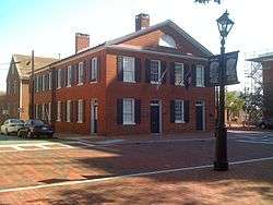 Charlottesville and Albemarle County Courthouse Historic District |
July 28, 1982 (#82004904) |
Roughly bounded by Park, Water, Saxton, and Main Sts. 38°01′53″N 78°28′42″W |
|
| 9 | Charlottesville Coca-Cola Bottling Works | 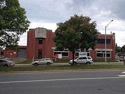 Charlottesville Coca-Cola Bottling Works |
February 27, 2013 (#13000045) |
722 Preston Ave. 38°02′10″N 78°29′17″W |
|
| 10 | Dabney-Thompson House | 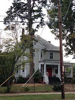 Dabney-Thompson House |
January 10, 1984 (#84003498) |
1602 Gordon Ave. 38°02′23″N 78°29′57″W |
|
| 11 | Daughters of Zion Cemetery | 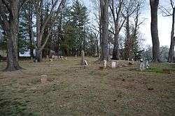 Daughters of Zion Cemetery |
June 24, 2010 (#10000382) |
Corner of 1st and Oak Sts. 38°01′36″N 78°29′04″W |
|
| 12 | Delevan Baptist Church | 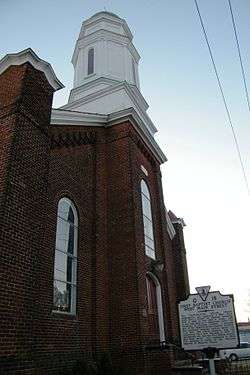 Delevan Baptist Church |
October 21, 1982 (#82001802) |
632 W. Main St. 38°01′52″N 78°29′23″W |
|
| 13 | Enderly |  Enderly |
October 21, 1982 (#82001803) |
603 Watson Ave. 38°02′27″N 78°28′14″W |
|
| 14 | Ficklin-Crawford Cottage | 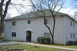 Ficklin-Crawford Cottage |
October 21, 1982 (#82001804) |
1200 Carlton Ave. 38°01′24″N 78°28′18″W |
|
| 15 | Fifeville and Tonsler Neighborhoods Historic District |  Fifeville and Tonsler Neighborhoods Historic District |
June 18, 2009 (#09000452) |
Bounded by Cherry Ave to the south, the railway to the north, 4th St., SW, to the east, and Spring St. to the west 38°01′45″N 78°29′21″W |
|
| 16 | The Foster Site | 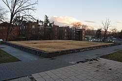 The Foster Site |
May 16, 2016 (#16000259) |
1540 Jefferson Park Ave. 38°01′54″N 78°30′16″W |
|
| 17 | Four Acres | 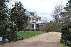 Four Acres |
October 21, 1982 (#82001805) |
1314 Rugby Rd. 38°02′58″N 78°29′25″W |
|
| 18 | Fry's Spring Historic District | 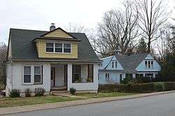 Fry's Spring Historic District |
November 19, 2014 (#14000944) |
Roughly Highland, Jefferson Park, Monte Vista, Stribling, Raymond, Robertson, Sunset, and Todd Aves., and Hill St. 38°01′08″N 78°30′48″W |
|
| 19 | Gardner-Mays Cottage | 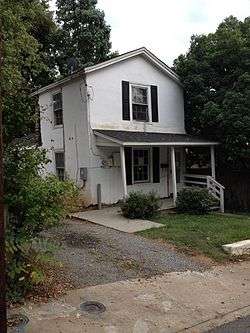 Gardner-Mays Cottage |
October 21, 1982 (#82001806) |
1022 Grove St. 38°01′45″N 78°29′56″W |
|
| 20 | Hard Bargain | 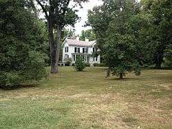 Hard Bargain |
January 10, 1984 (#84003521) |
1105 Park St. 38°02′35″N 78°28′16″W |
|
| 21 | Charles B. Holt House | 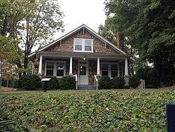 Charles B. Holt House |
April 14, 2006 (#06000320) |
1010 Preston Ave. 38°02′22″N 78°29′31″W |
|
| 22 | Hotel Gleason/Albemarle Hotel, Imperial Cafe | 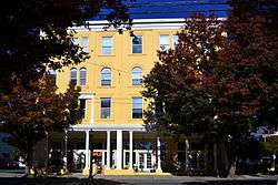 Hotel Gleason/Albemarle Hotel, Imperial Cafe |
August 10, 1983 (#83003267) |
617-619 W. Main St. 38°01′53″N 78°29′20″W |
|
| 23 | House at Pireus | 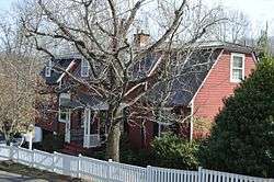 House at Pireus |
August 10, 1983 (#83003268) |
302 Riverside Ave. 38°01′19″N 78°27′21″W |
|
| 24 | Thomas Jonathan Jackson Sculpture | 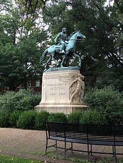 Thomas Jonathan Jackson Sculpture |
May 16, 1997 (#97000446) |
Jackson Park, bounded by High, Jefferson, and 4th Sts., and the Albemarle County Courthouse 38°01′55″N 78°28′41″W |
|
| 25 | Jefferson School, Carver Recreation Center, and School Site | 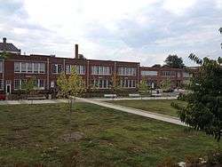 Jefferson School, Carver Recreation Center, and School Site |
February 15, 2006 (#06000050) |
233 4th St., NW. 38°01′56″N 78°29′13″W |
|
| 26 | Martha Jefferson Historic District | 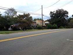 Martha Jefferson Historic District |
February 21, 2008 (#08000066) |
Includes parts of Lexington, Locust, and Grove Aves., and E. High, Maple, Sycamore, Poplar, and Hazel Sts. 38°01′59″N 78°28′13″W |
|
| 27 | King Lumber Company Warehouse | 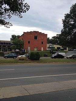 King Lumber Company Warehouse |
August 10, 1983 (#83003269) |
608 Preston Ave. 38°02′06″N 78°29′10″W |
|
| 28 | King-Runkle House | 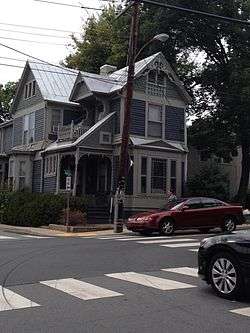 King-Runkle House |
August 10, 1983 (#83003270) |
201 14th St., NW. 38°02′05″N 78°29′58″W |
|
| 29 | Robert Edward Lee Sculpture | 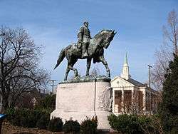 Robert Edward Lee Sculpture |
May 16, 1997 (#97000447) |
Lee Park, bounded by Market, Jefferson, 1st, and 2nd Sts., NE. 38°01′55″N 78°28′50″W |
|
| 30 | Lewis Farm |  Lewis Farm |
October 21, 1982 (#82001807) |
1201 Jefferson St. 38°01′44″N 78°28′08″W |
|
| 31 | Meriwether Lewis and William Clark Sculpture | 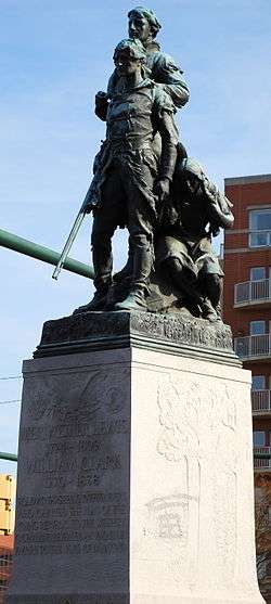 Meriwether Lewis and William Clark Sculpture |
May 16, 1997 (#97000449) |
Junction of Ridge and W. Main Sts., and McIntire Rd. 38°01′50″N 78°29′07″W |
|
| 32 | Locust Grove | 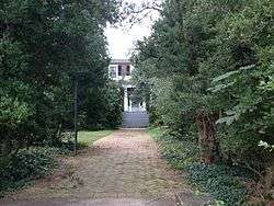 Locust Grove |
October 21, 1982 (#82001808) |
810 Locust Ave. 38°02′08″N 78°28′05″W |
|
| 33 | Marshall-Rucker-Smith House |  Marshall-Rucker-Smith House |
June 25, 1999 (#99000725) |
620 Park St. 38°02′08″N 78°28′30″W |
|
| 34 | McConnell-Neve House | 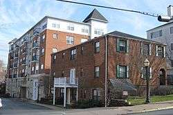 McConnell-Neve House |
August 10, 1983 (#83003271) |
228 14th St., NW. 38°02′09″N 78°29′54″W |
|
| 35 | William H. McGuffey Primary School |  William H. McGuffey Primary School |
December 23, 2009 (#09001156) |
201 2nd St., NW. 38°01′56″N 78°28′56″W |
|
| 36 | Montebello | 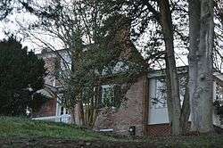 Montebello |
October 23, 2003 (#03001085) |
1700 Stadium Rd. 38°01′50″N 78°30′35″W |
|
| 37 | Morea | 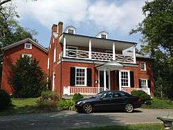 Morea |
May 3, 1984 (#84003522) |
209-211 Sprigg Lane 38°02′22″N 78°30′32″W |
|
| 38 | Mount Zion Baptist Church | 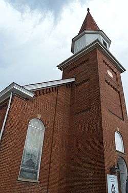 Mount Zion Baptist Church |
October 15, 1992 (#92001388) |
105 Ridge St. 38°01′48″N 78°29′08″W |
|
| 39 | North Belmont Neighborhood Historic District | 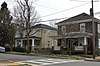 North Belmont Neighborhood Historic District |
May 31, 2018 (#100002528) |
Roughly Avon, Castalia, Church, Douglas, Goodman, Graves, Levy, Little Graves, Meridian, Rialto, and Sonoma Sts., and Belmont, Carlton, Hinton, and Monticello Aves. 38°01′20″N 78°28′36″W |
|
| 40 | Oak Lawn |  Oak Lawn |
May 25, 1973 (#73002204) |
Cherry Ave. and 9th St. 38°01′40″N 78°29′47″W |
|
| 41 | Oakhurst-Gildersleeve Neighborhood Historic District | 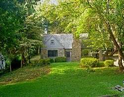 Oakhurst-Gildersleeve Neighborhood Historic District |
March 25, 2009 (#09000161) |
Oakhurst Circle, Gildersleeve Wood, Valley Rd., Valley Circle, and parts of Maywood Lane and Jefferson Park Ave. 38°01′51″N 78°30′24″W |
|
| 42 | Patton Mansion | 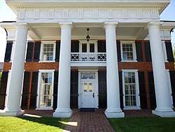 Patton Mansion |
October 21, 1982 (#82001809) |
1018 W. Main St. 38°01′57″N 78°29′44″W |
|
| 43 | Paxton Place | 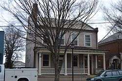 Paxton Place |
October 21, 1982 (#82001810) |
503 W. Main St. 38°01′52″N 78°29′16″W |
|
| 44 | Peyton-Ellington Building | 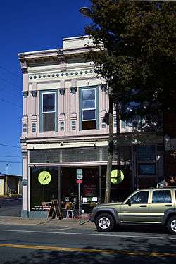 Peyton-Ellington Building |
October 21, 1982 (#82001811) |
711 W. Main St. 38°01′54″N 78°29′25″W |
|
| 45 | Piereus Store | 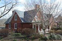 Piereus Store |
August 10, 1983 (#83003272) |
1901 E. Market St. 38°01′18″N 78°27′22″W |
|
| 46 | Pitts-Inge | 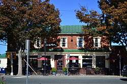 Pitts-Inge |
October 21, 1982 (#82001812) |
331-333 W. Main St. 38°01′50″N 78°29′11″W |
|
| 47 | Preston Court Apartments | 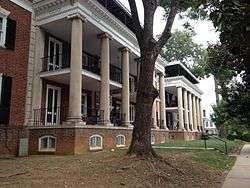 Preston Court Apartments |
October 29, 2007 (#07001134) |
1600 Grady Ave. 38°02′29″N 78°29′56″W |
|
| 48 | Recoleta | 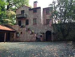 Recoleta |
August 11, 2004 (#04000858) |
120 Rothery Rd. 38°02′23″N 78°30′34″W |
|
| 49 | Ridge Street Historic District | 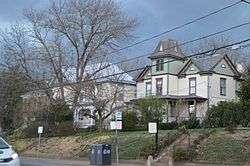 Ridge Street Historic District |
October 21, 1982 (#82001813) |
200-700 Ridge St. 38°01′40″N 78°29′12″W |
|
| 50 | Judge William J. Robertson House |  Judge William J. Robertson House |
December 22, 1999 (#99001601) |
705 Park St. 38°02′13″N 78°28′33″W |
|
| 51 | Rugby Road-University Corner Historic District |  Rugby Road-University Corner Historic District |
February 16, 1984 (#84003523) |
Roughly bounded by University Ave., Wayside Pl., 14th St., and U.S. Route 29 38°02′08″N 78°30′03″W |
Extends into Albemarle County |
| 52 | Stonefield | 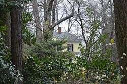 Stonefield |
January 10, 1984 (#84003524) |
1204 Rugby Rd. 38°02′53″N 78°29′31″W |
|
| 53 | Sunnyside | 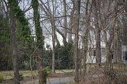 Sunnyside |
October 23, 2003 (#03001086) |
2150 Barracks Rd. 38°03′20″N 78°30′13″W |
|
| 54 | Timberlake-Branham House | 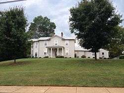 Timberlake-Branham House |
January 10, 1984 (#84003525) |
1512 E. Market St. 38°01′27″N 78°27′46″W |
|
| 55 | Benjamin Tonsler House | 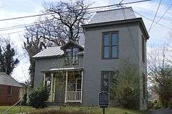 Benjamin Tonsler House |
August 10, 1983 (#83003274) |
327 6th St. 38°01′42″N 78°29′26″W |
|
| 56 | Turner-LaRowe House | 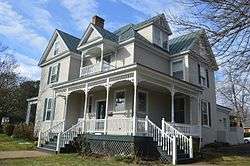 Turner-LaRowe House |
August 10, 1983 (#83003275) |
1 University Court 38°02′16″N 78°29′54″W |
|
| 57 | Robert L. Updike House | 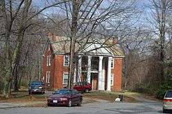 Robert L. Updike House |
August 10, 1983 (#83003276) |
620 Prospect Ave. 38°01′31″N 78°29′39″W |
|
| 58 | John Vowles House | 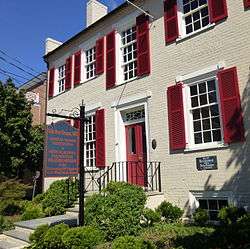 John Vowles House |
November 2, 1989 (#89001928) |
1111-1113 W. Main St. 38°01′59″N 78°29′48″W |
|
| 59 | Wertland Street Historic District | 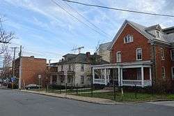 Wertland Street Historic District |
February 14, 1985 (#85000298) |
Wertland St. between 10th and 14th Sts. 38°02′05″N 78°29′47″W |
|
| 60 | West Main Street Historic District | 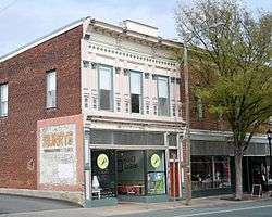 West Main Street Historic District |
September 18, 2017 (#100001641) |
Parts of W. Main St., 6th, 4th, and 8th Sts., NW., and Ridge St. 38°01′52″N 78°29′19″W |
|
| 61 | White Cross-Huntley Hall | 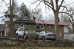 White Cross-Huntley Hall |
October 21, 1982 (#82001814) |
152 Stribling Ave. 38°01′20″N 78°31′12″W |
|
| 62 | Woolen Mills Chapel | 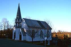 Woolen Mills Chapel |
October 21, 1982 (#82001815) |
1819 E. Market St. 38°01′19″N 78°27′23″W |
|
| 63 | Woolen Mills Village Historic District | 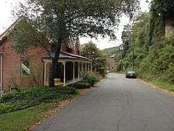 Woolen Mills Village Historic District |
April 12, 2010 (#10000196) |
Parts of Chesapeake, Franklin, Steephill, 18th NE., and E. Market Sts., and Riverside Ave.; and parts of Pireus Row and Marchant and E. Market St. 38°01′23″N 78°27′33″W |
Extends into Albemarle County |
| 64 | Wynhurst | 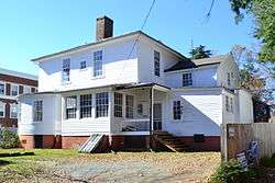 Wynhurst |
October 21, 1982 (#82001816) |
605 Preston Pl. 38°02′30″N 78°29′55″W |
|
| 65 | Young Building | 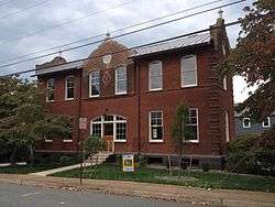 Young Building |
October 21, 1982 (#82001817) |
1102 Carlton Ave. 38°01′17″N 78°28′03″W |
Former listings
| [3] | Name on the Register | Image | Date listed | Date removed | Location | Summary |
|---|---|---|---|---|---|---|
| 1 | Rose Cottage/Peyton House |  Rose Cottage/Peyton House |
August 10, 1983 (#83003273) | February 7, 2017 | 800 Delevan St. 38°01′50″N 78°29′31″W |
See also
| Wikimedia Commons has media related to National Register of Historic Places in Charlottesville, Virginia. |
References
- The latitude and longitude information provided in this table was derived originally from the National Register Information System, which has been found to be fairly accurate for about 99% of listings. Some locations in this table may have been corrected to current GPS standards.
- "National Register of Historic Places: Weekly List Actions". National Park Service, United States Department of the Interior. Retrieved on June 19, 2020.
- Numbers represent an ordering by significant words. Various colorings, defined here, differentiate National Historic Landmarks and historic districts from other NRHP buildings, structures, sites or objects.
- "National Register Information System". National Register of Historic Places. National Park Service. April 24, 2008.
- The eight-digit number below each date is the number assigned to each location in the National Register Information System database, which can be viewed by clicking the number.

This article is issued from Wikipedia. The text is licensed under Creative Commons - Attribution - Sharealike. Additional terms may apply for the media files.