National Register of Historic Places listings in Augusta County, Virginia
This is a list of the National Register of Historic Places listings in Augusta County, Virginia.
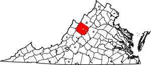
Location of Augusta County in Virginia
This is intended to be a complete list of the properties and districts on the National Register of Historic Places in Augusta County, Virginia, United States. The locations of National Register properties and districts for which the latitude and longitude coordinates are included below, may be seen in an online map.[1]
There are 55 properties and districts listed on the National Register in the county, including 1 National Historic Landmark.
- This National Park Service list is complete through NPS recent listings posted June 19, 2020.[2]
Current listings
| [3] | Name on the Register[4] | Image | Date listed[5] | Location | City or town | Description |
|---|---|---|---|---|---|---|
| 1 | James Alexander House | 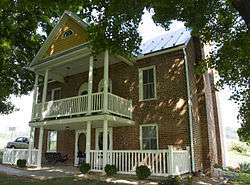 James Alexander House |
September 16, 1982 (#82004543) |
North of Spottswood on Almo Chapel Rd. 37°57′53″N 79°12′12″W |
Spottswood | |
| 2 | Archeological Site No. AU-154 | 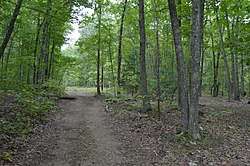 Archeological Site No. AU-154 |
December 13, 1985 (#85003171) |
Paine Run Hollow Rd. at the mouth of Paine Run Hollow[6] 38°11′56″N 78°47′44″W |
Grottoes | |
| 3 | Augusta County Training School | 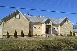 Augusta County Training School |
June 19, 1986 (#86001400) |
Cedar Green Rd. 38°08′49″N 79°07′54″W |
Cedar Green | |
| 4 | Augusta Military Academy | 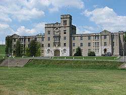 Augusta Military Academy |
February 10, 1983 (#83003258) |
North of Staunton on U.S. Route 11 38°14′16″N 78°58′39″W |
Fort Defiance | |
| 5 | Augusta Stone Church | Augusta Stone Church |
May 9, 1973 (#73001994) |
U.S. Route 11 38°14′18″N 78°58′32″W |
Fort Defiance | |
| 6 | Bare House and Mill |  Bare House and Mill |
November 21, 2002 (#02001364) |
157 Wilda Rd. 38°01′23″N 79°05′42″W |
Stuarts Draft | |
| 7 | Bethel Green | 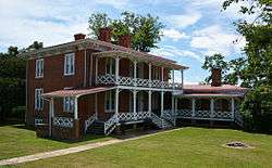 Bethel Green |
August 26, 1982 (#82004539) |
Howardsville Rd. 38°02′32″N 79°10′33″W |
Greenville | |
| 8 | Blackrock Springs Site | 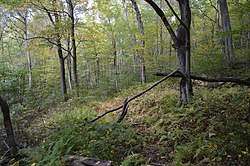 Blackrock Springs Site |
December 13, 1985 (#85003169) |
Source of Paine Run[7] 38°12′30″N 78°45′09″W |
Grottoes | |
| 9 | Chapel Hill |  Chapel Hill |
November 16, 1978 (#78003006) |
East of Mint Spring on White Hill Rd. 38°03′56″N 79°04′17″W |
Mint Spring | |
| 10 | Clover Mount | 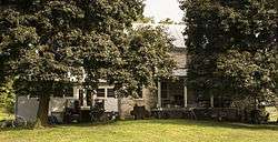 Clover Mount |
September 16, 1982 (#82004540) |
West of Greenville on Pilson Rd. 37°59′59″N 79°12′23″W |
Greenville | |
| 11 | Coiner House | 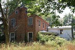 Coiner House |
March 30, 1978 (#78003005) |
Northwest of Crimora off Rockfish Rd. 38°10′00″N 78°51′54″W |
Crimora | |
| 12 | Craigsville School | 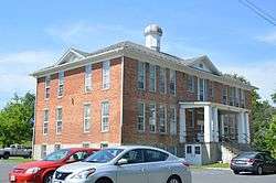 Craigsville School |
February 27, 1985 (#85000383) |
Railroad Ave. 38°04′46″N 79°22′47″W |
Craigsville | |
| 13 | Crimora School | Crimora School |
February 27, 1985 (#85000384) |
New Hope-Crimora Rd. 38°09′18″N 78°51′09″W |
Crimora | |
| 14 | Deerfield School |  Deerfield School |
June 19, 1986 (#86001402) |
Marble Valley Rd. 38°11′41″N 79°24′22″W |
Deerfield | |
| 15 | Estaline Schoolhouse |  Estaline Schoolhouse |
February 27, 1985 (#85000385) |
Estaline Valley Rd. 38°03′46″N 79°21′26″W |
Estaline Valley | |
| 16 | Folly | 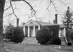 Folly |
October 25, 1973 (#73001995) |
South of Staunton on U.S. Route 11 38°05′26″N 79°05′41″W |
Staunton | |
| 17 | Glebe Burying Ground |  Glebe Burying Ground |
October 1, 1985 (#85002722) |
South of Swoope on Glebe School Rd. 38°06′34″N 79°13′20″W |
Swoope | |
| 18 | Glebe Schoolhouse | 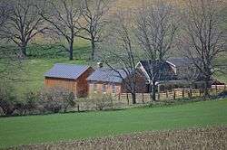 Glebe Schoolhouse |
February 27, 1985 (#85000386) |
Glebe School Rd. 38°06′37″N 79°13′15″W |
Summerdean | |
| 19 | Greenwood-Afton Rural Historic District |  Greenwood-Afton Rural Historic District |
May 6, 2011 (#11000258) |
Roughly 5 miles (8.0 km) to 7 miles (11 km) north and south of Interstate 64 38°01′42″N 78°52′09″W |
Greenwood | Boundaries modified on February 8, 2016. Extends into Albemarle and Nelson counties |
| 20 | Hanger Mill |  Hanger Mill |
November 8, 1991 (#91001596) |
Junction of U.S. Route 250 and Hangers Mill Rd. 38°13′10″N 79°08′09″W |
Churchville | |
| 21 | Harnsberger Octagonal Barn |  Harnsberger Octagonal Barn |
July 8, 1982 (#82004541) |
Snowflake Mill Rd. 38°15′44″N 78°51′50″W |
Grottoes | |
| 22 | Harper House | 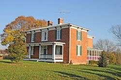 Harper House |
February 1, 2006 (#05001623) |
3029 U.S. Route 340 38°02′25″N 79°01′10″W |
Stuarts Draft | |
| 23 | Intervale |  Intervale |
February 14, 1985 (#85000296) |
Morris Mill Rd. 38°11′52″N 79°11′20″W |
Swoope | |
| 24 | Long Glade Farm | 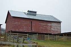 Long Glade Farm |
January 22, 1996 (#95001560) |
Mt. Solon Rd., south of the junction with Old Quarry Rd. 38°16′54″N 79°04′22″W |
Mount Solon | |
| 25 | Maple Front Farm | 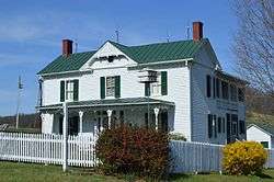 Maple Front Farm |
August 16, 2010 (#10000562) |
439 Cale Spring Rd. 38°03′33″N 79°14′28″W |
Middlebrook | |
| 26 | Middlebrook High School | 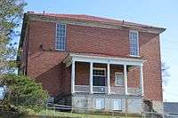 Middlebrook High School |
February 27, 1985 (#85000387) |
Cherry Grove Rd. 38°03′01″N 79°12′45″W |
Middlebrook | |
| 27 | Middlebrook Historic District | _near_Virginia_State_Secondary_Route_670_(Cherry_Grove_Road)_in_Middlebrook%2C_Augusta_County%2C_Virginia.jpg) Middlebrook Historic District |
February 10, 1983 (#83003259) |
Junction of State Route 252 and Mish Barn Rd. 38°03′06″N 79°12′48″W |
Middlebrook | |
| 28 | Middlebrook School | 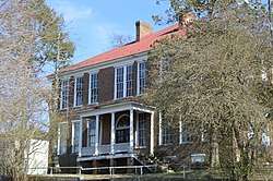 Middlebrook School |
February 27, 1985 (#85000388) |
Cherry Grove Rd. 38°03′02″N 79°12′44″W |
Middlebrook | |
| 29 | A. J. Miller House | 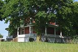 A. J. Miller House |
July 8, 1982 (#82004542) |
Sinking Springs Rd. 38°01′25″N 79°13′56″W |
Middlebrook | |
| 30 | Hannah Miller House | 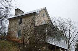 Hannah Miller House |
May 24, 1979 (#79003028) |
North of Mossy Creek off Mossy Creek Rd. 38°21′34″N 79°01′46″W |
Mossy Creek | |
| 31 | Henry Miller House | 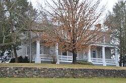 Henry Miller House |
May 23, 1979 (#79003029) |
East of Mossy Creek on State Route 42 38°21′27″N 79°01′40″W |
Mossy Creek | |
| 32 | Henry Mish Barn | 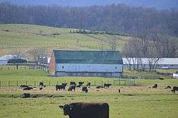 Henry Mish Barn |
February 10, 1983 (#83003260) |
North of Middlebrook on Mish Barn Rd. 38°03′54″N 79°13′30″W |
Middlebrook | |
| 33 | Moffett's Creek Schoolhouse |  Moffett's Creek Schoolhouse |
February 27, 1985 (#85000389) |
Mt. Hermon Rd. 38°00′10″N 79°18′27″W |
Newport | |
| 34 | Mt. Airy | 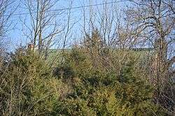 Mt. Airy |
August 22, 2012 (#12000538) |
Access road off Technology Dr., southeast of the Augusta County Government Center 38°11′22″N 79°00′44″W |
Verona | home of American folk artist Grandma Moses |
| 35 | Mt. Meridian Schoolhouse | 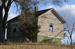 Mt. Meridian Schoolhouse |
February 27, 1985 (#85000390) |
Rockfish Rd. 38°15′35″N 78°51′38″W |
Mt. Meridian | |
| 36 | Mount Pleasant | 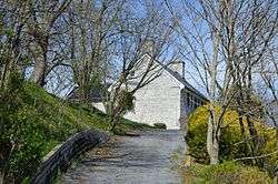 Mount Pleasant |
October 30, 1989 (#89001792) |
879 Middle River Rd. 38°14′36″N 79°05′10″W |
Staunton | |
| 37 | Mt. Sidney Historic District |  Mt. Sidney Historic District |
October 30, 1998 (#98001313) |
U.S. Route 11, Mt. Sidney School Ln., and Pottery Shop Ln. 38°15′22″N 78°57′36″W |
Mt. Sidney | |
| 38 | Mt. Sidney School |  Mt. Sidney School |
February 27, 1985 (#85000391) |
U.S. Route 11 38°15′22″N 78°57′43″W |
Mt. Sidney | |
| 39 | Mt. Torry Furnace |  Mt. Torry Furnace |
February 25, 1974 (#74002231) |
Southwest of Waynesboro on Mt. Torry Rd. in the George Washington National Forest 37°56′43″N 78°57′53″W |
Sherando | |
| 40 | Mt. Zion Schoolhouse |  Mt. Zion Schoolhouse |
February 27, 1985 (#85000392) |
Freemason Run Rd. 38°20′13″N 79°07′36″W |
Mount Solon | |
| 41 | New Hope High School |  New Hope High School |
February 27, 1985 (#85000393) |
Battlefield Rd. 38°12′04″N 78°54′14″W |
New Hope | |
| 42 | North River High School |  North River High School |
February 27, 1985 (#85000394) |
State Route 42 38°18′54″N 79°04′45″W |
Moscow | |
| 43 | Old Providence Stone Church |  Old Providence Stone Church |
December 5, 1972 (#72001383) |
Junction of Spottswood and Old Providence Rds. 37°57′40″N 79°13′35″W |
Spottswood | |
| 44 | Paine Run Rockshelter | 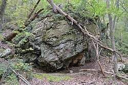 Paine Run Rockshelter |
December 13, 1985 (#85003170) |
Southern side of Paine Run Hollow[8] 38°11′54″N 78°47′34″W |
Grottoes | |
| 45 | Lewis Shuey House |  Lewis Shuey House |
February 10, 1983 (#83003261) |
South of Swoope on Shuey Rd. 38°07′07″N 79°13′38″W |
Swoope | |
| 46 | Skyline Drive Historic District |  Skyline Drive Historic District |
April 28, 1997 (#97000375) |
Shenandoah National Park, from the northern entrance station at Front Royal to the southern entrance station at the Rockfish Gap 38°08′32″N 78°46′48″W |
Luray | |
| 47 | Sugar Loaf Farm | 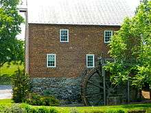 Sugar Loaf Farm |
July 9, 1991 (#91000884) |
West of the junction of Sugar Loaf and Eidson Creek Rds. 38°06′09″N 79°10′25″W |
Staunton | |
| 48 | Swannanoa |  Swannanoa |
October 1, 1969 (#69000221) |
South of the junction of U.S. Route 250 and the Howardsville Turnpike 38°01′41″N 78°52′08″W |
Waynesboro | Extends into Nelson County |
| 49 | Fannie Thompson House | 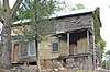 Fannie Thompson House |
May 11, 2018 (#100002438) |
7 Old Staunton Rd. 38°00′20″N 79°09′19″W |
Greenville | |
| 50 | Tinkling Spring Presbyterian Church |  Tinkling Spring Presbyterian Church |
April 11, 1973 (#73001993) |
Tinkling Spring Rd. south of its junction with Lifecore Dr. 38°05′06″N 78°58′57″W |
Fishersville | |
| 51 | Valley Railroad Stone Bridge | .jpg) Valley Railroad Stone Bridge |
November 19, 1974 (#74002105) |
South of Jolivue off U.S. Route 11 38°05′22″N 79°04′40″W |
Jolivue | |
| 52 | Verona School |  Verona School |
February 27, 1985 (#85000395) |
U.S. Route 11 38°12′15″N 79°00′26″W |
Verona | |
| 53 | Walker's Creek Schoolhouse |  Walker's Creek Schoolhouse |
February 27, 1985 (#85000396) |
Walker Creek Rd. 38°00′57″N 79°19′53″W |
Newport | |
| 54 | West View Schoolhouse | 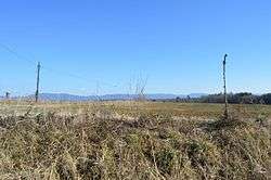 West View Schoolhouse |
February 27, 1985 (#85000397) |
Broad Run and Westview School Rds. 38°16′04″N 78°54′54″W |
Weyers Cave | |
| 55 | Weyers Cave School | 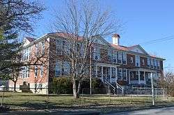 Weyers Cave School |
February 27, 1985 (#85000398) |
State Route 276 38°17′18″N 78°54′32″W |
Weyers Cave |
See also
| Wikimedia Commons has media related to National Register of Historic Places in Augusta County, Virginia. |
References
- The latitude and longitude information provided in this table was derived originally from the National Register Information System, which has been found to be fairly accurate for about 99% of listings. Some locations in this table may have been corrected to current GPS standards.
- "National Register of Historic Places: Weekly List Actions". National Park Service, United States Department of the Interior. Retrieved on June 19, 2020.
- Numbers represent an ordering by significant words. Various colorings, defined here, differentiate National Historic Landmarks and historic districts from other NRHP buildings, structures, sites or objects.
- "National Register Information System". National Register of Historic Places. National Park Service. April 24, 2008.
- The eight-digit number below each date is the number assigned to each location in the National Register Information System database, which can be viewed by clicking the number.
- Foss, Robert Ward. Man and Mountain: An Archaeological Overview of the Shenandoah National Park. Thesis U of Virginia, 1977, 66.
- Loth, Calder. The Virginia Landmarks Register. 4th ed. Charlottesville: U of Virginia P, 1999, 46.
- Foss, Robert Ward. Man and Mountain: An Archaeological Overview of the Shenandoah National Park. Thesis U of Virginia, 1977, 136.

Municipalities and communities of Augusta County, Virginia, United States | ||
|---|---|---|
| Towns | Map of Virginia highlighting Augusta County | |
| CDPs | ||
| Unincorporated communities | ||
| Footnotes | ‡This populated place also has portions in an adjacent county or counties | |
This article is issued from Wikipedia. The text is licensed under Creative Commons - Attribution - Sharealike. Additional terms may apply for the media files.