National Register of Historic Places listings in Campbell County, Virginia
This is a list of the National Register of Historic Places listings in Campbell County, Virginia.

Location of Campbell County in Virginia
This is intended to be a complete list of the properties and districts on the National Register of Historic Places in Campbell County, Virginia, United States. The locations of National Register properties and districts for which the latitude and longitude coordinates are included below, may be seen in a Google map.[1]
There are 15 properties and districts listed on the National Register in the county. Another property was once listed but has been removed.
- This National Park Service list is complete through NPS recent listings posted June 19, 2020.[2]
Current listings
| [3] | Name on the Register[4] | Image | Date listed[5] | Location | City or town | Description |
|---|---|---|---|---|---|---|
| 1 | Altavista Downtown Historic District | .jpg) Altavista Downtown Historic District |
May 28, 2010 (#10000306) |
400 and 500 blocks of 7th St.; 500, 600, and 700 blocks of Broad St.; 500 and 600 blocks of Main St.; and 400 block of Washington St. 37°06′34″N 79°17′27″W |
Altavista | |
| 2 | Avoca |  Avoca |
September 16, 1982 (#82004546) |
North of Altavista on U.S. Route 29 37°07′48″N 79°16′11″W |
Altavista | |
| 3 | Blenheim | 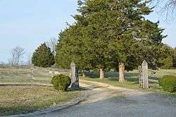 Blenheim |
May 31, 1979 (#79003033) |
2.4 miles (3.9 km) southwest of Spring Mills; also east of Nowlins Mill Rd., 3,500 feet (1,100 m) south of its junction with Red Oak School Rd. 37°13′15″N 78°57′07″W |
Spring Mills | Second set of boundaries represents a boundary increase of May 26, 1994 |
| 4 | Brookneal Historic District | 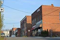 Brookneal Historic District |
June 8, 2011 (#11000348) |
Adams Ferry Rd., Old Main, E. Rush, and Commerce Sts., Lynchburg, Wycliffe, and Cook Aves., and Pick St. 37°02′49″N 78°56′32″W |
Brookneal | |
| 5 | Campbell County Courthouse | 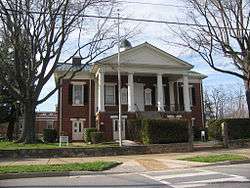 Campbell County Courthouse |
October 29, 1981 (#81000638) |
U.S. Route 501 37°16′37″N 79°06′05″W |
Rustburg | |
| 6 | Campbell County Training School | 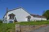 Campbell County Training School |
January 14, 2019 (#100003311) |
1470 State Route 24 37°16′35″N 79°05′23″W |
Rustburg | |
| 7 | Caryswood | 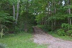 Caryswood |
March 17, 2010 (#10000089) |
8291 State Route 24 37°14′00″N 79°15′10″W |
Evington | |
| 8 | Cat Rock Sluice of the Roanoke Navigation | 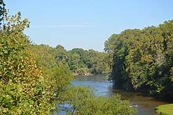 Cat Rock Sluice of the Roanoke Navigation |
March 25, 1980 (#80004177) |
West of Brookneal 37°02′38″N 78°57′39″W |
Brookneal | |
| 9 | Federal Hill |  Federal Hill |
September 9, 1982 (#82004547) |
South of Forest on Turkey Foot Rd. 37°18′38″N 79°17′02″W |
Forest | |
| 10 | Green Hill | .jpg) Green Hill |
November 12, 1969 (#69000226) |
Southwest of Long Island near the junction of Epsons and Pannills Rds. 37°03′43″N 79°04′20″W |
Long Island | |
| 11 | Mount Athos |  Mount Athos |
July 24, 1975 (#75002016) |
2 miles (3.2 km) north of Kelly[6] 37°24′30″N 79°02′49″W |
Kelly | |
| 12 | Norfolk Southern Six Mile Bridge No. 58 | 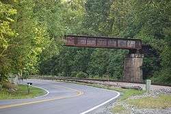 Norfolk Southern Six Mile Bridge No. 58 |
October 12, 1995 (#95001175) |
Over the James River west of the junction of Mt. Athos Rd. and the Norfolk Southern Railroad tracks 37°23′36″N 79°03′38″W |
Lynchburg | |
| 13 | Oak Grove | 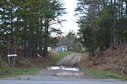 Oak Grove |
May 16, 2002 (#02000516) |
7378 Gladys Rd. 37°07′05″N 79°13′34″W |
Altavista | |
| 14 | Shady Grove | 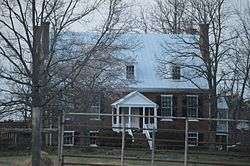 Shady Grove |
August 26, 1982 (#82004548) |
East of Gladys on Mollies Creek Rd. 37°10′24″N 79°02′52″W |
Gladys | |
| 15 | Walnut Hill | 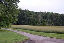 Walnut Hill |
January 27, 2000 (#99001724) |
Lawyers Rd. 37°16′19″N 79°13′11″W |
Lynchburg |
Former listing
| [3] | Name on the Register | Image | Date listed | Date removed | Location | City or town | Summary |
|---|---|---|---|---|---|---|---|
| 1 | Mansion Truss Bridge | 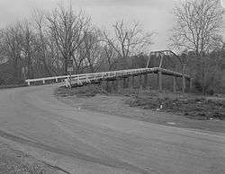 Mansion Truss Bridge |
April 15, 1978 (#78003011) | June 10, 2005 | VA 640 over Staunton River |
Mansion |
See also
| Wikimedia Commons has media related to National Register of Historic Places in Campbell County, Virginia. |
References
- The latitude and longitude information provided in this table was derived originally from the National Register Information System, which has been found to be fairly accurate for about 99% of listings. Some locations in this table may have been corrected to current GPS standards.
- "National Register of Historic Places: Weekly List Actions". National Park Service, United States Department of the Interior. Retrieved on June 19, 2020.
- Numbers represent an ordering by significant words. Various colorings, defined here, differentiate National Historic Landmarks and historic districts from other NRHP buildings, structures, sites or objects.
- "National Register Information System". National Register of Historic Places. National Park Service. April 24, 2008.
- The eight-digit number below each date is the number assigned to each location in the National Register Information System database, which can be viewed by clicking the number.
- Mount Athos, Virginia Department of Historic Resources, 1997.

Municipalities and communities of Campbell County, Virginia, United States | ||
|---|---|---|
| Towns | Map of Virginia highlighting Campbell County | |
| CDPs | ||
| Unincorporated communities | ||
| Footnotes | ‡This populated place also has portions in an adjacent county or counties | |
This article is issued from Wikipedia. The text is licensed under Creative Commons - Attribution - Sharealike. Additional terms may apply for the media files.