National Register of Historic Places listings in Westmoreland County, Virginia
This is a list of the National Register of Historic Places listings in Westmoreland County, Virginia.
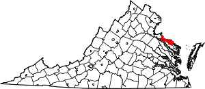
Location of Westmoreland County in Virginia
This is intended to be a complete list of the properties and districts on the National Register of Historic Places in Westmoreland County, Virginia, United States. The locations of National Register properties and districts for which the latitude and longitude coordinates are included below, may be seen in an online map.[1]
There are 23 properties and districts listed on the National Register in the county, including 2 National Historic Landmarks.
- This National Park Service list is complete through NPS recent listings posted June 19, 2020.[2]
Current listings
| [3] | Name on the Register[4] | Image | Date listed[5] | Location | City or town | Description |
|---|---|---|---|---|---|---|
| 1 | Bell House | 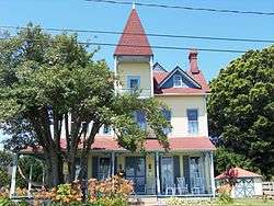 Bell House |
September 21, 1987 (#87000692) |
821 Irving Ave. 38°14′27″N 76°57′27″W |
Colonial Beach | |
| 2 | Blenheim | .jpg) Blenheim |
June 5, 1975 (#75002042) |
North of Wakefield Corner off State Route 204 38°10′51″N 76°56′56″W |
Wakefield Corner | |
| 3 | Bushfield | 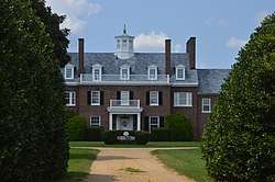 Bushfield |
February 11, 2004 (#04000053) |
367 Club House Loop 38°08′00″N 76°42′50″W |
Mount Holly | |
| 4 | Chantilly | 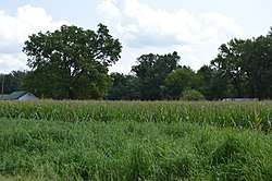 Chantilly |
December 16, 1971 (#71000990) |
Address Restricted |
Montross | |
| 5 | Ingleside | 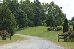 Ingleside |
March 15, 1979 (#79003094) |
South of Oak Grove on Leedstown Rd. 38°09′01″N 77°00′14″W |
Oak Grove | |
| 6 | Armstead T. Johnson High School | 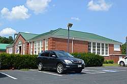 Armstead T. Johnson High School |
August 14, 1998 (#98001071) |
0.2 miles northwest of the junction of State Routes 3 and 202 38°04′39″N 76°46′54″W |
Montross | |
| 7 | Morgan Jones 1677 Pottery Kiln | 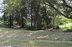 Morgan Jones 1677 Pottery Kiln |
October 16, 1974 (#74002150) |
Southwestern section of the Glebe Harbor subdivision peninsula[6] 38°08′01″N 76°39′13″W |
Hague | |
| 8 | Kinsale Historic District | 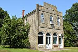 Kinsale Historic District |
July 22, 2005 (#05000476) |
Roughly along Kinsale Rd., Kinsale Bridge Rd., Sigouney Dr., Great House Rd., and Yeocomico Ln. 38°01′46″N 76°34′48″W |
Kinsale | |
| 9 | Kirnan - China Hall | August 5, 2019 (#100004257) |
498 Zion Church Road 38°03′49″N 76°37′19″W |
Hague | ||
| 10 | James Monroe Family Home Site | 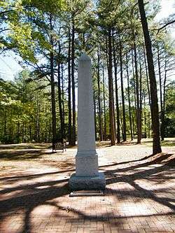 James Monroe Family Home Site |
July 24, 1979 (#79003095) |
4460 State Route 205 38°14′31″N 76°59′25″W |
Colonial Beach | Specific location represents a boundary increase of April 10, 2008; the site was originally listed as "Address Restricted" |
| 11 | Mount Pleasant | 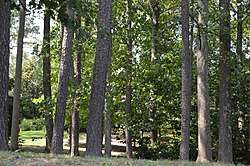 Mount Pleasant |
November 27, 2002 (#02001440) |
317 Coles Point Rd. 38°04′32″N 76°38′41″W |
Hague | |
| 12 | Panorama | 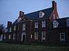 Panorama |
January 31, 2011 (#10001186) |
1006 Panorama Rd. 38°06′09″N 76°50′33″W |
Montross | |
| 13 | Rochester House | 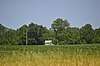 Rochester House |
January 25, 1991 (#90002205) |
Beulah Ln., 1 mile (1.6 km) northeast of Lyells off State Route 3 38°00′05″N 76°43′02″W |
Lyells | |
| 14 | Roxbury | 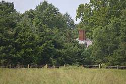 Roxbury |
March 15, 1979 (#79003096) |
1.7 miles (2.7 km) south of Oak Grove 38°09′27″N 77°00′10″W |
Oak Grove | |
| 15 | St. Peter's Episcopal Church | 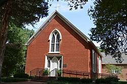 St. Peter's Episcopal Church |
January 16, 2004 (#03001445) |
Junction of State Routes 3 and 205 38°10′56″N 76°59′45″W |
Oak Grove | |
| 16 | SIELE (motor yacht) | .jpg) SIELE (motor yacht) |
November 12, 1998 (#98001310) |
Colonial Beach Yacht Center 38°13′56″N 76°57′56″W |
Colonial Beach | |
| 17 | Spence's Point | .jpg) Spence's Point |
November 11, 1971 (#71000991) |
On Sandy Point Neck, on Spences Point Rd. 38°05′13″N 76°33′46″W |
Westmoreland | |
| 18 | Spring Grove | 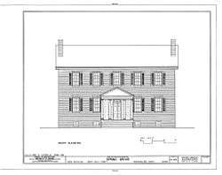 Spring Grove |
October 10, 1985 (#85003130) |
State Route 202 38°05′10″N 76°42′22″W |
Mount Holly | |
| 19 | Stratford Hall | 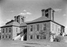 Stratford Hall |
October 15, 1966 (#66000851) |
North of Lerty on State Route 214 38°09′07″N 76°50′22″W |
Lerty | |
| 20 | George Washington Birthplace National Monument |  George Washington Birthplace National Monument |
October 15, 1966 (#66000850) |
East of Fredericksburg off U.S. Route 301 and State Route 3 38°11′09″N 76°55′05″W |
Colonial Beach | |
| 21 | Westmoreland State Park Historic District | .jpg) Westmoreland State Park Historic District |
November 16, 2005 (#05001265) |
1650 State Park Rd. 38°10′12″N 76°51′46″W |
Montross | |
| 22 | Wirtland |  Wirtland |
March 15, 1979 (#79003097) |
South of Oak Grove on Leedstown Rd. 38°09′23″N 77°00′28″W |
Oak Grove | |
| 23 | Yeocomico Church | 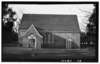 Yeocomico Church |
November 12, 1969 (#69000331) |
Old Yeocomico Rd. 38°03′45″N 76°35′49″W |
Tucker Hill |
See also
| Wikimedia Commons has media related to National Register of Historic Places in Westmoreland County, Virginia. |
References
- The latitude and longitude information provided in this table was derived originally from the National Register Information System, which has been found to be fairly accurate for about 99% of listings. Some locations in this table may have been corrected to current GPS standards.
- "National Register of Historic Places: Weekly List Actions". National Park Service, United States Department of the Interior. Retrieved on June 19, 2020.
- Numbers represent an ordering by significant words. Various colorings, defined here, differentiate National Historic Landmarks and historic districts from other NRHP buildings, structures, sites or objects.
- "National Register Information System". National Register of Historic Places. National Park Service. April 24, 2008.
- The eight-digit number below each date is the number assigned to each location in the National Register Information System database, which can be viewed by clicking the number.
- Kelson, William M., and Edward A. Chappell. "Excavation of a Seventeenth Century Pottery Kiln at Glebe Harbor, Westmoreland County, Virginia". Historical Archaeology 8 (1974), 53-63: 53.

Municipalities and communities of Westmoreland County, Virginia, United States | ||
|---|---|---|
| Towns | Map of Virginia highlighting Westmoreland County | |
| Unincorporated communities |
| |
This article is issued from Wikipedia. The text is licensed under Creative Commons - Attribution - Sharealike. Additional terms may apply for the media files.