Haymarket, Virginia
Haymarket is a town in Prince William County, Virginia, United States. The population was 1,782 at the 2010 census, a total that was estimated to have decreased to 1,715 in 2018.[5]
Haymarket, Virginia | |
|---|---|
Town | |
| Town of Haymarket | |
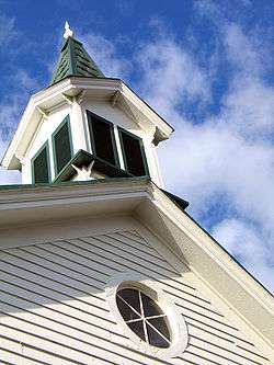 Spire of the Haymarket Museum | |
| Nickname(s): "The Crossroads" | |
 Location in Prince William County and the state of Virginia. | |
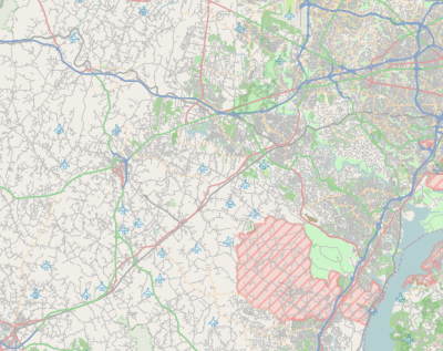 Haymarket Location in Prince William County and the state of Virginia. 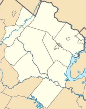 Haymarket Haymarket (Northern Virginia)  Haymarket Haymarket (Virginia)  Haymarket Haymarket (the United States) | |
| Coordinates: 38°48′46″N 77°38′6″W | |
| Country | |
| State | |
| County | |
| Government | |
| • Type | Mayor-council |
| • Mayor | David Leake |
| • Vice Mayor | Susan Edwards |
| Area | |
| • Total | 0.57 sq mi (1.49 km2) |
| • Land | 0.57 sq mi (1.49 km2) |
| • Water | 0.00 sq mi (0.00 km2) |
| Elevation | 367 ft (112 m) |
| Population (2010) | |
| • Total | 1,782 |
| • Estimate (2018)[2] | 1,715 |
| • Density | 2,987.80/sq mi (1,153.01/km2) |
| Time zone | UTC−5 (Eastern (EST)) |
| • Summer (DST) | UTC−4 (EDT) |
| ZIP codes | 20168-20169 |
| Area code(s) | 571, 703 Exchanges: (571: 248,261,284) (703: 753,754) |
| FIPS code | 51-35976[3] |
| GNIS feature ID | 1499541[4] |
| Website | townofhaymarket |
History

This was a hunting ground of the western Iroquois nations, who came from the New York and Pennsylvania area around the Great Lakes. They used hunting paths through here until 1722, when they made a treaty with the colonies of Virginia and New York to move into the Blue Ridge Mountain region.
Due to the hunting paths, this location, and later the town, were given the nickname The Crossroads. The town of Haymarket was developed here after the American Revolutionary War, formally founded in 1799 on the land of William Skinker. The Virginia General Assembly gave Skinker the rights to lay out the town, which he drew to consist of 13 streets and 140 lots. Shortly after, a clerk's office and jail were constructed in 1801, as the town had been selected as the site of what is now a district court. The town owed its early development to business and trade associated with the regular court sessions.
In 1807, the Virginia General Assembly abolished the district court in favor of the circuit court system, which established a court at each county seat. Until 1830 the court house remained the focal point of the town, while serving multiple purposes. In 1830, the court house was converted into and deeded as an Episcopal church; in 1833 it was consecrated as St Paul's.
During the Civil War, on November 4, 1862, Union troops invaded Haymarket and set the entire town on fire. Only four buildings survived: three small houses and St. Paul’s Church. For the remainder of the war, Haymarket remained mostly unpopulated. A skirmish took place on October 19, 1863, involving the Second Brigade, Second Division, Fifth Army Corp, and in June 1863.[6] They both involved Union encounters with the Confederate cavalry. Following General Robert E. Lee's surrender, Haymarket began to recover. Slowly it regained its former prosperity and size.
Post-Reconstruction era to present
Haymarket was incorporated in 1882, the second town in Prince William County to do so. The first mayor elected was Garrett Hulfish and the first councilmen elected were T.A. Smith, Charles Jordan, and William W. Meade. In May 1882 during the council's second meeting, the rudimentary ordinances were drafted and adopted.[7]
On March 19, 1892, two white men, Lee Heflin and Joseph Dye, were lynched in Haymarket. They had been convicted of the murder of a girl and sentenced to death, but the mob thought the legal system moved too slowly. The men were hanged from trees at the edge of woods; then the mob shot into their bodies. The Washington Post said, "mob law...is a dangerous thing to encourage. There is too much of it already throughout the country, and it spreads like a contagion so long as public sentiment tacitly approves it."[8] It was unusual that white men were lynched; in Virginia and the rest of the South, usually black men were victims of lynching.[9][10]
From 1882 to today, most of the buildings of central Haymarket have remained the same. The town borders U.S Route 15. Growth has occurred outside the town. While no schools are located with the town, the larger area has five schools – all part of the Prince William County School System.[11] In the 1970s during the construction of the Interstate System, Haymarket was served by Exit 40 of Interstate 66. Being connected to the interstate, during a period of growth in the Northern Virginia region, has produced a population boom in the area of suburban development.
In 1994 The Walt Disney Company bought extensive amounts of land in Haymarket for a proposed Disney's America theme park.[12] Local resistance to the resort, because of perceived adverse effects on the Manassas Battlefield, resulted in defeat of the park.[13]
William B. Snyder, a local business man, convinced Disney to sell the property to him.[14] Snyder, in turn, sold off most of the land to developers, except for the 405 acres (1.64 km2) donated to the National Capital Area Council of Cub Scouts. It used this land to develop Camp Snyder.[15]
In addition to St. Paul's Church, Evergreen, Locust Bottom, Mt. Atlas, and Old Town Hall and School are listed on the National Register of Historic Places.[16][17]
Geography
Haymarket is located at 38°48′46″N 77°38′6″W (38.812670, −77.635084).[18]
According to the United States Census Bureau, the town has a total area of 0.5 square miles (1.3 km2), all of it land.
The greater town of Haymarket (ZIP code 20169) has a total area of 32.2 square miles (83.4 km2), with 0.2 square miles (0.5 km2) of water.[19]
Demographics
| Historical population | |||
|---|---|---|---|
| Census | Pop. | %± | |
| 1880 | 107 | — | |
| 1910 | 162 | — | |
| 1920 | 133 | −17.9% | |
| 1930 | 167 | 25.6% | |
| 1940 | 156 | −6.6% | |
| 1950 | 213 | 36.5% | |
| 1960 | 257 | 20.7% | |
| 1970 | 288 | 12.1% | |
| 1980 | 230 | −20.1% | |
| 1990 | 483 | 110.0% | |
| 2000 | 879 | 82.0% | |
| 2010 | 1,782 | 102.7% | |
| Est. 2018 | 1,715 | [2] | −3.8% |
| U.S. Decennial Census[20] | |||
As of the census[3] of 2000, there were 879 people, 321 households, and 234 families residing in the town. The population density was 1,725.2 people per square mile (665.5/km2). There were 337 housing units at an average density of 661.4 per square mile (255.1/km2). The racial makeup of the town was 92.04% White, 5.35% African American, 0.80% Asian, 0.68% from other races, and 1.14% from two or more races. Hispanic or Latino of any race were 2.73% of the population.
There were 321 households out of which 43.0% had children under the age of 18 living with them, 63.9% were married couples living together, 7.8% had a female householder with no husband present, and 26.8% were non-families. 19.9% of all households were made up of individuals and 2.2% had someone living alone who was 65 years of age or older. The average household size was 2.74 and the average family size was 3.21. In the town, the population was spread out with 30.1% under the age of 18, 5.9% from 18 to 24, 42.3% from 25 to 44, 18.0% from 45 to 64, and 3.6% who were 65 years of age or older. The median age was 32 years. For every 100 females, there were 110.8 males. For every 100 females age 18 and over, there were 106.0 males.
The median income for a household in the town was $70,833, and the median income for a family was $76,197. Males had a median income of $51,576 versus $32,917 for females. The per capita income for the town was $26,503. About 1.7% of families and 4.3% of the population were below the poverty line, including 5.1% of those under age 18 and 6.1% of those age 65 or over.
Education
- Battlefield High School
- Haymarket Elementary School opened on September 2, 2014 after an August 19, 2014 ribbon cutting ceremony.[21]
- Mountain View Elementary opened in September 1995.[22]
Police department
The town of Haymarket is patrolled by the Haymarket Police Department along with the Prince William County Police department and Virginia State Police. Police Chief James E. Roop resigned in 2015 amid a scandal and state investigation into the Haymarket Police Department.[23]
_in_Haymarket%2C_Prince_William_County%2C_Virginia.jpg)
Transportation
Interstate 66 is the primary highway serving Haymarket. It extends westward to Interstate 81 near Front Royal, and eastward to Washington, D.C., with connections to Interstate 95 via Interstate 495. North-south travel is provided via U.S. Route 15, which skims the northwest side of town. US 15 extends north to Leesburg and south to Warrenton. Virginia State Route 55 also passes through Haymarket, serving as a local service road for I-66 and acting as Main Street within Haymarket.
Holland in Haymarket
The largest pick-your-own-spring-flower festival in the United States is located just two miles from downtown Haymarket. Late March/early April marks the start of the 3-week festival at Burnside Farms. Close to 500,000 bulbs are planted for one of the most spectacular picking fields in the country.
See also
References
- "2018 U.S. Gazetteer Files". United States Census Bureau. Retrieved Feb 16, 2020.
- "Population and Housing Unit Estimates". Retrieved June 4, 2019.
- "U.S. Census website". United States Census Bureau. Retrieved January 31, 2008.
- "US Board on Geographic Names". United States Geological Survey. October 25, 2007. Retrieved January 31, 2008.
- "American FactFinder - Results". factfinder2.census.gov. Archived from the original on February 12, 2020. Retrieved February 11, 2016.
- Scharf, John Thomas (2003). History of Western Maryland: Being a History of Frederick, Montgomery, Carroll, Washington, Allegany, and Garrett Counties from the Earliest Period to the Present Day, Including Biographical Sketches of Their Representative Men. Genealogical Publishing Com. ISBN 978-0-8063-4565-9.:312
- Historical Information, Town of Haymarket, retrieved October 30, 2013.
- "Swifter than the Law," Washington Post, March 19, 1892, p.1
- W. Fitzhugh Brundage, Lynching in the New South: Georgia and Virginia (Chicago: University of Illinois Press, 1993), 87-92
- "Mob Carries Out Death Sentence", History Engine, University of Richmond, 2008-2015
- Prince William County Schools retrieved October 30, 2013.
- Wines, Michael (1993-11-12). "A Disneyland of History Next to the Real Thing". The New York Times. ISSN 0362-4331. Retrieved 2016-05-08.
- Powell, Elizabeth A.; Stover, Sarah (2010-07-26). The Third Battle of Bull Run: The Disney's America Theme Park (A). Charlottesville. pp. 1–19. ProQuest 872767379.
- The Disney Drawing Board – Disney’s America retrieved October 30, 2013.
- Stewart, Nikita (2006-04-05). "$17 Million Camp Pledges Cub Scout Nirvana in Va.: [FINAL Edition]". The Washington Post. Washington, D.C., United States. pp. –01. ISSN 0190-8286. ProQuest 410008043.
- "National Register Information System". National Register of Historic Places. National Park Service. July 9, 2010.
- "National Register of Historic Places Listings". Weekly List of Actions Taken on Properties: 2/28/11 through 3/04/11. National Park Service. March 11, 2011.
- "US Gazetteer files: 2010, 2000, and 1990". United States Census Bureau. February 12, 2011. Retrieved April 23, 2011.
- US Census Bureau, retrieved October 30, 2013.
- "Census of Population and Housing". Census.gov. Retrieved June 4, 2015.
- "Haymarket Elementary School - Start Page". haymarketes.schools.pwcs.edu. Retrieved February 11, 2016.
- https://mountainviewes.pwcs.edu
- Jackman, Tom (23 January 2014). "Haymarket police chief suspended (again), state police now investigating". Retrieved 28 September 2017.
External links
| Wikimedia Commons has media related to Haymarket, Virginia. |
| |||||
| Administration |
|  | |||
| Organizations | |||||
| Landmarks |
| ||||
| Transportation |
| ||||
| Culture |
| ||||
| Education | |||||
Municipalities and communities of Prince William County, Virginia, United States | ||
|---|---|---|
| Towns | 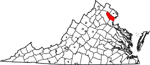 Map of Virginia highlighting Prince William County | |
| CDPs | ||
| Unincorporated communities | ||
| Footnotes | ‡This populated place also has portions in an adjacent county or counties | |