National Register of Historic Places listings in Alexandria, Virginia
This is a list of the National Register of Historic Places listings in Alexandria, Virginia.
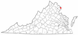
Location of Alexandria in Virginia
This is intended to be a complete list of the properties and districts on the National Register of Historic Places in the independent city of Alexandria, Virginia, United States. The locations of National Register properties and districts for which the latitude and longitude coordinates are included below, may be seen in an online map.[1]
There are 49 properties and districts listed on the National Register in the city, including 6 National Historic Landmarks.
- This National Park Service list is complete through NPS recent listings posted June 19, 2020.[2]
Current listings
| [3] | Name on the Register[4] | Image | Date listed[5] | Location | Description |
|---|---|---|---|---|---|
| 1 | Alexandria Canal Tide Lock | 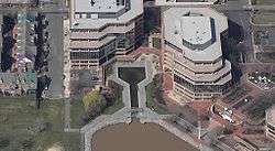 Alexandria Canal Tide Lock |
January 15, 1980 (#80004305) |
1 Canal Center Plaza[6] 38°48′50″N 77°02′19″W |
|
| 2 | Alexandria City Hall | 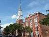 Alexandria City Hall |
March 8, 1984 (#84003491) |
301 King St. 38°48′20″N 77°02′35″W |
|
| 3 | Alexandria Historic District |  Alexandria Historic District |
November 13, 1966 (#66000928) |
Roughly bounded by Interstate 495, Patrick St., 2nd St., and the Potomac River 38°48′14″N 77°02′50″W |
|
| 4 | Alexandria National Cemetery | 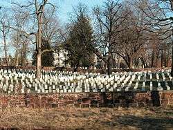 Alexandria National Cemetery |
March 2, 1995 (#95000106) |
1450 Wilkes St. 38°48′07″N 77°03′30″W |
|
| 5 | Alexandria Union Station | 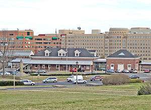 Alexandria Union Station |
February 27, 2013 (#13000044) |
110 Callahan Dr. 38°48′23″N 77°03′44″W |
|
| 6 | Alfred Street Baptist Church | 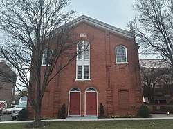 Alfred Street Baptist Church |
January 16, 2004 (#03001423) |
313 S. Alfred St. 38°48′10″N 77°03′00″W |
|
| 7 | Appomattox Statue | 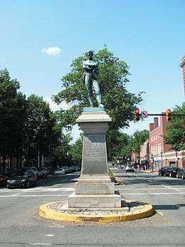 Appomattox Statue |
June 12, 2017 (#100001066) |
Junction of Prince and Washington Sts. 38°48′14″N 77°02′50″W |
|
| 8 | Bank of Alexandria | 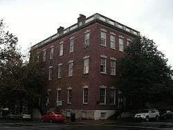 Bank of Alexandria |
June 4, 1973 (#73002202) |
133 N. Fairfax St. 38°48′20″N 77°02′32″W |
|
| 9 | Bayne-Fowle House | 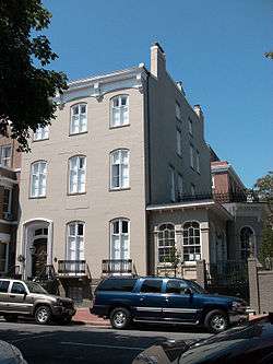 Bayne-Fowle House |
November 6, 1986 (#86003136) |
811 Prince St. 38°48′16″N 77°02′56″W |
|
| 10 | Beulah Baptist Church |  Beulah Baptist Church |
January 16, 2004 (#03001424) |
320 S. Washington St. 38°48′07″N 77°02′50″W |
|
| 11 | Bruin's Slave Jail | 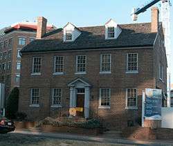 Bruin's Slave Jail |
August 14, 2000 (#00000890) |
1707 Duke St. 38°48′16″N 77°03′35″W |
|
| 12 | Carlyle House | 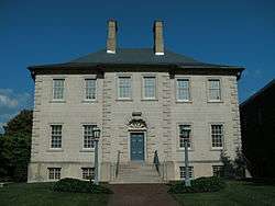 Carlyle House |
November 12, 1969 (#69000333) |
121 N. Fairfax St. 38°48′19″N 77°02′31″W |
|
| 13 | Christ Church | .JPG) Christ Church |
May 10, 1970 (#70000899) |
Southeast corner of Cameron and Columbus Sts. 38°48′23″N 77°02′51″W |
|
| 14 | Contrabands and Freedmen Cemetery | .jpg) Contrabands and Freedmen Cemetery |
August 15, 2012 (#12000516) |
1001 S. Washington St. 38°47′40″N 77°02′59″W |
|
| 15 | Davis Chapel | 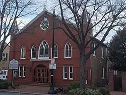 Davis Chapel |
January 16, 2004 (#03001428) |
606-A S. Washington St. 38°47′57″N 77°02′53″W |
|
| 16 | Fairfax-Moore House | 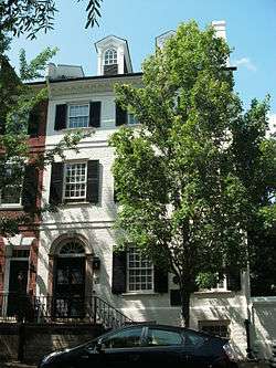 Fairfax-Moore House |
January 17, 1991 (#90002113) |
207 Prince St. 38°48′12″N 77°02′31″W |
|
| 17 | President Gerald R. Ford, Jr. House |  President Gerald R. Ford, Jr. House |
December 17, 1985 (#85003048) |
514 Crown View Dr. 38°48′47″N 77°04′47″W |
|
| 18 | Fort Ward | .JPG) Fort Ward |
August 26, 1982 (#82004538) |
4301 W. Braddock Rd. 38°49′50″N 77°06′08″W |
|
| 19 | Franklin and Armfield Office | 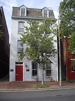 Franklin and Armfield Office |
June 2, 1978 (#78003146) |
1315 Duke St. 38°48′14″N 77°03′16″W |
|
| 20 | Gadsby's Tavern | 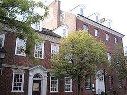 Gadsby's Tavern |
October 15, 1966 (#66000913) |
128 N. Royal St. 38°48′20″N 77°02′37″W |
|
| 21 | Charles M. Goodman House |  Charles M. Goodman House |
May 28, 2013 (#13000334) |
510 N. Quaker Ln. 38°48′51″N 77°05′25″W |
|
| 22 | Moses Hepburn Rowhouses | 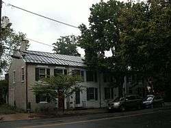 Moses Hepburn Rowhouses |
January 16, 2004 (#03001426) |
206-212 N. Pitt St. 38°48′23″N 77°02′41″W |
|
| 23 | Dr. Albert Johnson House |  Dr. Albert Johnson House |
January 16, 2004 (#03001422) |
814 Duke St. 38°48′11″N 77°02′57″W |
|
| 24 | Jones Point Lighthouse and District of Columbia South Cornerstone |  Jones Point Lighthouse and District of Columbia South Cornerstone |
May 19, 1980 (#80000352) |
Jones Point Park 38°47′26″N 77°02′26″W |
|
| 25 | Robert E. Lee Boyhood Home |  Robert E. Lee Boyhood Home |
June 5, 1986 (#86001228) |
607 Oronoco St. 38°48′35″N 77°02′43″W |
|
| 26 | Lee-Fendall House |  Lee-Fendall House |
June 22, 1979 (#79003277) |
614 Oronoco St. 38°48′34″N 77°02′45″W |
|
| 27 | Lloyd House | .jpg) Lloyd House |
July 12, 1976 (#76002222) |
220 N. Washington St. 38°48′26″N 77°02′48″W |
|
| 28 | The Lyceum | .jpg) The Lyceum |
May 27, 1969 (#69000334) |
201 S. Washington St. 38°48′14″N 77°02′51″W |
|
| 29 | Mount Vernon Memorial Highway | 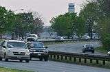 Mount Vernon Memorial Highway |
May 18, 1981 (#81000079) |
Washington St. and George Washington Memorial Parkway 38°48′25″N 77°03′00″W |
Extends into Arlington and Fairfax counties |
| 30 | Oakland Baptist Cemetery | 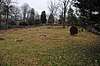 Oakland Baptist Cemetery |
September 4, 2018 (#100002883) |
4195 W. Braddock Rd. 38°49′48″N 77°06′02″W |
African-American cemetery associated with Fort Ward. |
| 31 | Odd Fellows Hall |  Odd Fellows Hall |
January 16, 2004 (#03001427) |
411 S. Columbus St. 38°48′06″N 77°02′57″W |
|
| 32 | Old Dominion Bank Building | 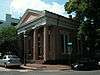 Old Dominion Bank Building |
March 20, 1980 (#80004307) |
201 Prince St. 38°48′12″N 77°02′31″W |
|
| 33 | Orange and Alexandria Railroad Hooff's Run Bridge | 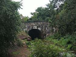 Orange and Alexandria Railroad Hooff's Run Bridge |
August 7, 2003 (#03000740) |
Jamieson Ave. at Hooff's Run 38°48′11″N 77°03′30″W |
|
| 34 | Old Presbyterian Meeting House | 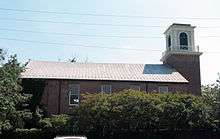 Old Presbyterian Meeting House |
February 16, 2001 (#01000143) |
321 S. Fairfax St. 38°48′06″N 77°02′36″W |
|
| 35 | Parkfairfax Historic District | 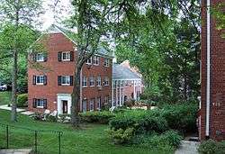 Parkfairfax Historic District |
February 22, 1999 (#99000146) |
Bounded by Quaker Ln., Interstate 395, Beverley Dr., Wellington Rd., Gunston Rd., Virginialley Dr., Glebe Rd. and Four-mile Run 38°50′12″N 77°04′48″W |
|
| 36 | Protestant Episcopal Theological Seminary |  Protestant Episcopal Theological Seminary |
November 17, 1980 (#80004166) |
3737 Seminary Rd. 38°49′14″N 77°05′31″W |
|
| 37 | Rosemont Historic District | _02.JPG) Rosemont Historic District |
September 24, 1992 (#92001275) |
Roughly bounded by Commonwealth Ave., W. Walnut St., Russell Rd., Rucker Pl., and King St. 38°48′39″N 77°03′38″W |
|
| 38 | St. Paul's Episcopal Church | 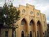 St. Paul's Episcopal Church |
May 9, 1985 (#85000987) |
228 S. Pitt St. 38°48′11″N 77°02′41″W |
|
| 39 | George Lewis Seaton House | 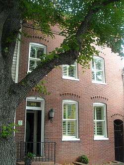 George Lewis Seaton House |
January 16, 2004 (#03001425) |
404 S. Royal St. 38°48′03″N 77°02′39″W |
|
| 40 | Southwest No. 1 Boundary Marker of the Original District of Columbia | _SW_1.jpg) Southwest No. 1 Boundary Marker of the Original District of Columbia |
February 1, 1991 (#91000006) |
1220 Wilkes St. 38°48′05″N 77°03′16″W |
|
| 41 | Southwest No. 2 Boundary Marker of the Original District of Columbia | 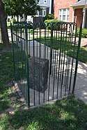 Southwest No. 2 Boundary Marker of the Original District of Columbia |
February 1, 1991 (#91000007) |
7 Russell Rd., on its eastern side, north of the junction with King St. 38°48′28″N 77°03′46″W |
|
| 42 | Southwest No. 3 Boundary Marker of the Original District of Columbia | _SW_3.jpg) Southwest No. 3 Boundary Marker of the Original District of Columbia |
February 1, 1991 (#91000008) |
2952 King St. 38°49′14″N 77°04′46″W |
|
| 43 | Southwest No. 4 Boundary Marker of the Original District of Columbia | _SW_4.jpg) Southwest No. 4 Boundary Marker of the Original District of Columbia |
February 1, 1991 (#91000009) |
King St. north of the junction with Wakefield St. 38°49′54″N 77°05′35″W |
Extends into Arlington County |
| 44 | Southwest No. 5 Boundary Marker of the Original District of Columbia | _SW_5.jpg) Southwest No. 5 Boundary Marker of the Original District of Columbia |
February 1, 1991 (#91000010) |
Northeast of the junction of King St. and Walter Reed Dr. 38°50′31″N 77°06′24″W |
Extends into Arlington County |
| 45 | Stabler-Leadbeater Apothecary Shop | .jpg) Stabler-Leadbeater Apothecary Shop |
November 24, 1982 (#82001796) |
105-107 S. Fairfax 38°48′16″N 77°02′34″W |
|
| 46 | Swann-Daingerfield House | 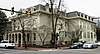 Swann-Daingerfield House |
May 23, 2019 (#100003979) |
712 Prince St. 38°48′14″N 77°02′53″W |
|
| 47 | Town of Potomac | 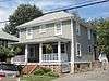 Town of Potomac |
September 10, 1992 (#92001186) |
Roughly bounded by Commonwealth Ave., U.S. Route 1, E. Bellefonte Ave., and Ashby Ave. 38°49′29″N 77°03′26″W |
|
| 48 | Uptown-Parker-Gray Historic District | 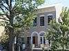 Uptown-Parker-Gray Historic District |
January 12, 2010 (#09001232) |
Roughly Cameron St. north to 1st St. and N. Columbus St.; west to the following streets forming west line: Buchanan St. and N. West St. 38°48′33″N 77°02′57″W |
|
| 49 | George Washington Masonic National Memorial | 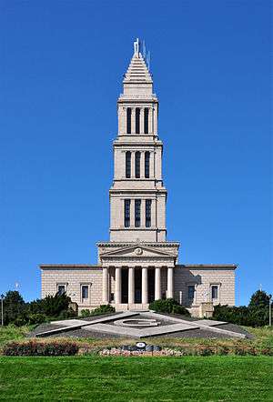 George Washington Masonic National Memorial |
July 21, 2015 (#15000622) |
101 Callahan St. 38°48′27″N 77°03′58″W |
Neoclassical tower is one of the largest private memorials to Washington, reflecting the Masonic involvement of many of the Founding Fathers |
See also
| Wikimedia Commons has media related to National Register of Historic Places in Alexandria, Virginia. |
References
- The latitude and longitude information provided in this table was derived originally from the National Register Information System, which has been found to be fairly accurate for about 99% of listings. Some locations in this table may have been corrected to current GPS standards.
- "National Register of Historic Places: Weekly List Actions". National Park Service, United States Department of the Interior. Retrieved on June 19, 2020.
- Numbers represent an ordering by significant words. Various colorings, defined here, differentiate National Historic Landmarks and historic districts from other NRHP buildings, structures, sites or objects.
- "National Register Information System". National Register of Historic Places. National Park Service. April 24, 2008.
- The eight-digit number below each date is the number assigned to each location in the National Register Information System database, which can be viewed by clicking the number.
- Alexandria Parks Listing (S-Z), City of Alexandria, 2016. Accessed 2016-12-25.

This article is issued from Wikipedia. The text is licensed under Creative Commons - Attribution - Sharealike. Additional terms may apply for the media files.