National Register of Historic Places listings in New Kent County, Virginia
This is a list of the National Register of Historic Places listings in New Kent County, Virginia.
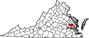
Location of New Kent County in Virginia
This is intended to be a complete list of the properties and districts on the National Register of Historic Places in New Kent County, Virginia, United States. The locations of National Register properties and districts for which the latitude and longitude coordinates are included below, may be seen in an online map.[1]
There are 16 properties and districts listed on the National Register in the county, including 2 National Historic Landmarks.
- This National Park Service list is complete through NPS recent listings posted June 26, 2020.[2]
Current listings
| [3] | Name on the Register[4] | Image | Date listed[5] | Location | City or town | Description |
|---|---|---|---|---|---|---|
| 1 | Cedar Grove | .jpg) Cedar Grove |
December 28, 1979 (#79003058) |
Northwest of Providence Forge on Emmaus Church Rd. 37°29′06″N 77°06′55″W |
Providence Forge | |
| 2 | Cedar Lane |  Cedar Lane |
May 8, 2017 (#100000985) |
9040 State Route 249 37°31′47″N 77°02′32″W |
New Kent | |
| 3 | Criss Cross | .jpg) Criss Cross |
May 11, 1973 (#73002043) |
Southwest of New Kent off Criss Cross Rd. 37°30′10″N 77°01′47″W |
New Kent | |
| 4 | Crump's Mill and Millpond | 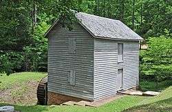 Crump's Mill and Millpond |
September 24, 1999 (#99001199) |
9065 Crump's Mill Rd. 37°32′24″N 77°05′22″W |
Quinton | |
| 5 | Cumberland | 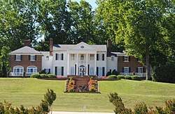 Cumberland |
May 8, 2017 (#100000986) |
9007 Cumberland Rd. 37°32′23″N 76°58′39″W |
New Kent | |
| 6 | Emmaus Baptist Church | 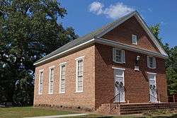 Emmaus Baptist Church |
June 10, 1993 (#93000506) |
Western side of State Route 106, 0.4 miles (0.64 km) south of Interstate 64 37°29′57″N 77°05′32″W |
Providence Forge | |
| 7 | Foster's Castle | 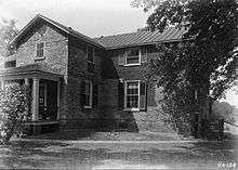 Foster's Castle |
April 11, 1973 (#73002044) |
Northeast of Tunstall off Old River Rd. 37°35′38″N 77°04′34″W |
Tunstall | |
| 8 | Hampstead |  Hampstead |
December 18, 1970 (#70000812) |
1 mile (1.6 km) northwest of the junction of Old Church and Steel Trap Rds. 37°36′25″N 77°07′43″W |
Tunstall | |
| 9 | Marl Hill |  Marl Hill |
December 21, 1990 (#90001832) |
St. Peters Ln., east of its junction with Old Church Rd. 37°32′23″N 77°03′03″W |
Talleysville | |
| 10 | Moss Side | 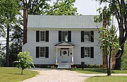 Moss Side |
June 5, 2017 (#100001046) |
8501 State Route 249 37°31′22″N 77°03′17″W |
New Kent | |
| 11 | Moysonec | 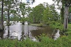 Moysonec |
June 20, 1975 (#75002026) |
Address Restricted |
Toano | |
| 12 | New Kent Ordinary | December 9, 2019 (#100004747) |
12000 New Kent Hwy. 37°31′05″N 76°58′42″W |
New Kent Court House | ||
| 13 | New Kent School; George W. Wilson School | 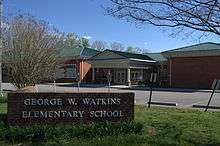 New Kent School; George W. Wilson School |
August 7, 2001 (#01001046) |
11825 State Route 249 (New Kent) and 6501 State Route 249 (Watkins) 37°31′46″N 77°05′54″W |
New Kent and Quinton | Pair of schools that represent widespread token desegregation of southern schools in the decade after the 1954 Brown v. Board of Education U.S. Supreme Court decision. Focus of 1968 Green v. County School Board, which was effective in bringing about real desegregation. |
| 14 | Olivet Presbyterian Church | 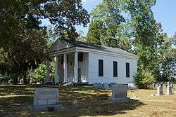 Olivet Presbyterian Church |
January 26, 1978 (#78003034) |
2.7 miles (4.3 km) northwest of Providence Forge on Olivet Church Rd. 37°28′49″N 77°03′49″W |
Providence Forge | |
| 15 | Spring Hill | 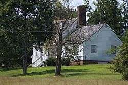 Spring Hill |
November 27, 2002 (#02001448) |
11221 Carriage Rd. 37°26′05″N 76°59′44″W |
Providence Forge | |
| 16 | St. Peter's Church | 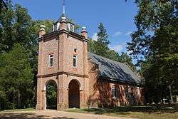 St. Peter's Church |
October 1, 1969 (#69000263) |
St. Peters Ln. 37°32′25″N 77°03′23″W |
New Kent | designated a National Historic Landmark March 2, 2012 (as St. Peter's Parish Church) |
See also
| Wikimedia Commons has media related to National Register of Historic Places in New Kent County, Virginia. |
References
- The latitude and longitude information provided in this table was derived originally from the National Register Information System, which has been found to be fairly accurate for about 99% of listings. Some locations in this table may have been corrected to current GPS standards.
- "National Register of Historic Places: Weekly List Actions". National Park Service, United States Department of the Interior. Retrieved on June 26, 2020.
- Numbers represent an ordering by significant words. Various colorings, defined here, differentiate National Historic Landmarks and historic districts from other NRHP buildings, structures, sites or objects.
- "National Register Information System". National Register of Historic Places. National Park Service. April 24, 2008.
- The eight-digit number below each date is the number assigned to each location in the National Register Information System database, which can be viewed by clicking the number.

Municipalities and communities of New Kent County, Virginia, United States | ||
|---|---|---|
| CDP | Map of Virginia highlighting New Kent County | |
| Unincorporated communities |
| |
This article is issued from Wikipedia. The text is licensed under Creative Commons - Attribution - Sharealike. Additional terms may apply for the media files.