National Register of Historic Places listings in Lee County, Virginia
This is a list of the National Register of Historic Places listings in Lee County, Virginia.
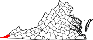
Location of Lee County in Virginia
This is intended to be a complete list of the properties and districts on the National Register of Historic Places in Lee County, Virginia, United States. The locations of National Register properties and districts for which the latitude and longitude coordinates are included below, may be seen in a Google map.[1]
There are 8 properties and districts listed on the National Register in the county, including 1 National Historic Landmark.
- This National Park Service list is complete through NPS recent listings posted June 19, 2020.[2]
Current listings
| [3] | Name on the Register[4] | Image | Date listed[5] | Location | City or town | Description |
|---|---|---|---|---|---|---|
| 1 | Cumberland Gap Historic District |  Cumberland Gap Historic District |
May 28, 1980 (#80000366) |
East of Middlesboro 36°36′09″N 83°40′13″W |
Gibson Station | Extends into Bell County, Kentucky and Claiborne County, Tennessee |
| 2 | Cumberland Gap National Historical Park |  Cumberland Gap National Historical Park |
October 15, 1966 (#66000353) |
East of Middlesboro along the Kentucky-Virginia state line 36°36′36″N 83°39′00″W |
Cumberland Gap | Extends into Bell County, Kentucky, Harlan County, Kentucky, and Claiborne County, Tennessee |
| 3 | Dickinson-Milbourn House |  Dickinson-Milbourn House |
August 12, 1993 (#93000825) |
U.S. Route 58 36°41′08″N 83°07′24″W |
Jonesville | |
| 4 | Duff Mansion House | 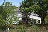 Duff Mansion House |
June 12, 2019 (#100004096) |
4354 Kane Gap Rd. 36°44′27″N 82°51′18″W |
Duffield | |
| 5 | Ely Mound | 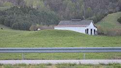 Ely Mound |
July 28, 1983 (#83003287) |
2 miles (3.2 km) west of Rose Hill off U.S. Route 58[6] 36°39′22″N 83°24′08″W |
Rose Hill | |
| 6 | Jonesville Methodist Campground | 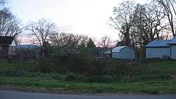 Jonesville Methodist Campground |
May 16, 1974 (#74002133) |
West of Jonesville at the junction of U.S. Route 58 and Campground Rd. 36°40′57″N 83°08′38″W |
Jonesville | |
| 7 | Keokee Store No. 1 | 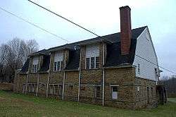 Keokee Store No. 1 |
April 30, 2007 (#07000397) |
Keokee Rd. 36°51′55″N 82°54′00″W |
Keokee | |
| 8 | William Sayers Homestead |  William Sayers Homestead |
February 17, 2015 (#15000017) |
110 Mabel Parkey Dr. 36°36′45″N 83°34′14″W |
Ewing |
See also
| Wikimedia Commons has media related to National Register of Historic Places in Lee County, Virginia. |
References
- The latitude and longitude information provided in this table was derived originally from the National Register Information System, which has been found to be fairly accurate for about 99% of listings. Some locations in this table may have been corrected to current GPS standards.
- "National Register of Historic Places: Weekly List Actions". National Park Service, United States Department of the Interior. Retrieved on June 19, 2020.
- Numbers represent an ordering by significant words. Various colorings, defined here, differentiate National Historic Landmarks and historic districts from other NRHP buildings, structures, sites or objects.
- "National Register Information System". National Register of Historic Places. National Park Service. April 24, 2008.
- The eight-digit number below each date is the number assigned to each location in the National Register Information System database, which can be viewed by clicking the number.
- Salmon, John S. A Guidebook to Virginia's Historical Markers. Charlottesville" U of Virginia P, 1994, 68.

Municipalities and communities of Lee County, Virginia, United States | ||
|---|---|---|
| Towns | Map of Virginia highlighting Lee County | |
| CDPs | ||
| Unincorporated communities |
| |
| Ghost town | ||
This article is issued from Wikipedia. The text is licensed under Creative Commons - Attribution - Sharealike. Additional terms may apply for the media files.