National Register of Historic Places listings in Bedford County, Virginia
This is a list of the National Register of Historic Places listings in Bedford County, Virginia.
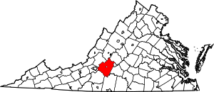
Location of Bedford County in Virginia
This is intended to be a complete list of the properties and districts on the National Register of Historic Places in Bedford County, Virginia, United States. The locations of National Register properties and districts for which the latitude and longitude coordinates are included below, may be seen in a Google map.[1]
There are 31 properties and districts listed on the National Register in the county, including 1 National Historic Landmark.
- This National Park Service list is complete through NPS recent listings posted June 26, 2020.[2]
Current listings
| [3] | Name on the Register[4] | Image | Date listed[5] | Location | City or town | Description |
|---|---|---|---|---|---|---|
| 1 | Avenel | 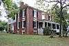 Avenel |
January 30, 1992 (#92000003) |
413 Avenel Ave. 37°20′17″N 79°31′28″W |
Bedford | |
| 2 | John D. Ballard House | 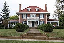 John D. Ballard House |
December 12, 1997 (#97001505) |
525 Longwood Ave. 37°20′22″N 79°31′12″W |
Bedford | |
| 3 | Bedford Historic District | 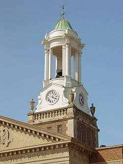 Bedford Historic District |
October 4, 1984 (#84000031) |
Roughly bounded by Longwood, Bedford, and Mountain Aves. and Peaks, Oak, Grove, and Washington Sts. 37°20′04″N 79°31′25″W |
Bedford | |
| 4 | Bedford Historic Meetinghouse | 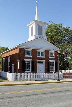 Bedford Historic Meetinghouse |
January 31, 1978 (#78003182) |
153 W. Main St. 37°20′05″N 79°31′32″W |
Bedford | |
| 5 | Bellevue |  Bellevue |
December 19, 1990 (#89001917) |
Bellevue Rd., 1 mile (1.6 km) east of Goode 37°21′52″N 79°22′02″W |
Goode | |
| 6 | Bellevue Rural Historic District | 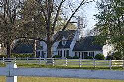 Bellevue Rural Historic District |
November 30, 2005 (#05001345) |
Bellevue Rd. 37°22′21″N 79°22′52″W |
Forest | |
| 7 | Big Otter Mill | 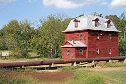 Big Otter Mill |
October 30, 1998 (#98001314) |
State Route 122 37°23′27″N 79°30′13″W |
Bedford | |
| 8 | Brook Hill Farm | 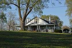 Brook Hill Farm |
June 6, 1997 (#97000489) |
0.75 miles (1.21 km) south of the junction of U.S. Route 221 and Bellevue Rd. 37°22′05″N 79°22′29″W |
Forest | |
| 9 | Burks-Guy-Hagen House | 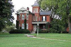 Burks-Guy-Hagen House |
December 19, 1985 (#85003201) |
520 Peaks St. 37°20′22″N 79°31′23″W |
Bedford | |
| 10 | Cifax Rural Historic District | 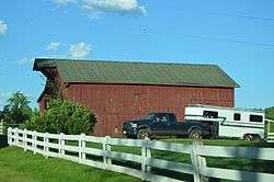 Cifax Rural Historic District |
February 20, 1992 (#92000052) |
Junction of Otterville and Old Cifax Rds., and the surrounding valley area 37°24′39″N 79°24′28″W |
Cifax | |
| 11 | Bowling Eldridge House | 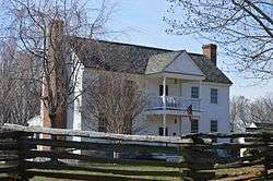 Bowling Eldridge House |
August 12, 1993 (#93000824) |
1651 Fox Hill Rd. 37°28′22″N 79°12′07″W |
Lynchburg | |
| 12 | Elk Hill | 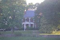 Elk Hill |
April 2, 1973 (#73001996) |
Northwest of Forest on Perrowville Rd. 37°24′33″N 79°20′36″W |
Forest | |
| 13 | Elks National Home | 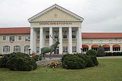 Elks National Home |
May 29, 2008 (#08000479) |
931 Ashland Ave. 37°20′36″N 79°32′06″W |
Bedford | |
| 14 | Fancy Farm |  Fancy Farm |
January 7, 1972 (#72001384) |
On State Route 43, north of its junction with Kelso Mill Rd. 37°23′54″N 79°33′23″W |
Bedford | |
| 15 | Hope Dawn | 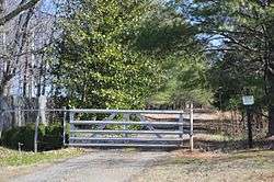 Hope Dawn |
October 9, 1974 (#74002106) |
Northwest of Lynchburg off Abert Rd. 37°29′55″N 79°13′59″W |
Lynchburg | |
| 16 | Liberty Hall | 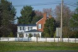 Liberty Hall |
August 12, 2009 (#09000613) |
12000 E. U.S. Route 460 37°18′23″N 79°18′48″W |
Forest | |
| 17 | Locust Level |  Locust Level |
December 21, 1990 (#90001841) |
U.S. Route 460, west of its junction with Goose Creek Valley Rd. 37°23′11″N 79°44′14″W |
Montvale | |
| 18 | Mount Airy | 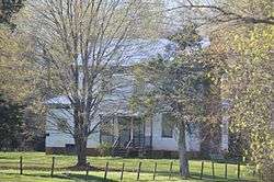 Mount Airy |
December 19, 1990 (#90001823) |
Junction of Chellis Ford and Mt. Airy Rds. 37°06′19″N 79°25′03″W |
Leesville | |
| 19 | New London Academy | 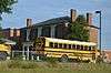 New London Academy |
April 13, 1972 (#72001385) |
Near the junction of U.S. Route 460 and New London Rd. 37°18′24″N 79°18′19″W |
Forest | |
| 20 | New Prospect Church |  New Prospect Church |
March 31, 2000 (#00000312) |
4445 Sheep Creek Rd. 37°25′39″N 79°38′09″W |
Bedford | |
| 21 | Old Rectory |  Old Rectory |
July 24, 1973 (#73001998) |
South of Perrowville on Perrowville Rd. 37°24′10″N 79°20′18″W |
Perrowville | |
| 22 | Olive Branch Missionary Baptist Church |  Olive Branch Missionary Baptist Church |
May 4, 2007 (#07000392) |
5982 Joppa Mill Rd. 37°14′55″N 79°37′33″W |
Moneta | |
| 23 | Otterburn | 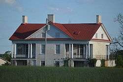 Otterburn |
February 16, 2001 (#01000146) |
Big Island Rd. 37°22′04″N 79°29′48″W |
Bedford | |
| 24 | Pleasant View | 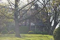 Pleasant View |
November 15, 2006 (#06001043) |
5050 Bellevue Rd. 37°20′48″N 79°21′42″W |
Forest | |
| 25 | Poplar Forest | 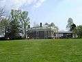 Poplar Forest |
November 12, 1969 (#69000223) |
1542 Bateman Bridge Rd. 37°20′53″N 79°15′52″W |
Lynchburg | |
| 26 | Rothsay | 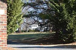 Rothsay |
October 30, 1992 (#92001387) |
Northern side of U.S. Route 221, 2,000 feet (610 m) east of its junction with Thomas Jefferson Rd. 37°22′01″N 79°17′01″W |
Forest | |
| 27 | Saint Stephen's Episcopal Church | 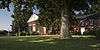 Saint Stephen's Episcopal Church |
November 7, 1985 (#85002766) |
Perrowville Rd. 37°22′41″N 79°18′29″W |
Forest | |
| 28 | Thomas Methodist Episcopal Chapel | 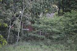 Thomas Methodist Episcopal Chapel |
August 11, 2004 (#04000844) |
Penicks Mill Rd. 37°22′43″N 79°37′37″W |
Thaxton | |
| 29 | Three Otters |  Three Otters |
September 15, 1970 (#70000785) |
West of the junction of State Route 43 and Three Otters Rd. 37°21′27″N 79°32′43″W |
Bedford | |
| 30 | Twin Oaks Farm |  Twin Oaks Farm |
July 5, 2001 (#01000704) |
Sheep Creek Rd. 37°25′37″N 79°37′57″W |
Peaks of Otter | |
| 31 | Woodbourne | 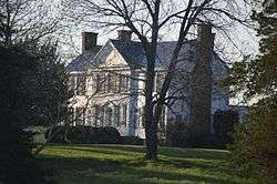 Woodbourne |
July 2, 1973 (#73001997) |
Northeast of Forest off Gumtree Rd. 37°22′11″N 79°16′44″W |
Forest |
See also
| Wikimedia Commons has media related to National Register of Historic Places in Bedford County, Virginia. |
References
- The latitude and longitude information provided in this table was derived originally from the National Register Information System, which has been found to be fairly accurate for about 99% of listings. Some locations in this table may have been corrected to current GPS standards.
- "National Register of Historic Places: Weekly List Actions". National Park Service, United States Department of the Interior. Retrieved on June 26, 2020.
- Numbers represent an ordering by significant words. Various colorings, defined here, differentiate National Historic Landmarks and historic districts from other NRHP buildings, structures, sites or objects.
- "National Register Information System". National Register of Historic Places. National Park Service. April 24, 2008.
- The eight-digit number below each date is the number assigned to each location in the National Register Information System database, which can be viewed by clicking the number.

Municipalities and communities of Bedford County, Virginia, United States | ||
|---|---|---|
| Town | Map of Virginia highlighting Bedford County | |
| CDPs | ||
| Unincorporated communities |
| |
This article is issued from Wikipedia. The text is licensed under Creative Commons - Attribution - Sharealike. Additional terms may apply for the media files.