National Register of Historic Places listings in Amherst County, Virginia
This is a list of the National Register of Historic Places listings in Amherst County, Virginia.
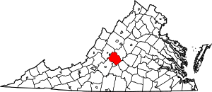
Location of Amherst County in Virginia
This is intended to be a complete list of the properties and districts on the National Register of Historic Places in Amherst County, Virginia, United States. The locations of National Register properties and districts for which the latitude and longitude coordinates are included below, may be seen in an online map.[1]
There are 33 properties and districts listed on the National Register in the county. Another property was once listed but has been removed.
- This National Park Service list is complete through NPS recent listings posted June 19, 2020.[2]
Current listings
| [3] | Name on the Register[4] | Image | Date listed[5] | Location | City or town | Description |
|---|---|---|---|---|---|---|
| 1 | Bear Mountain Indian Mission School | 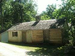 Bear Mountain Indian Mission School |
February 21, 1997 (#97000152) |
Southwestern corner of the junction of Kenmore and Indian Mission Rds. 37°34′22″N 79°07′37″W |
Amherst | |
| 2 | Brick House | 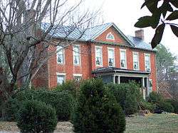 Brick House |
February 1, 2006 (#05001620) |
854 Fletcher's Level Rd. 37°38′38″N 79°01′17″W |
Clifford | |
| 3 | Brightwells Mill Complex | 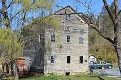 Brightwells Mill Complex |
August 15, 2016 (#16000527) |
586 Brightwells Mill Rd. 37°27′31″N 79°02′51″W |
Madison Heights | |
| 4 | Clifford-New Glasgow Historic District | 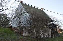 Clifford-New Glasgow Historic District |
March 12, 2012 (#12000122) |
State Route 151 and Fletchers Level Rd. 37°38′25″N 79°01′20″W |
Clifford | |
| 5 | Dulwich Manor |  Dulwich Manor |
May 28, 2013 (#13000335) |
550 U.S. Route 60 37°34′27″N 79°02′30″W |
Amherst | |
| 6 | Edge Hill |  Edge Hill |
May 15, 2008 (#08000418) |
1380 Edgehill Plantation Rd. 37°30′11″N 78°55′33″W |
Gladstone | |
| 7 | Edgewood |  Edgewood |
March 14, 2008 (#08000200) |
591 Puppy Creek Rd. 37°38′38″N 79°09′34″W |
Amherst | |
| 8 | Edgewood |  Edgewood |
August 16, 2006 (#06000706) |
138 Garland Ave. 37°34′55″N 79°03′20″W |
Amherst | |
| 9 | El Bethel Methodist Church | 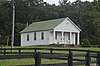 El Bethel Methodist Church |
April 20, 2018 (#100002354) |
925 Buffalo Springs Turnpike 37°38′43″N 79°13′15″W |
Amherst | |
| 10 | Elon Village Library | 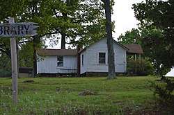 Elon Village Library |
November 22, 2016 (#16000793) |
Corner of Camden and Younger Drs. 37°30′50″N 79°11′40″W |
Amherst | |
| 11 | Emmanuel Baptist Church | 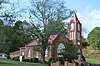 Emmanuel Baptist Church |
April 27, 2018 (#100002391) |
205 Sandidges Rd. 37°39′44″N 79°08′45″W |
Amherst | |
| 12 | Fairview | 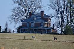 Fairview |
June 3, 2009 (#09000391) |
2416 Lowesville Rd. 37°41′58″N 79°03′56″W |
Amherst | |
| 13 | Forest Hill | 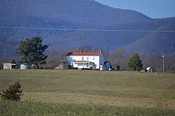 Forest Hill |
March 22, 2007 (#07000218) |
713 Indian Creek Rd. 37°42′26″N 79°05′04″W |
Amherst | |
| 14 | Fort Riverview (44AH91 and 44AH195) | 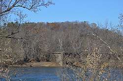 Fort Riverview (44AH91 and 44AH195) |
November 16, 1989 (#89001921) |
Hilltop above the James River[6] 37°23′45″N 79°03′55″W |
Madison Heights | |
| 15 | Galt's Mill Complex |  Galt's Mill Complex |
September 30, 2009 (#09000791) |
1133 Galt's Mill Rd. 37°26′49″N 79°00′39″W |
Madison Heights | |
| 16 | Geddes | 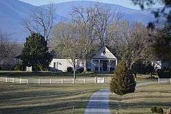 Geddes |
February 24, 1983 (#83003257) |
Jefferson Trace 37°40′01″N 78°59′14″W |
Clifford | |
| 17 | The Glebe | 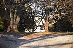 The Glebe |
May 15, 2008 (#08000419) |
156 State Route 151 37°37′23″N 79°00′50″W |
Amherst | |
| 18 | Hanshill | 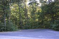 Hanshill |
September 29, 2011 (#11000715) |
142 Leftwich Rd. 37°28′18″N 79°09′15″W |
Madison Heights | |
| 19 | Hite Store | 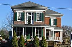 Hite Store |
June 6, 1997 (#97000487) |
0.25 miles (0.40 km) south of the junction of Woodson and Lowesville Rds. 37°43′06″N 79°04′01″W |
Lowesville | |
| 20 | Kenmore Farm | 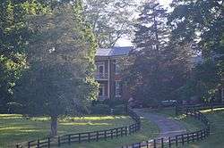 Kenmore Farm |
February 17, 2015 (#15000012) |
369 Kenmore Rd. 37°35′08″N 79°04′12″W |
Amherst | |
| 21 | Macedonia Methodist Church |  Macedonia Methodist Church |
February 8, 2012 (#12000017) |
1408 Coffeytown Rd. 37°46′20″N 79°13′39″W |
Vesuvius | |
| 22 | Madison Heights Elementary School | 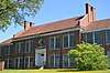 Madison Heights Elementary School |
April 2, 2019 (#100003601) |
123 Phelps Rd. 37°25′52″N 79°07′21″W |
Madison Heights | |
| 23 | Mountain View Farm |  Mountain View Farm |
September 3, 1997 (#96001453) |
2229 N. U.S. Route 29 37°38′29″N 78°59′08″W |
Clifford | |
| 24 | Norfolk Southern Six Mile Bridge No. 58 | 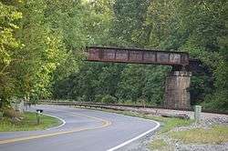 Norfolk Southern Six Mile Bridge No. 58 |
October 12, 1995 (#95001175) |
Over the James River west of the junction of Mt. Athos Rd. and the Norfolk Southern Railroad tracks 37°23′35″N 79°03′46″W |
Lynchburg | |
| 25 | Oak Lawn | 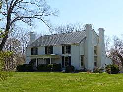 Oak Lawn |
September 6, 2006 (#06000802) |
155 Winridge Dr. 37°29′03″N 79°08′59″W |
Madison Heights | |
| 26 | Red Hill Farm |  Red Hill Farm |
June 9, 1980 (#80004168) |
West of Pedlar Mills on Minors Branch Rd. 37°33′28″N 79°15′53″W |
Pedlar Mills | |
| 27 | St. Luke's Episcopal Church |  St. Luke's Episcopal Church |
November 24, 2017 (#100001849) |
3788 Buffalo Springs Turnpike 37°33′32″N 79°15′17″W |
Pedlar Mills | |
| 28 | Speed the Plough |  Speed the Plough |
April 30, 2007 (#07000391) |
389 Fair Lea Ln. 37°32′00″N 79°11′28″W |
Monroe | |
| 29 | Sweet Briar College Historic District |  Sweet Briar College Historic District |
March 30, 1995 (#95000240) |
Sweet Briar Dr., 0.5 miles west of U.S. Route 29 37°33′14″N 79°04′48″W |
Sweet Briar | |
| 30 | Sweet Briar House |  Sweet Briar House |
September 15, 1970 (#70000783) |
Southwest of the junction of U.S. Route 29 and Sweet Briar Rd. 37°33′27″N 79°04′58″W |
Sweet Briar | |
| 31 | Thompson's Mill-Amherst Mill Complex | 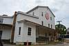 Thompson's Mill-Amherst Mill Complex |
March 5, 2019 (#100003484) |
138-140 Union Hill Rd. 37°34′36″N 79°02′55″W |
Amherst | |
| 32 | Tusculum |  Tusculum |
November 19, 2004 (#04001244) |
2077 N. U.S. Route 29 37°38′10″N 78°59′51″W |
Amherst | |
| 33 | Winton | 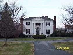 Winton |
May 2, 1974 (#74002104) |
West of State Route 151 37°38′17″N 79°01′27″W |
Clifford |
Former listing
| [3] | Name on the Register | Image | Date listed | Date removed | Location | City or town | Summary |
|---|---|---|---|---|---|---|---|
| 1 | Athlone | September 24, 1992 (#92001029) | March 19, 2001 | Junction of VA 151 and VA 674 |
Amherst | Destroyed by fire |
See also
| Wikimedia Commons has media related to National Register of Historic Places in Amherst County, Virginia. |
References
- The latitude and longitude information provided in this table was derived originally from the National Register Information System, which has been found to be fairly accurate for about 99% of listings. Some locations in this table may have been corrected to current GPS standards.
- "National Register of Historic Places: Weekly List Actions". National Park Service, United States Department of the Interior. Retrieved on June 19, 2020.
- Numbers represent an ordering by significant words. Various colorings, defined here, differentiate National Historic Landmarks and historic districts from other NRHP buildings, structures, sites or objects.
- "National Register Information System". National Register of Historic Places. National Park Service. April 24, 2008.
- The eight-digit number below each date is the number assigned to each location in the National Register Information System database, which can be viewed by clicking the number.
- Wittkotksi [sic], J. Mark, and John S. Salmon. National Register of Historic Places Inventory/Nomination: Fort Riverview. National Park Service, 1989-03, 9.

Municipalities and communities of Amherst County, Virginia, United States | ||
|---|---|---|
| Town | Map of Virginia highlighting Amherst County | |
| CDP | ||
| Unincorporated communities | ||
This article is issued from Wikipedia. The text is licensed under Creative Commons - Attribution - Sharealike. Additional terms may apply for the media files.