National Register of Historic Places listings in Newport News, Virginia
This is a list of the National Register of Historic Places listings in Newport News, Virginia.

Location of Newport News in Virginia
This is intended to be a complete list of the properties and districts on the National Register of Historic Places in the independent city of Newport News, Virginia, United States. The locations of National Register properties and districts for which the latitude and longitude coordinates are included below, may be seen in an online map.[1]
There are 34 properties and districts listed on the National Register in the city.
- This National Park Service list is complete through NPS recent listings posted June 26, 2020.[2]
Current listings
| [3] | Name on the Register[4] | Image | Date listed[5] | Location | Description |
|---|---|---|---|---|---|
| 1 | Basic Construction Company Headquarters Building | 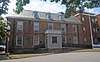 Basic Construction Company Headquarters Building |
April 15, 2019 (#100003614) |
80 29th St. 36°58′45″N 76°26′05″W |
|
| 2 | Boldrup Plantation Archeological Site | 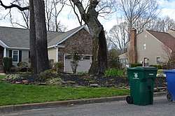 Boldrup Plantation Archeological Site |
September 16, 1982 (#82004573) |
Address Restricted |
|
| 3 | Causey's Mill | 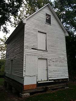 Causey's Mill |
February 21, 2008 (#08000078) |
11700 Warwick Rd. 37°03′32″N 76°29′01″W |
|
| 4 | Simon Reid Curtis House | .jpg) Simon Reid Curtis House |
August 20, 2009 (#09000641) |
10 Elmhurst St. 37°11′38″N 76°34′20″W |
|
| 5 | Dam No. One Battlefield Site | 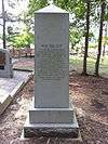 Dam No. One Battlefield Site |
August 4, 1995 (#95000972) |
13560 Jefferson Ave. 37°11′20″N 76°32′41″W |
|
| 6 | Denbigh Plantation Site | 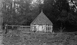 Denbigh Plantation Site |
February 16, 1970 (#70000873) |
Route 60, Newport News 37°05′25″N 76°32′20″W |
|
| 7 | Endview Plantation | 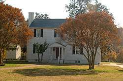 Endview Plantation |
May 8, 2008 (#08000391) |
362 Yorktown Rd. 37°12′41″N 76°34′08″W |
|
| 8 | James A. Fields House | 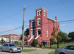 James A. Fields House |
June 6, 2002 (#02000623) |
617 27th St. 36°58′59″N 76°25′17″W |
|
| 9 | First Baptist Church-Newport News | 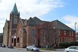 First Baptist Church-Newport News |
May 11, 2000 (#00000774) |
119 29th St. 36°58′48″N 76°25′59″W |
|
| 10 | First Denbigh Parish Church Archeological Site | 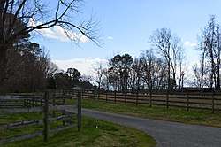 First Denbigh Parish Church Archeological Site |
September 7, 1982 (#82004574) |
Address Restricted |
|
| 11 | Fort Crafford |  Fort Crafford |
May 17, 1974 (#74002237) |
Fort Eustis Military Reservation on Mulberry Island Point 37°07′42″N 76°37′05″W |
|
| 12 | Greenlawn Cemetery | 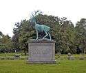 Greenlawn Cemetery |
February 5, 1999 (#99000139) |
2700 Parish Ave. 36°59′50″N 76°24′15″W |
|
| 13 | Hilton Village |  Hilton Village |
June 23, 1969 (#69000341) |
Bounded by the James River, Post St., the former Chesapeake and Ohio railroad tracks, and Hopkins St. 37°01′51″N 76°27′44″W |
|
| 14 | Hotel Warwick | .JPG) Hotel Warwick |
October 4, 1984 (#84000044) |
25th St. and West Ave. 36°58′37″N 76°25′55″W |
|
| 15 | Matthew Jones House |  Matthew Jones House |
June 11, 1969 (#69000342) |
Taylor Ave. and Harrison Rd., Fort Eustis 37°09′37″N 76°36′11″W |
|
| 16 | Lee Hall | 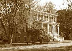 Lee Hall |
December 5, 1972 (#72001510) |
Near the junction of U.S. Route 60 and State Route 238 37°11′59″N 76°34′32″W |
|
| 17 | Lee Hall Depot | %2C_under_restoration.jpg) Lee Hall Depot |
September 24, 2010 (#10000793) |
9 Elmhurst St. 37°11′40″N 76°34′22″W |
|
| 18 | Lee's Mill Earthworks | 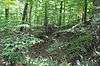 Lee's Mill Earthworks |
June 23, 2003 (#03000568) |
280 Rivers Ridge Cir. 37°09′54″N 76°33′55″W |
|
| 19 | Medical Arts Building | .jpg) Medical Arts Building |
September 14, 2002 (#02001001) |
2901 West Ave. 36°58′47″N 76°26′03″W |
|
| 20 | Newport News Middle Ground Light Station | 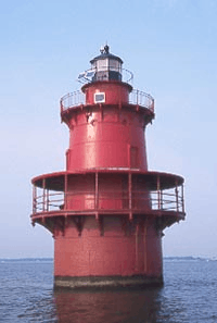 Newport News Middle Ground Light Station |
December 2, 2002 (#02001438) |
Approximately 2 miles (3.2 km) south-southeast of Newport News 36°56′43″N 76°23′30″W |
|
| 21 | Newport News Public Library | .JPG) Newport News Public Library |
August 17, 2005 (#05000894) |
2907 West Ave. 36°58′48″N 76°26′03″W |
|
| 22 | J. Thomas Newsome House | .jpg) J. Thomas Newsome House |
December 19, 1990 (#90001831) |
2803 Oak Ave. 36°59′25″N 76°24′19″W |
|
| 23 | Noland Company Building | .JPG) Noland Company Building |
May 21, 2010 (#10000283) |
2600 Warwick Boulevard 36°58′50″N 76°25′37″W |
|
| 24 | North End Historic District | 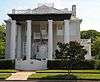 North End Historic District |
August 28, 1986 (#86001999) |
Roughly bounded by 68th St., Warwick Boulevard, 50th St., and Huntington Ave. 37°00′02″N 76°26′27″W |
|
| 25 | Queen Hith Plantation Complex Site | February 24, 1983 (#83003293) |
Address Restricted |
||
| 26 | Richneck Plantation Site | 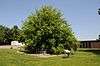 Richneck Plantation Site |
July 8, 1977 (#77001535) |
George J. McIntosh Elementary School, 185 Richneck Rd.[6] 37°08′50″N 76°31′46″W |
|
| 27 | Riverside Apartments | July 28, 1983 (#83003294) |
4500-4600 Washington Ave. 36°59′28″N 76°26′18″W |
||
| 28 | St. Vincent de Paul Catholic Church | .JPG) St. Vincent de Paul Catholic Church |
June 2, 2005 (#05000525) |
230 33rd St. 36°59′00″N 76°25′55″W |
|
| 29 | Skiffes Creek Sand Spit Site | 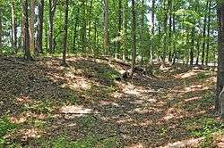 Skiffes Creek Sand Spit Site |
February 24, 1983 (#83003295) |
Address Restricted |
|
| 30 | Smith's Pharmacy | .JPG) Smith's Pharmacy |
June 6, 2002 (#02000618) |
3114 Chestnut Ave. 36°59′31″N 76°24′32″W |
|
| 31 | Southern Terminal Redoubt | 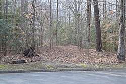 Southern Terminal Redoubt |
February 24, 1983 (#83003296) |
End of Enterprise Dr.[7] 37°10′33″N 76°35′38″W |
One of several archaeological sites in the Oakland Farm Industrial Park[8] |
| 32 | Temple Sinai | 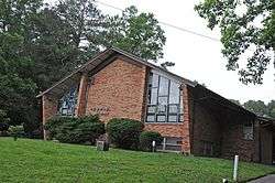 Temple Sinai |
May 18, 2015 (#15000252) |
11620 Warwick Boulevard 37°03′26″N 76°28′55″W |
|
| 33 | Warwick County Courthouses | 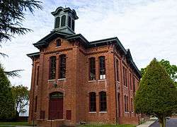 Warwick County Courthouses |
November 3, 1988 (#88002186) |
Old Courthouse Way 37°07′47″N 76°32′32″W |
|
| 34 | Whittaker Memorial Hospital | .JPG) Whittaker Memorial Hospital |
September 30, 2009 (#09000794) |
1003 28th St. 36°59′16″N 76°24′45″W |
See also
| Wikimedia Commons has media related to National Register of Historic Places in Newport News, Virginia. |
References
- The latitude and longitude information provided in this table was derived originally from the National Register Information System, which has been found to be fairly accurate for about 99% of listings. Some locations in this table may have been corrected to current GPS standards.
- "National Register of Historic Places: Weekly List Actions". National Park Service, United States Department of the Interior. Retrieved on June 26, 2020.
- Numbers represent an ordering by significant words. Various colorings, defined here, differentiate National Historic Landmarks and historic districts from other NRHP buildings, structures, sites or objects.
- "National Register Information System". National Register of Historic Places. National Park Service. April 24, 2008.
- The eight-digit number below each date is the number assigned to each location in the National Register Information System database, which can be viewed by clicking the number.
- Newport News: Richneck Plantation, National Park Service, n.d. Accessed 2018-02-09.
- Burton, Brian K. The Peninsula and Seven Days: A Battlefield Guide. Lincoln: U of Nebraska P, 2007, 17.
- Clarence R. Geier and Staff (April 1982). "Oakland Farm Industrial Park MRA". National Park Service. p. 2.

| Topics |  | |
|---|---|---|
| Parks | ||
| Historic Sites and Museums |
| |
| Military | ||
| Neighborhoods |
| |
This article is issued from Wikipedia. The text is licensed under Creative Commons - Attribution - Sharealike. Additional terms may apply for the media files.