National Register of Historic Places listings in Hanover County, Virginia
This is a list of the National Register of Historic Places listings in Hanover County, Virginia.
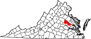
Location of Hanover County in Virginia
This is intended to be a complete list of the properties and districts on the National Register of Historic Places in Hanover County, Virginia, United States. The locations of National Register properties and districts for which the latitude and longitude coordinates are included below, may be seen in an online map.[1]
There are 42 properties and districts listed on the National Register in the county, including 3 National Historic Landmarks.
- This National Park Service list is complete through NPS recent listings posted June 26, 2020.[2]
Current listings
| [3] | Name on the Register[4] | Image | Date listed[5] | Location | City or town | Description |
|---|---|---|---|---|---|---|
| 1 | Ashland Historic District | _Station-Visitor's_Center.JPG) Ashland Historic District |
February 11, 1983 (#83003284) |
Center, Racecourse, James, Howard, and Clay Sts., and Hanover and Railroad Aves. 37°45′30″N 77°28′50″W |
Ashland | |
| 2 | Ashland UDC Jefferson Davis Highway Marker | 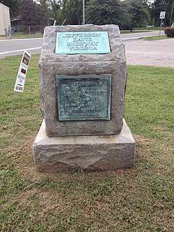 Ashland UDC Jefferson Davis Highway Marker |
August 27, 2013 (#13000642) |
Junction of U.S. Route 1 and Cedar Lane 37°41′22″N 77°27′46″W |
Glen Allen | |
| 3 | Beaverdam Depot | 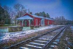 Beaverdam Depot |
November 8, 1988 (#88002060) |
On the CSX railroad tracks at the junction of Beaver Dam and Beaverdam School Rds. 37°56′28″N 77°39′12″W |
Beaverdam | |
| 4 | Church Quarter | .jpg) Church Quarter |
November 22, 2000 (#00001436) |
12432 Old Ridge Rd. 37°50′54″N 77°31′31″W |
Doswell | |
| 5 | Clover Lea | 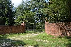 Clover Lea |
February 28, 1979 (#79003045) |
East of Mechanicsville off Piping Tree Rd. 37°38′36″N 77°11′05″W |
Mechanicsville | |
| 6 | Cold Harbor National Cemetery | .jpg) Cold Harbor National Cemetery |
August 10, 1995 (#95000922) |
0.5 miles (0.80 km) east of the junction of State Route 156 and Cold Harbor Rd. 37°35′22″N 77°16′48″W |
Mechanicsville | |
| 7 | Cool Well |  Cool Well |
September 6, 2007 (#07000931) |
8198 Shady Grove Rd. 37°37′35″N 77°22′32″W |
Mechanicsville | |
| 8 | Dewberry | .jpg) Dewberry |
May 23, 1996 (#96000576) |
Approximately 1 mile (1.6 km) northeast of the junction of Hewlett and Old Ridge Rds. 37°53′41″N 77°35′22″W |
Beaverdam | |
| 9 | Ellington | November 18, 2019 (#100004650) |
17335 Washington Hwy. 37°52′59″N 77°27′55″W |
Doswell | ||
| 10 | Fork Church | 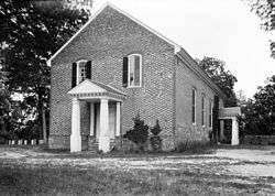 Fork Church |
February 26, 1970 (#70000801) |
At the junction of Old Ridge and Rocketts Mill Rds. 37°51′13″N 77°31′52″W |
Ashland | |
| 11 | Hanover County Courthouse | 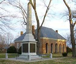 Hanover County Courthouse |
October 1, 1969 (#69000247) |
Junction of U.S. Route 301 and Library Dr. 37°45′47″N 77°22′01″W |
Hanover Court House | |
| 12 | Hanover County Courthouse Historic District | 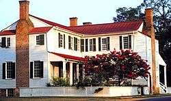 Hanover County Courthouse Historic District |
September 22, 1971 (#71000980) |
U.S. Route 301 37°45′46″N 77°22′00″W |
Hanover | |
| 13 | Hanover Meeting House |  Hanover Meeting House |
September 4, 1991 (#91001089) |
6411 Heatherwood Dr.[6] 37°38′42″N 77°19′50″W |
Mechanicsville | Site of the first non-Anglican church in Virginia |
| 14 | Hanover Town |  Hanover Town |
September 17, 1974 (#74002122) |
River Rd. on the western side of the Pamunkey River[7] 37°41′52″N 77°14′46″W |
Mechanicsville | |
| 15 | Hanover Wayside |  Hanover Wayside |
November 22, 2002 (#02001365) |
8225 Hanover Wayside Rd. 37°42′08″N 77°22′56″W |
Hanover | |
| 16 | Hickory Hill |  Hickory Hill |
November 21, 1974 (#74002121) |
East of Ashland off Hickory Hill Rd. 37°46′27″N 77°24′50″W |
Ashland | |
| 17 | Immanuel Episcopal Church | 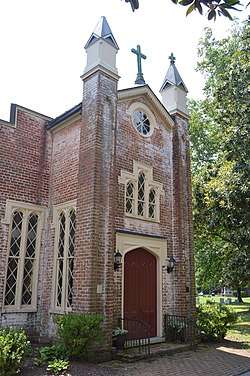 Immanuel Episcopal Church |
May 23, 1996 (#96000577) |
Old Church Rd., 1.7 miles (2.7 km) east of its junction with U.S. Route 360 37°38′35″N 77°12′59″W |
Mechanicsville | |
| 18 | Laurel Meadow | July 7, 1995 (#95000827) |
Eastern side of Lee Davis Rd., 0.2 miles (0.32 km) south of its junction with Pole Green Rd. 37°38′00″N 77°20′12″W |
Mechanicsville | ||
| 19 | Little River UDC Jefferson Davis Highway Marker | 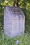 Little River UDC Jefferson Davis Highway Marker |
April 17, 2018 (#100002355) |
15400 Washington Highway 37°49′50″N 77°28′12″W |
Doswell | |
| 20 | Montpelier Historic District | 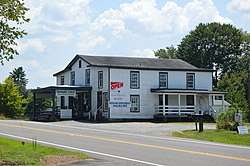 Montpelier Historic District |
May 16, 2002 (#02000517) |
Roughly along Mountain Rd. 37°49′08″N 77°40′59″W |
Montpelier | |
| 21 | Oak Forest | 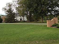 Oak Forest |
August 23, 1999 (#99000964) |
7400 Rural Point Rd. 37°40′35″N 77°21′07″W |
Mechanicsville | |
| 22 | Oakland | 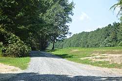 Oakland |
July 30, 1974 (#74002123) |
North of Montpelier 37°52′20″N 77°39′42″W |
Montpelier | |
| 23 | Oakley Hill | 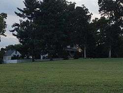 Oakley Hill |
May 19, 1994 (#94000459) |
Southern side of State Route 156, 2,500 feet (760 m) west of its junction with Lee Davis Rd. 37°35′45″N 77°20′23″W |
Mechanicsville | |
| 24 | Patrick Henry's Birthplace Archeological Site | 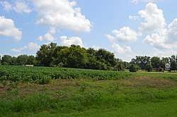 Patrick Henry's Birthplace Archeological Site |
August 2, 1982 (#82001819) |
9620 Studley Farm Dr.[8] 37°40′09″N 77°17′27″W |
Studley | |
| 25 | Pine Slash | November 19, 1987 (#87001946) |
Rural Point Rd. 37°39′21″N 77°19′31″W |
Studley | ||
| 26 | Randolph-Macon College Buildings |  Randolph-Macon College Buildings |
June 19, 1979 (#79003044) |
Randolph-Macon College campus 37°45′38″N 77°28′47″W |
Ashland | |
| 27 | Richmond National Battlefield Park | 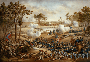 Richmond National Battlefield Park |
October 15, 1966 (#66000836) |
East of Richmond 37°35′24″N 77°17′06″W |
Richmond | |
| 28 | Edmund Ruffin Plantation | 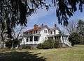 Edmund Ruffin Plantation |
October 15, 1966 (#66000837) |
11 miles (18 km) northeast of Richmond on U.S. Route 360 37°39′15″N 77°13′21″W |
Richmond | Also known as Marlbourne |
| 29 | Rural Plains | %2C_Richmond_National_Battlefield_Park_(Hanover_County%2C_Virginia).jpg) Rural Plains |
June 5, 1975 (#75002021) |
6 miles (9.7 km) north of Mechanicsville off Studley Rd. 37°39′39″N 77°20′49″W |
Mechanicsville | |
| 30 | St. Paul's Episcopal Church | _-_front.JPG) St. Paul's Episcopal Church |
May 19, 1994 (#94000460) |
Southwestern corner of the junction of U.S. Route 301 and State Route 54 37°45′56″N 77°22′15″W |
Hanover | |
| 31 | Scotchtown | .jpg) Scotchtown |
October 15, 1966 (#66000835) |
10 miles (16 km) northwest of Ashland on Scotchtown Rd. 37°50′40″N 77°35′10″W |
Ashland | Also known as the Patrick Henry House |
| 32 | Selwyn | 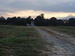 Selwyn |
May 22, 2003 (#03000445) |
6279 Powhite Farm Dr. 37°34′57″N 77°19′12″W |
Mechanicsville | |
| 33 | Sharp's Oakland | 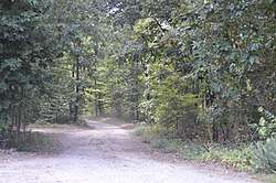 Sharp's Oakland |
January 24, 2002 (#01001514) |
12308 Verdon Rd. 37°53′57″N 77°30′47″W |
Doswell | |
| 34 | Slash Church | 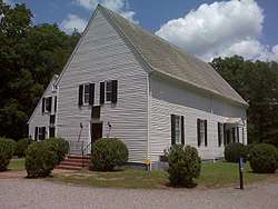 Slash Church |
September 22, 1972 (#72001399) |
Mt. Hermon Rd., north of its junction with Peaks Rd. 37°43′10″N 77°24′52″W |
Ashland | |
| 35 | Spring Green |  Spring Green |
December 31, 2002 (#02000316) |
2160 Old Church Rd. 37°37′50″N 77°10′21″W |
Mechanicsville | |
| 36 | Springfield |  Springfield |
August 16, 1994 (#94000990) |
Southern side of Old Ridge Rd., 0.4 miles (0.64 km) southwest of its junction with Coatesville Rd. 37°51′57″N 77°36′47″W |
Coatesville | |
| 37 | Sycamore Tavern |  Sycamore Tavern |
July 24, 1974 (#74002124) |
West of U.S. Route 33 37°49′23″N 77°41′14″W |
Montpelier | |
| 38 | The Tavern at Old Church |  The Tavern at Old Church |
May 16, 2016 (#16000260) |
3350-3360 Old Church Rd. 37°38′41″N 77°13′17″W |
Mechanicsville | |
| 39 | Totomoi |  Totomoi |
December 12, 1976 (#76002108) |
West of Studley on Rural Point Rd. 37°40′08″N 77°22′19″W |
Studley | |
| 40 | Trinity Church |  Trinity Church |
December 27, 1990 (#90001923) |
Junction of Teman and Goshen Rds. 37°54′04″N 77°37′56″W |
Beaverdam | |
| 41 | Virginia Industrial Home School for Colored Girls |  Virginia Industrial Home School for Colored Girls |
October 7, 2016 (#15000926) |
11391 Barrett Center Rd. 37°42′39″N 77°21′42″W |
Mechanicsville | |
| 42 | Williamsville |  Williamsville |
November 18, 1985 (#85002915) |
Off Williamsville Rd. 37°41′50″N 77°18′23″W |
Studley |
See also
| Wikimedia Commons has media related to National Register of Historic Places in Hanover County, Virginia. |
References
- The latitude and longitude information provided in this table was derived originally from the National Register Information System, which has been found to be fairly accurate for about 99% of listings. Some locations in this table may have been corrected to current GPS standards.
- "National Register of Historic Places: Weekly List Actions". National Park Service, United States Department of the Interior. Retrieved on June 26, 2020.
- Numbers represent an ordering by significant words. Various colorings, defined here, differentiate National Historic Landmarks and historic districts from other NRHP buildings, structures, sites or objects.
- "National Register Information System". National Register of Historic Places. National Park Service. April 24, 2008.
- The eight-digit number below each date is the number assigned to each location in the National Register Information System database, which can be viewed by clicking the number.
- "Visit Polegreen Church". Historic Polegreen Church Foundation. Retrieved 2014-03-23.
- "Hanovertown". Geographic Names Information System. United States Geological Survey.
- "Studley". Richmond Metropolitan Convention and Visitor's Bureau. Retrieved 2014-03-20.

Municipalities and communities of Hanover County, Virginia, United States | ||
|---|---|---|
County seat: Hanover Courthouse | ||
| Town | Map of Virginia highlighting Hanover County | |
| CDPs | ||
| Unincorporated communities | ||
This article is issued from Wikipedia. The text is licensed under Creative Commons - Attribution - Sharealike. Additional terms may apply for the media files.