National Register of Historic Places listings in Warren County, Virginia
This is a list of the National Register of Historic Places listings in Warren County, Virginia.

Location of Warren County in Virginia
This is intended to be a complete list of the properties and districts on the National Register of Historic Places in Warren County, Virginia, United States. The locations of National Register properties and districts for which the latitude and longitude coordinates are included below, may be seen in a Google map.[1]
There are 23 properties and districts listed on the National Register in the county, including 3 National Historic Landmarks.
- This National Park Service list is complete through NPS recent listings posted June 19, 2020.[2]
Current listings
| [3] | Name on the Register[4] | Image | Date listed[5] | Location | City or town | Description |
|---|---|---|---|---|---|---|
| 1 | Balthis House | 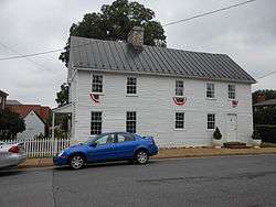 Balthis House |
August 11, 2004 (#04000860) |
55 Chester St. 38°55′10″N 78°11′28″W |
Front Royal | |
| 2 | Cedar Creek Battlefield and Belle Grove | 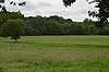 Cedar Creek Battlefield and Belle Grove |
August 11, 1969 (#69000243) |
On Interstate 81 between Middletown and Strasburg 39°00′00″N 78°18′40″W |
Middletown | Site of the Battle of Cedar Creek; designated a National Historic Landmark District in 1969. Extends into Frederick County. |
| 3 | Compton Gap Site |  Compton Gap Site |
December 13, 1985 (#85003176) |
Address Restricted |
Luray | |
| 4 | Erin | 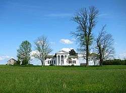 Erin |
December 28, 1979 (#79003093) |
Northeast of Front Royal on U.S. Routes 340/522 39°01′22″N 78°09′34″W |
Front Royal | |
| 5 | Fairview Farm | 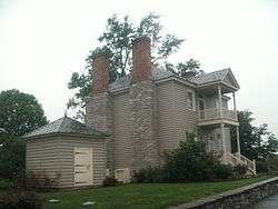 Fairview Farm |
June 5, 1986 (#86001249) |
Rockland Rd. 38°59′40″N 78°07′53″W |
Front Royal | |
| 6 | Flint Run Archeological District | 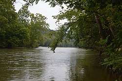 Flint Run Archeological District |
December 22, 1976 (#76002125) |
Straddling the Shenandoah River below Karo[6] 38°52′07″N 78°15′15″W |
Front Royal | Includes the Thunderbird Archeological District; occupies both sides of the river[6] |
| 7 | Front Royal Historic District | .jpg) Front Royal Historic District |
April 11, 2003 (#03000209) |
Irregular district around E. and W. Main St., and S. Royal Ave. 38°55′05″N 78°11′34″W |
Front Royal | |
| 8 | Front Royal Recreational Park Historic District | 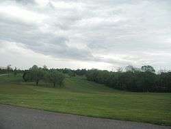 Front Royal Recreational Park Historic District |
October 27, 1992 (#91001975) |
Country Club Rd., 1.1 miles (1.8 km) north of Riverton off U.S. Route 522 38°57′30″N 78°11′10″W |
Front Royal | |
| 9 | Killahevlin | 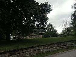 Killahevlin |
October 14, 1993 (#93001128) |
1401 N. Royal Ave. 38°56′13″N 78°11′37″W |
Front Royal | |
| 10 | Lackawanna | 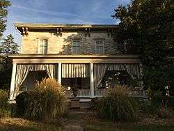 Lackawanna |
May 16, 2014 (#14000240) |
236 Riverside Dr. 38°56′43″N 78°11′39″W |
Front Royal | |
| 11 | Long Meadow |  Long Meadow |
October 12, 1995 (#95001169) |
Long Meadow Rd. about 0.9 miles south of its junction with Water Plant Rd. 38°59′02″N 78°18′08″W |
Middletown | |
| 12 | Milford Battlefield | 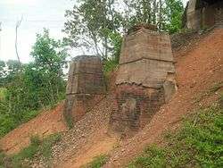 Milford Battlefield |
August 11, 2004 (#04000854) |
U.S. Route 340 and Overall Rd. 38°48′44″N 78°20′36″W |
Overall | Extends into Page County |
| 13 | Mount Zion | 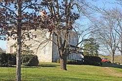 Mount Zion |
February 26, 1970 (#70000830) |
Northeast of the junction of Milldale and Ashley Station Rds. 39°00′07″N 78°05′59″W |
Milldale | |
| 13 | Mountain Home | 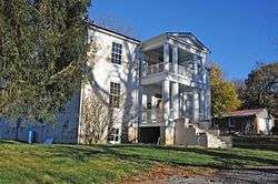 Mountain Home |
August 8, 2007 (#07000801) |
2471 Remound Rd. 38°52′30″N 78°08′41″W |
Front Royal | |
| 15 | Page County Bridge No. 1990 | 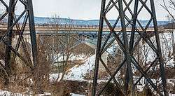 Page County Bridge No. 1990 |
May 15, 2008 (#08000423) |
U.S. Route 340 38°48′23″N 78°20′55″W |
Overall | Extends into Page County |
| 16 | Riverside | 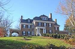 Riverside |
October 12, 1995 (#95001172) |
1315 Old Winchester Pike 38°56′42″N 78°11′47″W |
Front Royal | |
| 17 | Riverton Historic District |  Riverton Historic District |
May 16, 2002 (#02000514) |
Roughly along Crisman Dr., Duck St., Old Winchester Pike, the Queens Highway, Riverside Dr., Rugby St., and Strasburg Rd. 38°56′46″N 78°11′41″W |
Front Royal | |
| 18 | Rockland Rural Historic District | 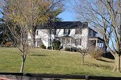 Rockland Rural Historic District |
November 17, 2015 (#15000809) |
Roughly bounded by the Clarke County line, the Shenandoah River, Winchester Rd., and the Norfolk Southern railroad line 39°00′06″N 78°05′56″W |
Front Royal | |
| 19 | Rose Hill | 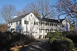 Rose Hill |
May 23, 1996 (#96000578) |
900 block of N. Royal Ave. 38°55′49″N 78°11′43″W |
Front Royal | |
| 20 | Skyline Drive Historic District | 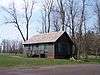 Skyline Drive Historic District |
April 28, 1997 (#97000375) |
Shenandoah National Park, from the northern entrance station at Front Royal to the southern entrance station at Rockfish Gap 38°46′49″N 78°12′10″W |
Luray | |
| 21 | Sonner Hall | 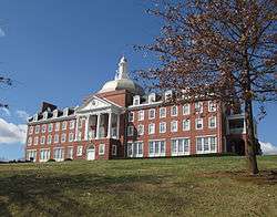 Sonner Hall |
January 29, 1987 (#87000007) |
3rd St. 38°55′23″N 78°11′53″W |
Front Royal | |
| 22 | Thunderbird Archeological District |  Thunderbird Archeological District |
May 5, 1977 (#77001495) |
Northern edge of the Shenandoah River floodplain, west of Kano[6] 38°52′10″N 78°16′19″W |
Limeton | |
| 23 | Warren County Courthouse |  Warren County Courthouse |
January 28, 2000 (#00000028) |
1 E. Main St. 38°55′03″N 78°11′35″W |
Front Royal |
See also
| Wikimedia Commons has media related to National Register of Historic Places in Warren County, Virginia. |
References
- The latitude and longitude information provided in this table was derived originally from the National Register Information System, which has been found to be fairly accurate for about 99% of listings. Some locations in this table may have been corrected to current GPS standards.
- "National Register of Historic Places: Weekly List Actions". National Park Service, United States Department of the Interior. Retrieved on June 19, 2020.
- Numbers represent an ordering by significant words. Various colorings, defined here, differentiate National Historic Landmarks and historic districts from other NRHP buildings, structures, sites or objects.
- "National Register Information System". National Register of Historic Places. National Park Service. April 24, 2008.
- The eight-digit number below each date is the number assigned to each location in the National Register Information System database, which can be viewed by clicking the number.
- Gardner, William M., ed. The Flint Run Paleo-Indian Complex : A Preliminary Report 1971-73 Seasons. Washington : Archeology Laboratory, Dept. of Anthropology, Catholic University of America, 1974, 7.

Municipalities and communities of Warren County, Virginia, United States | ||
|---|---|---|
| Town | Map of Virginia highlighting Warren County | |
| CDPs | ||
| Unincorporated communities |
| |
| Footnotes | ‡This populated place also has portions in an adjacent county or counties | |
This article is issued from Wikipedia. The text is licensed under Creative Commons - Attribution - Sharealike. Additional terms may apply for the media files.