National Register of Historic Places listings in Albemarle County, Virginia
This is a list of the National Register of Historic Places listings in Albemarle County, Virginia.
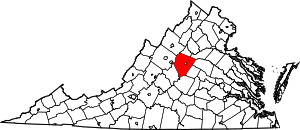
Location of Albemarle County in Virginia
This is intended to be a complete list of the properties and districts on the National Register of Historic Places in Albemarle County, Virginia, United States. The locations of National Register properties and districts for which the latitude and longitude coordinates are included below, may be seen in an online map.[1]
There are 101 properties and districts listed on the National Register in the county, including 5 National Historic Landmarks. Another property was once listed but has been removed.
- This National Park Service list is complete through NPS recent listings posted June 19, 2020.[2]
Current listings
| [3] | Name on the Register[4] | Image | Date listed[5] | Location | City or town | Description |
|---|---|---|---|---|---|---|
| 1 | Advance Mills |  Advance Mills |
April 12, 2002 (#02000362) |
Junction of Advance Mills and Frays Mills Rds. 38°11′00″N 78°26′21″W |
Advance Mills | |
| 2 | The Anchorage |  The Anchorage |
July 13, 2001 (#01000688) |
1864 Anchorage Farm 37°58′27″N 78°36′55″W |
Charlottesville | |
| 3 | Arrowhead |  Arrowhead |
July 9, 1991 (#91000885) |
Eastern side of U.S. Route 29 at Arrowhead Farm Ln. 37°58′49″N 78°35′41″W |
Charlottesville | |
| 4 | The Aviator | 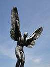 The Aviator |
November 9, 2006 (#06000758) |
575 Alderman Rd. 38°02′11″N 78°30′21″W |
Charlottesville | |
| 5 | Ballard-Maupin House |  Ballard-Maupin House |
February 5, 1999 (#99000142) |
4257 Ballard's Mill Rd. 38°09′11″N 78°35′49″W |
Free Union | |
| 6 | Batesville Historic District | 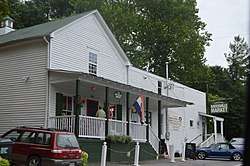 Batesville Historic District |
December 9, 1999 (#99001500) |
Junction of Plank and Craigs Store Rds. 37°59′44″N 78°43′21″W |
Batesville | |
| 7 | Bel Aire | 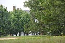 Bel Aire |
March 7, 2007 (#07000132) |
4710 Dickerson Rd. 38°09′46″N 78°25′38″W |
Charlottesville | |
| 8 | Bellair |  Bellair |
October 15, 1992 (#92001372) |
Southern side of Secretarys Rd., 3.8 miles (6.1 km) east of the junction with State Route 20 37°53′22″N 78°31′08″W |
Charlottesville | |
| 9 | Bellevue |  Bellevue |
July 9, 1991 (#91000886) |
Southern side of Plank Rd., 3,500 feet (1,100 m) west of the Dick Woods Rd. junction 38°00′38″N 78°44′57″W |
Batesville | |
| 10 | Bentivar | 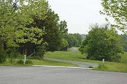 Bentivar |
April 20, 2005 (#05000333) |
1601 Bentivar Farm Rd. 38°04′59″N 78°26′05″W |
Charlottesville | |
| 11 | Birdwood |  Birdwood |
October 23, 2003 (#03001094) |
500 Birdwood Dr. 38°02′56″N 78°32′01″W |
Charlottesville | |
| 12 | Blenheim |  Blenheim |
May 17, 1976 (#76002089) |
South of Charlottesville on Blenheim Rd. 37°55′59″N 78°29′59″W |
Blenheim | |
| 13 | Blue Ridge Farm |  Blue Ridge Farm |
January 25, 1991 (#90002163) |
South of the junction of Plank and Ortman Rds. 38°00′46″N 78°46′03″W |
Greenwood | |
| 14 | Blue Ridge Swim Club |  Blue Ridge Swim Club |
May 19, 2015 (#15000248) |
1275 Owensville Rd. 38°04′24″N 78°35′23″W |
Ivy | |
| 15 | Boyd Tavern | .JPG) Boyd Tavern |
November 12, 2009 (#09000919) |
Union Mills Rd. 37°59′05″N 78°20′20″W |
Boyd Tavern | |
| 16 | Carr's Hill |  Carr's Hill |
April 23, 2008 (#08000340) |
1910 Carr's Hill Rd. 38°02′17″N 78°30′14″W |
Charlottesville | |
| 17 | Carrsbrook | .jpg) Carrsbrook |
July 8, 1982 (#82004532) |
Gloucester Ct. 38°05′37″N 78°27′18″W |
Charlottesville | |
| 18 | Casa Maria |  Casa Maria |
December 28, 1990 (#90001999) |
Ortman Rd., south of the junction with U.S. Route 250 38°01′55″N 78°45′27″W |
Greenwood | |
| 19 | Castle Hill | 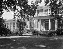 Castle Hill |
February 23, 1972 (#72001379) |
Northeast of Cismont near the junction of State Route 231 and Turkey Sag Rd. 38°05′08″N 78°17′53″W |
Cismont | |
| 20 | The Cedars | 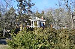 The Cedars |
December 27, 1990 (#89001909) |
U.S. Route 250, west of Interstate 64 38°02′29″N 78°44′18″W |
Greenwood | |
| 21 | Christ Church Glendower | 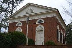 Christ Church Glendower |
July 2, 1971 (#71000974) |
On Glendower Rd., 0.4 miles (0.64 km) southwest of the junction with Coles Rolling Rd. 37°51′11″N 78°32′03″W |
Keene | |
| 22 | George Rogers Clark Sculpture |  George Rogers Clark Sculpture |
May 16, 1997 (#97000448) |
Monument Square, bounded by University and Jefferson Park Aves. and the railroad tracks 38°02′00″N 78°29′56″W |
Charlottesville | |
| 23 | Clark Hall, University of Virginia | 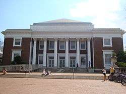 Clark Hall, University of Virginia |
September 5, 2008 (#08000871) |
291 McCormick Rd. 38°01′59″N 78°30′28″W |
Charlottesville | |
| 24 | Cliffside | 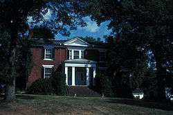 Cliffside |
September 16, 1982 (#82004536) |
North of Scottsville on State Route 6 37°48′12″N 78°29′58″W |
Scottsville | |
| 25 | Clifton | 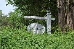 Clifton |
November 2, 1989 (#89001922) |
Milton Rd. at the Rivanna River 38°00′25″N 78°23′50″W |
Shadwell | |
| 26 | Cobham Park |  Cobham Park |
July 18, 1974 (#74002101) |
South of State Route 22 38°03′31″N 78°15′44″W |
Cobham | |
| 27 | Cocke's Mill House and Mill Site |  Cocke's Mill House and Mill Site |
December 6, 1990 (#90001828) |
Plank Rd. north of its junction with Alberene Rd. 37°54′30″N 78°37′02″W |
North Garden | |
| 28 | Cove Presbyterian Church |  Cove Presbyterian Church |
November 2, 1989 (#89001935) |
U.S. Route 29, north of Boaz Rd. 37°53′05″N 78°42′39″W |
Covesville | |
| 29 | Covesville Historic District | .jpg) Covesville Historic District |
June 2, 2005 (#05000521) |
Roughly along the railroad tracks, U.S. Route 29, Covesville Ln., and Boaz Rd. 37°53′27″N 78°42′17″W |
Covesville | |
| 30 | Crossroads Tavern | 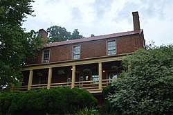 Crossroads Tavern |
August 16, 1984 (#84003481) |
Plank Rd. 37°57′27″N 78°39′38″W |
Crossroads | |
| 31 | Crozet Historic District |  Crozet Historic District |
November 28, 2012 (#12000985) |
Roughly Railroad, St. George, and Crozet Aves. 38°04′18″N 78°42′06″W |
Crozet | |
| 32 | D.S. Tavern | .png) D.S. Tavern |
September 29, 1983 (#83003255) |
U.S. Route 250 38°03′13″N 78°34′02″W |
Ivy | |
| 33 | Earlysville Union Church |  Earlysville Union Church |
December 11, 1997 (#97001504) |
Advance Mills Rd., south of the junction with Buck Mountain Rd. 38°09′25″N 78°28′59″W |
Earlysville | |
| 34 | East Belmont |  East Belmont |
August 2, 1999 (#99000853) |
Junction of State Route 22 and Black Cat Rd. 38°01′58″N 78°22′03″W |
Keswick | |
| 35 | Edge Hill | 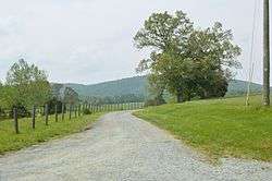 Edge Hill |
September 9, 1982 (#82004537) |
North of Shadwell on State Route 22 38°01′05″N 78°23′41″W |
Shadwell | |
| 36 | Edgemont | 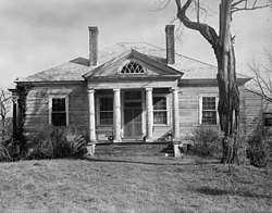 Edgemont |
November 28, 1980 (#80004162) |
Southeast of Colesville on Plank Rd. 37°54′17″N 78°37′01″W |
Covesville | |
| 37 | Ednam House | 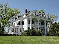 Ednam House |
July 8, 1982 (#82004533) |
U.S. Route 250 38°03′07″N 78°32′17″W |
Ednam | |
| 38 | Emmanuel Church | 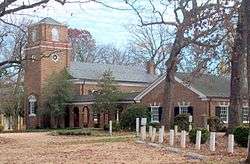 Emmanuel Church |
July 8, 1982 (#82004535) |
U.S. Route 250 38°02′00″N 78°45′47″W |
Greenwood | |
| 39 | Esmont |  Esmont |
May 6, 1980 (#80004163) |
North of Esmont 37°50′30″N 78°36′25″W |
Esmont | |
| 40 | Estes Farm | 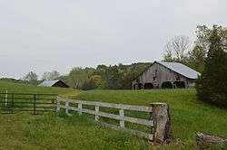 Estes Farm |
May 17, 2006 (#06000409) |
6185 Estes Ln. 38°12′18″N 78°29′44″W |
Dyke | |
| 41 | Estouteville | 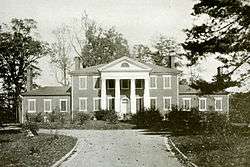 Estouteville |
January 30, 1978 (#78003002) |
Southeast of Powell Corner off Plank Rd. 37°53′12″N 78°34′23″W |
Powell Corner | |
| 42 | Farmington | .jpg) Farmington |
September 15, 1970 (#70000782) |
West of the junction of U.S. Routes 29 and 250 38°03′44″N 78°32′30″W |
Charlottesville | |
| 43 | Faulkner House |  Faulkner House |
May 3, 1984 (#84003484) |
2201 Old Ivy Rd. 38°02′52″N 78°30′49″W |
Charlottesville | |
| 44 | Gallison Hall | 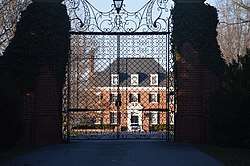 Gallison Hall |
December 28, 1990 (#90002013) |
24 Farmington Dr. 38°04′11″N 78°32′08″W |
Charlottesville | |
| 45 | Gardner House | March 18, 2020 (#100005103) |
3137 Shiffletts Mill Rd. 38°13′29″N 78°36′49″W |
Crozet vicinity | ||
| 46 | Grace Church |  Grace Church |
October 21, 1976 (#76002091) |
Northeast of Cismont on State Route 231 38°03′39″N 78°18′30″W |
Cismont | |
| 47 | Greenwood-Afton Rural Historic District |  Greenwood-Afton Rural Historic District |
May 6, 2011 (#11000258) |
Roughly 5 miles (8.0 km) to 7 miles (11 km) north and south of Interstate 64 38°03′21″N 78°46′12″W |
Greenwood | Boundaries modified on February 8, 2016. Extends into Augusta and Nelson counties |
| 48 | Guthrie Hall | 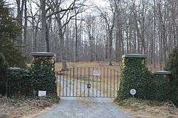 Guthrie Hall |
September 23, 1982 (#82004534) |
North of Esmont on Alberene Rd. 37°50′56″N 78°36′40″W |
Esmont | |
| 49 | Harris Farm |  Harris Farm |
May 18, 2015 (#15000249) |
2950 State Route 53 37°57′58″N 78°22′45″W |
Charlottesville | |
| 50 | High Meadows |  High Meadows |
May 30, 1986 (#86001185) |
Off State Route 20 37°48′34″N 78°29′56″W |
Scottsville | |
| 51 | Highland |  Highland |
August 14, 1973 (#73001990) |
Southeast of Charlottesville off State Route 53 37°58′58″N 78°27′22″W |
Simeon | |
| 52 | Home Tract |  Home Tract |
December 9, 1999 (#99001501) |
699 Ivy Depot Rd. 38°03′20″N 78°35′52″W |
Ivy | |
| 53 | Kenridge | 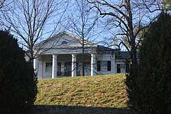 Kenridge |
May 15, 2008 (#08000416) |
912 Marsh Ln. 38°03′10″N 78°32′00″W |
Charlottesville | |
| 54 | Lewis Mountain |  Lewis Mountain |
December 7, 2009 (#09001052) |
1 Lewis Mountain Parkway 38°02′28″N 78°31′16″W |
Charlottesville | |
| 55 | Limestone | .tif.jpg) Limestone |
May 10, 2006 (#06000366) |
4401 Limestone Rd. 37°59′29″N 78°21′12″W |
Keswick | |
| 56 | Longwood | 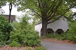 Longwood |
October 18, 1996 (#96001074) |
Northern side of Buck Mountain Rd. at its junction with Markwood and Simmons Gap Rds. 38°10′44″N 78°29′48″W |
Earlysville | |
| 57 | Malvern | .tif.jpg) Malvern |
August 4, 1995 (#95000974) |
Western side of Taylors Gap Rd., 1,250 feet (380 m) north of the junction with Dick Woods Rd. 38°01′46″N 78°38′25″W |
Charlottesville | |
| 58 | Leander McCormick Observatory | 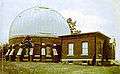 Leander McCormick Observatory |
November 19, 2004 (#04001245) |
600 McCormick Rd. 38°01′58″N 78°31′20″W |
Charlottesville | |
| 59 | Mechum River Farm |  Mechum River Farm |
March 29, 2007 (#07000235) |
1207 Burchs Creek Rd. 38°00′32″N 78°43′08″W |
Charlottesville | |
| 60 | Memorial Gymnasium | 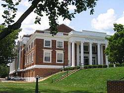 Memorial Gymnasium |
December 4, 2004 (#04001291) |
210 S. Emmett St. 38°02′15″N 78°30′26″W |
Charlottesville | |
| 61 | Midway |  Midway |
February 28, 1979 (#79003152) |
Southeast of Millington off Ridge Rd. 38°06′34″N 78°35′56″W |
Millington | |
| 62 | Miller School of Albemarle | 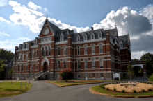 Miller School of Albemarle |
February 15, 1974 (#74002102) |
1000 Samuel Miller Loop 38°00′22″N 78°42′05″W |
Yancey Mills | |
| 63 | Mirador |  Mirador |
April 7, 1983 (#83003256) |
U.S. Route 250; also 7459 Mirador Farm Rd. 38°02′17″N 78°45′26″W |
Greenwood | Second address represents a boundary increase of May 2, 2003 |
| 64 | Monroe Hill | 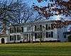 Monroe Hill |
June 2, 2004 (#04000575) |
252 and 256 McCormick Rd. 38°02′05″N 78°30′25″W |
Charlottesville | |
| 65 | Monticello | 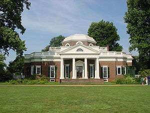 Monticello |
October 15, 1966 (#66000826) |
2 miles (3.2 km) south of Charlottesville on State Route 53 38°00′37″N 78°27′09″W |
Charlottesville | |
| 66 | Monticola | 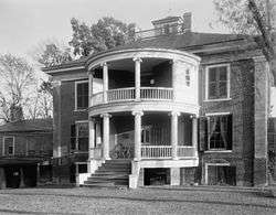 Monticola |
June 22, 1990 (#90000872) |
Howardsville Turnpike north of the junction with Lewiston Ford Rd. 37°44′33″N 78°38′57″W |
Howardsville | |
| 67 | Morven |  Morven |
April 24, 1973 (#73001991) |
West of Simeon off State Route 20 37°57′59″N 78°28′18″W |
Simeon | |
| 68 | Mount Fair |  Mount Fair |
December 28, 1990 (#90001997) |
Junction of Slam Gate Rd. and Browns Gap Turnpike 38°09′52″N 78°40′40″W |
Browns Cove | |
| 69 | Mount Ida |  Mount Ida |
April 27, 1987 (#87000624) |
East of Blenheim Rd., about 4 miles (6.4 km) north of Scottsville 37°51′03″N 78°28′56″W |
Scottsville | |
| 70 | Mount Walla | .png) Mount Walla |
November 22, 2000 (#00001442) |
604 Poplar Springs Rd. 37°48′01″N 78°29′32″W |
Scottsville | |
| 71 | Mountain Grove | .png) Mountain Grove |
September 8, 1980 (#80004164) |
Northwest of Esmont on Secretarys Sand Rd. 37°50′08″N 78°38′25″W |
Esmont | |
| 72 | Pantops Farm |  Pantops Farm |
May 7, 2014 (#05000483) |
400 Peter Jefferson St. 38°01′34″N 78°26′32″W |
Charlottesville | |
| 73 | Periwinkle Cottage | November 19, 2019 (#100004659) |
2245 Blue Ridge Ln. 38°04′07″N 78°32′29″W |
Charlottesville | ||
| 74 | Piedmont |  Piedmont |
February 1, 1991 (#90002184) |
Near the junction of Interstate 64 and Greenwood Rd. 38°02′46″N 78°46′32″W |
Greenwood | |
| 75 | Pine Knot |  Pine Knot |
February 1, 1989 (#88003211) |
Coles Rolling Rd. 37°50′57″N 78°31′30″W |
Glendower | |
| 76 | Plain Dealing |  Plain Dealing |
May 6, 1980 (#80004165) |
East of Keene 37°51′41″N 78°31′56″W |
Keene | |
| 77 | Proffit Historic District |  Proffit Historic District |
February 5, 1999 (#99000145) |
Roughly the area around the junction of the Norfolk Southern railway tracks and Proffit Rd. 38°06′32″N 78°25′28″W |
Proffit | |
| 78 | Ramsay |  Ramsay |
March 10, 2005 (#05000135) |
7760 Rockfish Gap Turnpike 38°02′06″N 78°46′04″W |
Greenwood | |
| 79 | The Rectory |  The Rectory |
November 7, 1991 (#91001579) |
Junction of Glendower and Coles Rolling Rds. 37°51′24″N 78°31′51″W |
Keene | |
| 80 | Red Hills |  Red Hills |
February 13, 1998 (#98000047) |
2051 Polo Grounds Rd. 38°05′44″N 78°25′40″W |
Charlottesville | |
| 81 | Redlands | .tif.jpg) Redlands |
November 12, 1969 (#69000218) |
Junction of Secretarys and Carters Mountain Rds. 37°54′44″N 78°31′47″W |
Covesville | |
| 82 | Rotunda, University of Virginia | 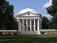 Rotunda, University of Virginia |
October 15, 1966 (#66000937) |
University of Virginia 38°02′08″N 78°30′12″W |
Charlottesville | |
| 83 | Rugby Road-University Corner Historic District | 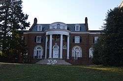 Rugby Road-University Corner Historic District |
February 16, 1984 (#84003523) |
Roughly bounded by University Ave., Wayside Pl., 14th St., and U.S. Route 29 38°02′17″N 78°30′11″W |
Charlottesville | Extends into Charlottesville |
| 84 | St. James Church | %2C_Owensville%2C_Albemarle_County%2C_VA_HABS_VA%2C2-OWEN.V%2C1-_(sheet_3_of_5).png) St. James Church |
January 14, 2013 (#12001186) |
Garth Rd. east of Owensville Rd. 38°06′08″N 78°34′22″W |
Charlottesville | also known as Garth Chapel[6] |
| 85 | St. John School |  St. John School |
January 14, 2019 (#100003312) |
1569 St. John Rd. 38°04′47″N 78°16′34″W |
Gordonsville | |
| 86 | Scottsville Historic District | .jpg) Scottsville Historic District |
July 30, 1976 (#76002093) |
State Route 6; also roughly bounded by the James River, the town limits, and Riverview, Mount Walla, Oakwood, Cliffside, and Chester 37°48′00″N 78°29′46″W |
Scottsville | Second set of boundaries represents a boundary increase of February 11, 2004. Extends into Fluvanna County. |
| 87 | Seven Oaks Farm and Black's Tavern |  Seven Oaks Farm and Black's Tavern |
December 26, 1989 (#89001906) |
U.S. Route 250, west of Interstate 64 38°02′31″N 78°44′47″W |
Greenwood | |
| 88 | Shack Mountain |  Shack Mountain |
September 1, 1976 (#76002090) |
2 miles (3.2 km) north-northwest of Charlottesville off Lambs Ln. 38°05′31″N 78°30′04″W |
Charlottesville | |
| 89 | Skyline Drive Historic District | Skyline Drive Historic District |
April 28, 1997 (#97000375) |
Shenandoah National Park, from the north entrance station at Front Royal to the south entrance station at the Rockfish Gap 38°13′48″N 78°43′34″W |
Luray | |
| 90 | Southern Albemarle Rural Historic District | 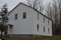 Southern Albemarle Rural Historic District |
November 28, 2007 (#07001236) |
Roughly bounded by the Rivanna River, State Route 20, Green Mountain, the James River, Blenheim, Jefferson Mill, Rolling, and Milton Rds., and the Monroe Parkway 37°53′47″N 78°36′36″W |
Charlottesville | |
| 91 | Southwest Mountains Rural Historic District |  Southwest Mountains Rural Historic District |
February 27, 1992 (#92000054) |
Roughly bounded by Interstate 64, State Route 20, the Orange County line, and the CSX railroad tracks 38°04′49″N 78°16′36″W |
Keswick | |
| 92 | Spring Hill |  Spring Hill |
November 21, 1983 (#83004232) |
Dick Woods Rd. 38°02′53″N 78°36′04″W |
Ivy | |
| 93 | Sunny Bank | .tif.jpg) Sunny Bank |
December 12, 1976 (#76002092) |
Northeast of Covesville, west of the junction of Plank and Old Lynchburg Rds. 37°55′14″N 78°38′56″W |
South Garden | |
| 94 | Sunnyfields |  Sunnyfields |
June 10, 1993 (#93000509) |
Western side of State Route 53, at the junction with Milton Rd. 37°59′32″N 78°27′14″W |
Simeon | |
| 95 | University of Virginia Historic District | _color.jpg) University of Virginia Historic District |
November 20, 1970 (#70000865) |
Bounded by University and Jefferson Park Aves., and Hospital and McCormick Rds. 38°02′05″N 78°30′15″W |
Charlottesville | Historic district on grounds of University of Virginia |
| 96 | Walker House | 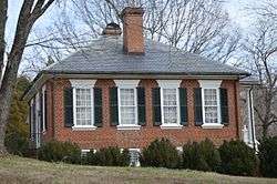 Walker House |
December 28, 1990 (#90002001) |
Warren Ferry Rd. south of the junction with James River Rd. 37°46′10″N 78°33′30″W |
Warren | |
| 97 | West Cote |  West Cote |
January 24, 2002 (#01001510) |
Off Howardsville Turnpike and James River Rd. 37°44′03″N 78°39′05″W |
Howardsville | |
| 98 | Woodburn |  Woodburn |
January 28, 2000 (#00000029) |
Proffit Rd., 2 miles east of U.S. Route 29 38°07′00″N 78°25′31″W |
Charlottesville | |
| 99 | Woodlands |  Woodlands |
November 2, 1989 (#89001931) |
Woodlands Rd. 38°06′20″N 78°30′03″W |
Charlottesville | |
| 100 | Woodstock Hall Tavern |  Woodstock Hall Tavern |
January 29, 1987 (#86003735) |
Dick Woods Rd. 38°01′37″N 78°37′52″W |
Ivy | |
| 101 | Woolen Mills Village Historic District |  Woolen Mills Village Historic District |
April 12, 2010 (#10000196) |
Area includes parts of Chesapeake, Franklin, Steephill, 18th, NE., and E. Market Sts. and Riverside Ave. in the City of Charlottesville; and parts of Pireus Row and Marchant and E. Market Sts. in Albemarle County.[7] 38°01′15″N 78°27′20″W |
Charlottesville | Extends into the city of Charlottesville |
Former listing
| [3] | Name on the Register | Image | Date listed | Date removed | Location | City or town | Summary |
|---|---|---|---|---|---|---|---|
| 1 | Enniscorthy | September 24, 1992 (#92001273) | March 20, 2001 | VA 627 .5 miles (0.80 km) south of the junction with VA 712 |
Keene |
See also
| Wikimedia Commons has media related to National Register of Historic Places in Albemarle County, Virginia. |
References
- The latitude and longitude information provided in this table was derived originally from the National Register Information System, which has been found to be fairly accurate for about 99% of listings. Some locations in this table may have been corrected to current GPS standards.
- "National Register of Historic Places: Weekly List Actions". National Park Service, United States Department of the Interior. Retrieved on June 19, 2020.
- Numbers represent an ordering by significant words. Various colorings, defined here, differentiate National Historic Landmarks and historic districts from other NRHP buildings, structures, sites or objects.
- "National Register Information System". National Register of Historic Places. National Park Service. April 24, 2008.
- The eight-digit number below each date is the number assigned to each location in the National Register Information System database, which can be viewed by clicking the number.
- "St. James Church National Register of Historic Places Registration Form" (PDF). Richmond, Virginia: Virginia Department of Historic Resources. May 5, 2012. Archived from the original (PDF) on September 26, 2012. Retrieved February 21, 2013.
- "Woolen Mills Village Historic District National Register of Historic Places Registration Form". Richmond, Virginia: Virginia Department of Historic Resources. August 27, 2009. Archived from the original on March 5, 2012. Retrieved April 30, 2010.

This article is issued from Wikipedia. The text is licensed under Creative Commons - Attribution - Sharealike. Additional terms may apply for the media files.