National Register of Historic Places listings in Nottoway County, Virginia
This is a list of the National Register of Historic Places listings in Nottoway County, Virginia.
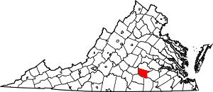
Location of Nottoway County in Virginia
This is intended to be a complete list of the properties and districts on the National Register of Historic Places in Nottoway County, Virginia, United States. The locations of National Register properties and districts for which the latitude and longitude coordinates are included below, may be seen in a Google map.[1]
There are 10 properties and districts listed on the National Register in the county.
- This National Park Service list is complete through NPS recent listings posted June 26, 2020.[2]
Current listings
| [3] | Name on the Register[4] | Image | Date listed[5] | Location | City or town | Description |
|---|---|---|---|---|---|---|
| 1 | Blackstone Historic District | 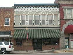 Blackstone Historic District |
January 25, 1991 (#90002174) |
Roughly bounded by Mann, Dillard, Tavern, S. High, Oak, 8th, and Freeman Sts., and the former Norfolk and Western railroad tracks 37°04′49″N 77°59′52″W |
Blackstone | |
| 2 | Burke's Tavern | 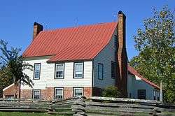 Burke's Tavern |
July 17, 1975 (#75002027) |
1.5 miles (2.4 km) west of Burkeville at the junction of Orchard and Burke Tavern Rds. 37°11′43″N 78°14′17″W |
Burkeville | |
| 3 | Hyde Park | 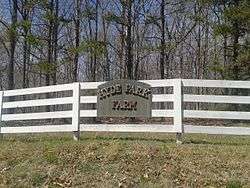 Hyde Park |
May 28, 2013 (#13000341) |
6808 W. Courthouse Rd. 37°07′17″N 78°10′17″W |
Burkeville | |
| 4 | Inverness | 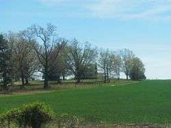 Inverness |
December 22, 1999 (#99001602) |
884 Inverness Ave. 37°11′07″N 78°11′17″W |
Burkeville | |
| 5 | Little Mountain Pictograph Site | February 15, 1991 (#91000021) |
Address Restricted |
Blackstone | ||
| 6 | Millbrook |  Millbrook |
March 23, 2010 (#10000094) |
1204 Snead Spring Rd. 37°05′59″N 78°07′57″W |
Crewe | |
| 7 | Mountain Hall |  Mountain Hall |
March 13, 2002 (#02000184) |
181 Mountain Hall Dr. 37°12′29″N 78°05′25″W |
Crewe | |
| 8 | Nottoway County Courthouse |  Nottoway County Courthouse |
August 13, 1973 (#73002045) |
Off U.S. Route 460 on Courthouse Rd. 37°07′42″N 78°04′48″W |
Nottoway | |
| 9 | Oakridge | 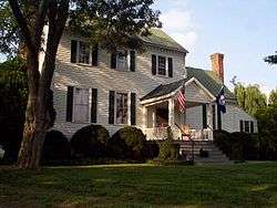 Oakridge |
January 30, 1978 (#78003035) |
West of Blackstone off Hungarytown Rd. 37°05′04″N 78°05′22″W |
Blackstone | |
| 10 | Schwartz Tavern |  Schwartz Tavern |
June 28, 1974 (#74002140) |
111 Tavern St. 37°04′54″N 77°59′44″W |
Blackstone |
See also
| Wikimedia Commons has media related to National Register of Historic Places in Nottoway County, Virginia. |
References
- The latitude and longitude information provided in this table was derived originally from the National Register Information System, which has been found to be fairly accurate for about 99% of listings. Some locations in this table may have been corrected to current GPS standards.
- "National Register of Historic Places: Weekly List Actions". National Park Service, United States Department of the Interior. Retrieved on June 26, 2020.
- Numbers represent an ordering by significant words. Various colorings, defined here, differentiate National Historic Landmarks and historic districts from other NRHP buildings, structures, sites or objects.
- "National Register Information System". National Register of Historic Places. National Park Service. April 24, 2008.
- The eight-digit number below each date is the number assigned to each location in the National Register Information System database, which can be viewed by clicking the number.

Municipalities and communities of Nottoway County, Virginia, United States | ||
|---|---|---|
| Towns | Map of Virginia highlighting Nottoway County | |
| CDP | ||
| Other localities | ||
This article is issued from Wikipedia. The text is licensed under Creative Commons - Attribution - Sharealike. Additional terms may apply for the media files.