National Register of Historic Places listings in Floyd County, Virginia
This is a list of the National Register of Historic Places listings in Floyd County, Virginia.
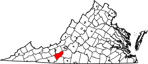
Location of Floyd County in Virginia
This is intended to be a complete list of the properties and districts on the National Register of Historic Places in Floyd County, Virginia, United States. The locations of National Register properties and districts for which the latitude and longitude coordinates are included below, may be seen in a Google map.[1]
There are 9 properties and districts listed on the National Register in the county.
- This National Park Service list is complete through NPS recent listings posted June 26, 2020.[2]
Current listings
| [3] | Name on the Register[4] | Image | Date listed[5] | Location | City or town | Description |
|---|---|---|---|---|---|---|
| 1 | Buffalo Mountain Presbyterian Church and Cemetery | 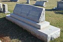 Buffalo Mountain Presbyterian Church and Cemetery |
March 30, 2007 (#07000229) |
2102 Childress Rd. 36°46′41″N 80°31′01″W |
Willis | Church is in Carroll County; cemetery is in Floyd County |
| 2 | Floyd Historic District |  Floyd Historic District |
November 16, 2005 (#05001266) |
Centered along Main and Osford Sts. between Penn Ave., and Baker St. and Sweeney and Nira St. 36°54′40″N 80°19′12″W |
Floyd | |
| 3 | Floyd Presbyterian Church | 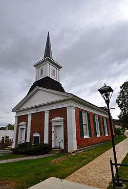 Floyd Presbyterian Church |
May 17, 1976 (#76002105) |
U.S. Route 221 36°54′41″N 80°19′05″W |
Floyd | |
| 4 | Glenanna | 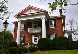 Glenanna |
May 16, 2002 (#02000523) |
204 W. Main St. 36°54′41″N 80°19′19″W |
Floyd | |
| 5 | Oakdale | 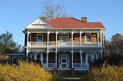 Oakdale |
March 17, 2010 (#10000090) |
5773 Franklin Pike 36°58′17″N 80°08′35″W |
Floyd | |
| 6 | Phlegar Farm | 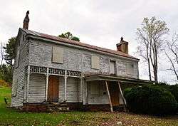 Phlegar Farm |
June 22, 2003 (#03000565) |
Off Christiansburg Pike 36°55′30″N 80°18′17″W |
Floyd | |
| 7 | Slate Mountain Presbyterian Church and Cemetery |  Slate Mountain Presbyterian Church and Cemetery |
March 30, 2007 (#07000227) |
Rock Church Rd. 36°46′42″N 80°23′31″W |
Meadows of Dan | |
| 8 | Willis Presbyterian Church and Cemetery |  Willis Presbyterian Church and Cemetery |
March 30, 2007 (#07000226) |
5733 Floyd Highway, S. 36°51′22″N 80°29′07″W |
Willis | |
| 9 | West Fork Furnace | 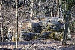 West Fork Furnace |
June 5, 2009 (#09000414) |
Old Furnace Rd. 36°50′03″N 80°22′31″W |
Floyd |
See also
| Wikimedia Commons has media related to National Register of Historic Places in Floyd County, Virginia. |
References
- The latitude and longitude information provided in this table was derived originally from the National Register Information System, which has been found to be fairly accurate for about 99% of listings. Some locations in this table may have been corrected to current GPS standards.
- "National Register of Historic Places: Weekly List Actions". National Park Service, United States Department of the Interior. Retrieved on June 26, 2020.
- Numbers represent an ordering by significant words. Various colorings, defined here, differentiate National Historic Landmarks and historic districts from other NRHP buildings, structures, sites or objects.
- "National Register Information System". National Register of Historic Places. National Park Service. April 24, 2008.
- The eight-digit number below each date is the number assigned to each location in the National Register Information System database, which can be viewed by clicking the number.

Municipalities and communities of Floyd County, Virginia, United States | ||
|---|---|---|
| Town | Map of Virginia highlighting Floyd County | |
| Unincorporated communities | ||
This article is issued from Wikipedia. The text is licensed under Creative Commons - Attribution - Sharealike. Additional terms may apply for the media files.